
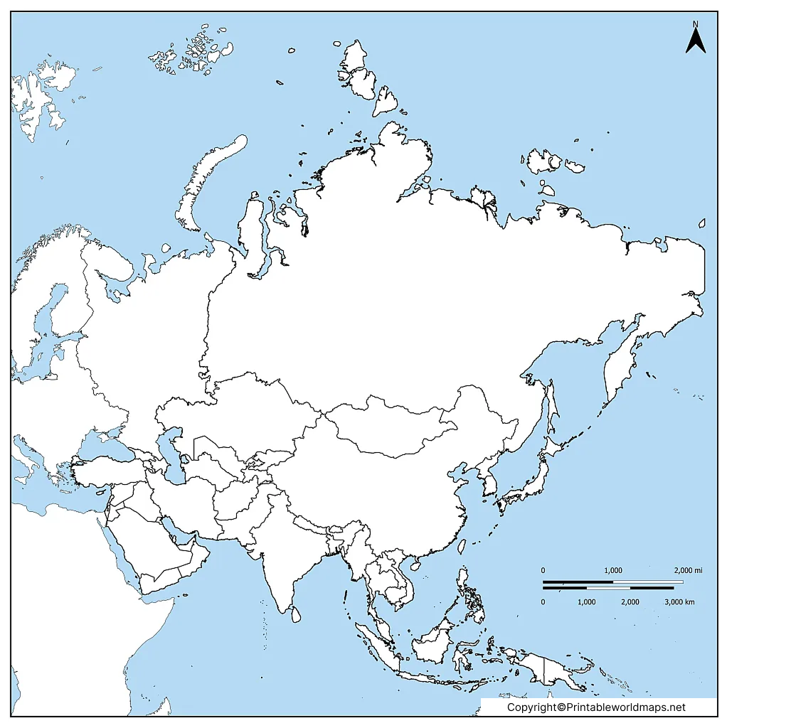

A printable blank map of Asia is a useful resource for students, teachers, parents, and geography enthusiasts who want to learn the countries, borders, capitals, and physical features of the Asian continent. Download a free map in PNG or PDF format, print it for classroom activities, or use it as a geography practice worksheet.
This collection includes different types of blank Asia maps, from country-border outlines to maps designed for identifying capital cities and practicing geographical features. Choose the version that best suits your learning needs.
You can also explore our political map of Asia to compare country names and boundaries with an unlabeled map.
Blank Map of Asia
Asia is the world’s largest continent by land area and its most populous continent. It covers approximately 44.6 million square kilometres (17.2 million square miles) and contains a wide range of landscapes, climates, cultures, and countries.
A blank map of Asia with country borders is useful for learning the locations and shapes of countries without relying on printed labels. Students can use it to identify countries, test their knowledge, and prepare for geography examinations.

Asia Blank Map
An Asia blank map is helpful for understanding the geographical arrangement of countries across the continent. Asia is bordered by the Arctic Ocean to the north, the Pacific Ocean to the east, and the Indian Ocean to the south. Its western boundary with Europe is conventionally drawn using features that include the Ural Mountains, the Caucasus region, and the Black and Caspian seas.
The boundary between Europe and Asia is a geographical convention, so maps may differ slightly in how they represent transcontinental countries and territories.
Use this blank map to practise identifying countries, tracing boundaries, and locating neighbouring regions. The western part of Russia is shown separately on this version to help illustrate the conventional Europe–Asia boundary.

Asia Map Blank
A blank Asia map can also be used to practise locating capital cities and learning the political geography of the continent.
Asia is commonly divided into major geographical subregions, including Central Asia, East Asia, South Asia, Southeast Asia, and Western Asia. Some classification systems also distinguish North Asia. These regions help learners organise countries into smaller groups for study.
The following map is intended for practising country locations and capital names. Students can write the names of countries and capitals, mark major rivers, or add mountain ranges to improve their understanding of Asian geography.

Blank Asia Map
A blank Asia map showing only the continent’s outer outline is useful for introductory geography activities, map labelling, and drawing exercises.
Unlike a political map with country borders, an outline map focuses on the overall shape of Asia. Learners can use it to mark the continent’s surrounding oceans, indicate major geographical regions, or sketch important physical features.
Asia contains some of the world’s most varied landscapes, including the Himalayan mountain range, the Tibetan Plateau, the Gobi Desert, extensive river systems, and broad plains. Mount Everest, located in the Himalayas on the Nepal–China border, has an officially announced elevation of 8,848.86 metres.

Map of Asia Blank
A map of Asia without labels gives learners an opportunity to study the continent independently. Instead of immediately seeing the names of countries, students can test their memory and use a separate reference map to check their answers.
For an effective exercise, begin by labelling large countries and familiar regions. Next, identify neighbouring countries, islands, seas, and major geographical features. Finally, compare the completed worksheet with a labelled reference map.
This activity is suitable for classroom revision, homework, self-study, and geography quizzes.

Unlabeled Map of Asia
An unlabeled map of Asia is a practical tool for studying the continent’s political and physical geography. Teachers can use it for classroom tests, while students can complete it independently to check how well they remember country locations and regional boundaries.
Asia is home to a wide range of cultures, languages, climates, and historical civilisations. Its geography includes densely populated river plains, high mountain ranges, deserts, tropical islands, and cold northern regions. These differences make the continent an interesting subject for map-based learning.

How to Use a Printable Blank Map of Asia
Follow these simple steps to get the most from your map:
- Choose a map: Select a country-border map for political geography or an outline map for basic labelling.
- Download the file: Open the PNG image or PDF link provided above.
- Print the worksheet: Use A4 paper for a convenient classroom or home study sheet. Check the print preview before printing.
- Label the countries: Write country names in the appropriate spaces and use a separate reference map to verify them.
- Practise capitals: Add the capital cities where the map provides enough room.
- Identify physical features: Mark mountain ranges, rivers, deserts, seas, and surrounding oceans where appropriate.
- Check your answers: Compare your completed map with a reliable atlas or labelled political map.
Tips for Printing an Asia Blank Map
For the clearest result, open the PDF in a PDF reader and choose the paper size that matches your printer. Select Fit to page if the map extends beyond the printable area, and use landscape orientation when it provides more room for country labels.
If you use a PNG file, check its resolution before printing. A larger image may provide better detail than a small preview image. For maps with many country borders, printing in colour is optional; black-and-white printing can work well for writing and labelling exercises.
Always check the individual download link to confirm that it opens the intended map and paper size before printing multiple copies.
Educational Benefits of a Blank Map of Asia
Blank maps support active learning by asking students to recall information instead of simply reading labels. They can help learners:
- Memorise the locations and shapes of Asian countries.
- Practise identifying capitals and neighbouring countries.
- Understand the relationship between countries, oceans, and geographical regions.
- Review physical geography, including rivers, mountains, and deserts.
- Prepare for classroom quizzes, homework, and geography examinations.
- Develop map-reading skills and spatial awareness.
Teachers can also use completed worksheets to identify topics that need further explanation.
Frequently Asked Questions
1. Where can I download a printable blank map of Asia for free?
You can use the PNG and PDF download links provided in this article. Select the map that matches your needs, open its download link, and save the file to your device.
2. What is a blank map of Asia used for?
A blank map of Asia is used to practise identifying countries, capitals, borders, oceans, and physical features. It is useful for school assignments, geography revision, classroom tests, and independent learning.
3. Is a blank map of Asia available in PDF format?
Yes. PDF versions are linked throughout this article. Open the relevant PDF link to check the file and save or print it.
4. What is the difference between a blank map and an unlabeled map of Asia?
The terms are often used interchangeably. A blank map may show country borders or only the continent’s outline, while an unlabeled map generally refers to a map without printed names. Always check the map preview to see which details are included.
5. Can I use a blank Asia map to learn capital cities?
Yes. Choose a map that includes country borders and enough space for writing. Add each capital next to its country, then compare your answers with a current, reliable reference.
6. Which paper size should I use to print an Asia map?
A4 is a practical choice for most home and school printers. If the map contains many small borders or labels, check the preview and consider a larger paper size when available.
7. How can I check whether my Asia map is accurate?
Compare the map with a reliable atlas or an authoritative geographical reference, such as National Geographic’s educational resources. Political boundaries and country classifications can change, so use an appropriate current reference for formal study.
Reference links
https://education.nationalgeographic.org/resource/asia/Copy reference URL
https://education.nationalgeographic.org/resource/asia-human/Copy reference URL
https://www.nationalgeographic.org/national-geographic-map-policyCopy reference URL
More Free Printable Maps
Here is a list of more blank maps, world maps, and country maps for you to check out. Additionally, you can use our site search to find any other map you might need. Increase your knowledge of the world now and teach geography successfully with a printed world map or other great tools from our website!
In case you cannot find your desired map on our site, feel free to contact us! In your message or comment, describe in detail what kind of map you need. Maybe we can produce it for you free of charge. We have done so before for several of our users, e.g. for the topic Germany postal codes maps.
Blank Maps
- Blank World Map
- Outline Map of Germany
- Blank Map of the United States
- Outline Map of Thailand
- Outline Map of China
Continent Maps
- Political Map of Asia
- Map of South America with Countries
- Labeled Map of North America
- Map of Europe with Countries
- Blank Map of Europe
- Labeled Map of Africa

48 thoughts on “Printable Blank Map of Asia – Map of Asia Blank [PDF]”