

World Shipping Routes Map with Ports PDF is one of the most useful resources for understanding international maritime transportation and global trade. Whether you are a student, logistics professional, shipping company, importer, exporter, or geography enthusiast, this printable map helps you visualize the world’s busiest shipping lanes, major seaports, strategic canals, and international maritime routes in one place.
This guide includes free printable maps, explains how global shipping routes work, highlights the world’s busiest maritime corridors, and provides trusted references to help you understand modern international shipping.

World Shipping Routes Map with Ports PDF
A World Shipping Routes Map with Ports PDF displays the major sea lanes used by cargo ships across the world’s oceans. It also identifies important commercial ports that connect international trade between continents.
The printable map typically includes:
- Major international shipping routes
- Important commercial seaports
- International container terminals
- Strategic canals and straits
- Ocean trade corridors
- Major maritime regions
- International shipping connections
Businesses involved in international trade rely heavily on these shipping routes because nearly 80% of global trade by volume is transported by sea, according to the United Nations Conference on Trade and Development (UNCTAD).
Printable World Shipping Routes Map with Ports

A printable shipping routes map is useful for:
- Students studying geography and international trade
- Shipping companies
- Import-export businesses
- Supply chain professionals
- Maritime academies
- Logistics planners
- Researchers
- Port authorities
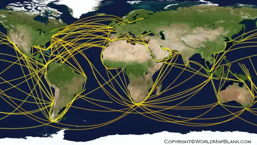
Our printable PDF allows users to:
- Print in high quality
- Use for classroom learning
- Plan shipping routes
- Understand global cargo movement
- Study maritime transportation networks
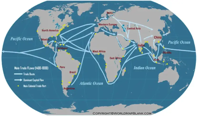
Major Global Shipping Routes
The world’s shipping network consists of several important maritime corridors that carry millions of containers every year.
Asia-Europe Shipping Route
This is one of the busiest shipping corridors connecting East Asia with Europe through the Suez Canal.
Trans-Pacific Shipping Route
Connects China, Japan, South Korea, and Southeast Asia with the west coast of North America.
Trans-Atlantic Shipping Route
Links Europe with the eastern coast of North America.
Middle East Oil Shipping Route
Carries crude oil from Gulf countries through the Strait of Hormuz to markets worldwide.
Asia-Australia Shipping Route
Important for transporting minerals, agricultural products, and manufactured goods.
Major Ports Included in the World Shipping Routes Map with Ports PDF
Some of the world’s busiest ports commonly shown include:
- Port of Shanghai (China)
- Port of Singapore
- Port of Ningbo-Zhoushan (China)
- Port of Shenzhen (China)
- Port of Busan (South Korea)
- Port of Rotterdam (Netherlands)
- Port of Antwerp-Bruges (Belgium)
- Port of Los Angeles (USA)
- Port of Long Beach (USA)
- Port of Dubai – Jebel Ali (UAE)
These ports serve as major international gateways for container shipping and global commerce.
Important Maritime Chokepoints
The printable map also highlights strategic waterways that influence global shipping.
Suez Canal
Connects the Mediterranean Sea with the Red Sea, significantly reducing travel time between Europe and Asia.
Panama Canal
Connects the Atlantic Ocean with the Pacific Ocean, allowing ships to avoid sailing around South America.
Strait of Hormuz
One of the world’s most important oil transportation routes.
Strait of Malacca
A crucial passage connecting the Indian Ocean with the Pacific Ocean.
Bab el-Mandeb Strait
Links the Red Sea to the Gulf of Aden and supports Europe-Asia shipping.
Why Shipping Routes Matter
Global shipping routes play an essential role in:
- International trade
- Economic growth
- Supply chain management
- Import and export operations
- Energy transportation
- Container logistics
- Global manufacturing
Efficient shipping routes reduce transportation costs and improve delivery times for businesses worldwide.
Interesting Facts About Global Shipping
- Around 80% of global merchandise trade by volume is transported by sea.
- More than 50,000 merchant ships operate internationally.
- The Port of Shanghai is currently the world’s busiest container port.
- The Strait of Malacca handles roughly one-quarter of global traded goods.
- Container ships can carry more than 24,000 TEUs (Twenty-foot Equivalent Units).
- The Suez Canal shortens voyages between Europe and Asia by thousands of kilometers compared to the route around Africa.
- Maritime transport is generally the most cost-effective method for moving bulk cargo internationally.
Download Free World Shipping Routes Map with Ports PDF
Our World Shipping Routes Map with Ports PDF is available in high-quality printable format for educational, research, logistics planning, and personal learning purposes.
The map can be downloaded, printed, and shared for:
- Geography education
- Maritime studies
- Shipping route planning
- Business presentations
- International trade research
- Classroom projects


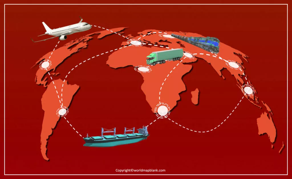
Well, the world shipping route map is one such map that offers the entire presentation of the shipping route. The map comes with all the national and international shipping routes that are scattered all around the globe. One can easily find all the routes that connect one region from the others. It can be the regions such as from one country to another or the one city to other. Furthermore, the map also includes the airline shipping routes as well along with the roads.

So, for the same reason, this map is highly significant in itself for all the logistics companies around. These companies can easily find the best shipping route to ship the goods or cargo from one place to other. The standard of shipping highly leaves its impact upon the large business organizations working pattern. At last, the shipping of goods and services always affects the consumer experience.
Shipping Routes Map with Ports
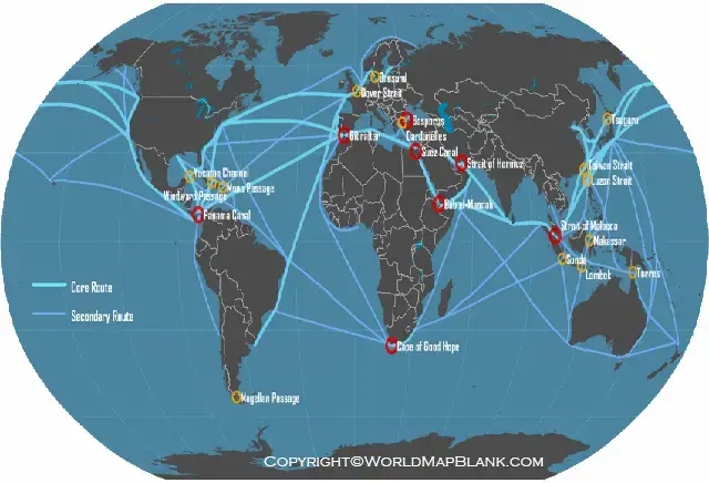
The map is also available in digital formats to provide the virtual support of navigation. One can easily use the map to navigate around the world on a specific shipping route. So, feel free to print this map from here and use it for the purpose of easy and accurate shipping of cargo or services. The map can also be shared with others with its digital format to other digital mediums such as smartphones, tablets, etc.
More Free Maps for Download in PDF
Please find below some links to other printable world maps, continent maps and country maps in PDF. All the maps on our website can be downloaded and used for free.
World Maps
- World Map for Kids
- Labeled World Map
- Time Zone World Map
- Physical World Map
- Political World Map
- Printable World Map Poster
- World Map with Continents
Continent Maps
- Labeled Map of Africa
- Blank Map of South America
- Blank Map of Europe
- Labeled Map of South America
- Blank Map of Asia
- Labeled Map of Europe
Country Maps
- Blank Map of the United States
- Labeled Map of China
- Map of Ukraine with Regions
- France Map with Regions
- Blank Map of China
FAQs
What is a World Shipping Routes Map with Ports PDF?
A World Shipping Routes Map with Ports PDF is a printable map that displays major international sea routes, commercial ports, shipping lanes, canals, and maritime trade corridors used for global cargo transportation.
Why are global shipping routes important?
Shipping routes enable international trade by connecting countries through efficient sea transportation. Nearly 80% of world merchandise trade by volume moves via maritime shipping.
Which are the busiest shipping routes in the world?
Some of the busiest routes include the Asia-Europe route through the Suez Canal, the Trans-Pacific route, the Trans-Atlantic route, and oil shipping routes through the Strait of Hormuz.
Which ports are included on the shipping routes map?
Major ports include Shanghai, Singapore, Rotterdam, Busan, Shenzhen, Los Angeles, Long Beach, Ningbo-Zhoushan, Antwerp-Bruges, and Jebel Ali.
Is the World Shipping Routes Map with Ports PDF free?
Yes. The printable PDF map is available for free download for educational, research, and personal use.
Who can use this shipping routes map?
Students, teachers, logistics companies, import-export businesses, maritime professionals, researchers, and geography enthusiasts can all benefit from this map.
What are maritime chokepoints?
Maritime chokepoints are narrow waterways like the Suez Canal, Panama Canal, Strait of Malacca, and Strait of Hormuz through which a significant portion of global shipping passes.
Can I print the shipping routes map?
Yes. The map is designed in high resolution and can be printed for classrooms, offices, logistics planning, or study purposes.
