

A Labeled Map of North America with Countries is one of the most useful educational and reference tools for students, teachers, travelers, researchers, and geography enthusiasts. It helps users identify countries, capitals, major cities, rivers, mountain ranges, and political boundaries across the continent. Whether you are preparing for school exams, competitive exams, research projects, or travel planning, a clearly labeled North America map provides accurate geographic information in an easy-to-understand format.
North America is the third-largest continent in the world after Asia and Africa, covering approximately 24.71 million square kilometers (9.54 million square miles). It occupies nearly 16.5% of Earth’s land area and lies almost entirely within the Northern Hemisphere, extending into the Western Hemisphere. The continent is bordered by the Arctic Ocean to the north, the Atlantic Ocean to the east, the Pacific Ocean to the west, and the Caribbean Sea and South America to the south.
- Labeled Map of Asia
- Labeled Map of Europe
- Labeled Map of Africa
- Labeled Map of South America
- Labeled Map of North America
- World Map With Continents
- Physical World Map
- Political World Map
- World Map with Oceans
- World Map Poster
- World Time Zone Map
- Labeled Map of World
- Blank Map of World
A printable Labeled Map of North America with Countries PDF makes it easy to study geographical features, understand political divisions, compare regions, and complete classroom assignments. It is also widely used for presentations, homeschooling, GIS studies, environmental research, and map labeling practice.
Labeled Map of North America
A Labeled Map of North America displays the political boundaries of countries along with important geographical features such as:
- Countries
- Capitals
- Major cities
- Rivers
- Lakes
- Mountain ranges
- Islands
- Oceans
- International borders
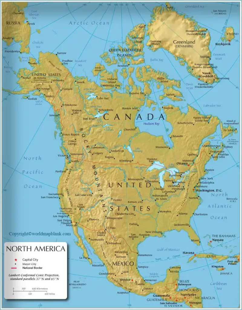
The continent consists of 23 sovereign countries along with several dependent territories. Some educational sources include Greenland separately because it is an autonomous territory within the Kingdom of Denmark rather than an independent country.
Quick Facts about North America
| Feature | Details |
|---|---|
| Continent | North America |
| Total Area | 24.71 million km² |
| World Rank | 3rd Largest Continent |
| Population | Over 600 million |
| Number of Sovereign Countries | 23 |
| Largest Country (Area) | Canada |
| Largest Country (Population) | United States |
| Smallest Sovereign Country | Saint Kitts and Nevis |
| Highest Mountain | Denali (6,190 m) |
| Longest River | Mississippi–Missouri River System |
| Largest Lake | Lake Superior |
Labeled North America Map with Countries
A Labeled North America Map with Countries clearly identifies every sovereign nation on the continent.
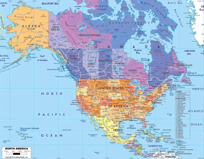
The 23 sovereign countries are:
- Antigua and Barbuda
- Bahamas
- Barbados
- Belize
- Canada
- Costa Rica
- Cuba
- Dominica
- Dominican Republic
- El Salvador
- Grenada
- Guatemala
- Haiti
- Honduras
- Jamaica
- Mexico
- Nicaragua
- Panama
- Saint Kitts and Nevis
- Saint Lucia
- Saint Vincent and the Grenadines
- Trinidad and Tobago
- United States
Greenland is also commonly shown on many maps because of its geographic location, although politically it is an autonomous territory of Denmark.
Largest Countries in North America
| Country | Importance |
|---|---|
| Canada | Largest by land area |
| United States | Largest population and economy |
| Mexico | Third largest country and second most populated |
Labeled North America Map with Capitals
A Labeled North America Map with Capitals helps students quickly identify the administrative centers of every country.
Some important capitals include:
| Country | Capital |
|---|---|
| Canada | Ottawa |
| United States | Washington, D.C. |
| Mexico | Mexico City |
| Cuba | Havana |
| Jamaica | Kingston |
| Bahamas | Nassau |
| Guatemala | Guatemala City |
| Panama | Panama City |
| Costa Rica | San José |
| Dominican Republic | Santo Domingo |
| Haiti | Port-au-Prince |
| Belize | Belmopan |
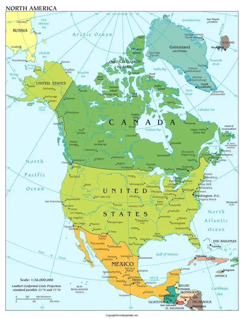
Learning capitals is essential for geography quizzes, competitive examinations, and international studies.
North America Map with Cities Labeled
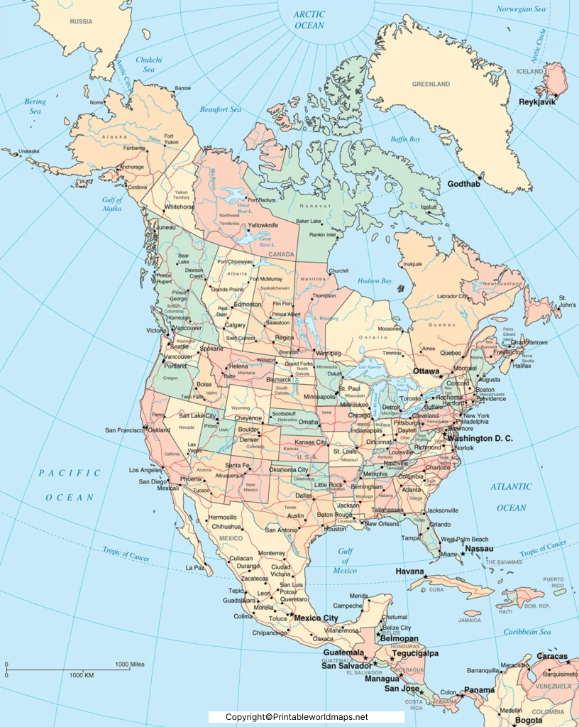
A North America Map with Cities Labeled highlights major metropolitan areas across the continent.
Some of the most important cities include:
- New York City
- Los Angeles
- Chicago
- Houston
- Dallas
- Toronto
- Vancouver
- Montreal
- Mexico City
- Guadalajara
- Monterrey
- San Francisco
- Washington, D.C.
- Miami
- Atlanta
- Seattle
- Boston
- Philadelphia
- Phoenix
- Denver
- Guatemala City
- Santo Domingo
- Panama City
- Havana
- Kingston
These cities are important centers for business, tourism, education, transportation, and culture.
Major Physical Features Found on a Labeled Map of North America
Besides countries and cities, a detailed labeled map also includes important natural features such as:
- Rocky Mountains
- Appalachian Mountains
- Sierra Madre Mountains
- Great Plains
- Canadian Shield
- Mississippi River
- Missouri River
- Rio Grande
- Yukon River
- Mackenzie River
- Great Lakes
- Gulf of Mexico
- Hudson Bay
- Arctic Ocean
- Atlantic Ocean
- Pacific Ocean
- Caribbean Sea
These features are essential for understanding North America’s physical geography and ecosystems.
Why Use a Labeled Map of North America?
A printable labeled map is useful for:
- School and college assignments
- Geography projects
- UPSC, SSC, and competitive exam preparation
- Classroom teaching
- Homeschool education
- Travel planning
- Historical research
- Climate and environmental studies
- GIS and mapping projects
- General knowledge improvement
Interesting Facts About North America
- North America is the third-largest continent on Earth.
- Canada has the longest coastline in the world.
- The United States has 50 states.
- Mexico has 31 states and one federal entity (Mexico City).
- Greenland is the world’s largest island.
- Lake Superior is the largest freshwater lake by surface area in the world.
- Denali in Alaska is the highest peak in North America.
- The Mississippi–Missouri River System is among the longest river systems in the world.
- North America spans every major climate zone, from Arctic tundra to tropical rainforests.
- The continent contains some of the world’s most visited national parks, including Yellowstone and Banff.
FAQs
How many countries are there in North America?
North America has 23 sovereign countries, along with several dependent territories such as Greenland.
Which is the largest country in North America?
Canada is the largest country by land area in North America.
Which country has the highest population in North America?
The United States has the largest population on the continent.
What is included in a labeled map of North America?
A labeled map typically includes countries, capitals, major cities, rivers, lakes, mountains, oceans, and political boundaries.
Can I download a printable North America map in PDF?
Yes. Printable PDF versions are commonly used for education, classroom activities, research, and geography practice.
What is the capital of Canada?
Ottawa is the capital city of Canada.
Is Greenland a country in North America?
No. Greenland is geographically part of North America but is an autonomous territory within the Kingdom of Denmark.
Why is a labeled North America map useful?
It helps students, teachers, travelers, and researchers understand geography, prepare for exams, and identify countries, capitals, and physical features.
Reference Links
- https://www.britannica.com/place/North-America
- https://education.nationalgeographic.org/resource/north-america-physical-geography/
- https://www.cia.gov/the-world-factbook/
- https://www.un.org/geospatial
- https://www.naturalearthdata.com/
- https://www.worldatlas.com/
- https://www.nationsonline.org/oneworld/north_america.htm

6 thoughts on “Labeled Map of North America with Countries in PDF”