
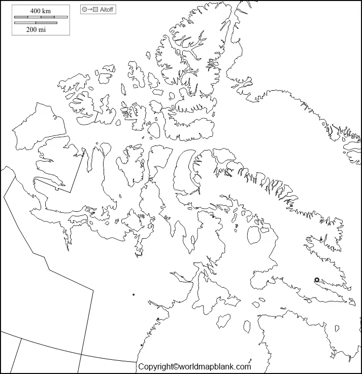

Explore northern Canada’s geography with this printable blank map of Nunavut. This page provides outline maps, printable map files, a practice worksheet, and a transparent PNG map for students, teachers, parents, and geography enthusiasts.
Nunavut is Canada’s largest territory by area, located in the country’s Arctic and northern regions. Its capital is Iqaluit, and its geography includes extensive coastlines, Arctic islands, lakes, and tundra landscapes. The territory officially became a separate territory on April 1, 1999. [1]
Use the maps below to practise identifying the shape of Nunavut, study its physical geography, complete classroom assignments, or prepare educational presentations.
- World Map with Continents
- Labeled Map of South America
- Labeled Map of Africa
- Political World Map
- Blank Map of World
- World Map with oceans
- World Map Poster
- Labeled Map of Europe
- Labeled Map of Africa
- Blank Map of Asia
- World Time Zone Map
- Labeled Map of World
- Physical World Map
The blank map of Nunavut – outline is useful for learning the territory’s boundaries and general shape. Use it to practise drawing map outlines, label important geographical features, or compare Nunavut with other Canadian territories.

Nunavut includes a vast mainland area and numerous Arctic islands. Its coastline and island geography make it particularly useful for studying Canada’s northern landscape. For more detailed reference information, Natural Resources Canada provides official Nunavut maps showing boundaries, coastlines, major lakes, and rivers. [2]
You can print the outline for geography practice or use it as a starting point for a map-labeling activity. For accurate place names and geographical boundaries, consult an authoritative reference map.
This printable map of Nunavut offers a convenient way to study the territory without needing a physical atlas. Use the available map file for school assignments, geography revision, presentations, or independent learning.

Before printing, open the file and check that the map fits the paper size you need. Select landscape or portrait orientation according to the map’s proportions, and use the print preview to avoid cutting off the edges.
PNG files are convenient for viewing and inserting into documents or presentations. PDF files are generally more convenient for printing, although the final print quality also depends on the file resolution and printer settings.

A blank map of Nunavut practice worksheet can help students develop map-reading skills and remember the territory’s location within Canada. Teachers and parents can use the worksheet for classroom exercises, homework, or geography quizzes.
Try these activities:
- Trace the outer boundary of Nunavut.
- Mark Iqaluit, the territorial capital, using a reliable reference map.
- Identify the surrounding Arctic waters and major islands where the worksheet provides enough detail.
- Compare Nunavut’s location with the Northwest Territories and Manitoba.
- Write three facts about Nunavut’s geography beside the map.
For a more challenging activity, ask students to complete the map without looking at a reference and then check their answers against an official map.

The transparent PNG Nunavut map is useful for digital projects that require a map without an opaque background. If the supplied image has a transparent background, you can place it over coloured backgrounds, presentation slides, educational posters, or other graphics.
A transparent map can also help teachers prepare custom worksheets and allow students to annotate geographical features digitally. Check the downloaded image before using it, as transparency depends on the actual file rather than its title alone.
If you need to place the map over another image, verify that the PNG retains transparency in your editing software. PDF output may display differently depending on how the original file was created and exported.
Use these facts to add context to your map activities and improve your understanding of the territory.
- Capital: Iqaluit.
- Location: Northern Canada, extending across Arctic regions.
- Territorial status: Nunavut was established on April 1, 1999, after separating from the Northwest Territories.
- Name meaning: Nunavut means “our land” in Inuktitut.
- Geographical features: The territory includes mainland landscapes, Arctic islands, coastlines, lakes, and rivers.
- Official map reference: Natural Resources Canada publishes Nunavut political, outline, and relief maps for geographical reference. [1][2]
Nunavut’s enormous area and dispersed communities make its geography distinctive. When studying the territory, remember that a simplified blank outline may not show every island, lake, settlement, or boundary detail.
Follow these steps to get the most out of the printable maps:
- Choose the outline, printable map, worksheet, or transparent PNG that suits your task.
- Open the relevant PNG or PDF link.
- For a paper activity, check the print preview and select an appropriate paper size.
- Print the map or insert the digital image into a worksheet or presentation.
- Add labels, notes, and geographical features using a reference map when needed.
For school projects, write the map’s title and source alongside your completed work. If the map will be used in a publication or commercial project, check the file’s ownership and usage permissions first.
You can use the PNG and PDF links provided in this article to view or download the outline map, printable map, practice worksheet, and transparent PNG map.
Iqaluit is the capital of Nunavut. You can mark it on a blank map using an official political map as your reference.
Nunavut is a territory of Canada, not a province. It became a separate territory on April 1, 1999.
What is the difference between a blank outline map and a political map?
A blank outline map is primarily intended for tracing, labelling, and geography practice. A political map typically includes administrative boundaries and may identify the capital and selected settlements.
Yes, you can use the supplied files for personal learning and classroom activities, subject to any applicable rights and usage restrictions. Check the file’s licence before redistributing it or using it commercially.
If the downloaded PNG has a transparent background, you can place it over coloured backgrounds or use it in presentations, posters, and digital learning materials.
Natural Resources Canada provides official Nunavut reference maps, including political, outline, and relief maps. These are useful for checking boundaries and geographical features. [2]
Reference links
https://natural-resources.canada.ca/maps-tools-publications/maps/atlas-canada/reference-maps
https://www.statcan.gc.ca/o1/en/plus/5957-nunavut-newfoundland-and-labrador-marking-milestones
https://open.canada.ca/data/en/dataset/ab003071-a512-5a22-80a4-b20a682885de
