
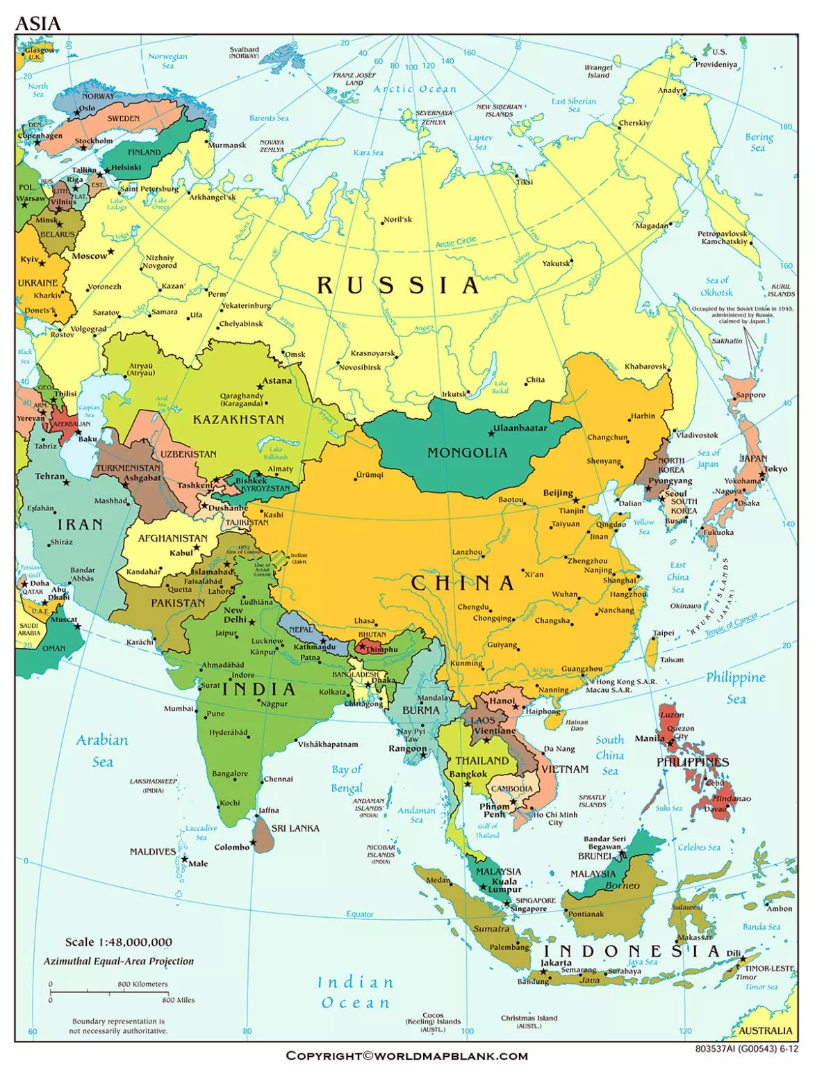
A Printable Asia Political Map helps students, teachers, researchers, and geography enthusiasts identify countries, international boundaries, major regions, and geographic relationships across Asia. This page provides a printable political map of Asia along with PDF versions for convenient study and reference.
Our Printable Asia Political Map is designed for learning, classroom activities, geography projects, presentations, and general reference.
Asia Political Map
Asia is the largest continent by land area and extends across much of the Northern and Eastern Hemispheres. It includes a wide range of physical environments, from the Arctic regions of northern Asia and the high mountains of Central and South Asia to the deserts of Western and Central Asia and the islands of Southeast Asia.
A political map focuses on countries, boundaries, regional divisions, and geographic locations, rather than physical features such as mountains, rivers, and deserts.
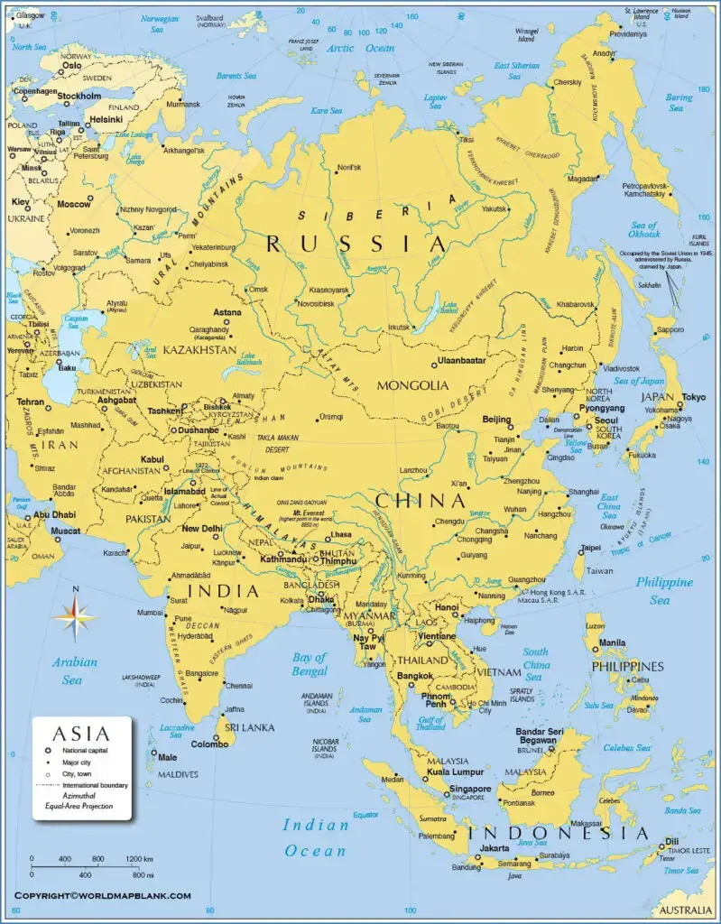
The map can be used as a visual reference for identifying countries and understanding the geographic arrangement of Asia. For an authoritative geographic classification, the United Nations M49 system divides Asia into Central Asia, Eastern Asia, South-eastern Asia, Southern Asia, and Western Asia.
Printable Asia Political Map
The Printable Asia Political Map provides a convenient way to study the political geography of the continent. You can print the map for classroom activities, geography assignments, country identification exercises, or personal reference.
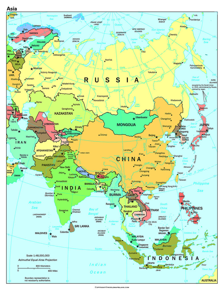
Asia is commonly discussed through several geographic subregions. The United Nations M49 geographic classification identifies:
- Central Asia
- Eastern Asia
- South-eastern Asia
- Southern Asia
- Western Asia
The UN classification includes countries and areas within these geographic groupings, making it useful when comparing regional geography and country locations.
Why Use a Printable Asia Political Map?
A printable political map can be useful for:
- Learning the location of Asian countries
- Identifying international boundaries
- Studying Asian geographic regions
- Preparing school and university assignments
- Creating geography worksheets
- Teaching country and region identification
- Comparing neighboring countries
- Planning geography-related presentations
The printable format is particularly useful when a physical copy is needed for classroom or offline study.
Map of Asia’s Political
A Map of Asia Political focuses on the political geography of the continent. Unlike a physical map, it emphasizes country boundaries, country names, and geographic divisions.
Political boundaries can change over time because of administrative changes, agreements, territorial disputes, or changes in internationally recognized status. For that reason, maps should be checked against reliable geographic sources when accuracy is important.
The United Nations Statistics Division’s M49 classification provides standardized geographic groupings and country/area names for statistical and geographical purposes.
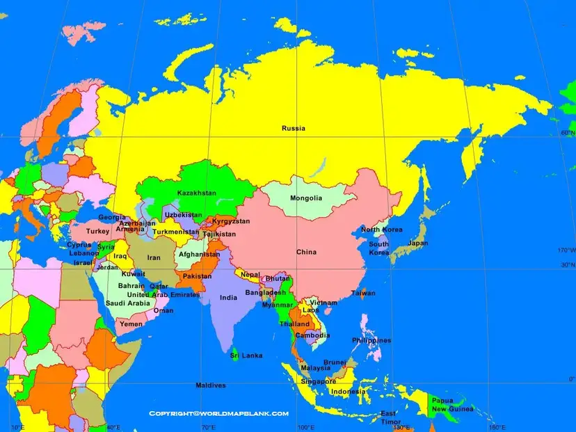
Asia Political Map Regions
For geographical study, Asia can be organized into five major UN M49 subregions:
| Region | Examples of countries/areas |
|---|---|
| Central Asia | Kazakhstan, Kyrgyzstan, Tajikistan, Turkmenistan, Uzbekistan |
| Eastern Asia | China, Japan, Mongolia, Republic of Korea, Democratic People’s Republic of Korea |
| South-eastern Asia | Indonesia, Malaysia, Philippines, Singapore, Thailand, Viet Nam and others |
| Southern Asia | India, Pakistan, Bangladesh, Nepal, Bhutan, Sri Lanka and others |
| Western Asia | Türkiye, Saudi Arabia, United Arab Emirates, Iraq, Israel and others |
The exact list should be interpreted according to the classification being used because geographic organizations may use different definitions for transcontinental areas and political entities. The table above follows the UN M49 framework.
Map of Asia Political Labeled
A Map of Asia Political Labeled is useful when you need country names displayed directly on the map. Labeled maps make it easier to identify neighboring countries and understand the overall geographic arrangement of Asia.
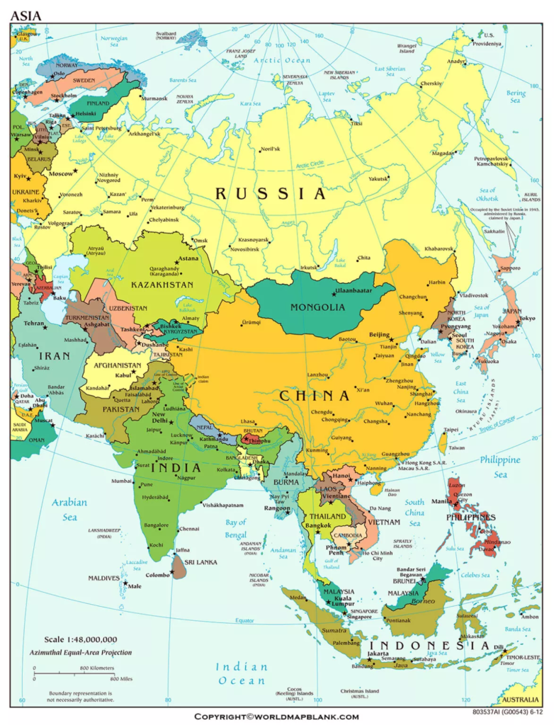
The labeled map can be printed and used for geography lessons, country-location exercises, study notes, and educational projects.
Asia Political Map for Students
Students can use a Printable Asia Political Map to practice:
- Identifying Asian countries.
- Locating countries within their geographic subregions.
- Recognizing neighboring countries.
- Understanding the distribution of countries across the continent.
- Comparing political geography with physical geography.
For more consistent geographic terminology, students can refer to the United Nations M49 classification when completing geography assignments.
Asia Political Map for Teachers
Teachers can use the printable map for classroom worksheets, quizzes, map-labeling exercises, presentations, and geography revision.
A blank or unlabeled version can also be useful for testing students’ knowledge of country locations, while a labeled version can serve as a reference sheet.
Important Note About Political Boundaries
Political maps represent geographic and political information at a particular point in time. Some boundaries and territorial situations can be disputed or represented differently by different authorities.
Therefore, this map should be treated as a general educational reference, not as a legal or diplomatic authority. For official geographic classifications, consult authoritative sources such as the United Nations Statistics Division.
Printable Asia Political Map PDF
The PDF versions provided on this page are useful when you need to:
- Print the map at home or school
- Save the map for offline use
- Add the map to educational materials
- Use it in geography projects
- Keep a reference copy on your computer or tablet
Using a PDF can also make printing easier because the document can be opened and printed independently of the webpage.
Asia Political Map: Key Facts
Here are several useful facts for understanding Asia’s political geography:
- Asia is the world’s largest continent by land area.
- Asia contains a highly diverse collection of countries and geographic regions.
- The United Nations M49 system divides Asia into five statistical/geographic subregions.
- These subregions are Central Asia, Eastern Asia, South-eastern Asia, Southern Asia, and Western Asia.
- Asia includes both continental countries and numerous island nations.
- Some countries have territory extending across more than one commonly recognized continental region.
- Political maps and geographic classifications can differ depending on the source and purpose.
Frequently Asked Questions
What is a Printable Asia Political Map?
A Printable Asia Political Map shows countries, political boundaries, country names, and geographic regions of Asia. It can be downloaded or printed for educational and reference purposes.
How many countries are shown on an Asia political map?
The number depends on the geographic and political classification being used. The United Nations M49 framework lists countries and areas within five Asian subregions rather than defining Asia simply as a fixed number of sovereign countries.
What are the five regions of Asia according to the UN?
The UN M49 classification divides Asia into Central Asia, Eastern Asia, South-eastern Asia, Southern Asia, and Western Asia.
Is the Printable Asia Political Map useful for students?
Yes. It can help students identify countries, understand regional geography, learn neighboring countries, and complete map-labeling exercises.
Can I print the Asia political map?
Yes. The PDF versions provided on this page can be used for printing and offline study.
What is the difference between a political map and a physical map?
A political map emphasizes countries, boundaries, and political divisions. A physical map emphasizes natural features such as mountains, rivers, deserts, plateaus, and oceans.
Why can political maps differ?
Maps can differ because geographic classifications, boundary representations, disputed territories, and the purpose of the map may vary between sources.
Where can I verify Asian geographic regions?
The United Nations Statistics Division’s M49 geographic classification is a useful authoritative reference for geographic regions and country/area groupings.
Reference Links
https://unstats.un.org/unsd/methodology/m49/overview
https://unstats.un.org/unsd/methodology/m49
https://unstats.un.org/unsd/ungegn/divisions
https://unstats.un.org/unsd/demographic-social/products/dyb/index.cshtml









