
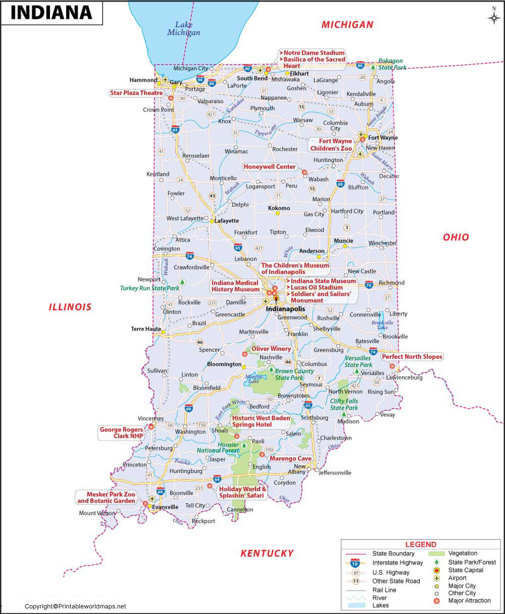

The Labeled Map of Indiana helps you identify Indiana’s location, state capital, major cities, counties, rivers, and surrounding states. Indiana is in the Midwestern United States and borders Michigan, Ohio, Kentucky, and Illinois. It also has a shoreline along Lake Michigan in the northwest.
Indiana became the 19th state of the United States on December 11, 1816. Its capital and largest city is Indianapolis, which is located in Marion County.
A labeled map is useful for students, teachers, travelers, researchers, and anyone who needs a quick geographic reference for Indiana.
Labeled Map of Indiana
The Labeled Map of Indiana shows the state’s major geographic features, including its capital, cities, rivers, highways, counties, and surrounding states.
Indiana is bordered by Illinois to the west, Ohio to the east, Michigan to the north, and Kentucky to the south. The Ohio River forms much of Indiana’s southern boundary with Kentucky, while the Wabash River is one of the state’s most important waterways.
Indiana has approximately 36,420 square miles of total area, making it one of the smaller U.S. states by area. The state’s geography includes agricultural land, forests, rivers, lakes, and urban areas.
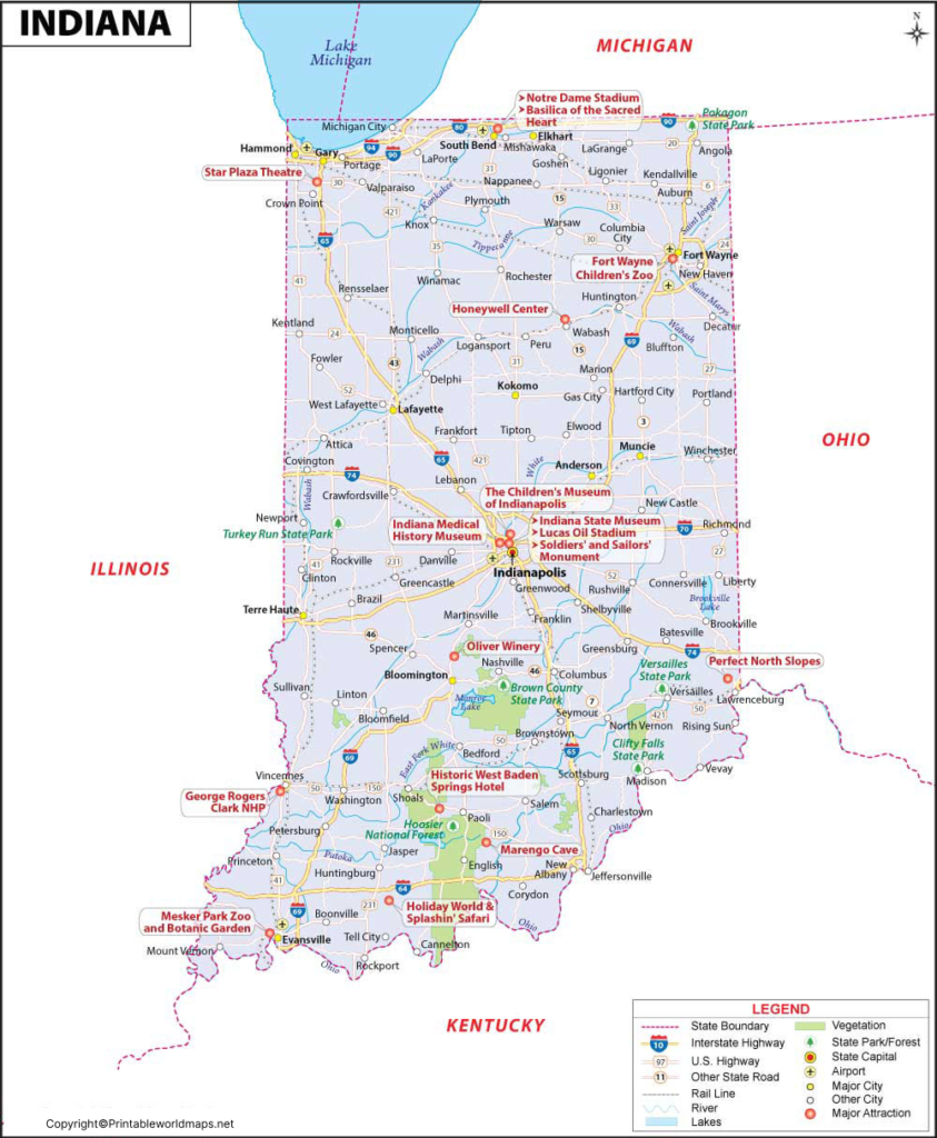
Indiana Geography and Major Rivers
The Wabash River is the longest river entirely within Indiana and is an important part of the state’s physical geography. Other significant waterways include the White River, East Fork White River, Tippecanoe River, Eel River, Mississinewa River, and Salamonie River.
Indiana’s northern boundary includes a shoreline on Lake Michigan, connecting the state to the Great Lakes region.
The state’s landscape varies from the agricultural plains of northern and central Indiana to the more hilly terrain found in southern Indiana.
Labeled Map of Indiana Printable
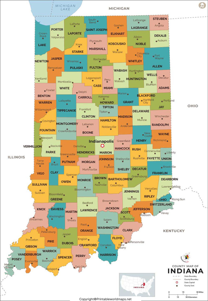
A Labeled Map of Indiana Printable is useful for classroom activities, geography assignments, state studies, trip planning, and reference work.
Indiana is divided into 92 counties. Counties provide an important administrative division of the state and are useful when studying local geography, communities, and government.
For students, a printable map can also be used to practice locating Indianapolis, major cities, neighboring states, Lake Michigan, and major rivers.
Labeled Indiana Map with Cities
The Labeled Indiana Map with Cities identifies important population centers throughout the state.
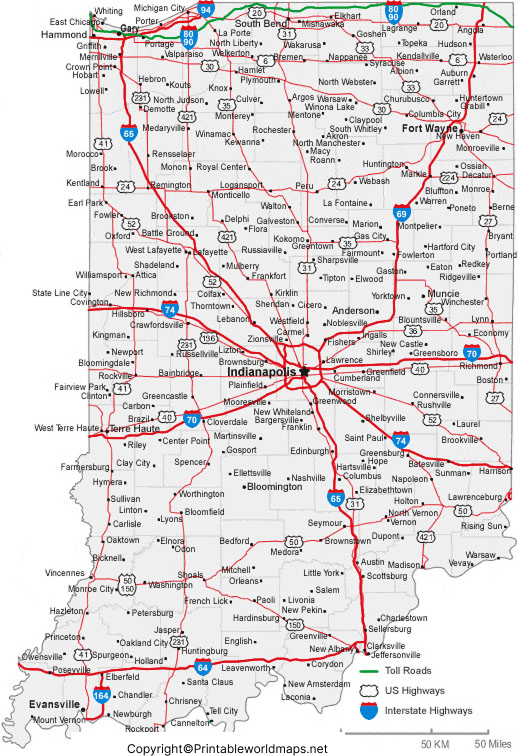
Major Indiana cities include:
- Indianapolis
- Fort Wayne
- Evansville
- South Bend
- Carmel
- Fishers
- Bloomington
- Hammond
- Gary
- Lafayette
Indianapolis is the state capital and largest city. Fort Wayne is another major population center in northeastern Indiana, while Evansville is an important city in southwestern Indiana.
Labeled Indiana Map with Capital
The Labeled Indiana Map with Capital highlights Indianapolis, the capital city of Indiana.
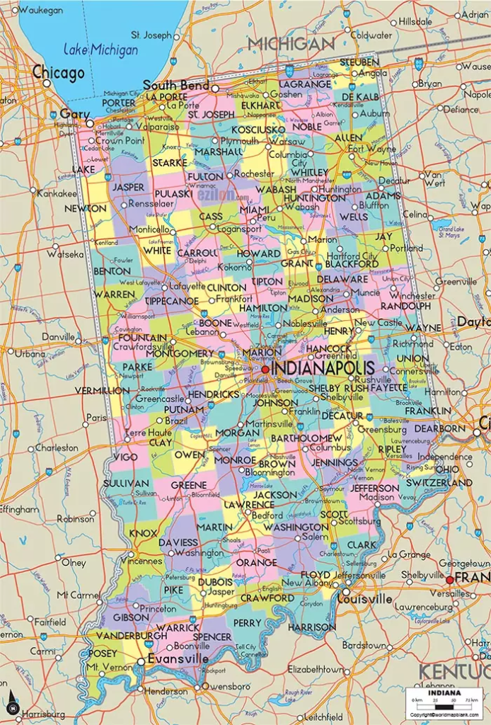
Indianapolis became Indiana’s permanent capital in 1825. Today, Indianapolis serves as the center of state government and is one of the state’s major economic and transportation hubs.
The city is located near the geographic center of Indiana in Marion County. It is also widely known for major sporting and cultural events, including the Indianapolis 500.
Indiana Map with Counties
Indiana has 92 counties, each with its own county government. A county map can help users identify the administrative divisions of the state and locate cities and communities within individual counties.
For geography students, combining a labeled state map with a county map provides a more detailed understanding of Indiana’s political and geographic organization.
Indiana Border States
Indiana shares land borders with four states:
| Direction | State |
|---|---|
| North | Michigan |
| East | Ohio |
| South | Kentucky |
| West | Illinois |
Indiana also reaches Lake Michigan along its northwestern edge.
Important Facts About Indiana
Here are several useful facts to remember when studying the Labeled Map of Indiana:
- State: Indiana
- Capital: Indianapolis
- Largest city: Indianapolis
- Counties: 92
- Statehood: December 11, 1816
- Order of admission: 19th U.S. state
- Region: Midwestern United States
- Northern water boundary: Lake Michigan
- Major river: Wabash River
- Southern boundary: Ohio River
- Neighboring states: Illinois, Michigan, Ohio, and Kentucky
How to Use the Labeled Map of Indiana
The map can be used for several educational and practical purposes:
For students: Identify Indiana’s capital, major cities, neighboring states, rivers, and geographic regions.
For teachers: Use the printable map for geography lessons, worksheets, quizzes, and classroom activities.
For travelers: Locate major Indiana cities and understand their relationship to surrounding states and Lake Michigan.
For researchers: Use the map as a quick geographic reference before examining more detailed county, transportation, or demographic data.
Frequently Asked Questions About the Labeled Map of Indiana
What is the capital of Indiana?
Indianapolis is the capital of Indiana. It is located in Marion County near the geographic center of the state.
How many counties are in Indiana?
Indiana has 92 counties.
What states border Indiana?
Indiana borders Illinois, Michigan, Ohio, and Kentucky.
What is the largest city in Indiana?
Indianapolis is the largest city in Indiana by population.
When did Indiana become a state?
Indiana became the 19th state of the United States on December 11, 1816.
Does Indiana border Lake Michigan?
Yes. Indiana has a shoreline along Lake Michigan in the northwestern part of the state.
What river is longest in Indiana?
The Wabash River is the longest river entirely within Indiana and is one of the state’s major rivers.
Where can I download a printable Indiana map?
You can download the printable Indiana maps and PDF versions provided in this article for educational and reference purposes.
What cities are shown on an Indiana cities map?
Depending on the map, major cities can include Indianapolis, Fort Wayne, Evansville, South Bend, Carmel, Fishers, Bloomington, Hammond, Gary, and Lafayette.
reference links
https://www.in.gov/core/about-indiana
https://www.census.gov/quickfacts/fact/table/IN/PST045225
https://www.britannica.com/place/Indiana
https://www.usgs.gov/states/indiana
