

A Physical World Map shows the major natural features of Earth, including continents, oceans, mountains, plateaus, deserts, rivers, lakes and other prominent landforms. This collection provides free printable physical world maps in labeled, blank-outline and PDF formats for geography study, classroom activities, teaching and reference.
Unlike a political world map, which emphasizes countries and political boundaries, a physical map focuses primarily on the natural geography and terrain of the Earth. Depending on the map design, colors, labels and symbols can be used to distinguish elevation, water bodies, mountain systems and other physical features.
The maps on this page can be viewed online or downloaded as PDF files for printing and offline use.
- World Map with Continents
- Labeled Map of South America
- Labeled Map of Africa
- Labeled Map of Europe
- Blank Map of Asia
- World Time Zone Map
- Political World Map
- Blank Map of World
- World Map with oceans
- World Map Poster
- Labeled Map of World
- Labeled Map of Europe
Printable Physical World Map
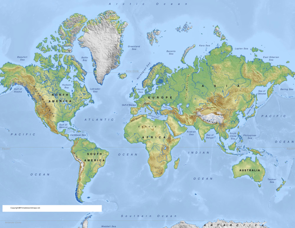
This Physical World Map is designed to help readers identify major natural features and understand the broad geographic structure of Earth. It can be useful for students, teachers, homeschooling activities, geography revision and general reference.
A physical map should not be confused with a topographic map. Topographic maps provide more detailed information about elevation and terrain, often using contour lines to represent changes in elevation. The U.S. Geological Survey explains that contour lines connect locations having the same elevation and can be used to show the shape and steepness of terrain.
Blank Physical World Map – Outline
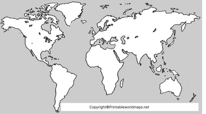
A blank Physical World Map removes many of the labels so that students can practice identifying geographical features independently.
This format can be useful for:
- Geography quizzes
- Classroom worksheets
- Map-labeling exercises
- Homeschool lessons
- Geography revision
- Identifying continents and oceans
- Practicing major physical features
Teachers can print the outline and ask students to label selected mountains, rivers, deserts, oceans or other features.
Physical Map of World Labeled
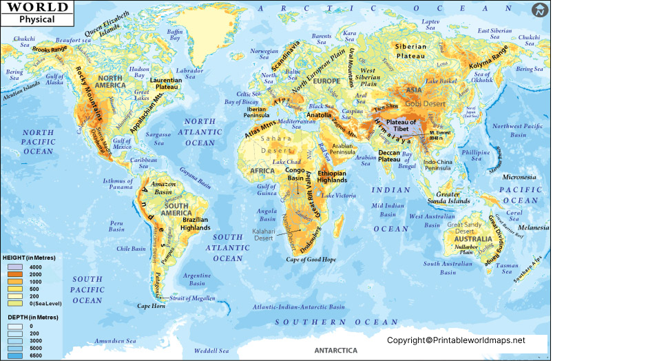
A Physical World Map labeled with major geographic features provides a useful visual reference for students learning physical geography.
Physical geography focuses on Earth’s natural environment and processes. A map can help students connect locations with landforms such as mountain ranges, plains, deserts, rivers, lakes and oceans.
The world is commonly divided into seven continents: Africa, Antarctica, Asia, Australia, Europe, North America and South America. National Geographic also recognizes five oceans: the Arctic, Atlantic, Indian, Pacific and Southern oceans.
Major Features Shown on a Physical World Map
Depending on the particular map, a physical world map may identify or help locate:
- Continents
- Oceans
- Seas
- Mountain ranges
- Major peaks
- Rivers
- Lakes
- Deserts
- Plains
- Plateaus
- Islands
- Peninsulas
- Major geographic regions
These features help students understand where important natural formations occur and how Earth’s land and water are distributed.
What Is a Physical World Map?
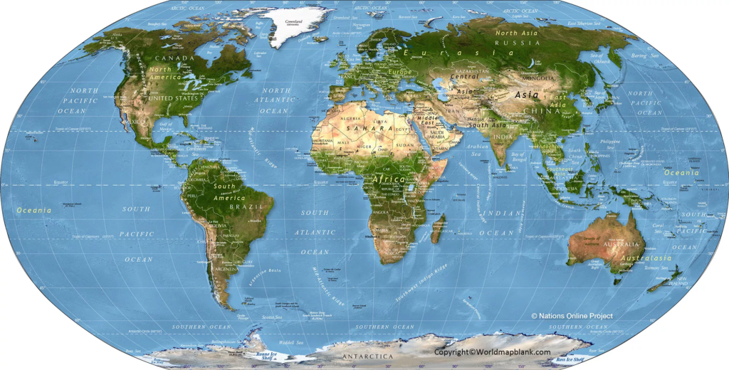
A Physical World Map is a map designed primarily to represent Earth’s natural geographic features rather than political divisions.
For example, physical maps can show mountain ranges, rivers, lakes, deserts, plains and other landforms. Mapmakers commonly use colors, shading and labels to make differences in terrain and water features easier to recognize.
A detailed topographic map goes further by representing elevation and terrain shape using contour lines. USGS describes topographic maps as representations of natural and selected human-made features with terrain elevation shown through contour lines.
Seven Continents on the World Map
The seven commonly recognized continents are:
- Asia
- Africa
- North America
- South America
- Antarctica
- Europe
- Australia
National Geographic lists these seven continental divisions from largest to smallest as Asia, Africa, North America, South America, Antarctica, Europe and Australia.
The classification of continents can vary in some educational traditions. For example, some sources use Oceania as a broader regional term associated with Australia and the Pacific islands. National Geographic treats Oceania as a region rather than a separate continent.
Five Oceans of the World
The five oceans commonly identified today are:
- Pacific Ocean
- Atlantic Ocean
- Indian Ocean
- Southern Ocean
- Arctic Ocean
The ocean covers approximately 71% of Earth’s surface. National Geographic recognizes the Southern Ocean as the fifth named ocean surrounding Antarctica.
The CIA World Factbook also provides geographic information about the five oceans, including their areas, average depths and deepest points.
Why Use a Printable Physical World Map?
A printable map is useful because it provides a physical reference that students can annotate, label and use away from a computer or mobile device.
Common uses include:
- Geography homework
- Classroom teaching
- Homeschooling
- Exam preparation
- Map-labeling practice
- Geography projects
- Educational displays
- Travel and general reference
PDF versions can also be convenient for printing because the document can be saved and opened on different devices that support PDF files.
How to Use the Blank Map for Practice
The blank physical map can be used as a simple geography exercise:
Step 1: Print the blank map.
Step 2: Identify the seven continents.
Step 3: Label the five oceans.
Step 4: Add major mountain ranges, rivers, deserts and other features required for the lesson.
Step 5: Compare the completed worksheet with the labeled physical map.
This approach can turn a static map into a practical geography learning activity.
Important Geography Facts
Here are several useful facts to remember when studying a physical world map:
- Earth has seven commonly recognized continents.
- Earth has five commonly recognized oceans.
- Oceans cover about 71% of Earth’s surface.
- Physical maps emphasize natural features such as mountains, rivers, lakes and landforms.
- Topographic maps use contour lines to represent elevation and terrain shape.
- The United Nations currently has 193 Member States, but the number of UN Member States should not be treated as a simple definition of the number of countries or territories represented on every world map
Frequently Asked Questions
What is a Physical World Map?
A Physical World Map represents the natural geography of Earth, including features such as mountains, rivers, lakes, deserts, plains, oceans and other landforms.
What are the seven continents?
The seven commonly recognized continents are Asia, Africa, North America, South America, Antarctica, Europe and Australia.
How many oceans are there in the world?
Five oceans are commonly recognized: Pacific, Atlantic, Indian, Southern and Arctic.
What is the difference between a physical and political world map?
A physical map emphasizes natural geographic features, while a political map emphasizes countries, boundaries, capitals and other political divisions.
Can I print the Physical World Map?
Yes. The PDF versions provided on this page can be downloaded and printed for personal educational and reference use.
Is there a blank Physical World Map?
Yes. A blank physical world map outline is provided above for labeling exercises and geography practice.
Why are different colors used on physical maps?
Colors and shading are commonly used to distinguish different types of terrain, elevation or water features. The exact color scheme depends on the mapmaker and map design.
Are physical maps useful for students?
Yes. They can help students visually connect geographic names with the locations of mountains, rivers, oceans, deserts, continents and other natural features.
Is a physical map the same as a topographic map?
No. A physical map provides a broad representation of natural geographic features. A topographic map provides more detailed information about terrain and elevation, commonly using contour lines.
Where can I verify world geography information?
Reliable references include the U.S. Geological Survey, National Geographic Society, United Nations and CIA World Factbook. Links are provided below for further research.
Reference link
https://www.usgs.gov/faqs/what-a-topographic-map?items_per_page=6&page=0
https://www.usgs.gov/educational-resources/topographic-mapping
https://www.nationalgeographic.org/national-geographic-map-policy
https://education.nationalgeographic.org/resource/Continent
https://education.nationalgeographic.org/resource/oceans
https://www.un.org/en/about-us
https://www.cia.gov/the-world-factbook/static/6c4d9b9a41b27707b6720720df7161d6/Physical_World.pdf

8 thoughts on “Free Printable Physical World Map Labeled”