
Labeled India Map is a useful reference for identifying India’s states, union territories, capital cities, major cities, neighboring countries, and important geographic features. This page provides printable India maps, downloadable PDF resources, and updated geographic information for students, teachers, travelers, researchers, and anyone looking for a clear map of India.
India, officially the Republic of India, is located in South Asia. It is bordered by the Himalayas to the north and surrounded by the Bay of Bengal to the east, the Arabian Sea to the west, and the Indian Ocean to the south. India shares land borders with Pakistan, China, Nepal, Bhutan, Bangladesh, and Myanmar. Sri Lanka lies across the sea to the southeast.
India covers approximately 3,287,263 square kilometers, making it the world’s seventh-largest country by area. The country extends from the Himalayan region in the north to the Indian Ocean in the south and has a highly varied landscape that includes mountains, plains, plateaus, deserts, forests, islands, and coastal regions.
- World map with continents
- Physical world map
- Political world map
- Labeled map of Asia
- Labeled map of Africa
- Labeled map of Europe
- Labeled map of South America
- World time zone map
- Labeled map of World
- Blank map of the world
- Labeled map of North America
- Blank map of Asia
- World map with oceans
- World map poster
Labeled India Map
The Labeled India Map below provides a visual reference for India’s geographic location and major administrative areas.
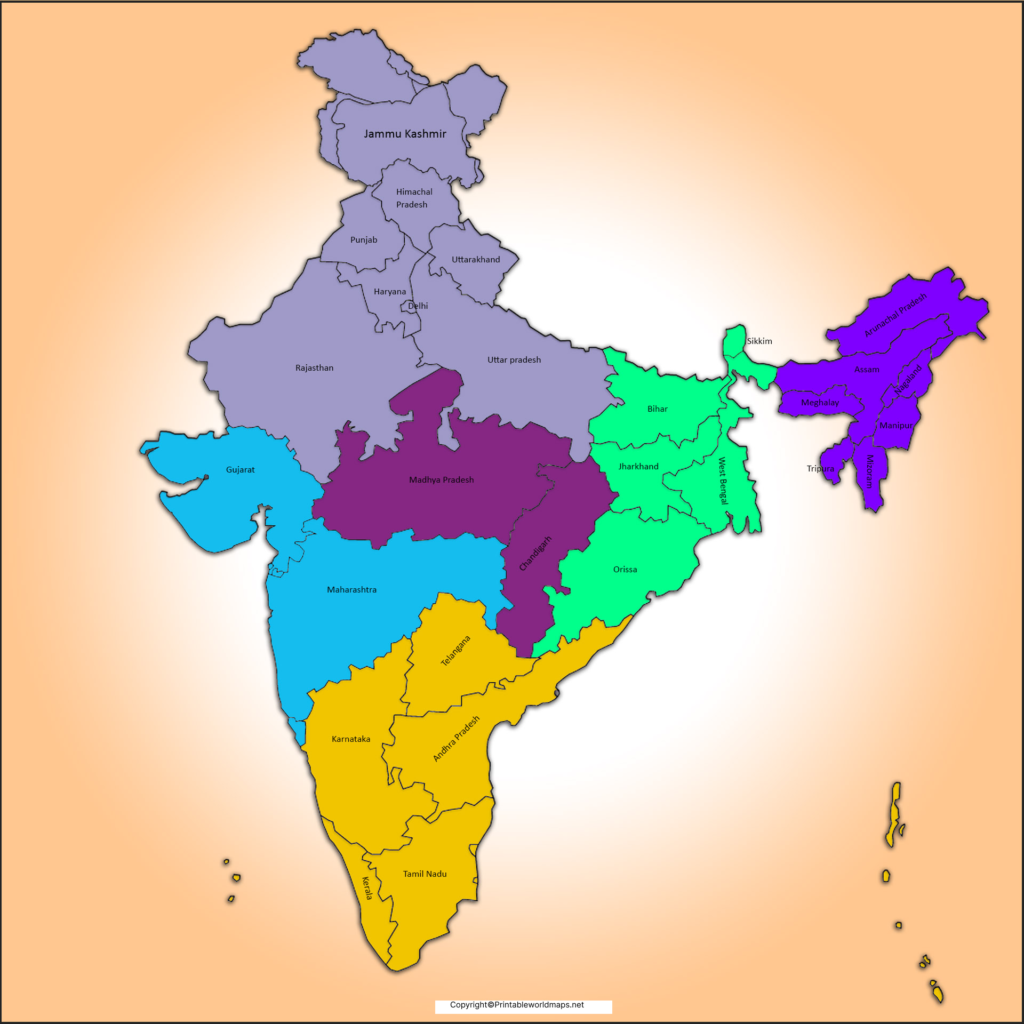
India’s total area is 3,287,263 km². According to the United Nations 2025 estimate, India’s population is approximately 1.464 billion. The latest completed national population census remains the 2011 Census, which recorded India’s population at about 1.21 billion.
Using the census year and the source date is important because population figures change over time. For current comparisons, estimates and projections should not be presented as census counts.
India’s geography includes several major physical regions:
- The Himalayan mountain system in the north
- The Northern Plains
- The Peninsular Plateau
- The Thar Desert
- The coastal plains
- The northeastern hills
- The Andaman and Nicobar Islands
- The Lakshadweep islands
The country also contains major river systems, including the Ganga, Brahmaputra, Indus, Godavari, Krishna, Mahanadi, Narmada, and Tapi.
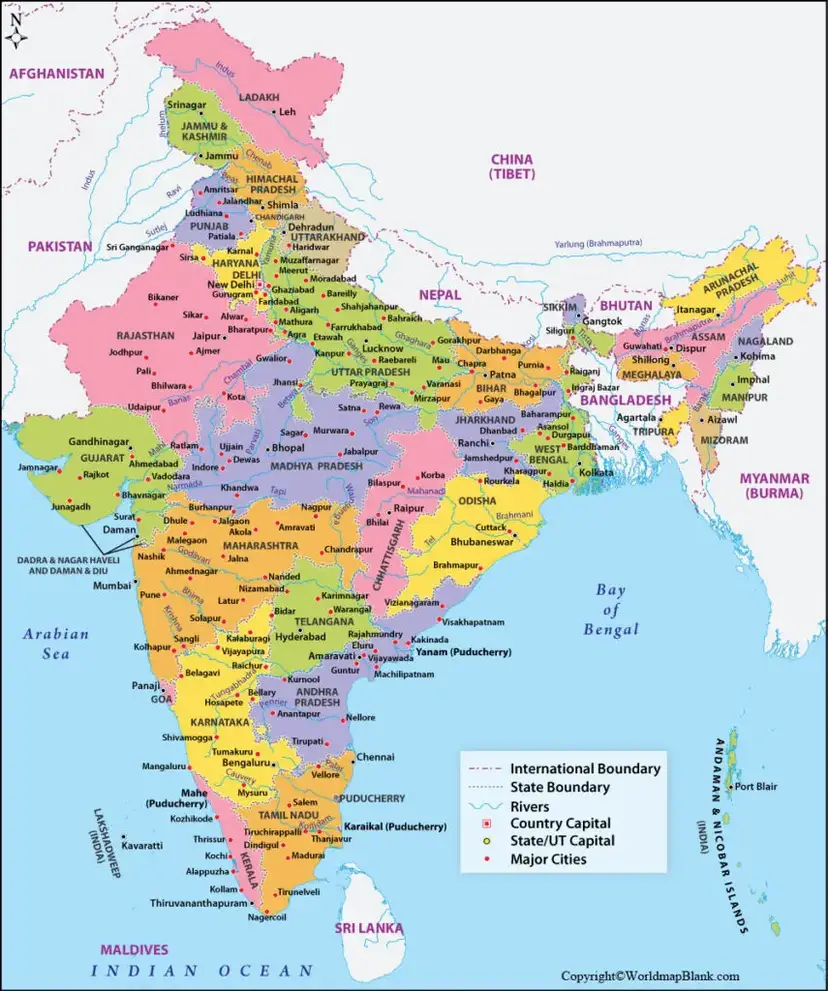
Labeled Map of India with States
India currently has 28 states and 8 union territories, for a total of 36 states and union territories. The Government of India’s National Portal and Ministry of Home Affairs provide current administrative information for these area
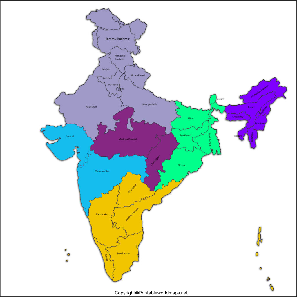
The 28 states have their own elected state governments, while union territories are administered under the constitutional framework applicable to union territories. Some union territories have legislatures.
28 States of India and Their Capitals
| State | Capital |
|---|
| Andhra Pradesh | Amaravati |
| Arunachal Pradesh | Itanagar |
| Assam | Dispur |
| Bihar | Patna |
| Chhattisgarh | Raipur |
| Goa | Panaji |
| Gujarat | Gandhinagar |
| Haryana | Chandigarh |
| Himachal Pradesh | Shimla |
| Jharkhand | Ranchi |
| Karnataka | Bengaluru |
| Kerala | Thiruvananthapuram |
| Madhya Pradesh | Bhopal |
| Maharashtra | Mumbai |
| Manipur | Imphal |
| Meghalaya | Shillong |
| Mizoram | Aizawl |
| Nagaland | Kohima |
| Odisha | Bhubaneswar |
| Punjab | Chandigarh |
| Rajasthan | Jaipur |
| Sikkim | Gangtok |
| Tamil Nadu | Chennai |
| Telangana | Hyderabad |
| Tripura | Agartala |
| Uttar Pradesh | Lucknow |
| Uttarakhand | Dehradun |
| West Bengal | Kolkata |
Labeled Map of India with Union Territories
ndia has 8 union territories. They are:
| Union Territory | Capital |
|---|---|
| Andaman and Nicobar Islands | Port Blair |
| Chandigarh | Chandigarh |
| Dadra and Nagar Haveli and Daman and Diu | Daman |
| Delhi (NCT) | New Delhi |
| Jammu and Kashmir | Srinagar (summer), Jammu (winter) |
| Ladakh | Leh |
| Lakshadweep | Kavaratti |
| Puducherry | Puducherry |
The present administrative structure should not be confused with older India maps. Historical maps may show different numbers of states and union territories because India’s boundaries and administrative organization have changed over time.
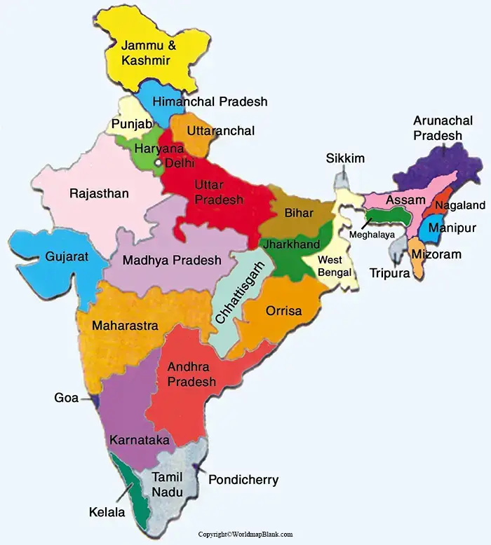
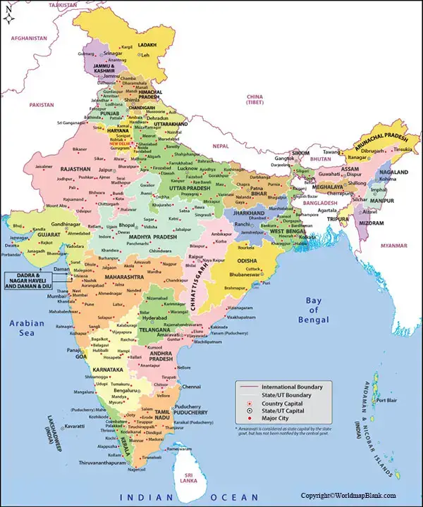
Labeled Map of India with Cities
A Labeled India Map with Cities helps users identify major urban centers and their approximate geographic positions.
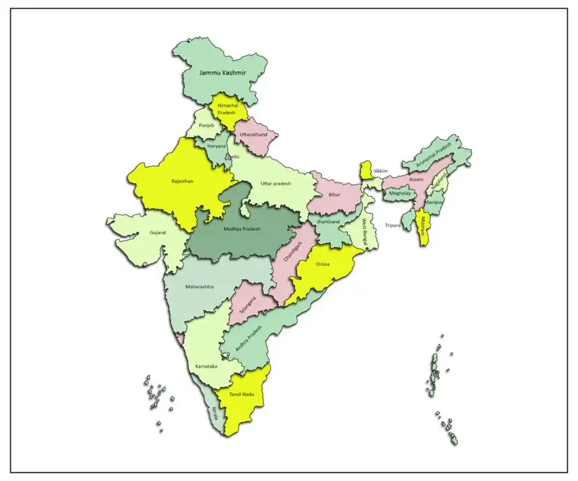
Important cities shown on India maps may include:
- New Delhi
- Mumbai
- Bengaluru
- Chennai
- Kolkata
- Hyderabad
- Ahmedabad
- Pune
- Jaipur
- Lucknow
- Surat
- Kanpur
- Nagpur
- Indore
- Bhopal
- Patna
- Chandigarh
- Kochi
- Visakhapatnam
- Bhubaneswar
- Guwahati
- Srinagar
The term “major city” can refer to population, economic activity, administration, transportation, education, industry, or regional importance. Therefore, a map showing major cities should not automatically be interpreted as a ranking of India’s cities.
Labeled India Map with Capital
India’s national capital is New Delhi, which forms part of the National Capital Territory of Delhi.
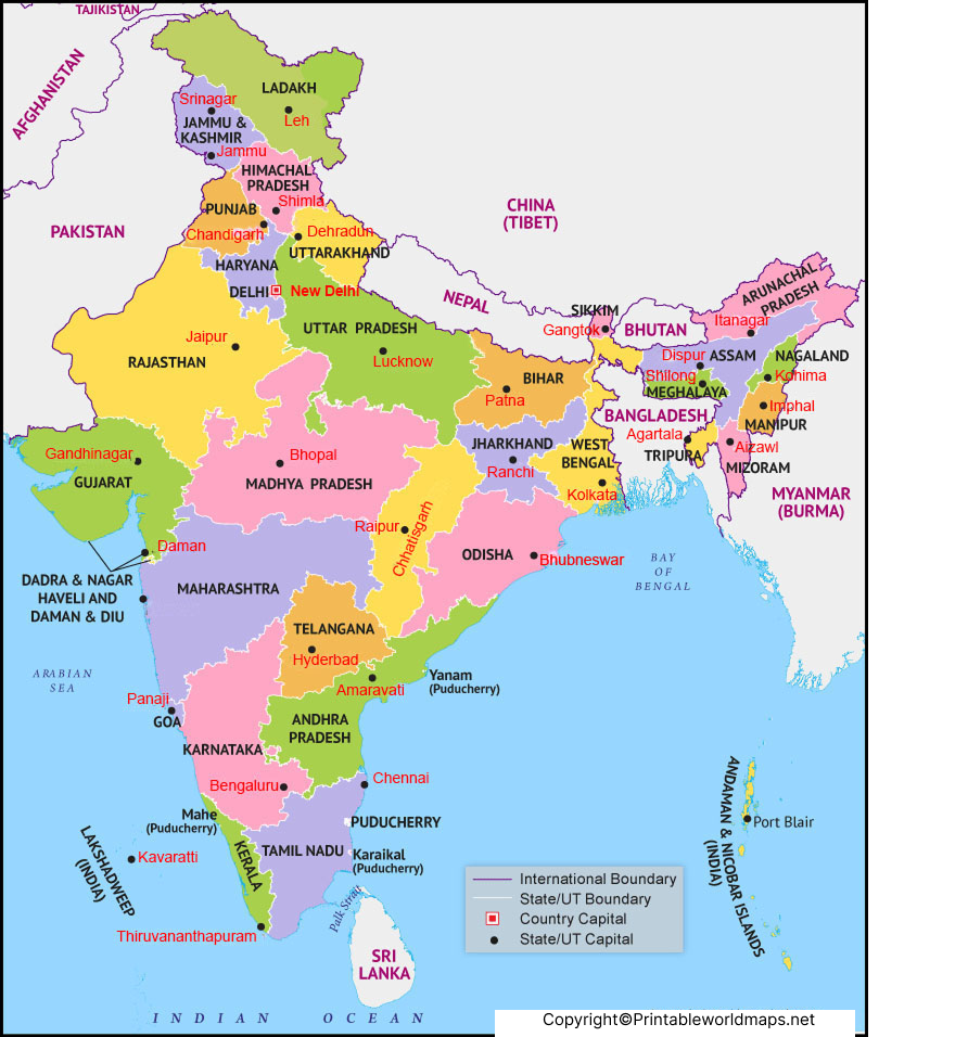
New Delhi is located in northern India along the Yamuna River. Delhi borders Haryana on three sides and Uttar Pradesh to the east.
It is important to distinguish between Delhi and New Delhi. Delhi is the National Capital Territory, while New Delhi is the capital of India and an important administrative area within Delhi.
Geography of India
India’s geographic position gives it a distinctive relationship with the surrounding mountains, seas, and neighboring countries.
The country lies approximately between 8°4′ and 37°6′ north latitude and 68°7′ and 97°25′ east longitude.
India’s northern boundary is dominated by the Himalayas. To the south, the Indian peninsula extends into the Indian Ocean. The Arabian Sea lies to the west, while the Bay of Bengal lies to the east.
Neighboring Countries
India shares land borders with:
- Pakistan
- Afghanistan
- China
- Nepal
- Bhutan
- Bangladesh
- Myanmar
The exact treatment of India’s western and northern boundary descriptions can vary between sources because some boundaries are disputed. For a general educational map, use an authoritative map source and clearly distinguish internationally recognized boundaries from disputed areas.
Sri Lanka is separated from India by the Palk Strait and Gulf of Mannar.
Major Physical Features Shown on an India Map
A detailed physical or labeled map can help identify several important geographic regions.
The Himalayas
The Himalayan mountain system stretches across northern India and includes some of the world’s highest mountain peaks. It strongly influences India’s climate, river systems, ecology, and human settlement.
The Northern Plains
The Northern Plains are associated with major river systems such as the Ganga, Yamuna, and Brahmaputra. The region contains extensive agricultural areas and many large urban centers.
The Thar Desert
The Thar Desert is mainly located in Rajasthan and extends into parts of neighboring Pakistan. It is an important geographic feature of northwestern India.
The Deccan Plateau
The Deccan Plateau occupies much of peninsular India and includes extensive areas of Maharashtra, Karnataka, Telangana, Andhra Pradesh, and Tamil Nadu.
Coastal Regions
India has extensive coastlines along the Arabian Sea, Bay of Bengal, and Indian Ocean. Its coastal geography includes beaches, estuaries, deltas, lagoons, mangroves, ports, and islands.
Major Rivers of India
Rivers are an important part of India’s physical geography and are frequently identified on educational maps.
Major river systems include:
- Ganga
- Yamuna
- Brahmaputra
- Indus
- Godavari
- Krishna
- Mahanadi
- Narmada
- Tapi
- Kaveri
The Himalayan and peninsular river systems differ in their geographic origins, flow patterns, drainage characteristics, and seasonal behavior.
India Map for Students and Education
A Labeled India Map can be useful for school assignments, geography lessons, classroom activities, quizzes, presentations, and exam preparation.
Students can use different map types for different purposes:
- Political map: states, union territories, and boundaries
- Physical map: mountains, plateaus, plains, deserts, and rivers
- Road map: highways and transportation routes
- City map: major urban locations
- Blank map: practice labeling states and geographic features
- Outline map: drawing, coloring, and classroom exercises
For educational use, check the publication date and source of a map before using it in assignments because administrative boundaries and geographic measurements can be updated.
Why Use a Labeled India Map?
A labeled map provides a quick geographic reference without requiring users to identify every location from an outline alone.
It can help users:
- Identify Indian states and union territories.
- Locate state capitals.
- Find major cities.
- Understand India’s neighboring countries.
- Study India’s physical geography.
- Prepare geography assignments.
- Print a map for classroom use.
- Compare India’s regions and geographic features.
- Understand India’s position within South Asia.
- Use a visual reference while studying Indian geography.
India Map: Important Facts at a Glance
| Fact | Information |
|---|---|
| Official name | Republic of India |
| Region | South Asia |
| Capital | New Delhi |
| Number of states | 28 |
| Number of union territories | 8 |
| Total states and UTs | 36 |
| Area | 3,287,263 km² |
| Currency | Indian Rupee (INR) |
| Country code | +91 |
| Time zone | Indian Standard Time (IST), UTC+5:30 |
| 2011 Census population | 1,210,854,977 |
| UN 2025 population estimate | Approximately 1.464 billion |
| Highest mountain peak in India | Kangchenjunga |
| Major surrounding waters | Arabian Sea, Bay of Bengal, Indian Ocean |
| Official language at Union level | Hindi and English are used for Union official purposes under applicable law |
| Independence | 15 August 1947 |
| Republic | 26 January 1950 |
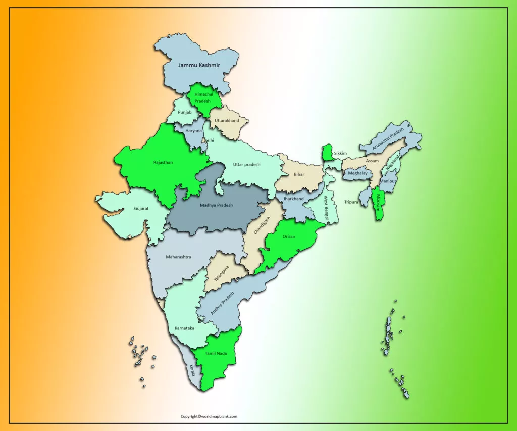
Frequently Asked Questions About the Labeled India Map
How many states are there in India?
India has 28 states and 8 union territories, making a total of 36 states and union territories.
What is the capital of India?
New Delhi is the capital of India.
What is the area of India?
India covers approximately 3,287,263 square kilometers.
How many union territories are there in India?
India currently has 8 union territories.
What is the difference between Delhi and New Delhi?
Delhi is the National Capital Territory, while New Delhi is the capital of India and an administrative area within Delhi.
India shares land borders with Pakistan, Afghanistan, China, Nepal, Bhutan, Bangladesh, and Myanmar. Boundary descriptions involving some areas are subject to territorial disputes and should be interpreted using authoritative sources.
What are the major cities shown on a labeled India map?
Depending on the map, major cities can include New Delhi, Mumbai, Bengaluru, Chennai, Kolkata, Hyderabad, Ahmedabad, Pune, Jaipur, Lucknow, Surat, Nagpur, and other regional centers.
Where can I download a printable India map?
The PDF resources provided on this page can be used to download and print different versions of the India map, including labeled maps, state maps, city maps, and capital maps.
What is India’s population?
The official 2011 Census recorded 1,210,854,977 people. For a newer figure, the United Nations estimated India’s 2025 population at approximately 1.464 billion. These are different types of figures and should not be treated as interchangeable.
What seas and ocean surround India?
The Arabian Sea lies to the west, the Bay of Bengal lies to the east, and the Indian Ocean lies to the south.
Reference Links
Government of India — National Portal
https://www.india.gov.in/
Government of India — States and Union Territories
https://www.india.gov.in/services/state
Ministry of Home Affairs — Union Territories
https://www.mha.gov.in/
Census of India — Population Finder
https://censusindia.gov.in/census.website/en/data/population-finder
Census of India — 2011 Population Data
https://www.censusindia.gov.in/
United Nations — India Data
https://data.un.org/en/iso/IN.html
Survey of India
https://surveyofindia.gov.in/
Press Information Bureau — Government of India
https://www.pib.gov.in/









