
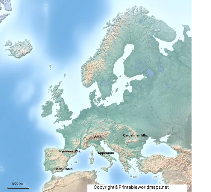
A labeled map of Europe shows the countries, major geographical features, seas, rivers, and important cities of Europe with their names clearly marked. This page provides several printable labeled maps of Europe in PDF and image formats for geography lessons, classroom activities, studying, worksheets, presentations, and map quizzes.
Because the geographical definition of Europe varies in some cases, the number of countries associated with the continent can differ depending on the classification used. For example, the United Nations uses its M49 statistical classification to group countries and areas for statistical purposes, while organizations such as the Council of Europe use a different membership-based definition.
Use the maps below to study European countries, capitals, rivers, seas, and neighboring regions. You can view the maps online, download the available PDF files, or print them for educational use.
Labeled Map of Europe
Our labeled map of Europe provides a clear geographical overview of the continent, including country names and major geographical boundaries.
Europe is the western part of the larger Eurasian landmass. Its eastern boundary is commonly associated with the Ural Mountains, although the precise geographical boundaries of Europe are not defined by a single universally accepted standard.
A labeled Europe map is useful because it allows students and readers to identify countries by location rather than memorizing country names separately.
What You Can Learn From a Labeled Map of Europe
A labeled Europe map can help you identify:
- European countries and their relative locations
- National capitals
- Major rivers
- Surrounding seas and oceans
- Neighboring regions of Asia and Africa
- Northern, Southern, Eastern, and Western European regions
- Countries that extend across the Europe–Asia boundary
- Major geographical features used to understand Europe’s physical geography
For statistical purposes, the United Nations M49 system places countries and areas into geographical regions for data and reporting. The UN also notes that these classifications are designed for statistical convenience and do not establish political or legal boundaries.
Map of Europe with Countries and Capitals
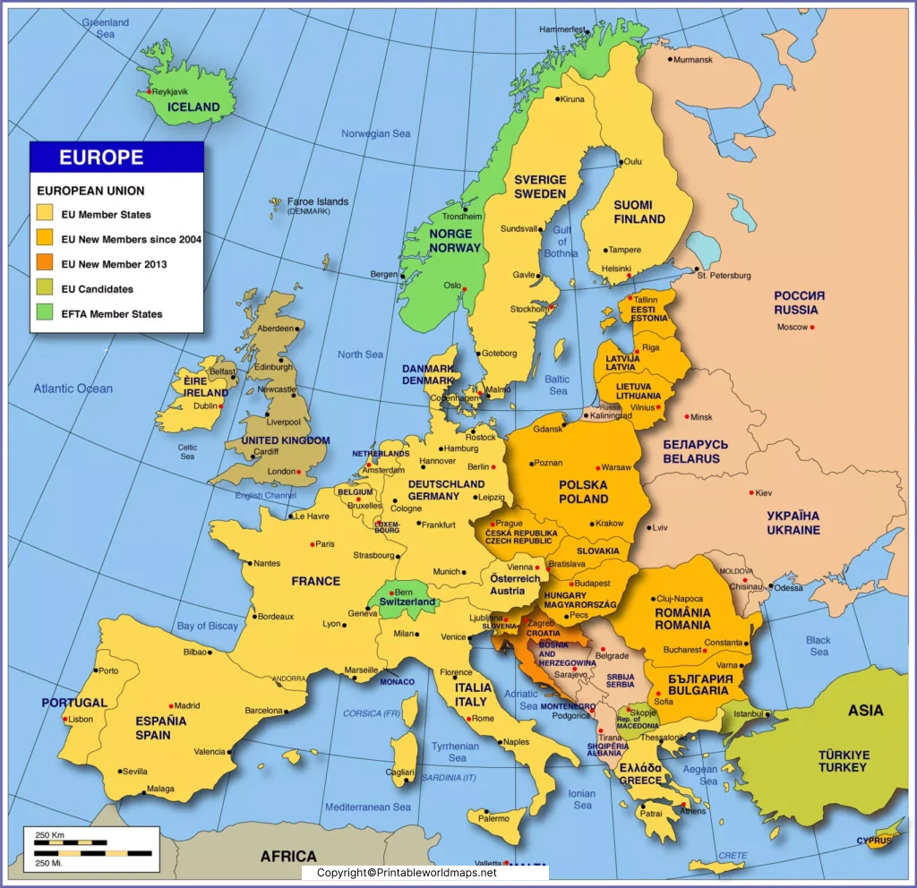
This labeled map of Europe with countries and capitals is useful for students who want to learn both the location of each country and its capital city.

European countries commonly shown on educational maps include Albania, Andorra, Austria, Belarus, Belgium, Bosnia and Herzegovina, Bulgaria, Croatia, Czechia, Denmark, Estonia, Finland, France, Germany, Greece, Hungary, Iceland, Ireland, Italy, Latvia, Liechtenstein, Lithuania, Luxembourg, Malta, Moldova, Monaco, Montenegro, the Netherlands, North Macedonia, Norway, Poland, Portugal, Romania, San Marino, Serbia, Slovakia, Slovenia, Spain, Sweden, Switzerland, Ukraine, the United Kingdom, and others depending on the geographical classification used.
Some countries have territory associated with both Europe and Asia. These include Russia and Türkiye, while Armenia, Azerbaijan, Georgia, and Kazakhstan are also involved in different geographical definitions of the Europe–Asia boundary.
The Council of Europe currently has 46 member states, which is an institutional grouping rather than a definition of all European countries.
Labeled Map of Europe with Rivers
A labeled map of Europe with rivers helps students understand Europe’s physical geography and the waterways that cross multiple countries.
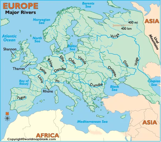
Major European rivers represented on this type of map include:
- Danube
- Rhine
- Volga
- Dnieper
- Don
- Vistula
- Oder
- Elbe
- Loire
- Seine
- Rhône
- Tagus
- Po
- Thames
- Shannon
Rivers are particularly useful for geography study because many European waterways cross national borders and connect different parts of the continent.
Seas and Water Bodies Around Europe
A Europe rivers and physical geography map may also show important surrounding water bodies, including:
- Atlantic Ocean
- North Sea
- Norwegian Sea
- Barents Sea
- Baltic Sea
- Mediterranean Sea
- Black Sea
- Caspian Sea
- Bay of Biscay
Europe Map with Capitals Labeled
This Europe map with capitals labeled is designed for learning the names and locations of European capital cities.
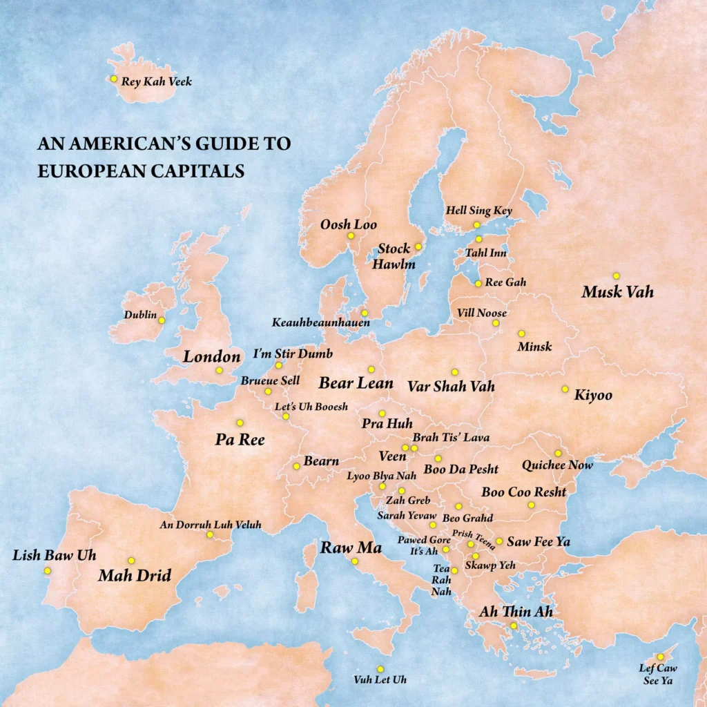
A capital-city map can be used for:
- Geography homework
- Classroom lessons
- Capital-city memorization
- Geography quizzes
- Student worksheets
- Presentation materials
- Independent study
For an additional challenge, use a blank map and try to fill in the capitals without looking at the labeled version.
Europe Map with Country Names
This Europe map with country names focuses primarily on national boundaries and country labels. It is useful when you need a straightforward reference map without a large number of city labels.
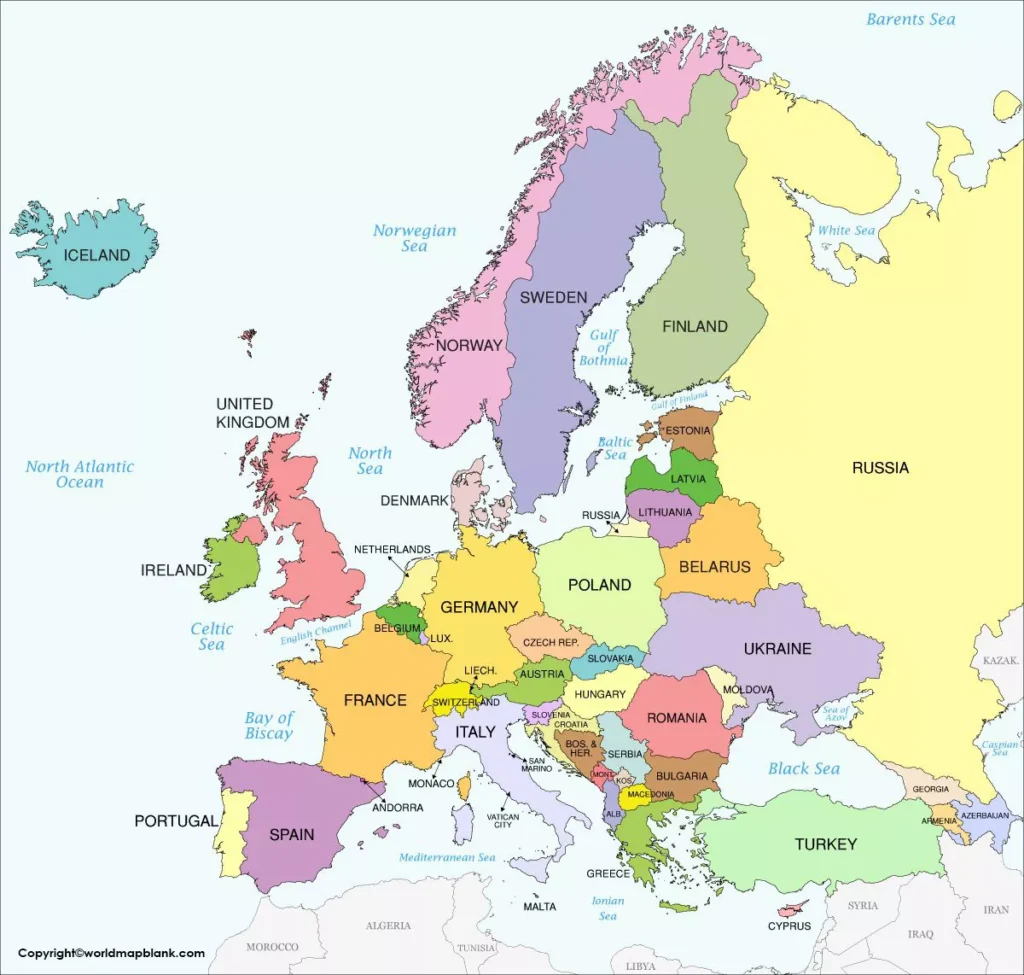
The map also provides geographical context by showing neighboring areas and surrounding seas.
For classroom exercises, pair this labeled map with our blank map of Europe and ask students to identify countries, borders, and capitals without the labels.
How Many Countries Are in Europe?
There is no single number that applies to every geographical or institutional definition of Europe.
The difference occurs because Europe and Asia form one continuous Eurasian landmass, and several countries are geographically or politically associated with both regions. The classification can therefore change depending on whether the focus is physical geography, statistical regions, political organizations, or commonly used educational conventions.
The United Nations M49 classification is specifically designed for statistical purposes and states that its regional groupings do not imply a political or legal position concerning borders or affiliations.
For comparison, the Council of Europe currently lists 46 member states. This figure should not be treated as the total number of geographical countries in Europe because Council of Europe membership is an institutional classification.
This is why educational maps may sometimes show different numbers of European countries.
Europe–Asia Boundary
One of the most interesting aspects of European geography is its boundary with Asia.
Europe is part of Eurasia, so there is no ocean separating the two continents across their entire eastern boundary. A commonly used geographical convention follows features such as the Ural Mountains, Ural River, Caspian Sea, Caucasus region, Black Sea, and associated waterways.
However, there is no single universally accepted definition for every part of the Europe–Asia boundary. This is particularly relevant when discussing countries such as Russia and Türkiye.
For students, a labeled map is therefore more useful when it is viewed as a geographical reference rather than assuming every boundary classification is universally agreed upon.
How to Use a Labeled Map of Europe
A printable labeled map of Europe can be used in many ways.
For Students
Use the map to learn:
- Country locations
- European capitals
- Major rivers
- Seas and oceans
- Regional geography
- Europe–Asia geography
For Teachers
Teachers can use the maps for:
- Geography worksheets
- Classroom presentations
- Map-labeling exercises
- Country identification activities
- Capital-city quizzes
- Geography revision
- Homework assignments
For Geography Quizzes
Print the labeled map first to study the locations. Then use a blank Europe map to test your knowledge by filling in the country names and capitals from memory.
Frequently Asked Questions About the Labeled Map of Europe
What is a labeled map of Europe?
A labeled map of Europe is a geographical map that identifies European countries and may also show capitals, rivers, seas, surrounding regions, and other important geographical features.
Can I download the labeled map of Europe as a PDF?
Yes. The maps on this page include downloadable PDF versions where provided. You can save them for offline study or print them for classroom and educational activities.
How many countries are shown on a Europe map?
The number can vary depending on the geographical or institutional classification being used. Europe–Asia boundary questions and different definitions of European territory can affect the total.
What countries are included in Europe?
Commonly recognized European countries include France, Germany, Spain, Italy, Portugal, Poland, Norway, Sweden, Finland, Greece, Ireland, Ukraine, Switzerland, Austria, Belgium, the Netherlands, and many others. Countries with territory or geographical connections spanning Europe and Asia may be treated differently by different classifications.
What is the largest country in Europe?
Russia is the largest country by total area and has territory in both Europe and Asia. If considering countries located entirely within Europe, Ukraine is commonly identified as the largest.
What is the smallest country in Europe?
Vatican City is the smallest sovereign state in Europe by area and population.
What is the longest river in Europe?
The Volga is generally recognized as the longest river in Europe. It flows through western Russia and empties into the Caspian Sea.
What is the difference between a labeled and blank map of Europe?
A labeled map displays geographical names, while a blank map removes most or all labels so students can practice identifying countries, capitals, and geographical features.
Can I use these Europe maps for school projects?
Yes. The printable maps can be useful for geography lessons, worksheets, presentations, revision activities, and map-based classroom exercises. Check the site’s specific usage terms if you intend to redistribute or commercially reproduce the files.
Why do different websites show different numbers of European countries?
Different sources may use different geographical, statistical, political, or institutional definitions. The United Nations M49 system, for example, is designed for statistical classification and explicitly states that its groupings do not establish political or legal boundaries.
Reference Links
https://unstats.un.org/unsd/methodology/m49
https://www.coe.int/en/web/portal/members-states
Maps of European Countries
Map of Germany with States and Cities









