

A Blank Map of Botswana is a useful resource for students, teachers, geography enthusiasts, and anyone who wants to study the country’s location, shape, and neighboring countries. These printable maps are useful for classroom activities, geography assignments, map-labeling exercises, and educational projects.
You can use the blank outline map, printable map, transparent PNG map, and practice worksheet below to explore Botswana’s geography. Choose a PNG image for digital projects or a PDF file for convenient printing.
- Labeled Map of Asia
- Labeled Map of Europe
- Labeled Map of Africa
- Labeled Map of South America
- Labeled Map of North America
- World Map With Continents
- Physical World Map
- Political World Map
- World Map with Oceans
- World Map Poster
- World Time Zone Map
- Labeled Map of World
- Blank Map of World
Blank Map of Botswana – Outline
A blank map of Botswana outline shows the country’s external boundaries without requiring you to rely on labels for every geographical feature. It is suitable for drawing exercises, identifying neighboring countries, and learning the general shape of Botswana.
Botswana is a landlocked country in Southern Africa. It shares borders with Namibia, South Africa, Zimbabwe, and Zambia. Its landscape is largely associated with the Kalahari, while the Okavango Delta and Chobe region are notable geographical features in the north.

Use this outline to practice tracing the country’s shape, identifying its borders, or adding labels for major towns and geographical features. For formal educational or research work, compare your completed map with an authoritative reference map.
Printable Map of Botswana
A printable map of Botswana is convenient for school assignments, revision, classroom exercises, and personal geography projects. Instead of drawing the entire country from scratch, you can print the map and use it as a starting point for learning.
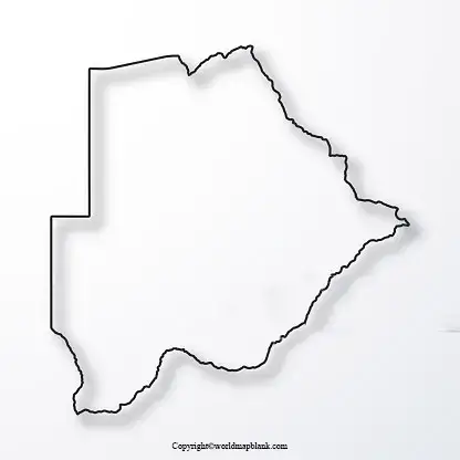
Depending on the version, a printable map can help you mark the capital city, neighboring countries, major towns, rivers, and important geographical regions.
For a classroom activity, ask students to identify Botswana’s capital, label its four neighboring countries, and mark the approximate location of the Okavango Delta. Check whether the particular map includes labels or boundaries before using it for a specific exercise.
Transparent PNG Blank Map of Botswana
A transparent PNG blank map of Botswana can be useful for digital presentations, school projects, worksheets, and custom map designs. Unlike a JPEG image, a PNG file can preserve a transparent background when the original image has transparency.
This makes the format useful for placing the map over a colored background, adding labels, or incorporating the outline into a presentation. Actual transparency depends on the image file, so check the downloaded PNG before using it.

For the best results, use a graphics editor or presentation application to add place names, notes, or other educational details. If the map will be published or used in a commercial project, check the applicable image license and attribution requirements first.
Map of Botswana for Practice Worksheet
A map of Botswana practice worksheet can help learners test their knowledge of African geography. An unlabeled map encourages students to recall locations independently rather than simply reading information from a labeled map.
Teachers and students can use this worksheet for classroom assessments, homework, revision, and geography quizzes.

Suggested map practice activities
- Trace the outline of Botswana.
- Label Namibia, South Africa, Zimbabwe, and Zambia.
- Mark Gaborone, the capital of Botswana.
- Locate the Okavango Delta in northwestern Botswana.
- Identify the Chobe region in the north.
- Compare your answers with an authoritative reference map.
Repeat the exercise without looking at your reference material to improve geographical recall. Teachers can also ask learners to explain why Botswana is described as a landlocked country.
Botswana Geography: Important Facts
Use these verified geographical facts to add context to your blank map exercise.
- Official name: Republic of Botswana.
- Region: Southern Africa.
- Capital city: Gaborone.
- Total area: Approximately 581,730 square kilometres.
- Geographical position: Botswana is landlocked.
- Neighboring countries: Namibia, South Africa, Zimbabwe, and Zambia.
- Major landscape: Much of the country is associated with the Kalahari sands.
- Notable geographical feature: The Okavango Delta is located in northwestern Botswana.
- Official language: English.
- National language: Setswana.
These details are supported by the Government of Botswana and Botswana Tourism Organisation. See the reference links at the end of this article.
Why is Botswana’s location important?
Botswana’s position in Southern Africa makes it useful for studying regional geography and international boundaries. On a blank map, students can examine its landlocked location, its borders with four countries, and the relationship between its interior landscapes and northern river systems.
The Okavango Delta is particularly interesting because the Okavango River flows inland into a large delta system rather than reaching the sea. This is a valuable example of how rivers and landforms influence the geography of a region.
How to Use and Print a Blank Botswana Map
Follow these steps to get the most from your printable map:
- Choose a format: Select PNG or JPG for an image file, or PDF for a print-ready document.
- Open the file: Check that the complete map is visible and that the borders are not cut off.
- Select paper size: Use A4 or Letter paper according to your printer and classroom requirements.
- Adjust print settings: Choose portrait or landscape orientation to suit the map’s proportions. Use the print preview to check the result.
- Complete the exercise: Add country names, cities, geographical features, or other labels as required.
- Verify your answers: Compare the finished worksheet with an authoritative geographical reference.
For a clean worksheet, print the map in black and white if it has clear boundaries. For digital use, choose a sufficiently high-resolution image so the outline remains readable when enlarged.
Frequently Asked Questions
1. Where can I download a blank map of Botswana?
You can download the blank Botswana outline map from the PNG and PDF links provided in the outline section above. The printable map and practice worksheet sections also include their own download links.
2. Is the blank map of Botswana available as a PDF?
Yes. PDF download links are provided for the outline map, printable map, transparent-map version, and practice worksheet. Open the relevant link to check the file before printing.
3. What is a blank outline map of Botswana used for?
It is useful for geography lessons, map tracing, school assignments, quizzes, labeling neighboring countries, and educational presentations.
4. What is the capital city of Botswana?
Gaborone is the capital city of Botswana.
5. Which countries border Botswana?
Botswana shares borders with Namibia, South Africa, Zimbabwe, and Zambia.
6. Why is Botswana called a landlocked country?
Botswana is landlocked because it has no direct coastline on an ocean or sea. Its international borders are with other countries.
7. Can I use a transparent PNG map in a presentation?
Yes. A PNG with a genuine transparent background can be placed over different backgrounds in a presentation or graphics editor. Check the image’s transparency and usage permissions before publishing it.
8. What is the best way to print a Botswana map for school?
Download the PDF when available, check the print preview, and select a suitable paper size. Make sure the entire outline is visible and leave enough space for students to add labels.
9. What geographical feature is the Okavango Delta known for?
The Okavango Delta is a major inland delta system in northwestern Botswana. It is an important feature for studying the country’s rivers, wetlands, and natural environments.
10. Where can I verify facts about Botswana’s geography?
Consult the official Government of Botswana website and the Botswana Tourism Organisation’s geographical information pages. These provide reliable background information on the country’s location, capital, area, borders, and landscape.
Reference links
https://gov.bw/about-our-country
https://www.botswanatourism.co.bw/index.php/glance
https://www.botswanatourism.co.bw/index.php/location
https://www.hcigaborone.gov.in/page/botswanaprofile
https://www.nationalgeographic.org/education/what-is-geography
