

A Blank Map of Lithuania is a useful resource for students, teachers, researchers, travelers, and anyone who wants to study the geography of Lithuania. Printable outline maps can be used for labeling cities, identifying neighboring countries, practicing geography, creating classroom worksheets, and preparing presentations.
This page provides several useful Lithuania map formats, including a blank outline map, printable map, transparent PNG map, PDF map, and practice worksheet. The maps can be downloaded, printed, or used digitally for educational and creative projects.
Lithuania is a country in the Baltic region of northeastern Europe. It shares land borders with Latvia, Belarus, Poland, and Russia’s Kaliningrad Oblast and has a coastline on the Baltic Sea. Its capital and largest city is Vilnius.
- Labeled Map of Asia
- Labeled Map of Europe
- Labeled Map of Africa
- Labeled Map of South America
- Labeled Map of North America
- World Map With Continents
- Physical World Map
- Political World Map
- World Map with Oceans
- World Map Poster
- World Time Zone Map
- Labeled Map of World
- Blank Map of World
Blank Map of Lithuania – Outline
The Blank Map of Lithuania outline is designed for geography practice, classroom activities, worksheets, coloring exercises, and map-labeling assignments. A blank outline removes most geographic labels so students can identify important locations themselves.
Lithuania covers approximately 65,284 square kilometers. According to 2025 figures published by the European Union using Eurostat data, the country has a population of 2,890,664. The capital city is Vilnius, and Lithuanian is the country’s official language.
Lithuania’s neighboring countries are:
- Latvia to the north
- Belarus to the east and southeast
- Poland to the south
- Russia’s Kaliningrad Oblast to the southwest
- Baltic Sea to the west
A blank outline map is particularly useful because students can add borders, cities, rivers, lakes, counties, or other geographic features by hand.
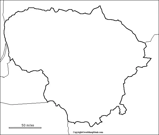
How to Use the Blank Lithuania Outline Map
Teachers and students can use the outline map for:
- Identifying Lithuania’s neighboring countries
- Labeling Vilnius and other major cities
- Marking rivers and lakes
- Practicing country and regional geography
- Creating geography quizzes
- Coloring and classroom activities
- Making custom study worksheets
- Preparing school projects and presentations
For repeated classroom use, teachers can print multiple copies and create different exercises from the same basic outline.
Printable Map of Lithuania
A printable map of Lithuania provides more geographic information than a completely blank outline. It can help users identify cities, boundaries, geographic locations, and surrounding countries.

A printable Lithuania map can be useful for students studying European geography, teachers preparing classroom materials, travelers planning an educational project, and researchers who need a simple geographic reference.
For best printing results, use a high-resolution PNG or PDF file and select the appropriate paper size in your printer settings.
Transparent PNG Blank Map of Lithuania

A transparent PNG map of Lithuania is useful when the map needs to be placed over another background. Because the background is transparent, the map can be incorporated into presentations, worksheets, graphics, websites, videos, and other digital projects.
The transparent PNG version can be useful for:
- PowerPoint presentations
- Geography worksheets
- Educational websites
- Digital maps
- Infographics
- Video projects
- Graphic design
- Classroom presentations
Users can combine the transparent map with colors, labels, symbols, photographs, or other geographic information.
Map of Lithuania for Practice Worksheet
A Lithuania map practice worksheet gives students an opportunity to test their geographic knowledge without relying on pre-labeled information.
A teacher can ask students to identify or label:
- Lithuania
- Vilnius
- Latvia
- Belarus
- Poland
- Kaliningrad Oblast
- Baltic Sea
- Major rivers
- Important lakes
- Counties or municipalities
The worksheet can also be adapted for different age groups. Younger students may focus on coloring and identifying neighboring countries, while older students can label physical and administrative features.
Lithuania Map Facts
The following facts provide useful geographic context when studying a Blank Map of Lithuania:
| Geographic fact | Information |
|---|---|
| Official name | Republic of Lithuania |
| Capital | Vilnius |
| Area | 65,284 km² |
| Population | 2,890,664 (2025) |
| Official language | Lithuanian |
| Currency | Euro (€) |
| EU membership | Since 1 May 2004 |
| Euro area | Since 1 January 2015 |
| Schengen Area | Since 21 December 2007 |
| Counties | 10 |
| Municipalities | 60 |
| Highest point | Aukštojas, 294 m |
| Longest river listed in national statistics | Nemunas, 476.9 km within Lithuania |
| Region | Baltic region of Europe |
The area and population figures above are from the European Union’s Lithuania country profile, which identifies the population and geographical size as 2025 Eurostat figures. Lithuania’s administrative structure of 10 counties and 60 municipalities is documented by Lithuania’s State Data Agency.
The State Data Agency also lists Aukštojas at 294.0 metres as the country’s highest hill and the Nemunas at 476.9 km within Lithuania among its geographic data.
Administrative Map of Lithuania
Lithuania is administratively divided into 10 counties and 60 municipalities. The counties are:
- Alytus County
- Kaunas County
- Klaipėda County
- Marijampolė County
- Panevėžys County
- Šiauliai County
- Tauragė County
- Telšiai County
- Utena County
- Vilnius County
These administrative divisions can be useful when creating a labeled or blank administrative map of Lithuania. The official State Data Agency provides county and municipality information through its regional statistics resources.
Major Cities to Locate on a Lithuania Map
When using a blank map for geography practice, students can locate and label important Lithuanian cities such as:
- Vilnius – the capital and largest city
- Kaunas – a major city in central Lithuania
- Klaipėda – an important Baltic Sea port
- Šiauliai – a major city in northern Lithuania
- Panevėžys – an important city in northern-central Lithuania
- Alytus – a city in southern Lithuania
- Marijampolė – a city in southwestern Lithuania
- Telšiai – a city in western Lithuania
- Utena – a city in northeastern Lithuania
- Tauragė – a city in western Lithuania
These locations provide useful starting points for classroom exercises involving cities, regions, transportation, and physical geography.
Physical Geography of Lithuania
Lithuania has a relatively low-lying landscape with forests, lakes, rivers, wetlands, agricultural areas, and gently varied terrain.
The country’s geographic features include numerous inland lakes and rivers. National statistics identify Drūkšiai as one of Lithuania’s largest lakes and the Nemunas as its longest river within the country.
Lithuania also has protected natural areas, including national parks and regional parks. The State Data Agency’s environmental statistics provide official information on protected areas and geographic features.
Lithuania Map for Students and Teachers
A blank map is especially useful for active learning because students have to recall locations instead of simply reading labels.
Teachers can create activities such as:
- Label-the-map exercises
- Neighboring-country quizzes
- City identification tests
- River and lake labeling
- County identification activities
- Map coloring exercises
- Geography homework
- European geography revision
- Classroom competitions
- Printable study guides
For older students, the map can be combined with physical geography, population, transportation, historical geography, or administrative-division assignments.
Blank Map of Lithuania for Digital Projects
The transparent PNG version is suitable for users who need to place a Lithuania outline on top of another digital design.
For example, a student could use a transparent map to create a presentation showing Lithuania’s location in Europe, while a designer could add labels, colors, arrows, or geographic symbols.
For educational websites and presentations, adding a descriptive image ALT attribute such as “Blank Map of Lithuania” helps explain the image to search engines and users who rely on accessibility tools.
How to Print the Lithuania Map
To print a Lithuania map:
- Choose the required PNG or PDF map.
- Open the file at its original resolution.
- Select your printer or PDF print option.
- Choose the required paper size.
- Select portrait or landscape orientation as appropriate.
- Use a suitable scaling option such as “Fit to Page.”
- Print the map and add labels or notes if needed.
PDF files are generally convenient when consistent page formatting is important, while PNG files are useful when the map needs to be inserted into another document or digital design.
Frequently Asked Questions About the Blank Map of Lithuania
What is a Blank Map of Lithuania used for?
A Blank Map of Lithuania can be used for geography practice, classroom worksheets, map labeling, coloring activities, presentations, research, and educational projects.
What countries border Lithuania?
Lithuania shares land borders with Latvia, Belarus, Poland, and Russia’s Kaliningrad Oblast. It also has a coastline along the Baltic Sea.
What is the capital of Lithuania?
Vilnius is the capital of Lithuania and is also the country’s largest city.
What is the area of Lithuania?
Lithuania has a geographical area of 65,284 square kilometers, according to the European Union’s country profile using 2025 Eurostat figures.
How many people live in Lithuania?
The European Union’s Lithuania profile gives a 2025 population of 2,890,664, based on Eurostat data. Population figures can change over time, so a dated source should be used when publishing statistics.
How many counties does Lithuania have?
Lithuania currently has 10 counties and 60 municipalities.
What is the highest point in Lithuania?
Aukštojas is listed by Lithuania’s State Data Agency at 294.0 metres as the country’s highest hill.
What is the longest river in Lithuania?
The Nemunas is listed in Lithuania’s official geographic statistics with 476.9 km within Lithuania.
Can I use a blank Lithuania map for a school worksheet?
Yes. A blank outline map is particularly suitable for labeling exercises, geography tests, coloring activities, and student worksheets.
What is the difference between a blank map and a transparent PNG map?
A blank map generally removes labels so users can add geographic information themselves. A transparent PNG additionally has a transparent background, making it easier to place the map over other images, colors, presentations, or designs.
Why Use Printable Lithuania Maps?
Printable maps are useful because they provide a simple visual reference that can be used without specialized mapping software. A single outline can also be reused for different learning activities.
Reference links
https://european-union.europa.eu/principles-countries-history/eu-countries/lithuania_en
https://osp.stat.gov.lt/en/geografiniai-duomenys1
https://osp.stat.gov.lt/en/regionine-statistika-pagal-statistikos-sritis
