

A Labeled Map of Asia helps students, teachers, researchers, and geography enthusiasts identify countries, international boundaries, capitals, and major cities across the Asian continent. This collection includes printable Asia maps with country names, capital cities, and city labels, making it easier to study Asian geography or prepare classroom activities.
You can view the maps online and use the available PDF files for printing, revision, assignments, and educational reference. Choose the version that best matches your needs, whether you want to learn country locations, memorize capitals, or explore the major geographical regions of Asia.
- Labeled Map of Asia
- Labeled Map of Europe
- Labeled Map of South America
- Labeled Map of North America
- Australia Labeled Map
- World Map With Continents
- Physical World Map
- Political World Map
- World Map with Oceans
- World Map Poster
- World Time Zone Map
- Labeled Map of World
- Blank Map of the World
Labeled Map of Asia
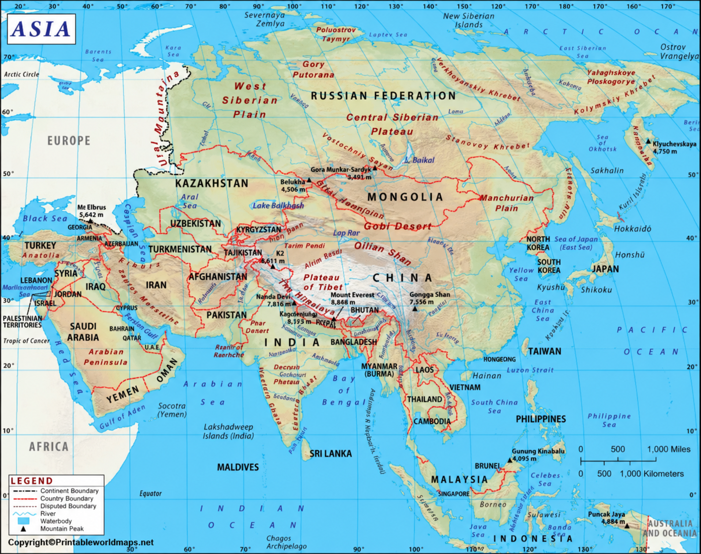
A labeled map of Asia provides a useful overview of the continent’s countries and geographical features. Depending on the map, labels may identify country names, borders, coastlines, rivers, mountain ranges, or other physical features.
Asia is the world’s largest continent by land area and is commonly divided into six broad geographical regions: East Asia, Southeast Asia, South Asia, Central Asia, Western Asia, and Northern Asia. These regional groupings help learners understand the continent’s geographical diversity.
Labeled Asia Map with Countries
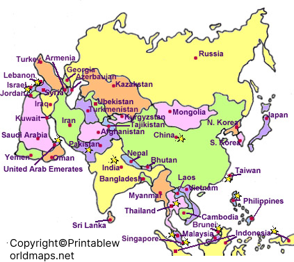
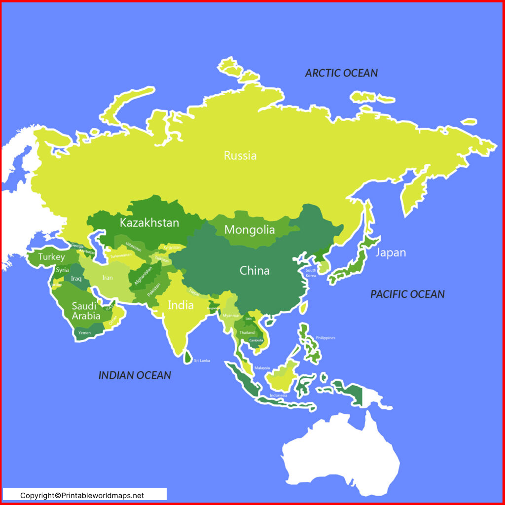
A labeled Asia map with countries helps users locate national boundaries and learn the names and positions of countries throughout the continent. It is particularly useful for school assignments, geography quizzes, and general reference.
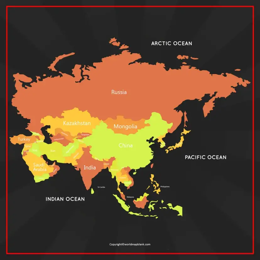
The map can help learners explore countries such as China, India, Japan, Indonesia, Saudi Arabia, Thailand, Kazakhstan, and Mongolia, along with their neighboring countries.

Asia’s geographical boundaries also extend into countries that span more than one continent. Russia is located in both Europe and Asia, while Türkiye is a transcontinental country connecting southeastern Europe and western Asia. This is one reason country counts and regional classifications can differ between educational sources.
For consistent results, check the labels and geographic conventions used in the particular map you choose.
Labeled Map of Asia with Capitals
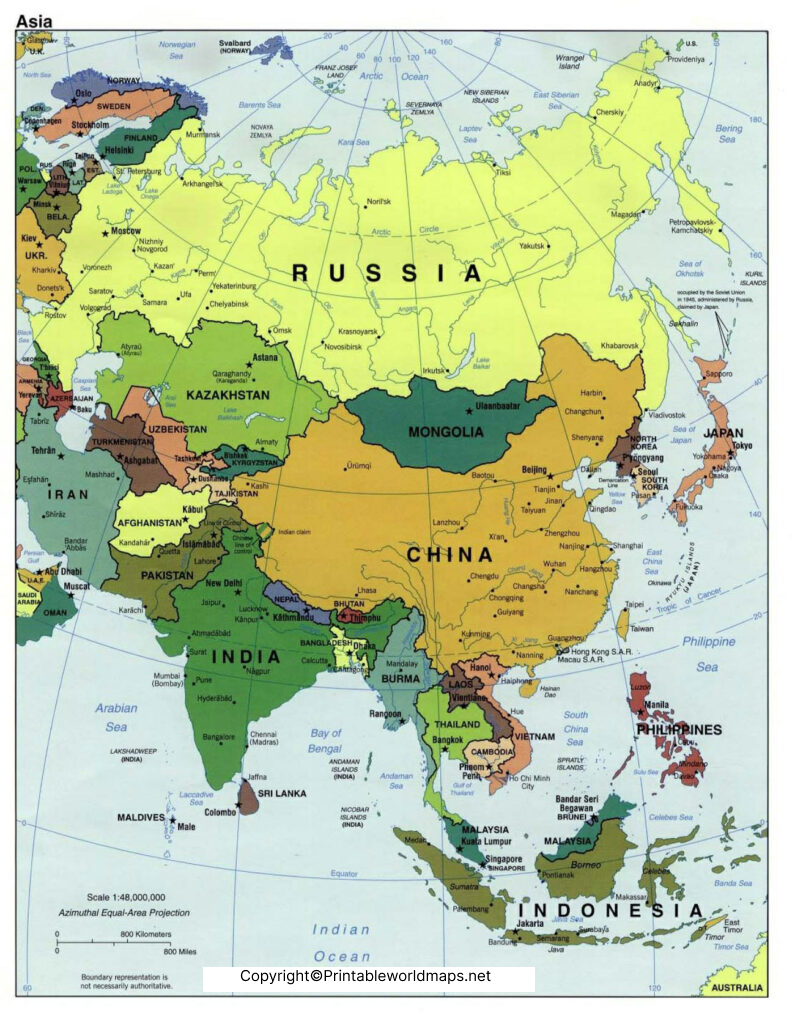
A labeled map of Asia with capitals combines country locations with the names of their capital cities. This format is helpful for students learning political geography and for anyone who wants to understand the relationship between countries and their administrative centers.
Examples of Asian capitals include:
- New Delhi — India
- Beijing — China
- Tokyo — Japan
- Seoul — South Korea
- Bangkok — Thailand
- Kathmandu — Nepal
- Dhaka — Bangladesh
- Islamabad — Pakistan
- Riyadh — Saudi Arabia
- Ulaanbaatar — Mongolia
- Hanoi — Vietnam
- Kuala Lumpur — Malaysia
These examples provide a starting point for studying capitals across different regions of Asia. Capital designations and the treatment of disputed territories can vary by source, so consult a current authoritative reference when using a map for formal educational or research purposes.
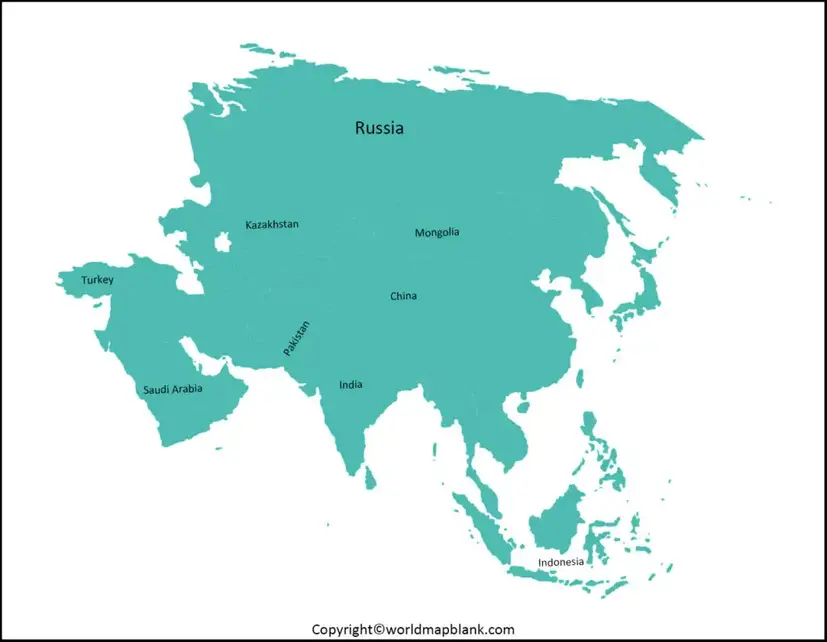
Asia Map with Cities Labeled
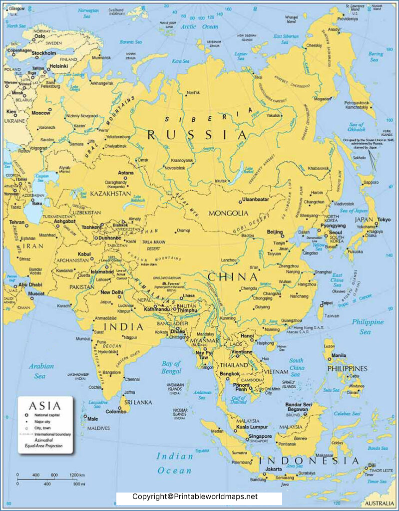
An Asia map with cities labeled highlights selected cities in addition to geographical boundaries. Depending on the map’s design, these labels may include capitals, major population centers, commercial hubs, or other important urban locations.
For example, cities such as Mumbai, Shanghai, Tokyo, Singapore, Bangkok, Dubai, and Jakarta are significant urban centers in different parts of Asia. Their roles vary, including finance, manufacturing, trade, tourism, and transportation.
A city-labeled map is useful for classroom projects, regional comparisons, travel research, and understanding where important cities are located in relation to neighboring countries.
How to Use a Printable Labeled Map of Asia
A printable map can be used for several practical learning activities:
- Learn country locations: Find countries and identify their neighbors.
- Practice capitals: Cover the capital labels and test your knowledge.
- Study regions: Group countries into broad geographical regions.
- Prepare school assignments: Use a printed map for geography projects and revision.
- Compare cities: Locate major urban centers and understand their geographical distribution.
- Improve map-reading skills: Practice identifying boundaries, coastlines, and relative locations.
For classroom use, choose a map with clear text, legible country boundaries, and sufficient print resolution. A PDF is often convenient for printing because it can preserve the document’s page layout.
Printable Asia Map PDF: Which Version Should You Choose?
Choose a map according to the information you need:
| Map type | Best use |
|---|---|
| Labeled map of Asia | General geographical study |
| Asia map with countries | Learning country names and boundaries |
| Asia map with capitals | Memorizing capitals and country locations |
| Asia map with cities | Identifying selected urban centers |
| Blank map of Asia | Quizzes, labeling exercises, and practice |
Before printing, check the map’s orientation, text size, page dimensions, and whether the PDF includes all the labels you need. Some maps may be more suitable for an A4 worksheet, while others work better on larger paper.
Important Facts About the Geography of Asia
Asia contains a wide range of physical environments, including high mountain ranges, large plateaus, deserts, river valleys, tropical forests, and extensive coastlines.
The Himalayas include Mount Everest, the world’s highest mountain above sea level. The continent also contains major rivers such as the Yangtze, Ganges, Indus, Mekong, and Yellow River. These physical features influence settlement patterns, agriculture, transport, and economic activity.
Asia’s regional divisions are useful for studying the continent, but they are not identical in every geographical or statistical classification. For example, the boundaries between Europe and Asia are based on conventional geographical definitions, and some countries span both continents.
For verified geographical background, consult National Geographic’s overview of Asia and the United Nations Member States directory.
Frequently Asked Questions
1. Where can I download a labeled map of Asia in PDF format?
You can use the PDF links provided in this article to access labeled Asia maps. Select the country, capital, or city version that best matches your requirements.
2. What information does a labeled map of Asia show?
Depending on the version, it may show country names, international boundaries, capital cities, major cities, and selected geographical features.
3. Is a labeled map of Asia useful for students?
Yes. It can support geography lessons, school assignments, revision, country-identification exercises, and capital-city quizzes.
4. What is the difference between a labeled and a blank map of Asia?
A labeled map includes names or other identifying information. A blank map leaves some or all labels out so users can practice identifying and marking geographical features themselves.
5. Can I print an Asia map for a school project?
Yes. Open the relevant PDF and check its page size and print settings. Choose a paper size that keeps country names and boundaries readable.
6. How many countries are in Asia?
The commonly cited figure is 48 countries, although counts can vary according to geographical definitions and how transcontinental countries and disputed territories are treated. For an assignment or formal reference, follow the classification used by your textbook or chosen authoritative source.
7. Which map is best for learning Asian capitals?
A labeled Asia map with capitals is the most suitable option because it connects country names with their capital cities in a single view.
8. Are the capital cities and country boundaries on every map guaranteed to be current?
Not necessarily. Maps can become outdated, and territorial or political classifications may differ between publishers. Verify important details against current authoritative sources before using a map for formal research.
Reference links
https://education.nationalgeographic.org/resource/asia-human
https://www.un.org/about-us/member-states
https://www.un.org/dgacm/en/content/regional-groups
https://developers.google.com/search/docs/fundamentals/creating-helpful-content
https://developers.google.com/search/docs/fundamentals/seo-starter-guide

21 thoughts on “Labeled Map of Asia with Countries in PDF”