
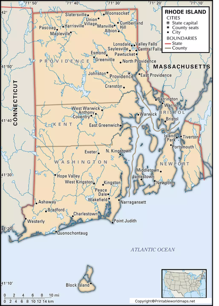
Labeled Map of Rhode Island with Capital & Cities
By viewing the Labeled Map of Rhode Island, it is possible to know more about Rhode Island (RI). In fact, the map
Read more
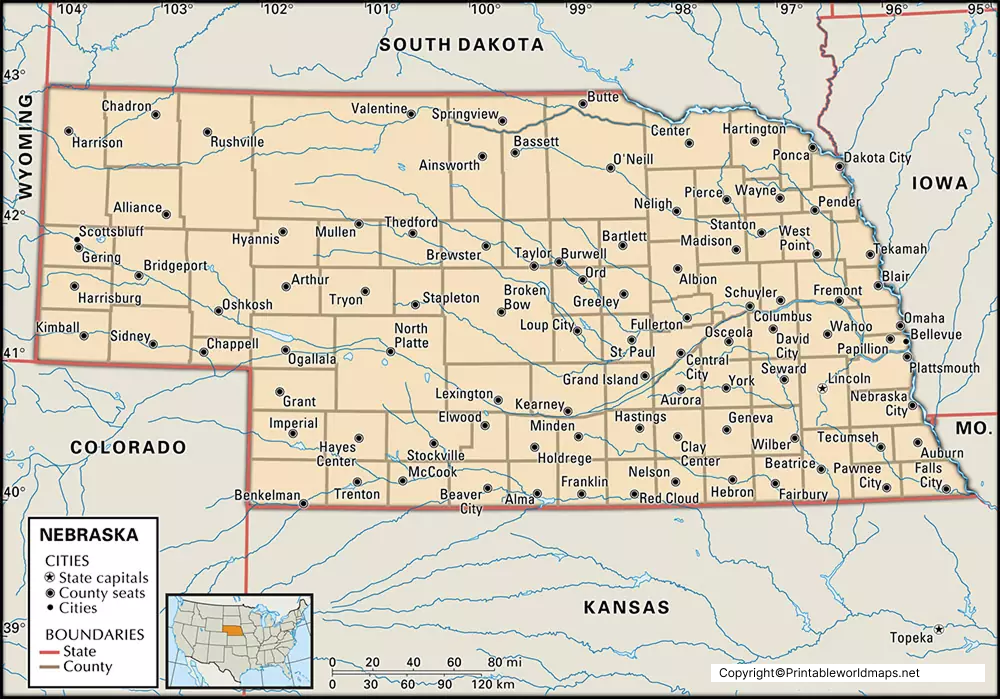
Labeled Map of Nebraska with Capital & Cities
The user of Labeled Map of Nebraska will be able to find all the details about the boundaries surrounding this state, in
Read more
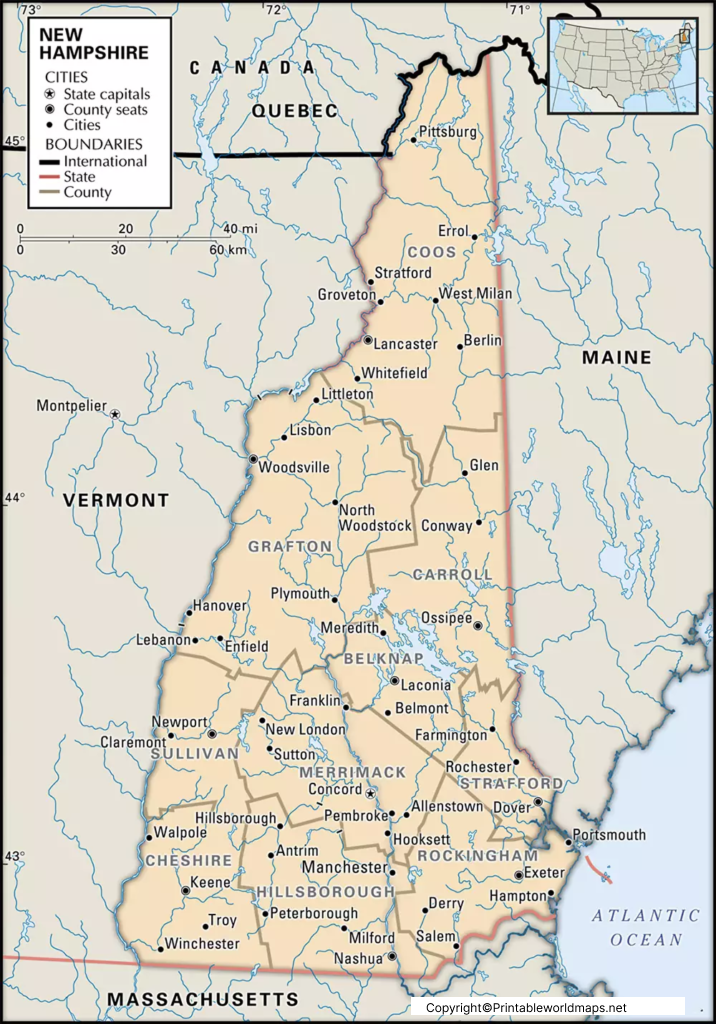
Labeled Map of New Hampshire with Capital & Cities
The advantage of viewing the Labeled Map of New Hampshire is that any user can find out the location of New Hampshire
Read more
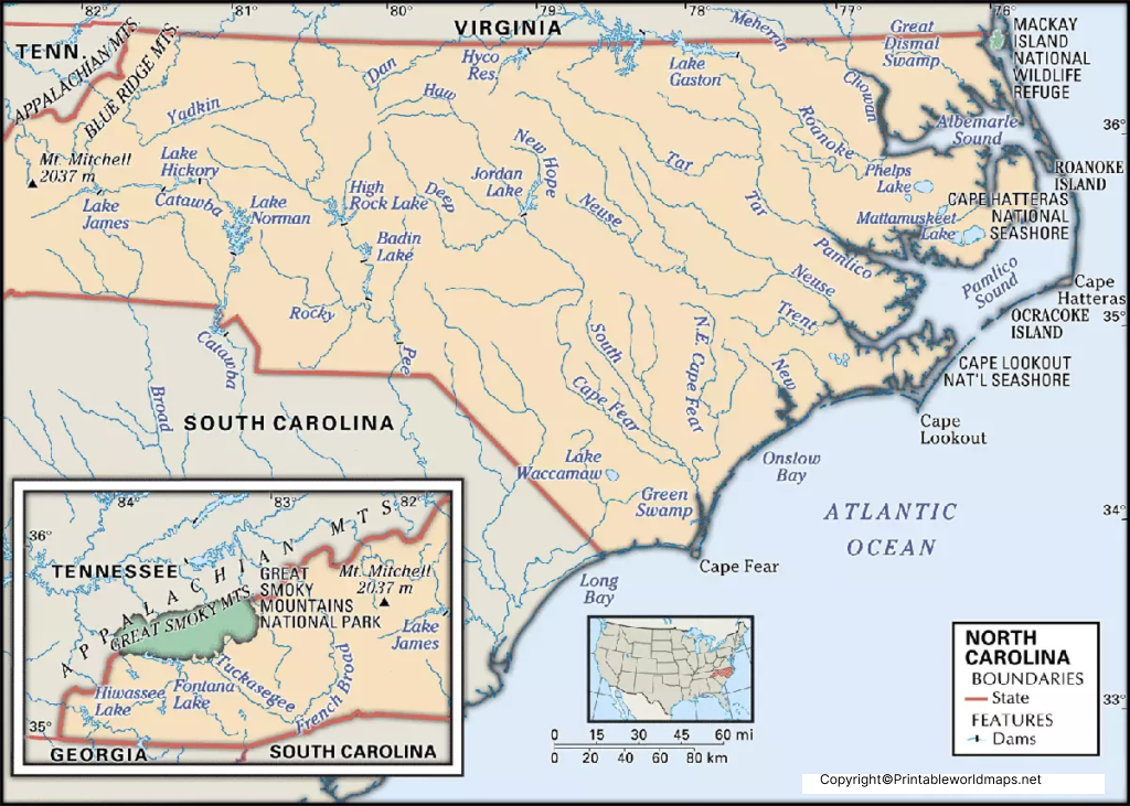
Labeled Map of North Carolina with Capital & Cities
By reading the Labeled Map of North Carolina, the user can analyze and collect a variety of information from the map. While
Read more
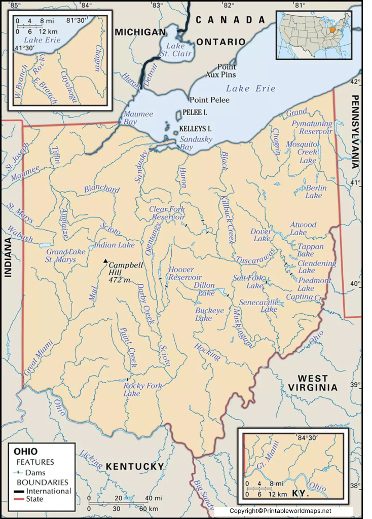
Labeled Map of Ohio with Capital & Cities
The Labeled Map of Ohio, shows the user the exact location of Ohio state, in the US. This state is situated in
Read more
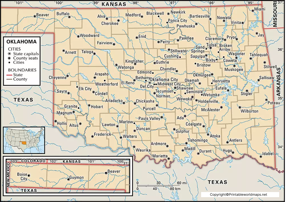
Labeled Map of Oklahoma with Capital & Cities
The greatest advantage of viewing Labeled Map of Oklahoma is that it makes the user understand the location of this state, in
Read more
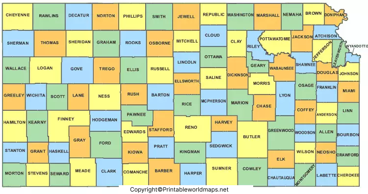
Labeled Map of Kansas with Capital & Cities
Labeled Map of Kansas reveals as to where Kansas state is located, in the US. Based on this, it is
Read more
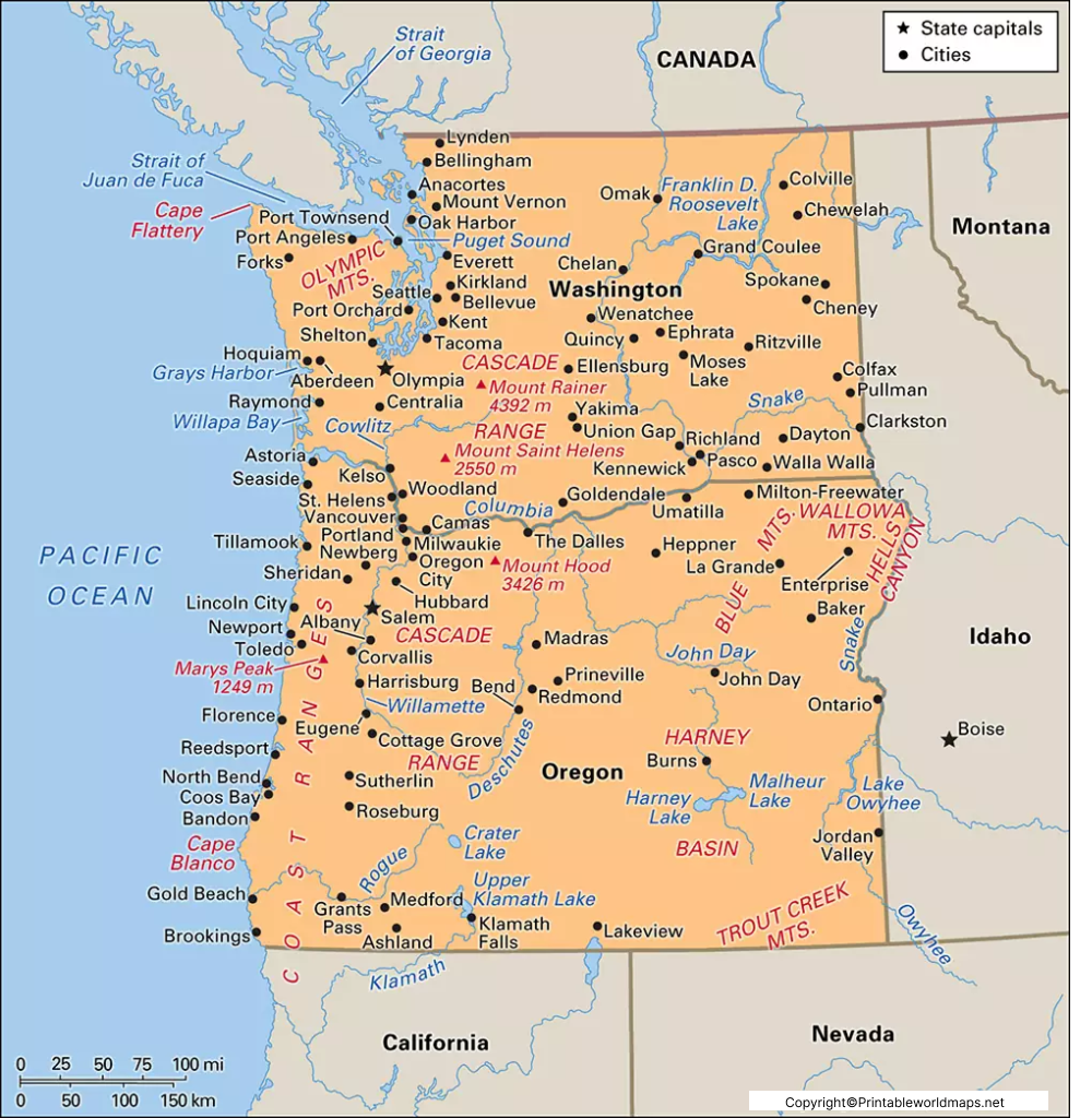
Labeled Map of Oregon with Capital & Cities
The Labeled Map of Oregon helps the user to gather information about Oregon state, situated in the US. From the labeled map
Read more
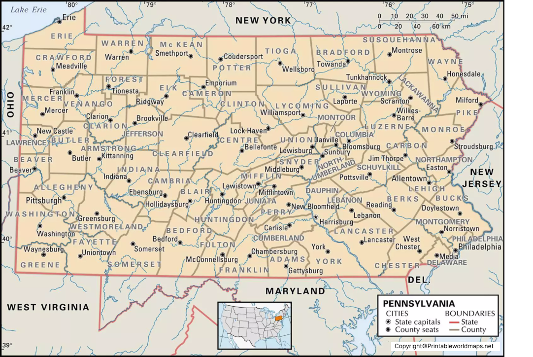
Labeled Map of Pennsylvania with Capital & Cities
The Labeled Map of Pennsylvania depicts where in the US, Pennsylvania state is situated. This state is recognized as the Commonwealth of
Read more
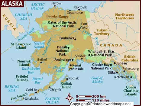
Labeled Map of Alaska with States, Capital & Cities
Labeled Map of Alaska enables the user to find the location of Alaska state, based in the US. This is
Read more
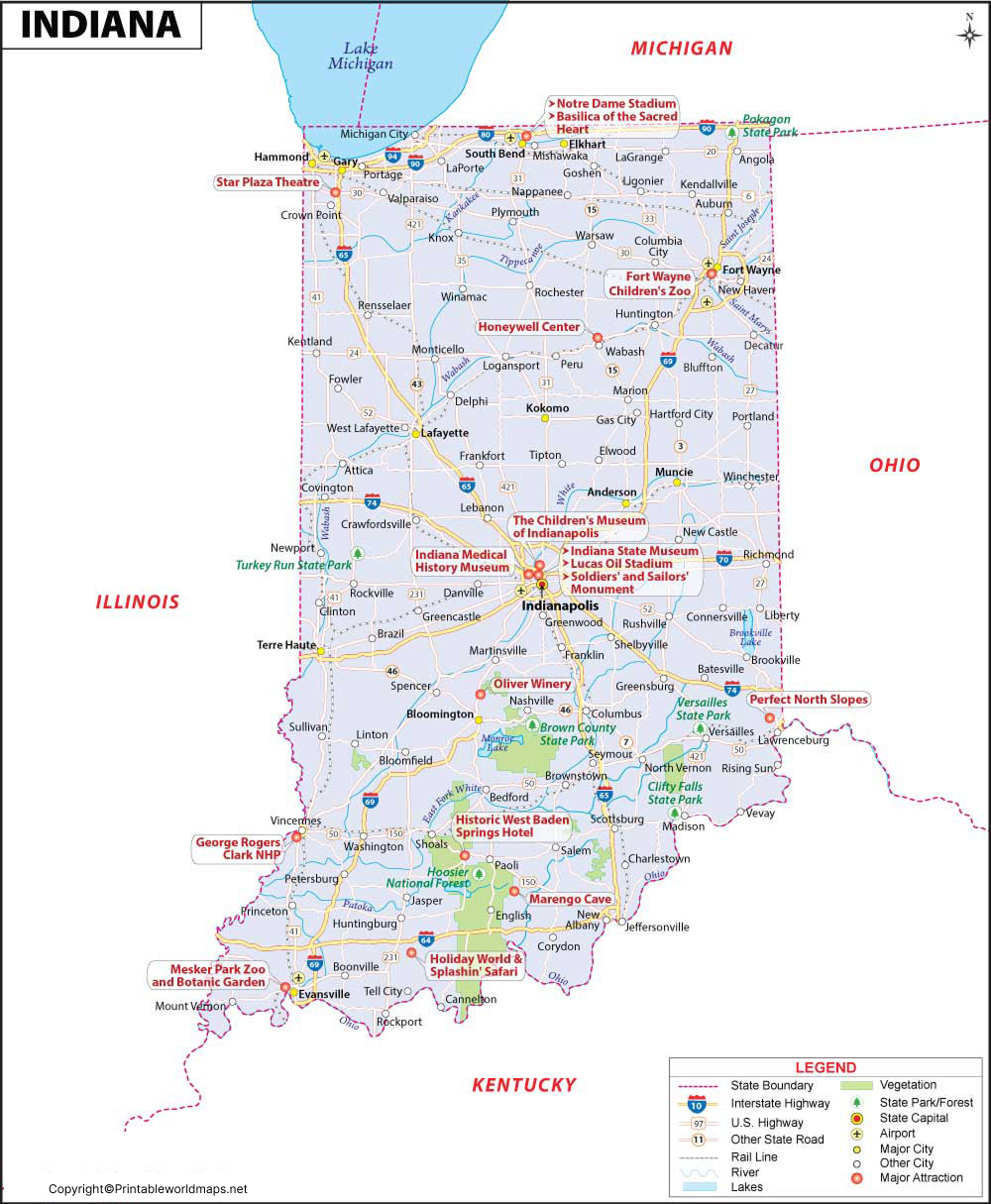
Labeled Map of Indiana with Capital & Cities
With the help of Labeled Map of Indiana, the user can learn about where Indiana state is located in the US. According
Read more
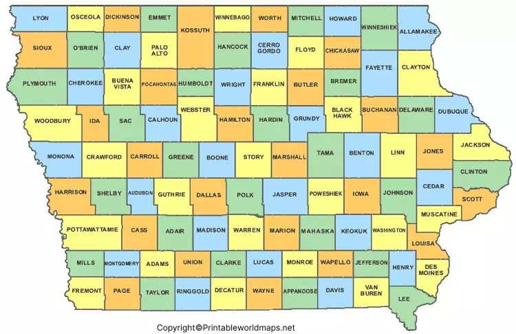
Labeled Map of Iowa with Capital & Cities
The Labeled Map of Iowa indicates where in the US, this Iowa state is situated. Accordingly, the user can identify that Iowa
Read more
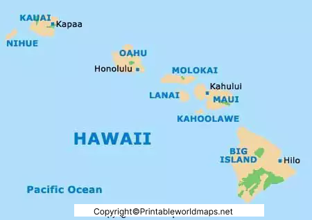
Labeled Map of Hawaii with Capital & Cities
From the Labeled Map of Hawaii, anyone can get the details of Hawaii state in the US. Hawaii is a group of
Read more
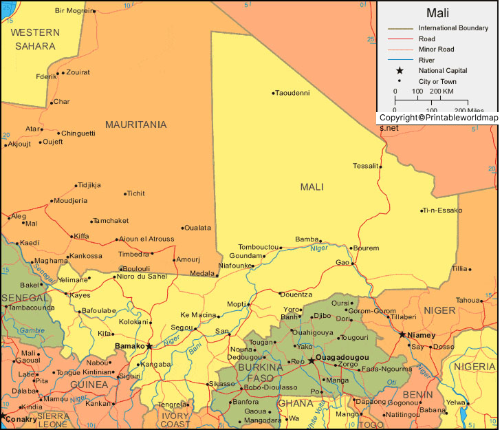
Labeled Map of Mali with States, Capital & Cities
The Labeled Map of Mali shows about Mali and its bordering nations with details, like railroads and main ports, cities of major
Read more
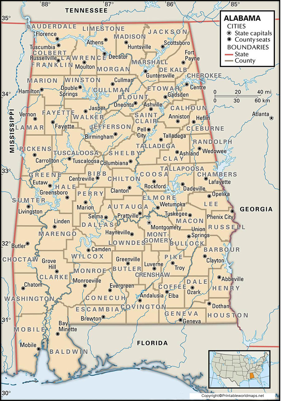
Labeled Map of Alabama with Capital & Cities
The Labeled Map of Alabama reveals the exact location of the Alabama state in the US. Alabama became the twenty-second state to
Read more
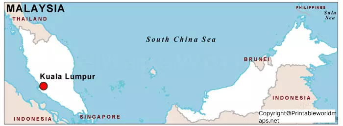
Labeled Map of Malaysia with States, Capital & Cities
The Labeled Map of Malaysia shows that it is a country located in the south-eastern region of Asia. It consists of
Read more
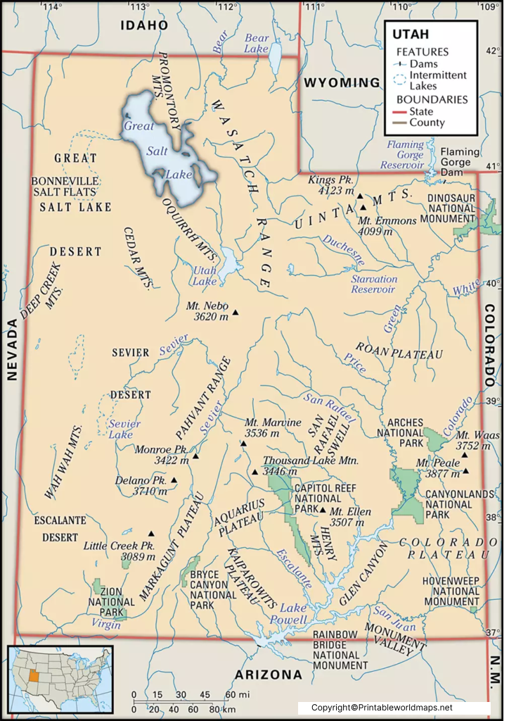
Labeled Map of Utah with Capital & Cities
The Labeled Map of Utah indicates the exact location of the state of Utah, in the US. This state is one of
Read more
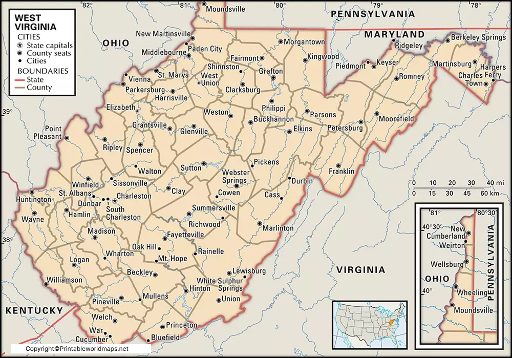
Labeled Map of West Virginia with Capital & Cities
The location of the US state of West Virginia can be visualized easily by viewing the Labeled Map of West
Read more
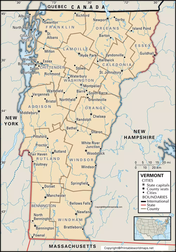
Labeled Map of Vermont with Capital & Cities
By viewing the Labeled Map of Vermont, it is possible to have knowledge about where, in the US, is Vermont located.
Read more
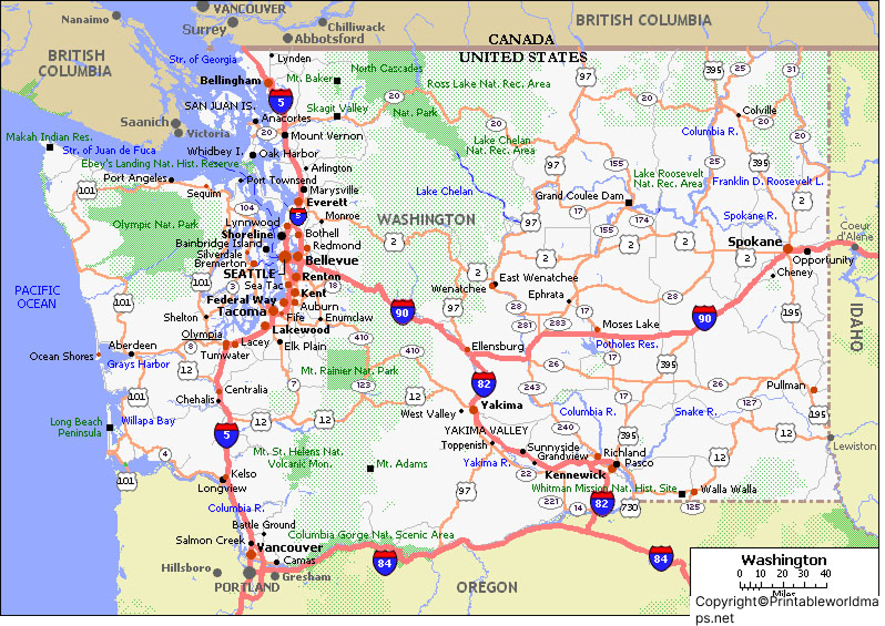
Labeled Map of Washington with Capital & Cities
The Labeled Map of Washington, enables any user to find the location of Washington state, in the US. It can be
Read more
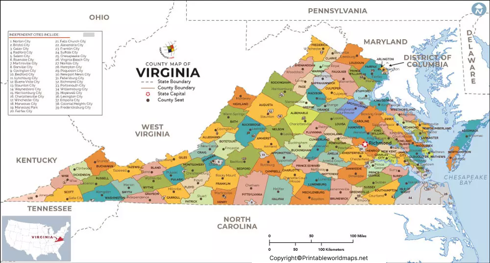
Labeled Map of Virginia with Capital & Cities
The Labeled Map of Virginia, reveals the location of Virginia state, in the US. This state is recognized officially as the Commonwealth
Read more
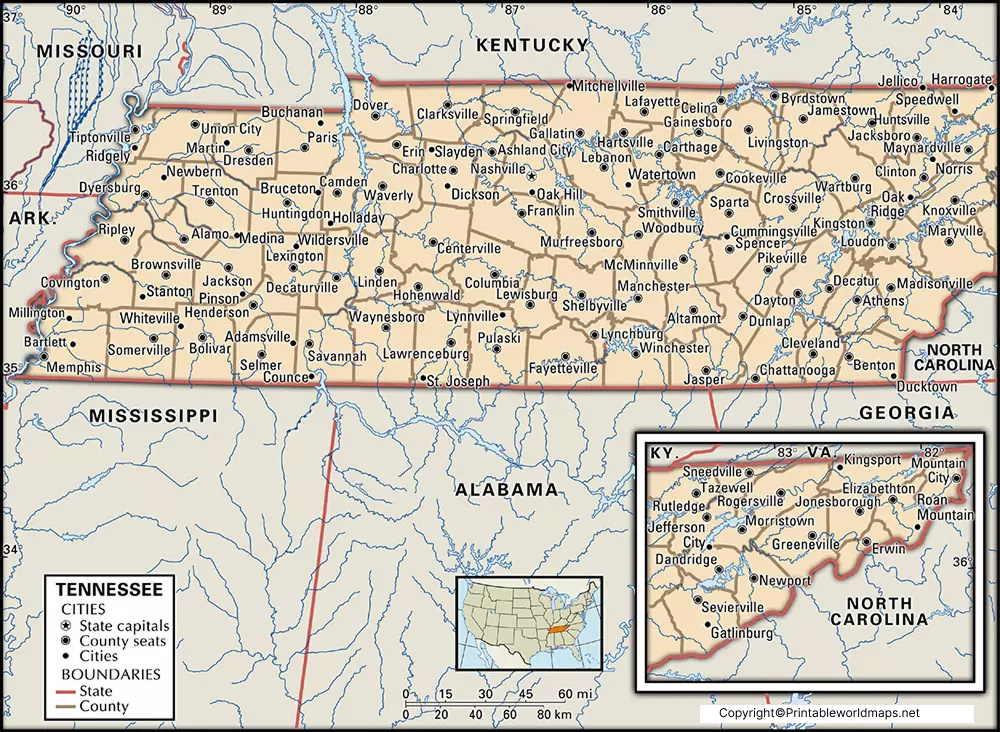
Labeled Map of Tennessee with Capital & Cities
The exact location of Tennessee state in the US can be found out from the Labeled Map of Tennessee. It is a
Read more
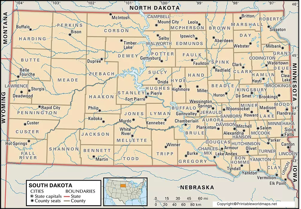
Labeled Map of South Dakota with Capital & Cities
The Labeled Map of South Dakota, provides details about this state as to where this state is situated, in the US.
Read more
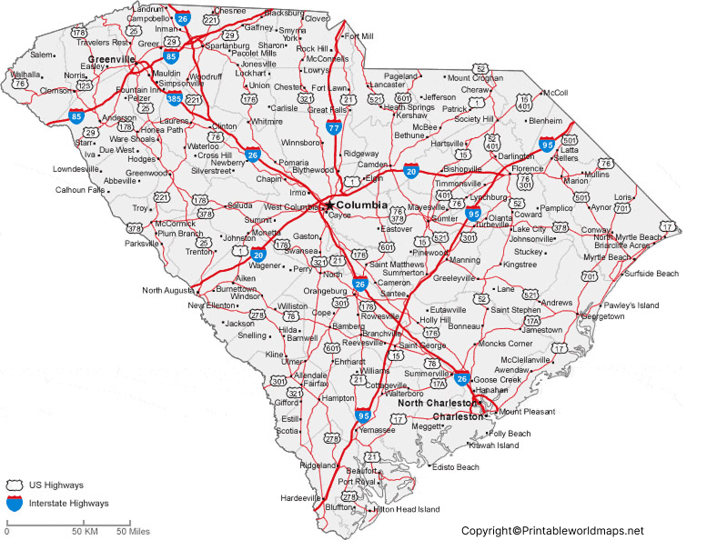
Labeled Map of South Carolina with Capital & Cities
While looking into Labeled Map of South Carolina, any user can find out where South Carolina state is situated, in the US.
Read more
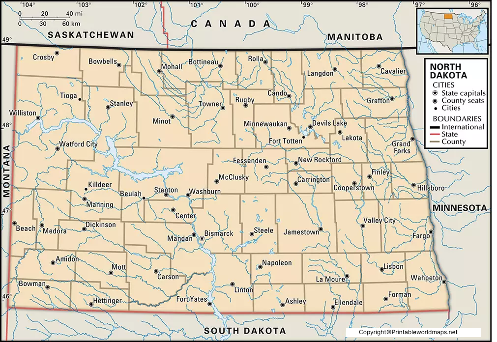
Labeled Map of North Dakota with Capital & Cities
Labeled Map of North Dakota, provides all information about this state, in the US. It is a landlocked state
Read more
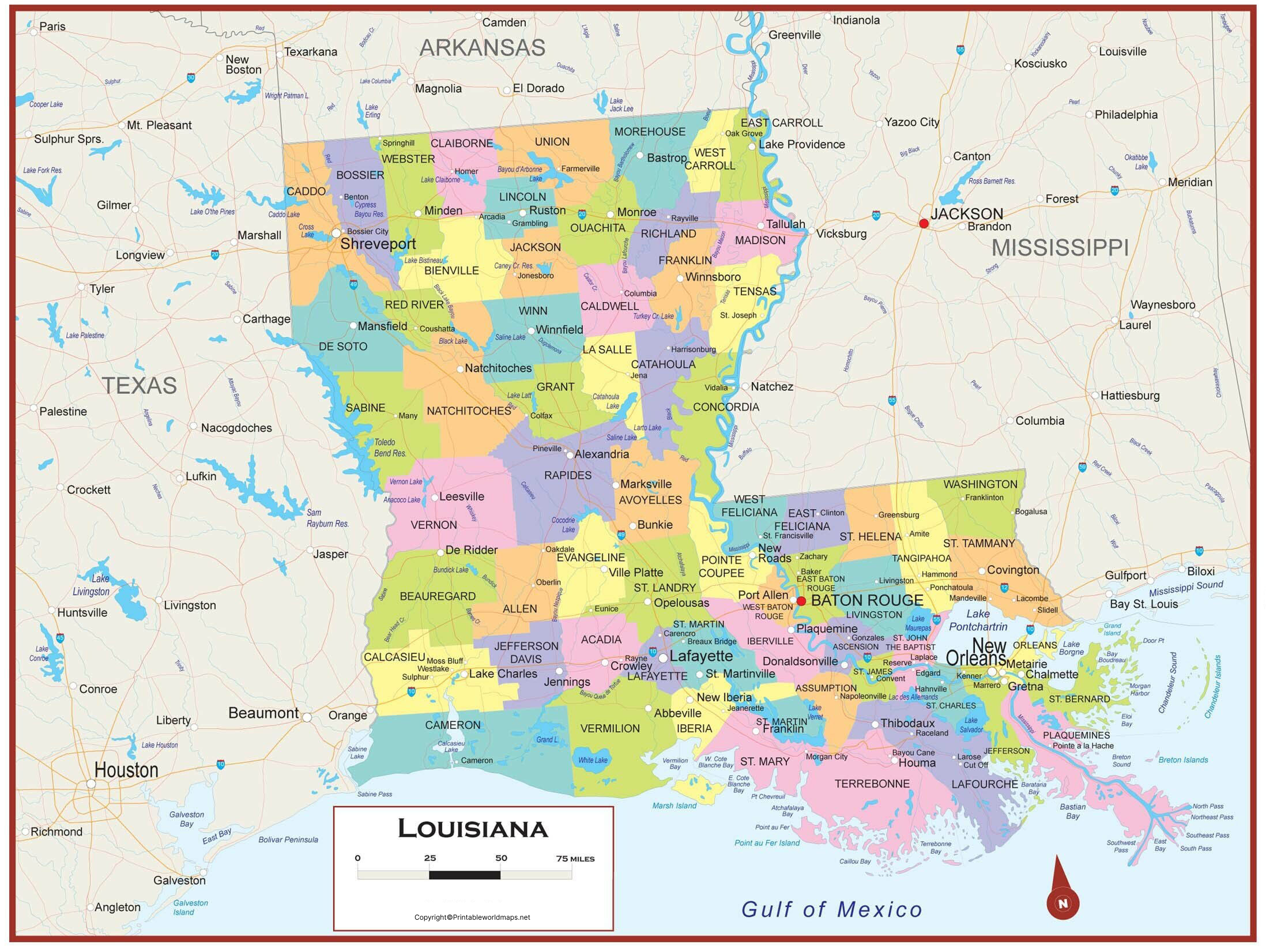
Labeled Map of Louisiana with Capital & Cities
Labeled Map of Louisiana indicates the location of this state in the US. It is one among the fifty states
Read more
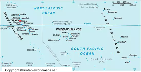
Labeled Map of Kiribati with States, Capital & Cities
A labeled Map of Kiribati shows that Kiribati is an independent republic comprising a chain of islands, located in the Pacific
Read more
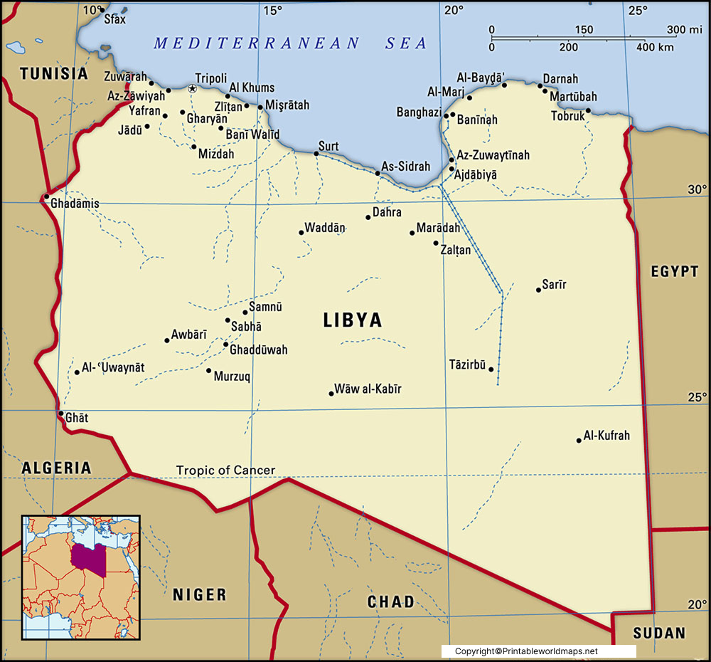
Labeled Map of Libya with States, Capital & Cities
The Labeled Map of Libya shows that it is a country located in the Maghreb region in North Africa. The country
Read more
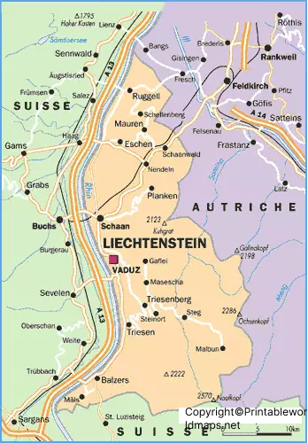
Labeled Map of Liechtenstein with States, Capital & Cities
The Labeled Map of Liechtenstein shows that Liechtenstein is one of the smallest countries in Europe. It is a country located between
Read more
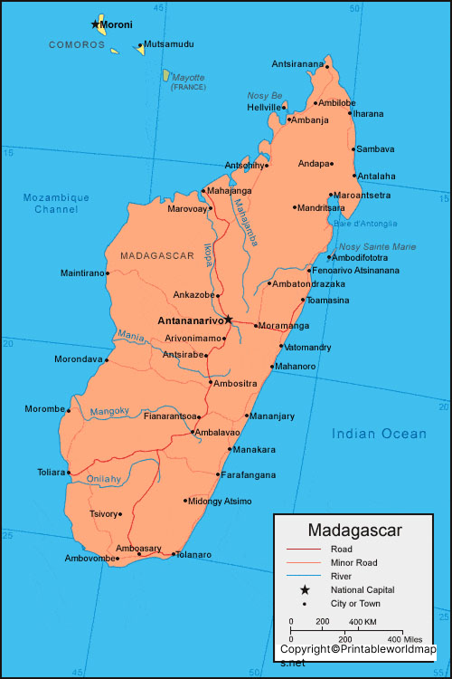
Labeled Map of Madagascar with States, Capital & Cities
The Labeled Map of Madagascar shows that it is the largest African island located in the Indian Ocean. It is considered as
Read more
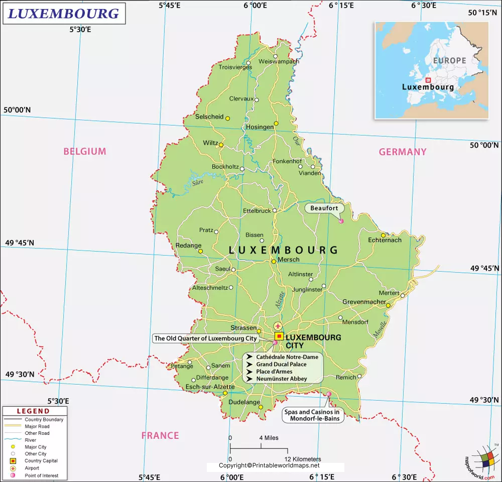
Labeled Map of Luxembourg with States, Capital & Cities
The Labeled Map of Luxembourg reveals that Luxembourg, officially known as the Grand Duchy of Luxembourg, is a landlocked nation. It is
Read more
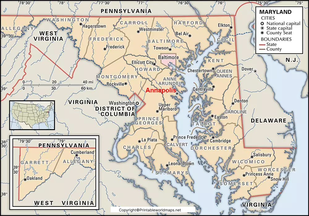
Labeled Map of Maryland with States, Capital & Cities
Labeled Map of Maryland provides the user all the details of this important US state. When the user clicks on
Read more


