
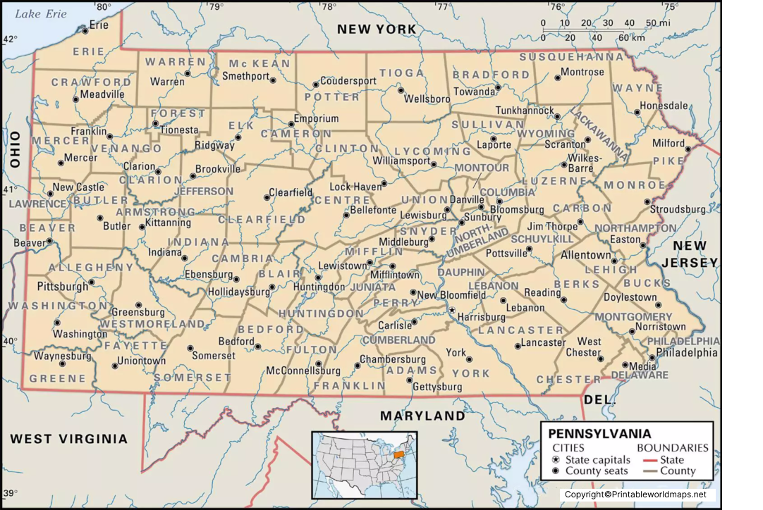

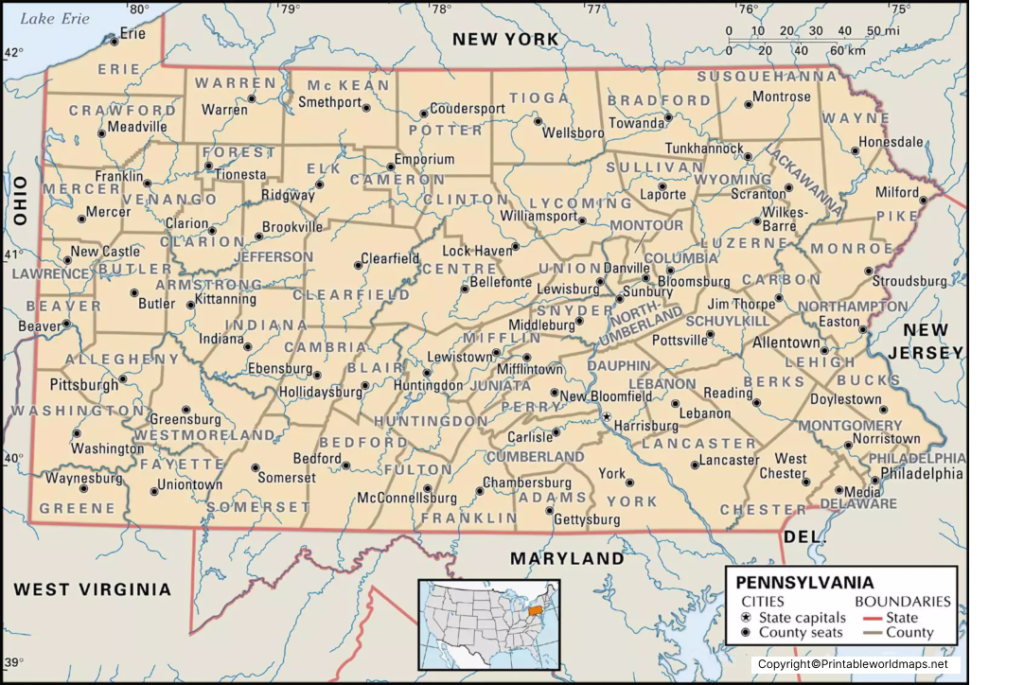
Labeled Map of Pennsylvania shows the location of Pennsylvania in the northeastern United States, along with its capital, major cities, counties, rivers, and important transportation routes. Pennsylvania is officially known as the Commonwealth of Pennsylvania and is commonly called the Keystone State.
Pennsylvania borders New York to the north and northeast, New Jersey to the east, Delaware and Maryland to the southeast, West Virginia and Ohio to the west and southwest, and has a short shoreline along Lake Erie.
This collection includes labeled, printable, and city-focused Pennsylvania maps that can be useful for students, teachers, travelers, researchers, and anyone studying Pennsylvania geography.
Labeled Map of Pennsylvania
A labeled map of Pennsylvania identifies important geographic and political features throughout the state. The map can show the state capital, major cities, counties, rivers, lakes, highways, and surrounding states.
Pennsylvania has 67 counties, with Harrisburg serving as the state capital. Philadelphia is the largest city in the state and an important historical and economic center.
Pennsylvania covers approximately 46,054 square miles (119,280 square kilometers), according to the U.S. Census Bureau.
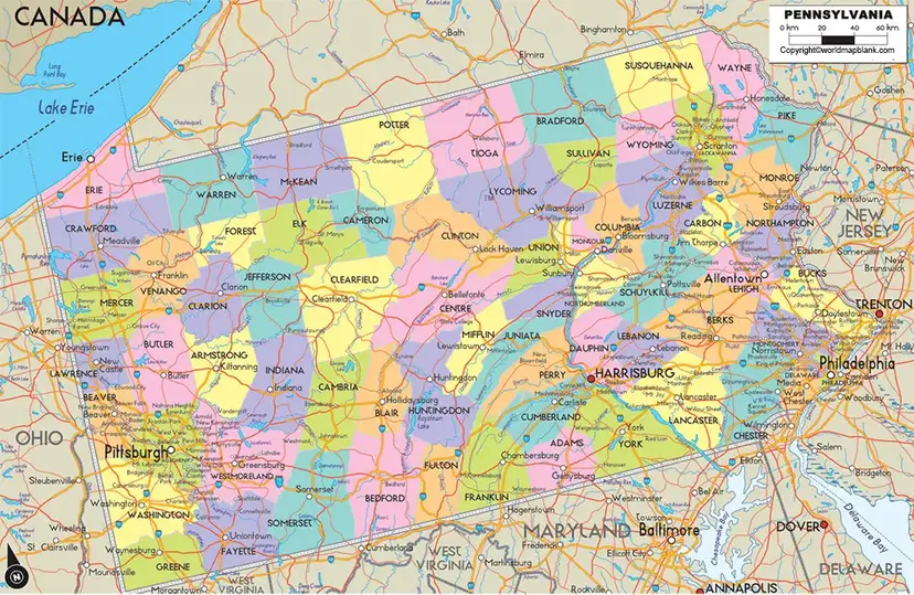
Printable Map of Pennsylvania Labeled
A printable map of Pennsylvania labeled can be useful for classroom activities, geography assignments, travel planning, and reference purposes.
The printable version can help users identify Pennsylvania’s capital, cities, counties, neighboring states, and other geographic features without relying on an interactive map.
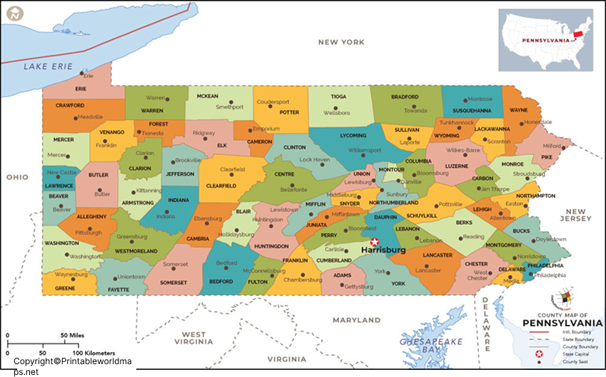
Labeled Map of Pennsylvania with Cities
A labeled map of Pennsylvania with cities helps identify important urban centers across the Commonwealth.
Some of Pennsylvania’s major cities include:
| City | Geographic significance |
|---|---|
| Philadelphia | Largest city and major historic center |
| Pittsburgh | Major city in western Pennsylvania |
| Allentown | Important city in the Lehigh Valley |
| Erie | Major city on Lake Erie |
| Reading | City in southeastern Pennsylvania |
| Scranton | Major city in northeastern Pennsylvania |
| Bethlehem | City in the Lehigh Valley |
| Lancaster | Important city in southeastern Pennsylvania |
| Harrisburg | State capital |
The map can be particularly useful for understanding the relative locations of Pennsylvania’s major cities.
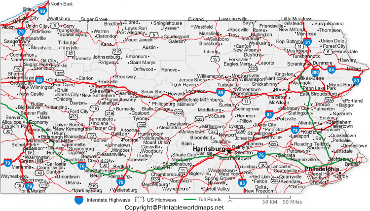
Labeled Pennsylvania Map with Capital
The Labeled Pennsylvania Map with Capital identifies Harrisburg, the capital city of Pennsylvania.
Harrisburg is located along the Susquehanna River in the south-central part of the state. It serves as the seat of Pennsylvania’s state government.
The Pennsylvania State Capitol is located in Harrisburg and is an important landmark associated with the state’s government.
Pennsylvania Geography and Major Rivers
Pennsylvania has a diverse geography that includes mountains, valleys, forests, rivers, lakes, and urban areas.
Major rivers associated with Pennsylvania include:
- Susquehanna River
- Delaware River
- Allegheny River
- Monongahela River
- Ohio River
- Schuylkill River
The Allegheny and Monongahela rivers meet at Pittsburgh and form the Ohio River.
The state also has a shoreline along Lake Erie, providing Pennsylvania with access to one of the Great Lakes.
Pennsylvania Counties
Pennsylvania is divided into 67 counties. Counties provide an important level of local government and administration.
Philadelphia is unusual because it functions as both a city and a county, officially known as the City and County of Philadelphia.
A county map can therefore complement the labeled Pennsylvania map when users need more detailed information about the state’s political geography.
Pennsylvania Map for Students and Education
A labeled Pennsylvania map can be useful for:
- Geography assignments
- State capitals lessons
- Identifying major cities
- Learning neighboring states
- County identification
- River and lake studies
- Classroom map activities
- Printable worksheets
- State geography projects
Teachers and students can use the printable versions for classroom exercises and geography reference.
Interesting Facts About Pennsylvania
- State capital: Harrisburg
- Largest city: Philadelphia
- Nickname: Keystone State
- Number of counties: 67
- Lake: Lake Erie
- Major river: Susquehanna River
- Major western cities: Pittsburgh and Erie
- State location: Northeastern/Mid-Atlantic United States
- Statehood: Pennsylvania became the second state admitted to the Union on December 12, 1787.
- Independence history: Philadelphia played a major role in the founding history of the United States.
Why Use a Labeled Map of Pennsylvania?
A labeled map provides geographic information in a visual format, making it easier to understand where cities, counties, rivers, and other features are located.
The maps on this page can be used for:
Education: Geography classes, assignments, and projects.
Planning: General geographic reference and travel planning.
Research: Locating Pennsylvania cities, counties, and physical features.
Printing: PNG and PDF versions can be used as printable reference materials.
Frequently Asked Questions
What is the capital of Pennsylvania?
Harrisburg is the capital of Pennsylvania.
What is the largest city in Pennsylvania?
Philadelphia is the largest city in Pennsylvania by population.
How many counties are in Pennsylvania?
Pennsylvania has 67 counties.
What is Pennsylvania’s nickname?
Pennsylvania is commonly known as the Keystone State.
Which states border Pennsylvania?
Pennsylvania borders New York, New Jersey, Delaware, Maryland, West Virginia, and Ohio. It also has a shoreline along Lake Erie.
What are the major cities shown on a Pennsylvania map?
Major cities include Philadelphia, Pittsburgh, Allentown, Erie, Reading, Scranton, Bethlehem, Lancaster, and Harrisburg.
What river runs through Harrisburg?
The Susquehanna River runs through Harrisburg.
Can I print the Pennsylvania map?
Yes. The page provides PNG and PDF map resources that can be downloaded and printed.
Where is Pennsylvania located?
Pennsylvania is located in the northeastern United States and is generally considered part of the Mid-Atlantic region.
Why is Pennsylvania called the Keystone State?
The nickname “Keystone State” reflects Pennsylvania’s historical importance among the original U.S. states and its central role in the early United States.
Reference Links
https://www.census.gov/quickfacts/fact/table/PA/PST045225
https://www.usgs.gov/centers/pennsylvania-water-science-center
