

A Printable Blank Map of Iraq is a useful resource for students, teachers, geography learners, and anyone who wants to study the country’s shape, location, and neighboring countries. You can use a blank outline map for school assignments, geography practice, labeling exercises, and classroom activities.
Iraq is a country in Western Asia, with Baghdad as its capital. It shares land borders with Turkey, Iran, Syria, Jordan, Saudi Arabia, and Kuwait. Its geography includes broad plains, mountainous areas in the north and northeast, desert landscapes, and the important Tigris and Euphrates river systems.
On this page, you can explore blank outline maps of Iraq, printable map images, and PDF resources for educational use. Choose the version that best suits your needs, then print it or use it for your geography practice.
- World Map with Continents
- Labeled Map of Africa
- Labeled Map of Europe
- Blank Map of Asia
- Physical World Map
- Political World Map
- World Map with oceans
- World Map Poster
- World Time Zone Map
- Labeled Map of World
- Blank Map of World
- Labeled Map of Africa
- Labeled Map of Europe
- Labeled Map of Antarctica
- Labeled Map of South America
Blank Map of Iraq – Outline
A blank outline map of Iraq shows the country’s general shape and outer boundary without requiring you to study a large amount of text. It is especially helpful for students who need to trace the country, practice drawing its outline, or complete a geography assignment.
Use the outline map below as a starting point for learning about Iraq’s location in Western Asia.
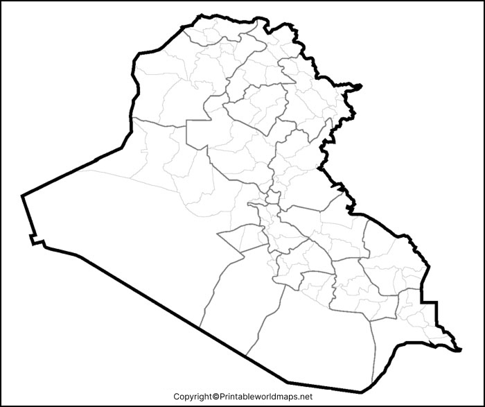
How to Use the Blank Outline Map
- Trace the outer boundary of Iraq to practice drawing its shape.
- Label Iraq’s neighboring countries.
- Mark Baghdad, the national capital, if your worksheet includes city locations.
- Add the Tigris and Euphrates rivers using a suitable reference map.
- Use the outline for school projects, classroom quizzes, and geography revision.
Printable Map of Iraq
A printable map of Iraq is convenient when you want a ready-made geography resource instead of drawing the country from scratch. Depending on the version you choose, you can use the map as a classroom handout, a study aid, or a reference for a school project.
Check out for More Maps–
Printable India Map
Printable Indonesia Map

Transparent PNG Iraq Map
A transparent PNG map can be useful when you want to place the map over a colored background, add it to a worksheet, or include it in a presentation without a solid white rectangle around the image.
Before using this file as a transparent map, check whether the image actually has a transparent background. The PNG file format supports transparency, but not every PNG image contains a transparent background.

For school projects and presentations, you can place a suitable transparent map over a light-colored background and add labels or other educational elements. Always inspect the map to confirm which geographical features are included.
Map of Iraq for Practice Worksheet
A blank map of Iraq can turn geography revision into a practical activity. Students can use it to practice identifying the country’s position, recalling neighboring countries, and understanding major physical features.

Practice Questions for Students
- What is the capital city of Iraq?
- Which six countries share land borders with Iraq?
- Name the two major rivers associated with Iraq’s geography.
- In which part of Asia is Iraq located?
- Which parts of Iraq have mountainous terrain?
- What is the name of the waterway formed where the Tigris and Euphrates meet?
Students can write their answers separately or label the appropriate features on a map that includes the necessary boundaries and geographical details.
Important Geography Facts About Iraq
Use these facts alongside the printable blank map of Iraq to make your geography lesson more informative.
- Official name: Republic of Iraq.
- Capital: Baghdad.
- Region: Western Asia, commonly included in the Middle East.
- Neighboring countries: Turkey, Iran, Syria, Jordan, Saudi Arabia, and Kuwait.
- Major rivers: Tigris and Euphrates.
- Geographical features: Broad plains, desert regions, northern and northeastern mountains, and southern marshlands.
- Natural resources: Iraq has significant petroleum and natural gas resources.
- Languages: Arabic and Kurdish are official languages at the national level.
These facts are useful for geography assignments, map-labeling exercises, and general knowledge activities.
Understanding Iraq’s Geography
Iraq has a varied landscape despite its extensive dry regions. Much of the country consists of plains, while mountain ranges extend along parts of the northern and northeastern borders. Desert areas occupy substantial parts of the west and southwest.
The Tigris and Euphrates are particularly important to the country’s geography. Their river systems support agriculture and settlements, and the rivers meet in southern Iraq to form the Shatt al-Arab waterway, which flows toward the Gulf.
When studying a blank map, try identifying Iraq’s neighboring countries first. Then compare the outline with a labeled reference map to locate Baghdad, the rivers, and the country’s main physical regions.
For more accurate geographical information, consult authoritative references such as the CIA World Factbook’s archived Iraq profile and the World Bank’s Iraq resources.
Tips for Printing and Using Your Iraq Map
- Choose the correct file: Use the outline for tracing and the PDF for convenient page-based printing.
- Check the map details: Confirm whether the map includes country borders, rivers, cities, or administrative divisions.
- Preview before printing: Check that the outline fits on the page and is not cropped.
- Use a labeled reference: Compare your worksheet with a reliable reference map when checking answers.
- Keep the map readable: Use clear labels and avoid placing text too close to the country’s boundary.
Frequently Asked Questions
1. Where can I download a printable blank map of Iraq?
You can open the PNG image or PDF linked in the sections above. Choose the format that best suits your printing or study requirements.
2. Is the blank map of Iraq suitable for students?
Yes. A blank outline map can help students practice tracing, labeling neighboring countries, learning geographical features, and preparing for classroom tests.
3. Can I print the Iraq map in PDF format?
Yes. Use the PDF link provided on this page. Check the print preview and select a suitable paper size before printing.
4. What is the difference between a blank map and a labeled map of Iraq?
A blank map generally leaves out some or all place names so learners can fill them in. A labeled map includes geographical names and features to help users identify locations.
5. Which countries border Iraq?
Iraq shares land borders with Turkey, Iran, Syria, Jordan, Saudi Arabia, and Kuwait.
6. What is the capital of Iraq?
Baghdad is the capital of Iraq.
7. Which rivers are important in Iraq?
The Tigris and Euphrates are the country’s two major rivers. They are central to understanding Iraq’s physical geography and settlement patterns.
8. Is the transparent PNG map suitable for presentations?
A PNG map can be used in presentations, but transparency depends on the actual image file. Check that the background is transparent before placing it over another design.
9. Can I use a blank Iraq map for a geography quiz?
Yes. It can be used for exercises involving the country’s outline, neighboring countries, capital city, and physical features, provided the selected map contains the details required for the quiz.
10. Where can I verify geographical facts about Iraq?
You can consult the CIA World Factbook, the World Bank, and other reputable geographical references. Use a suitable labeled map when you need to verify specific locations or boundaries.
Conclusion
A Printable Blank Map of Iraq is a practical resource for learning geography, preparing worksheets, and completing educational projects. Choose an outline, PNG image, or PDF according to your needs, and use a reliable labeled reference map to check geographical details.
Whether you are studying Iraq’s neighboring countries, its major rivers, or its physical landscape, a printable map provides a simple way to practice and strengthen your geographical knowledge.
Reference links
https://www.cia.gov/the-world-factbook/about/archives
https://www.worldbank.org/en/country/iraq
https://data.worldbank.org/country/iraq
https://maps.worldbank.org/projects/wb/country/IQ/Iraq
https://www.britannica.com/place/Iraq

1 thought on “Printable Blank Map of Iraq – Outline, Transparent, PNG map ”