

The Labeled Map of Utah shows the location of Utah in the western United States and identifies important geographic features such as the state capital, major cities, counties, rivers, highways, and other places. Utah became the 45th U.S. state on January 4, 1896.
Utah is bordered by Idaho and Wyoming to the north, Colorado to the east, Arizona to the south, and Nevada to the west. Utah also meets Arizona, Colorado, and New Mexico at the Four Corners, one of the few locations in the United States where four states meet.
This page provides labeled Utah maps for viewing and printing, including maps showing Utah’s capital, major cities, and other geographic features.
Labeled Map of Utah
The Labeled Map of Utah is useful for identifying the state’s capital, cities, counties, rivers, transportation routes, and general geographic position.
Utah covers approximately 84,900 square miles and is the 11th-largest U.S. state by area. Utah’s official state information identifies Salt Lake City as the state capital and January 4, 1896, as its statehood date.
Utah has a diverse landscape that includes the Wasatch Range, high plateaus, desert regions, canyons, and the Great Salt Lake. The state’s highest point is Kings Peak, which reaches about 13,528 feet in elevation.
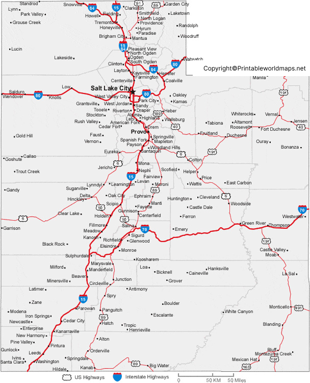
Labeled Map of Utah Printable
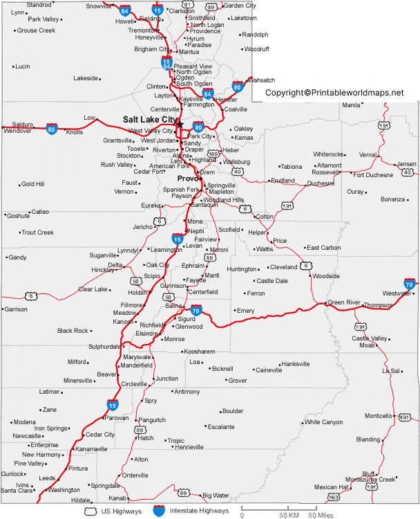
A printable Labeled Map of Utah provides a convenient way to study Utah’s geography without relying on an interactive map.
Utah has 29 counties. The official Utah.gov county listing includes counties such as Salt Lake, Utah, Weber, Davis, Washington, San Juan, Tooele, Summit, and others. Utah
A county map can help students and readers understand how Utah is divided administratively and where different communities are located.
Labeled Map of Utah with Cities
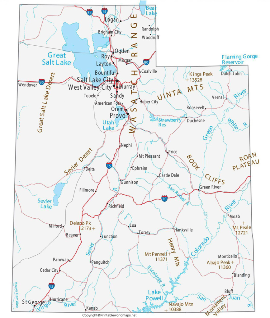
The Labeled Map of Utah with Cities identifies several important population centers, including Salt Lake City, West Valley City, West Jordan, Provo, Orem, Sandy, and St. George.
According to the 2020 Census, West Valley City had 140,230 residents, West Jordan had 116,961, Provo had 115,162, and St. George had 95,342. These figures are 2020 Census counts and should not be treated as current population estimates.
Salt Lake City, Utah’s capital, had a 2020 Census population of 199,723, with the U.S. Census Bureau estimating its population at 218,428 on July 1, 2025.
Major Cities Shown on the Utah Map
Some notable Utah cities include:
- Salt Lake City — state capital and a major population center
- West Valley City — a major city west of Salt Lake City
- West Jordan — a large city in Salt Lake County
- Provo — a major city in Utah County
- Orem — a city in Utah County
- Sandy — a city south of Salt Lake City
- St. George — a major city in southwestern Utah
- Ogden — a city north of Salt Lake City
- Park City — a mountain community known for recreation and tourism
The Census Bureau provides official population and geographic information for Utah’s incorporated places.
Labeled Utah Map with Capital
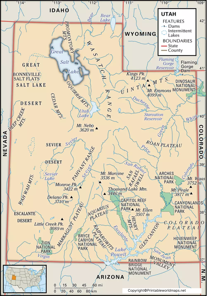
The Labeled Utah Map with Capital clearly identifies Salt Lake City as the capital of Utah.
Salt Lake City is located in northern Utah, near the Great Salt Lake and the Wasatch Mountains. It serves as the seat of Utah’s state government. Utah.gov identifies Salt Lake City as the state’s capital.
The city is also an important transportation, business, education, healthcare, and technology center in the state.
Rivers and Water Features on a Utah Map
A detailed Labeled Map of Utah can help locate important rivers and water bodies across the state.
Major rivers and waterways associated with Utah include the:
- Colorado River
- Green River
- Bear River
- San Juan River
- Sevier River
- Virgin River
- Jordan River
The Great Salt Lake is one of Utah’s most distinctive geographic features. It is a shallow, saline lake with no natural outlet to the ocean. The Bear, Weber, and Jordan rivers flow into the lake.
The Great Salt Lake is also ecologically and economically important to Utah and the wider western United States.
Utah Map for Students and Geography Projects
A Labeled Map of Utah can be used for:
- School geography projects
- State research assignments
- Identifying Utah’s capital
- Learning major Utah cities
- Studying counties and boundaries
- Locating major rivers and lakes
- Understanding Utah’s position in the western United States
- Classroom map exercises
- Printable geography worksheets
Using a labeled map alongside official government and Census information can help students distinguish between geographic locations and statistical information.
Interesting Facts About Utah
Here are several useful facts that can add context to a Utah map:
- Capital: Salt Lake City
- Statehood: January 4, 1896
- Order of admission: 45th state
- Area: Approximately 84,900 square miles
- Counties: 29
- Highest point: Kings Peak, about 13,528 feet
- Nickname: Beehive State
- Notable geographic feature: Great Salt Lake
- Four Corners: Utah meets Arizona, Colorado, and New Mexico at Four Corners
Utah’s official state website provides state-level information on its capital, statehood, population, area, and geographic characteristics.
Why Use a Labeled Utah Map?
A labeled map is particularly useful when you need to quickly identify where Utah’s capital, major cities, counties, rivers, and other geographic features are located.
For students, printable maps can support geography assignments and classroom activities. For travelers and researchers, city and regional maps provide a quick geographic reference.
Frequently Asked Questions
What is the capital of Utah?
Salt Lake City is the capital of Utah. It is located in the north-central part of the state near the Great Salt Lake and Wasatch Mountains.
When did Utah become a state?
Utah became the 45th state in the United States on January 4, 1896.
How many counties are in Utah?
Utah has 29 counties. The Utah.gov government directory lists all 29 counties.
What are some major cities in Utah?
Major Utah cities include Salt Lake City, West Valley City, West Jordan, Provo, Orem, Sandy, Ogden, and St. George.
What is the largest city in Utah?
By the 2020 Census, Salt Lake City had 199,723 residents, while West Valley City had 140,230 and West Jordan had 116,961. Current population estimates can differ from decennial Census counts.
What are the main rivers in Utah?
Important rivers associated with Utah include the Colorado, Green, Bear, San Juan, Sevier, Virgin, and Jordan rivers.
What is the Great Salt Lake?
The Great Salt Lake is a large, shallow, saline lake in northern Utah. It is a closed-basin lake, meaning it has no natural river outlet to the ocean.
Can I print the Utah map?
Yes. The printable PNG and PDF versions above can be used for personal study, classroom activities, and other appropriate educational purposes, subject to the site’s image and content-use terms.
Where can I find official Utah information?
Official information about Utah’s government, geography, counties, population, and state facts is available through Utah.gov, the U.S. Census Bureau, the U.S. Senate, and the Utah Geological Survey.
Reference Links
https://www.utah.gov/about/quick-facts.html
https://www.senate.gov/states/UT/timeline.shtml
https://www.census.gov/quickfacts/fact/csv/saltlakecitycityutah/INC910224
https://tigerweb.geo.census.gov/tigerwebmain/Files/bas26/tigerweb_bas26_incplace_2020_tab20_ut.html
https://www.utah.gov/government/cityCounty.html
