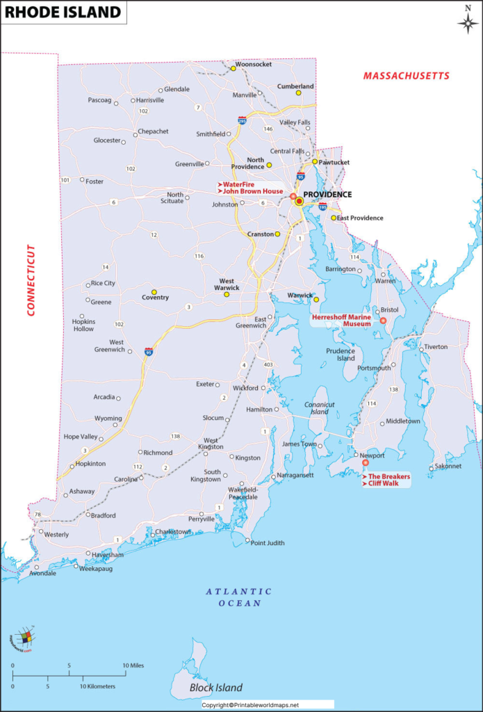
By viewing the Labeled Map of Rhode Island, it is possible to know more about Rhode Island (RI). In fact, the map provides not only the location of Rhode Island state in the USA, but also where in the US, it is situated. Officially, the state of Rhode Island is not considered to be an Island. This state is identified as the smallest out of the fifty US states in terms of area occupied by it. In the region of New England, Rhode Island is situated in the east coast of the US.
Contents
Labeled Map of Rhode Island
When compared, the area of Rhode Island is equivalent to about twice the size of the city of Phoenix, in Arizona. With only two other states, Rhode Island has borders in the north. In the east and west, it has borders with Massachusetts and Connecticut. In the south, RI has established its borders with the straits of Block Island Sound and Rhode Island Sound. Further, the RI shares a maritime border with the state of New York between Block Island, RI, and Long Island of New York State. An inlet of the Atlantic Ocean, known as Narragansett Bay, it extends deeply into the southeastern portion of Rhode Island.

A detailed map of RI shows the well-defined boundaries surrounding the state. It also provides the user the detailed location of the state capital city, known as Providence, populated places and major cities, lakes and rivers, principal highways, interstate highways and railroads. The area occupied by the RI state is 1,544 square miles or 3,999 square kilometers. The official nickname of this state is, “The Ocean State,” and the other nickname of this state is, ‘Little Rhody.’ Major rivers that flow in RI, include the Pawcatuck River, the Wood River, the Pawcatuck River, the Blackstone River and the Sakonnet River. RI has a population count of 1,059,300 people and is regarded as the second most densely populated state, in the US. More than fifty percent of the population belong to the religion of Catholics in the state.
Printable Map of Rhode Island Labeled

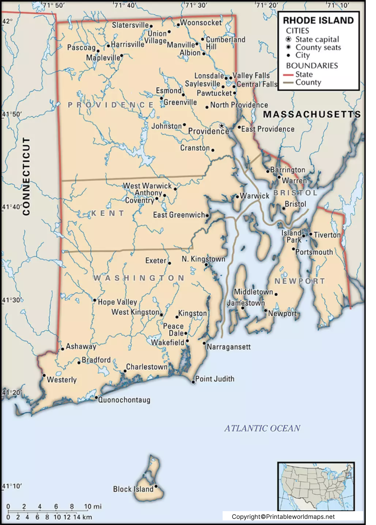
As a part of the labeled map of Rhode Island[F] with states, there are five counties. They are Providence County with a population of 637,000, Kent County with a population of 164,300, Washington County with a population of 125,500, Newport County with a population of 82,000, and Bristol County with a population of 48,500. More than fifty percent of the state is covered with forests.
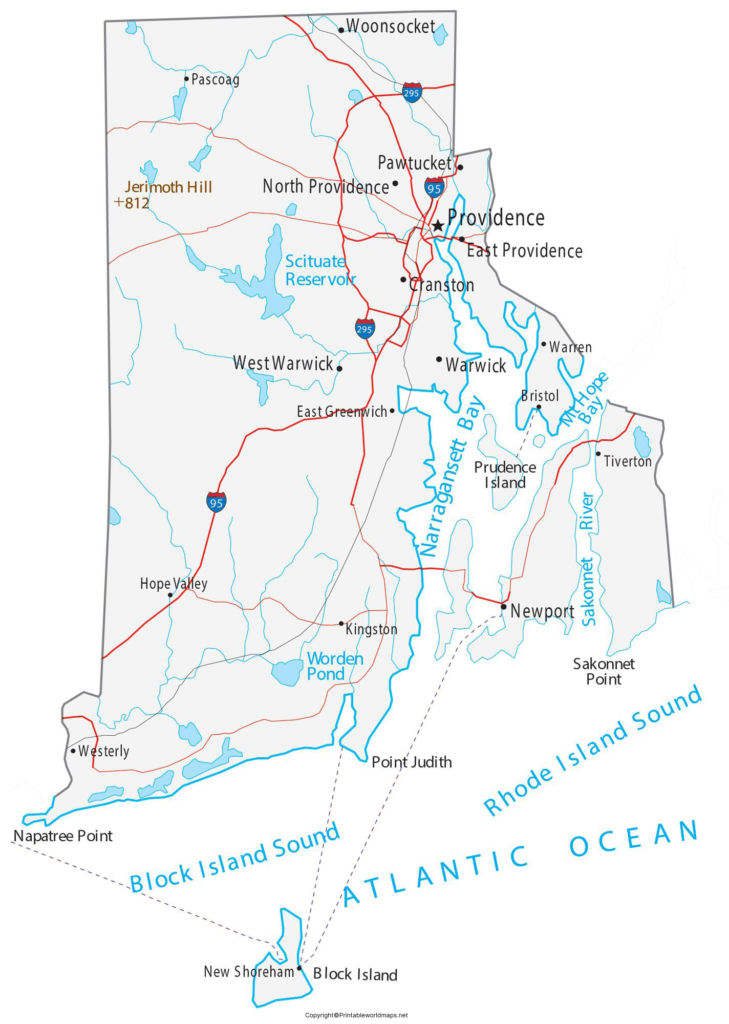
Labeled Map of Rhode Island with Cities

As a part of the labeled map of Rhode Island[F] with cities, major cities are Warwick that has a population count of 81,700, Cranston with a population of 81,000, Pawtucket with a population of 71,600, East Providence with a population of 47,000, Woonsocket with a population count of 41,200.
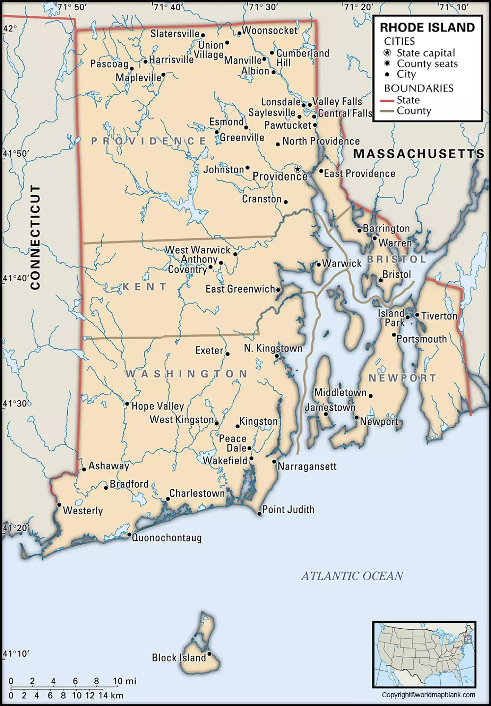
Labeled Rhode Island Map with Capital

Providence is the largest as well as the capital city of RI that has population of 179,200 people. The city became very famous as it has a major New World seaport.


