
The Labeled Map of Libya shows the country in North Africa, including its international borders, Mediterranean coastline, capital, major cities, and administrative areas. Libya borders Egypt and Sudan to the east and southeast, Chad and Niger to the south, and Algeria and Tunisia to the west. Its northern coastline faces the Mediterranean Sea.
Libya covers about 1.76 million square kilometers, making it one of Africa’s largest countries by area. The World Bank reports a population of approximately 7.46 million in 2025.
Most of Libya’s population is concentrated near the Mediterranean coast, while much of the country’s interior is covered by the Sahara Desert. A World Bank geographic profile notes that more than 90% of the population lives along the Mediterranean coastal zone.
This page provides labeled Libya maps showing districts, cities, the capital, surrounding countries, major geographic features, and printable PDF versions.
- World map with continents
- Physical world map
- Political world map
- Labeled map of Asia
- Labeled map of Africa
- Labeled map of Europe
- Labeled map of South America
- World time zone map
- Labeled map of World
- Blank map of world
- Labeled map of North America
- Blank map of Asia
- World map with oceans
- World map poster
Labeled Map of Libya
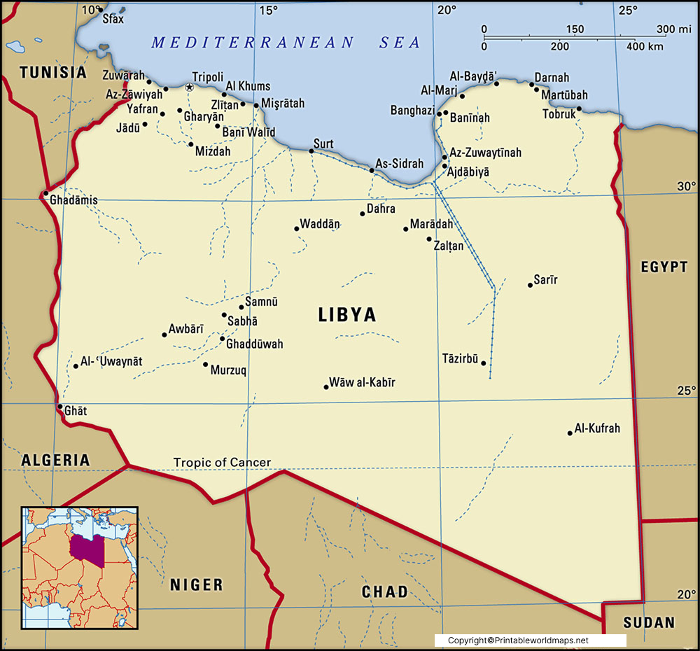
The Labeled Map of Libya identifies the country’s location in North Africa and shows its Mediterranean coastline, international borders, major cities, and important geographic features.
Libya’s total surface area is approximately 1,759,540 square kilometers. The World Bank reports a population of 7,458,555 in 2025.
The country’s landscape is dominated by desert and semi-desert environments. The Mediterranean coastal area contains the majority of Libya’s population and many of its major urban centers.
Libya’s Location
Libya is bordered by:
- Egypt — east
- Sudan — southeast
- Chad — south
- Niger — southwest
- Algeria — west
- Tunisia — northwest
- Mediterranean Sea — north
Libya’s geographic position connects North Africa with the central Mediterranean region.
Labeled Map of Libya with States
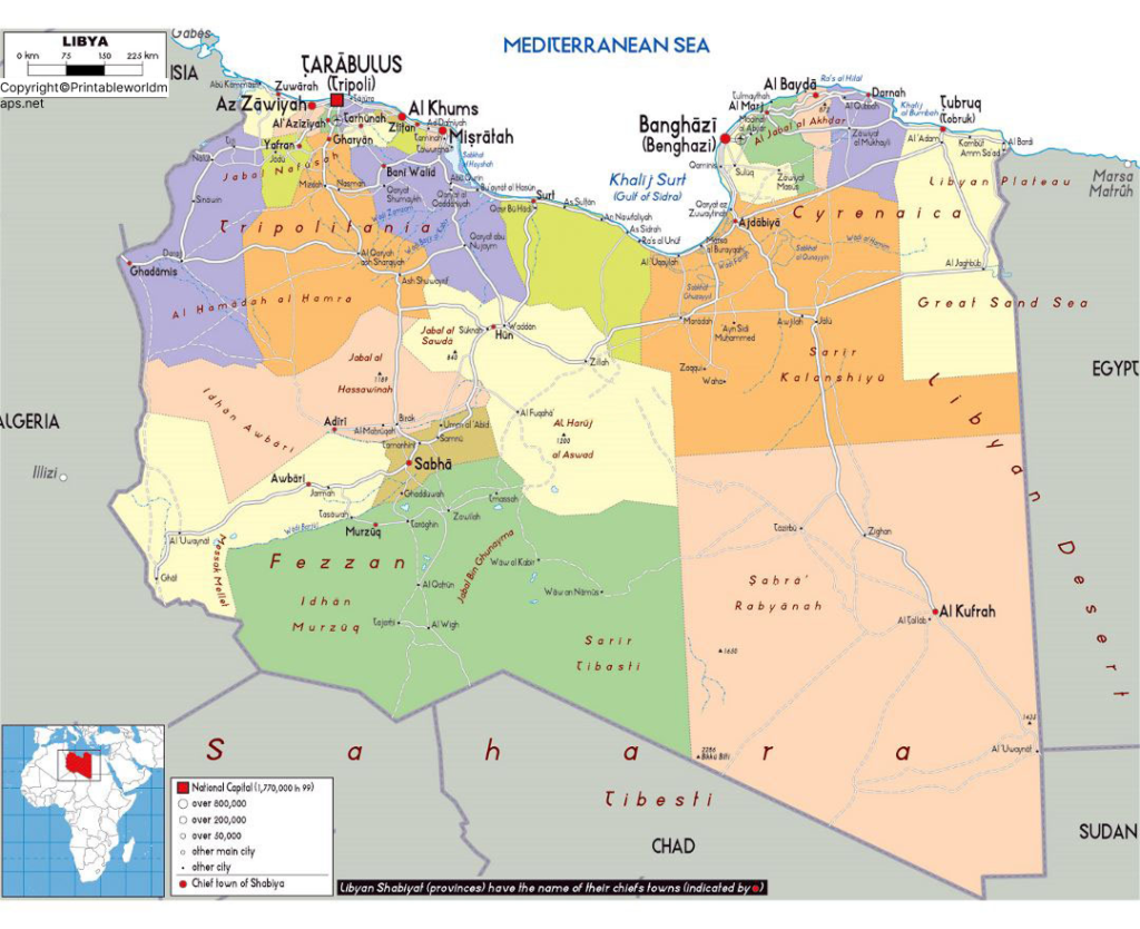
The Labeled Map of Libya with States shows Libya’s administrative areas, major cities, borders, and capital.
The term “states” is commonly used in map searches, but Libya’s administrative structure has changed over time. Historical systems included the three regions of Tripolitania, Cyrenaica, and Fezzan, while later administrative arrangements introduced governorates and other divisions. A World Bank historical review documents these changes and notes the transition from the three federal states to a unitary administrative system in the 1960s.
For this reason, the map should be described carefully as showing administrative districts/divisions, rather than implying that Libya’s current system is identical to a conventional state system.
Administrative Areas Shown on the Map
The map identifies administrative areas including:
- Al Butnan
- Al Jabal al Akhdar
- Al Jabal al Gharbi
- Al Jfara
- Al Jufrah
- Al Kufrah
- Al Marj
- Al Murgub
- Al Wahat
- An Nuqat al Khams
- Az Zawiyah
- Benghazi
- Darnah
- Ghat
- Misratah
- Murzuq
- Nalut
- Sabha
- Surt
- Tripoli
- Wadi Al Hayaa
- Wadi Al Shatii
Labeled Map of Libya with Cities
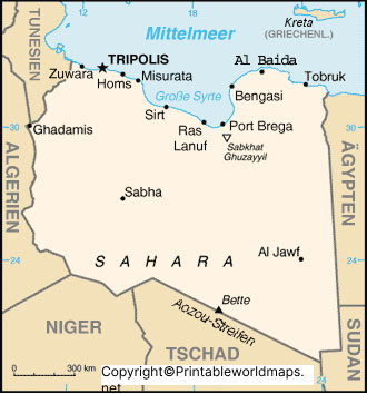
The Labeled Map of Libya with Cities identifies major urban centers across the country and helps show how population and settlements are distributed geographically.
Major cities shown on or commonly associated with maps of Libya include:
- Tripoli
- Benghazi
- Misrata
- Sirte
- Derna
- Tobruk
- Sabha
- Zawiya
- Sabratha
- Ghadames
Tripoli is the country’s capital and one of its principal urban centers. Benghazi is another major city located in eastern Libya.
Why Libya’s Cities Are Concentrated Along the Coast
Libya has a striking geographic population pattern. Large parts of the interior are sparsely populated because of the Sahara, while the Mediterranean coastal zone contains most of the country’s major settlements.
World Bank geographic research states that more than 90% of Libya’s population lives along the Mediterranean coast between Tripoli and Tobruk.
This makes a labeled cities map particularly useful for understanding Libya’s settlement pattern.
Labeled Libya Map with Capital
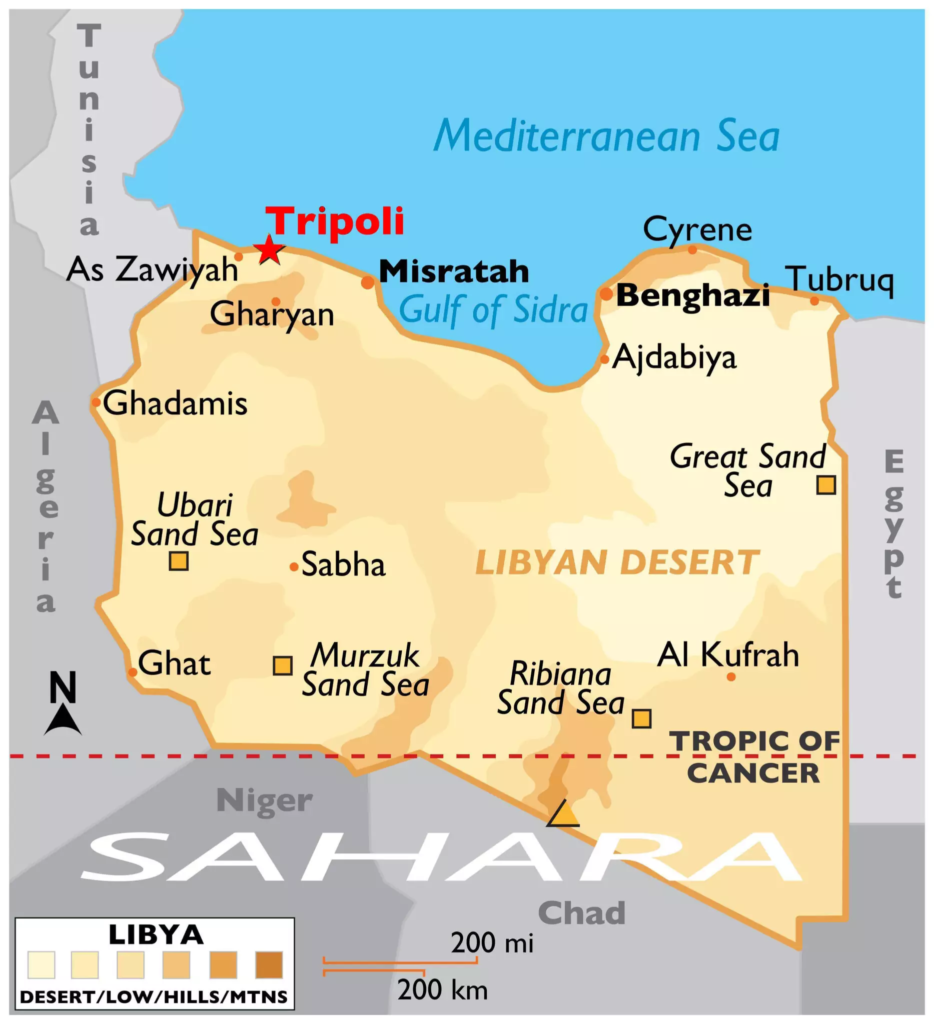
The Labeled Libya Map with Capital identifies Tripoli, the capital of Libya.
Tripoli is located on Libya’s northwestern Mediterranean coast. It is an important political, economic, cultural, and transportation center and is one of the country’s largest cities.
Tripoli on the Libya Map
Tripoli’s coastal location helps explain its historical and modern importance. Its position on the Mediterranean has supported connections with other North African and Mediterranean cities.
The CIA World Factbook’s Libya atlas identifies Tripoli as the capital.
Geography of Libya
The Labeled Map of Libya is also useful for understanding the country’s physical geography.
Key geographic features include:
Mediterranean Coast
Libya has a long Mediterranean coastline along its northern boundary. Many of the country’s major population centers are located in or near this coastal zone.
Sahara Desert
The Sahara covers most of Libya’s interior. The desert environment contributes to the country’s very low overall population density.
Libyan Desert
The eastern and southeastern parts of Libya include extensive desert landscapes that form part of the wider Sahara.
Sparse Interior Population
The contrast between Libya’s large land area and relatively small population is particularly significant. The World Bank reports a surface area of about 1.76 million square kilometers and a 2025 population of about 7.46 million.
Libya Map: Key Facts
| Feature | Information |
|---|---|
| Country | Libya |
| Region | North Africa |
| Capital | Tripoli |
| Coastline | Mediterranean Sea |
| Surface area | About 1.76 million km² |
| Population | 7,458,555 (2025) |
| Western neighbors | Algeria, Tunisia |
| Eastern neighbors | Egypt |
| Southern neighbors | Niger, Chad, Sudan |
| Main geographic region | Sahara Desert |
| Major cities | Tripoli, Benghazi, Misrata, Sirte, Derna, Tobruk, Sabha |
Population and surface-area figures above are based on current World Bank data rather than the older figures in the original article.
Historical Administrative Regions of Libya
For readers interested in historical geography, Libya was historically associated with three major regions:
- Tripolitania — northwestern Libya
- Cyrenaica — eastern Libya
- Fezzan — southwestern Libya
These regions have important historical and geographic significance. However, they should not automatically be treated as the country’s current administrative divisions.
The World Bank’s study of local government in Libya documents the country’s changing administrative structures, including the three federal states established under the 1951 Constitution and the later transition to governorates.
Why Use a Labeled Map of Libya?
A labeled Libya map can be useful for:
- Geography lessons
- School assignments
- Classroom presentations
- Learning African countries and capitals
- Identifying Libya’s neighboring countries
- Studying North African geography
- Locating major Libyan cities
- Understanding Libya’s coastal population pattern
- Comparing historical and modern administrative geography
- Printing for educational use
For students, a labeled map provides geographic context that is difficult to obtain from a country outline alone.
Frequently Asked Questions
What is the capital of Libya?
Tripoli is the capital of Libya.
Where is Libya located?
Libya is located in North Africa along the Mediterranean Sea. It borders Egypt, Sudan, Chad, Niger, Algeria, and Tunisia.
How large is Libya?
Libya has a surface area of approximately 1,759,540 square kilometers.
What is the population of Libya?
The World Bank reports a population of 7,458,555 in 2025.
What countries border Libya?
Libya shares land borders with Egypt, Sudan, Chad, Niger, Algeria, and Tunisia.
What sea borders Libya?
The Mediterranean Sea borders Libya to the north.
What are the major cities of Libya?
Major cities include Tripoli, Benghazi, Misrata, Sirte, Derna, Tobruk, Sabha, Zawiya, Sabratha, and Ghadames.
What are the historical regions of Libya?
The three historically important regions are Tripolitania, Cyrenaica, and Fezzan. These are historical geographic regions and should not be confused with every current administrative classification.
Is Libya mostly desert?
Yes. Much of Libya consists of desert landscapes associated with the Sahara, while the Mediterranean coastal region contains most of the country’s population and major cities.
Can I print the Labeled Map of Libya?
Yes. The map resources on this page can be provided as printable image and PDF versions for educational and reference purposes.
Additional Facts About Libya
- Libya is located in the Maghreb/North African region.
- Its northern coastline opens onto the Mediterranean Sea.
- Tripoli is the national capital. CIA
- Libya’s surface area is approximately 1.76 million km². DataBank
- The World Bank estimates Libya’s population at 7.46 million in 2025. World Bank Open Data
- Libya has a very low population density relative to its large land area. DataBank
- Most Libyan residents live near the Mediterranean coast. World Bank
- The country’s interior is dominated by the Sahara and is much more sparsely populated.
- Libya’s administrative divisions have changed throughout its modern history.
Reference Links
World Bank — Libya Data: https://data.worldbank.org/country/libya
World Bank — Libya Country Profile: https://databank.worldbank.org/views/reports/reportwidget.aspx?Id=b450fd57&Report_Name=CountryProfile&country=LBY
World Bank — Libya Surface Area: https://data.worldbank.org/indicator/AG.SRF.TOTL.K2?locations=LY
World Bank — Libya Local Government Forum: https://documents1.worldbank.org/curated/en/889311615360771327/pdf/Proceedings-of-the-Libya-Local-Government-Forum.pdf
CIA — Libya World Leaders: https://www.cia.gov/resources/world-leaders/foreign-governments/libya
CIA — Libya Atlas: https://www.cia.gov/the-world-factbook/about/archives/2024/static/b2550d20871f82024f1a323f98319248/LY_Libya_atlas.pdf









