

Explore the Asia Mountains Map with printable mountain maps, labeled geography resources, and downloadable PDF files. This page helps students, teachers, geography enthusiasts, and researchers identify major mountain ranges across Asia and understand their locations, physical features, and importance.
Use the maps below for geography lessons, school projects, map-labeling exercises, revision, and personal reference. Choose the labeled version when studying mountain names or the general map when you want to explore the physical geography of Asia.
Asia Mountains Map
Asia is the world’s largest continent by land area and includes an extraordinary variety of landscapes, from high mountain systems and elevated plateaus to broad plains and deserts. Its mountain regions influence climate, river systems, ecosystems, transportation, and human settlement.
The Asia Mountains Map provides a visual starting point for locating important mountain ranges and understanding their distribution across the continent.
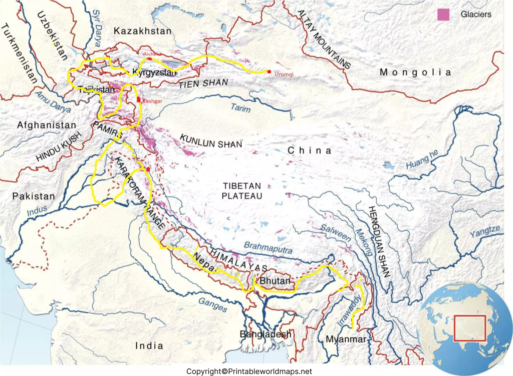
For the best results, open the full-size map before printing. Check the labels and image resolution to ensure mountain names remain readable on your chosen paper size.
Map of Asia Mountains
The Map of Asia Mountains helps readers explore the continent’s major mountain systems, including the Himalayas, Karakoram, Hindu Kush, Kunlun Mountains, Tian Shan, Altai Mountains, and Zagros Mountains.
These ranges extend across different parts of Asia and vary in elevation, geology, climate, and landscape. Some contain extremely high snow-covered peaks, while others include extensive ridges, valleys, and dry mountain environments.
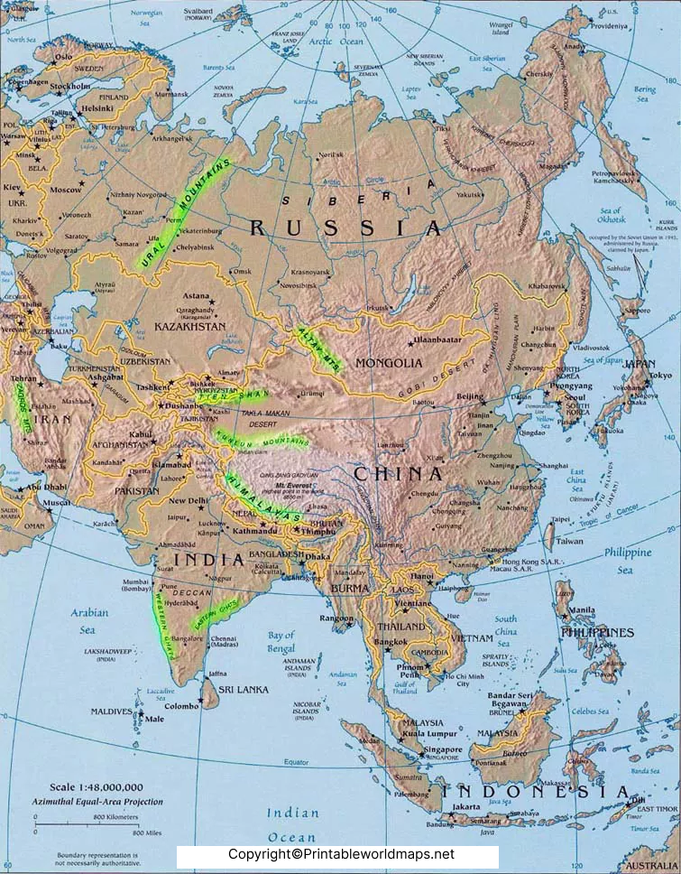
Use this map to compare the approximate locations of mountain ranges and identify their relationships with nearby countries, plateaus, and lowland regions. For precise boundaries, elevations, or scientific research, consult authoritative topographic maps and geographical references.
Asia Map with Mountains
An Asia Map with Mountains is useful for understanding the continent’s physical geography. It connects mountain locations with the surrounding landforms and helps readers see how mountain systems are distributed across South, Central, East, and West Asia.
The Himalayas lie north of the Indian subcontinent, while the Karakoram and Hindu Kush form part of the wider high-mountain region of South and Central Asia. The Kunlun Mountains extend along the northern margin of the Tibetan Plateau, and the Tian Shan stretches across Central Asia.
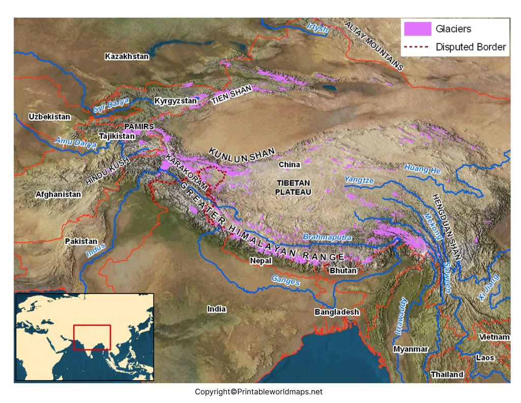
This map is suitable for classroom discussions, geography assignments, and general reference. Pair it with a political map of Asia to compare mountain locations with international borders and country names.
Printable Asia Mountains Map Labeled
A Printable Asia Mountains Map Labeled is particularly helpful for students and teachers who need to identify mountain ranges and review their locations. A labeled map can also support classroom quizzes, geography worksheets, and independent learning.
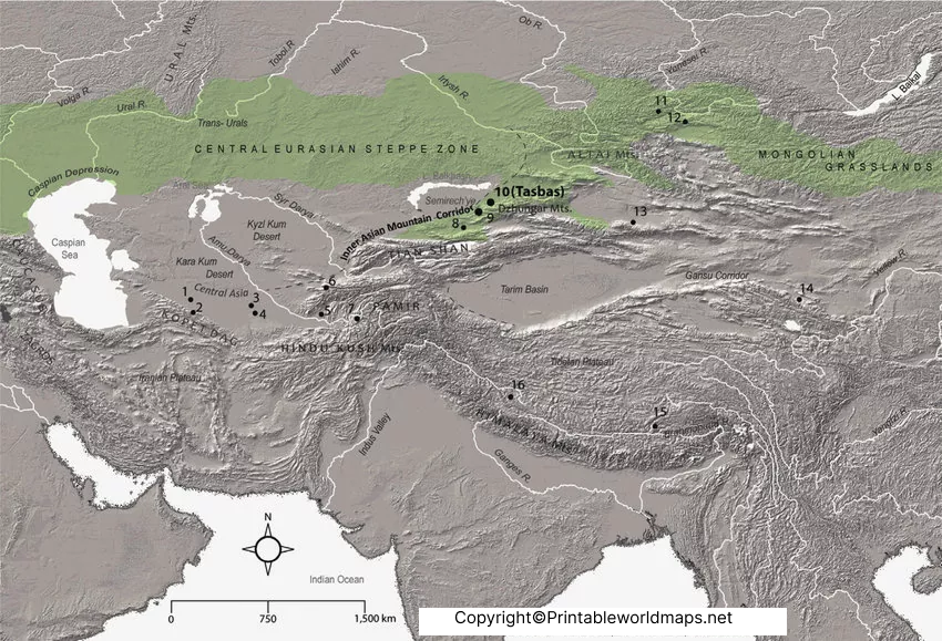
For classroom use, print a labeled version as a reference sheet. To test your knowledge, cover the names and try to identify the ranges independently. You can also use the map as a starting point for researching the countries, peaks, rivers, and environments associated with each mountain system.
7 Major Mountain Ranges in Asia
Asia contains many mountain systems, each with distinct geographical characteristics. The following examples are useful starting points when studying the continent’s physical geography.
- Himalayas: A major mountain system in South Asia that includes Mount Everest, the world’s highest mountain above sea level.
- Karakoram: A high mountain range in the region where Pakistan, India, and China meet, known for its extensive glaciers and prominent peaks, including K2.
- Hindu Kush: A rugged mountain system extending through Afghanistan and northern Pakistan.
- Kunlun Mountains: A major mountain system along the northern edge of the Tibetan Plateau in western China.
- Tian Shan: A vast mountain system extending across Central Asia, including parts of Kyrgyzstan, Kazakhstan, and China.
- Altai Mountains: A mountain system spanning parts of Russia, Mongolia, China, and Kazakhstan.
- Zagros Mountains: A major mountain belt in western Iran that continues into parts of Iraq and the surrounding region.
These are seven examples, not a complete inventory of all Asian mountain ranges. Mountain-system boundaries and geographic classifications can vary by reference source.
Interesting Facts About Asian Mountains
- Mount Everest is the highest mountain above sea level. Nepal and China jointly announced its height as 8,848.86 metres in December 2020.
- The Himalayas are geologically active. Their formation is associated with the continuing convergence of the Indian and Eurasian tectonic plates.
- Mountain regions influence river systems. Snow and glacier melt contribute to the water systems of several major Asian river basins, although the contribution varies by river and season.
- The Tibetan Plateau is closely connected to Asia’s mountain geography. Major mountain systems surround or border the plateau, creating a distinctive high-elevation landscape.
- Asian mountains support diverse ecosystems. Altitude, rainfall, temperature, and exposure create different habitats, from forested slopes to alpine meadows and permanently glaciated areas.
These facts help explain why mountain maps are useful beyond identifying peaks: they also provide context for climate, geology, biodiversity, and human geography.
How to Use and Print the Asia Mountains Map
Follow these steps to get the most from the printable maps:
- Choose the general, mountain-focused, or labeled map according to your learning needs.
- Open the full-size PNG image to inspect the labels and map details.
- Select the corresponding PDF download when you prefer a document format for printing.
- Use a suitable paper size and check the print preview before printing.
- Keep a labeled reference nearby when completing exercises or testing your geographical knowledge.
For worksheets, a labeled map is useful for revision, while an unlabeled or less-detailed map can be used for practice if the version available on this page supports that purpose.
Frequently Asked Questions
1. What is an Asia Mountains Map?
An Asia Mountains Map is a geographical map that identifies or illustrates mountain ranges and major mountainous areas across Asia. Depending on the map, it may include labels, country boundaries, physical features, and prominent peaks.
2. Where can I download a printable Asia Mountains Map?
You can download the map from the PDF links provided in the sections above. Choose the version that best matches your needs, such as the general mountain map or the labeled map.
3. Which is the highest mountain in Asia?
Mount Everest is the highest mountain in Asia and the world when measured by elevation above sea level. Its officially announced height is 8,848.86 metres.
4. Which are the major mountain ranges in Asia?
Important examples include the Himalayas, Karakoram, Hindu Kush, Kunlun Mountains, Tian Shan, Altai Mountains, and Zagros Mountains. Asia contains many additional ranges.
5. Why are Asian mountain ranges important?
Asian mountains influence weather patterns, river systems, biodiversity, transport routes, settlement, agriculture, tourism, and cultural traditions. Their effects differ across regions.
6. Is a labeled Asia Mountains Map useful for students?
Yes. A labeled map can help students learn mountain names, understand their relative locations, prepare for geography examinations, and complete school projects.
7. Can I use the Asia Mountains Map for research?
The map can be a useful starting point for general learning and preliminary research. For academic work, precise coordinates, elevation measurements, or detailed geographical analysis, verify information using authoritative topographic and scientific sources.
Reference links
https://education.nationalgeographic.org/resource/asia
https://data.un.org/legacy/en/reg/g142.html
More Free and Printable Maps for Download
Below you’ll find a link collection to other interesting maps of different parts of the world. We offer world maps, country and continent maps as well as physical and other maps. All our maps are available for free download as PDF files.
World Maps
Continent Maps
- Political Map of Europe
- Blank Map of Europe
- Labeled Map of Africa
- Blank Map of South America
- Labeled Map of South America
- Blank Map of Asia
- Political Map of Asia
- Physical Map of Asia
- Labeled Map of South America
- Labeled Map of Europe
Country Maps
- Map of Ukraine with Regions
- Labeled Map of Germany
- Map of France with Regions
- Blank Map of Russia
- Blank Map of China
- Labeled Map of Bahrain

4 thoughts on “Printable Asia Mountains Map – Map of Asia Mountains”