


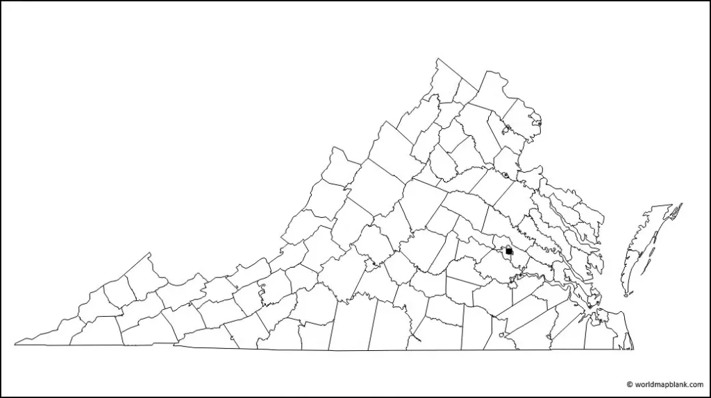
A Blank Map of Virginia is a useful resource for students, teachers, parents, and geography enthusiasts who want to study Virginia’s location, boundaries, cities, and physical features. This page provides printable Virginia map resources in PNG and PDF formats, including an outline map, a transparent PNG map, and a practice worksheet.
Choose the map that suits your needs, download the available file, and print it for classroom activities, homework, geography revision, or personal study.
Blank Map of Virginia – Outline
A blank Virginia outline map provides a simple starting point for learning the state’s shape and geographic position. Students can use an outline map to label important cities, neighboring states, rivers, mountain regions, and other features, depending on the detail included in the map.

How to Use a Virginia Outline Map
- Identify Virginia on a map of the United States.
- Mark Richmond, the state capital, if the map provides enough detail.
- Locate neighboring states and the District of Columbia.
- Label major rivers or mountain regions using a reliable atlas.
- Use different pencil colors to distinguish physical and political features.
Check the labels and boundaries against a trusted reference map before using the worksheet for graded schoolwork.
Printable Map of Virginia
A printable map of Virginia is helpful for classroom lessons, homework, geography projects, and independent learning. A printed map lets learners write labels, mark locations, and make notes without needing to edit a digital map.

Tips for Printing a Virginia Map
- Select the PDF format when you want a document that is easy to print.
- Use the PNG image for worksheets, presentations, or compatible document editors.
- Choose a page orientation that matches the map’s proportions.
- Preview the page before printing to avoid cutting off the map edges.
- Use a high-quality print setting when small boundaries or labels need to remain legible.
The readability of the printed result depends on the source image, printer settings, and paper size.
Transparent PNG Blank Map of Virginia
A transparent PNG map can be useful for educational presentations, digital worksheets, and graphic-design projects. Transparency allows a map image to be placed over a colored background without automatically displaying a solid rectangular background, provided the downloaded file retains its transparency.

PNG vs. PDF: Which Format Should You Choose?
PNG is generally convenient for inserting an image into a presentation or compatible editing application. PDF is generally convenient for printing and sharing a page while preserving its document layout.
If transparency is important, check the PNG file itself. Converting a transparent image to PDF does not guarantee that the PDF will preserve transparency in the same way.
Blank Virginia Map Worksheet
A blank Virginia map worksheet can help students practise identifying geographic locations and recalling information. Teachers and parents can use a map worksheet for revision, classroom exercises, or an introductory state geography activity.
Practice Activities for Students
Use the worksheet to practise the following tasks, where the map provides enough detail:
- Mark Richmond, the capital of Virginia.
- Identify Virginia’s neighboring states and the District of Columbia.
- Locate the Appalachian Mountains and the Blue Ridge Mountains using a reference atlas.
- Find the Potomac River, James River, and other major waterways on a detailed reference map.
- Compare Virginia’s coastal plain, Piedmont, and mountain regions.
- Write a short description of Virginia’s location in the eastern United States.
Teacher tip: Give students a completed reference map for checking their answers after they finish the blank worksheet. This encourages independent learning and helps correct geographic misconceptions.
Interesting Facts About Virginia
These facts provide useful context for students working with a blank map of Virginia.
- Capital: Richmond is the capital of Virginia.
- Statehood: Virginia became the 10th state of the United States on June 25, 1788.
- Geographic variety: Virginia includes coastal areas, the Piedmont, and mountainous regions in the west.
- Waterways: The Potomac and James rivers are important geographic features associated with Virginia.
- Local government: Virginia has both counties and independent cities, so a county-only map may not show every local-government boundary.
- Official map resources: The Virginia Department of Transportation provides state transportation maps and downloadable county road maps.
For verified geographic and administrative information, consult the official resources linked at the end of this article.
How to Choose the Right Virginia Map
Choose an outline map if your goal is to practise the state’s shape and location. Choose a printable map if you need a paper copy for schoolwork or teaching. A transparent PNG is useful for compatible digital projects, while a worksheet is suitable for structured practice.
If you need exact county boundaries, road information, or detailed administrative geography, use an official or specialist reference map rather than assuming that every blank outline contains those details.
Frequently Asked Questions
1. Where can I download a blank map of Virginia?
You can use the PNG and PDF links provided in the outline-map section above. Select the format that works best for your classroom, homework, or personal study.
2. Is the printable Virginia map available as a PDF?
Yes. PDF download links are provided for the outline map, printable map, transparent-map resource, and practice worksheet. Open the relevant link to access the available file.
3. What is a blank Virginia map used for?
A blank Virginia map can be used for geography lessons, state identification, labeling exercises, classroom quizzes, homework, and map-reading practice.
4. Can I use a Virginia map worksheet for school projects?
Yes. A worksheet can support school projects and revision. Check your teacher’s requirements and use a reliable reference map to verify geographic labels and boundaries.
5. What is the difference between a Virginia PNG map and a PDF map?
PNG is an image format suitable for digital documents and presentations. PDF is a document format commonly used for printing and sharing. A transparent PNG may also be useful for designs that need a see-through background.
6. Where can I find official Virginia county maps?
The Virginia Department of Transportation provides downloadable county road maps through its official maps page. These are useful when you need road or county-level reference information.
7. What is the capital of Virginia?
Richmond is the capital of Virginia. Students can mark its location on a sufficiently detailed blank map and check their answer against an official or educational reference map.
8. Are blank Virginia maps suitable for geography practice?
Yes. They can help learners practise location recall, map labeling, spatial awareness, and recognition of state boundaries. The activity is most effective when students check their completed work against a trusted reference.
Reference links
https://www.vdot.virginia.gov/travel-traffic/maps
https://www.census.gov/quickfacts/fact/table/VA/LND110220
https://www.virginia.gov/local-government
https://www2.census.gov/geo/pdfs/reference/guidestloc/All_GSLCG.pdf
More Free Printable Maps for Download
Here is a collection of other maps you can get on our website for free in PDF.
USA 50 States Maps Blank
- Printable Blank Map of Colorado
- Blank Map of Hawaii
- Printable Blank Map of Idaho
- Blank Map of Illinois
- Printable Blank Map of Indiana
- Blank Map of Iowa
- Printable Blank Map of Kansas
- Blank Map of Kentucky
- Printable Blank Map of Louisiana
- Printable Blank Map of Maryland
- Blank Map of Michigan
- Printable Blank Map of Mississippi
- Blank Map of Missouri
- Blank Map of New Hampshire
- Printable Blank Map of New Jersey
- Blank Map of New Mexico
- Printable Blank Map of New York
- Blank Map of North Carolina
- Printable Blank Map of Oklahoma
- Blank Map of Rhode Island
- Printable Blank Map of South Dakota
- Blank Map of Washington
- Printable Blank Map of West Virginia
- Blank Map of Vermont
World Maps
Continent Maps
- Blank Map of South America
- South America Map with Countries
- Europe Map with Countries
- Blank Map of Europe
- Labeled Map of Asia
- Blank Map of Asia
- Africa Map with Countries
