

A Blank Map of Cyprus is a useful resource for students, teachers, geography enthusiasts, and anyone who wants to study the island’s shape and location. This page provides a printable Cyprus map outline, a transparent PNG map, a regular printable map, and a practice worksheet in PDF format.
Cyprus is an island in the northeastern Mediterranean Sea and the third-largest island in the Mediterranean after Sicily and Sardinia. Its total area is approximately 9,251 square kilometres. Its location near Europe, Asia, and Africa has influenced the island’s geography, history, and culture.
Use the free map resources below for geography lessons, school assignments, map-labeling exercises, presentations, and personal study.
- Blank Map of Armenia
- World map with continents
- Blank map of World
- labeled map of Asia
- Physical map of World
- Labeled map of Africa
- Blank Map of Egypt
- Labeled map of Europe
- World map poster
- World map with oceans
- World time zone map
- Blank Map of Ethiopia
- Blank Map of Azerbaijan
- Labeled map of World
- Labeled map of South America
- Blank Map of Sudan
- Labeled map of North America
- Blank map of Asia
- Blank Map of France
- Political world map
- Blank Map of Finland
- Blank Map of Fiji
Blank Map of Cyprus Outline
The blank map of Cyprus outline is suitable for learning the island’s overall shape and practising basic map-drawing skills. Students can trace the coastline, identify the island’s position in the Mediterranean Sea, and add geographical labels as part of a classroom exercise.
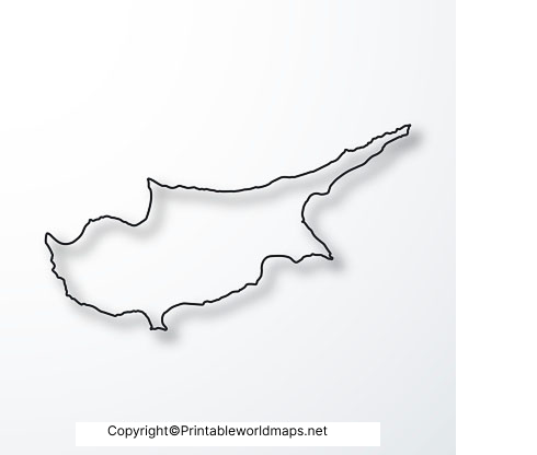
This outline map is useful for geography homework, worksheets, revision activities, and map-drawing practice. Check the downloaded file before printing to ensure that the outline is clear and fits your intended page size.
Printable Map of Cyprus
A printable map of Cyprus is a convenient option for students, teachers, and learners who want a map ready to use. Unlike a blank outline intended for tracing, a printable map can be used as a reference while studying the island’s location and geographical shape.

For classroom use, print the map on A4 paper using the fit-to-page setting. Choose grayscale printing for worksheets that students will label or annotate. Before distributing copies, check the map’s labels, resolution, and usage permissions.
Transparent PNG Cyprus Map
The transparent PNG Cyprus map is useful for digital projects, presentations, educational slides, and custom map layouts. PNG images can support transparent backgrounds, allowing a map graphic to be placed over a coloured background or other design elements when the original file contains transparency.
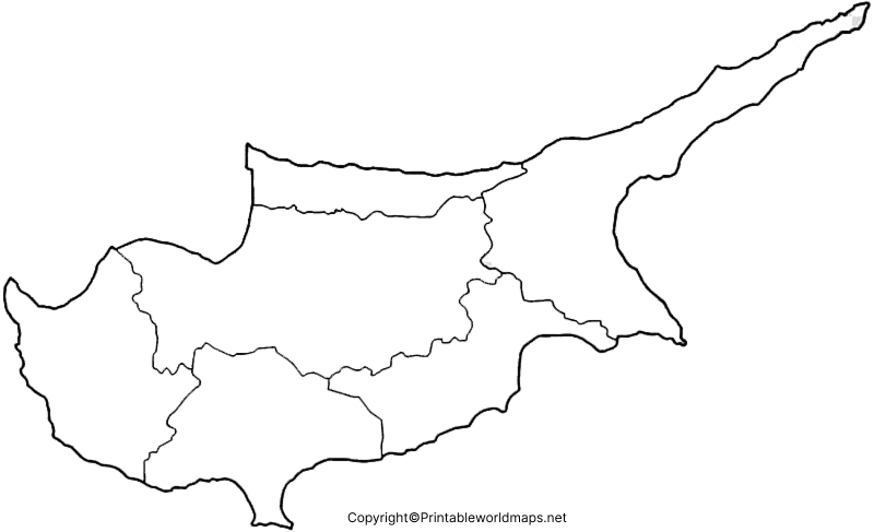
For the best results, check that the PNG background is actually transparent in your image editor. A white-looking background does not always mean the image has an alpha channel. Use the map as a visual reference, and consult an authoritative geographical source if your project requires precise boundaries or official cartographic information.
Map of Cyprus for Practice Worksheet
The Cyprus map practice worksheet helps learners test their understanding of the island’s outline and geographical location. Teachers and parents can use it for classroom activities, homework, revision, and independent study.

How to Use the Cyprus Map Worksheet
- Study the island’s outline before starting the exercise.
- Trace the coastline carefully using a pencil.
- Mark the approximate location of Nicosia, the capital of Cyprus, if the worksheet requires it.
- Use a reference map to identify nearby countries and the Mediterranean Sea.
- Compare your completed worksheet with a reliable geographical reference.
These activities can help students improve map-reading skills, spatial awareness, and familiarity with the eastern Mediterranean region.
Geographical Facts About Cyprus
A blank map becomes more useful when learners understand the geographical features it represents. The following facts provide context for classroom exercises and independent study.
| Geographical feature | Fact |
|---|---|
| Location | Northeastern Mediterranean Sea |
| Total area | Approximately 9,251 square kilometres |
| Regional size | Third-largest island in the Mediterranean |
| Capital | Nicosia, also known as Lefkosia |
| Major mountain range | Troodos Mountains |
| Highest peak | Mount Olympus, in the Troodos range |
| Surrounding sea | Mediterranean Sea |
Where Is Cyprus Located?
Cyprus lies in the eastern part of the Mediterranean Sea, south of Türkiye and west of Syria. Its geographical position connects the eastern Mediterranean with the wider regions of Europe, western Asia, and North Africa.
What Is the Capital of Cyprus?
Nicosia, also called Lefkosia, is the capital of Cyprus. Students can use a suitable reference map to mark its approximate location on a blank map.
Why Are Blank Maps Useful for Learning?
Blank maps encourage active learning. Instead of simply reading place names, students practise recognising shapes, locating features, labelling places, and recalling geographical information from memory.
Tips for Printing a Cyprus Map
- For worksheets: Use A4 paper and the fit-to-page print setting.
- For tracing: Choose a clear outline with enough white space for pencil marks.
- For presentations: Use a high-resolution PNG and verify the transparency.
- For digital documents: Check image quality after resizing.
- For accurate geographical work: Compare the map with an authoritative source and check its date, scale, legend, and boundary information.
Frequently Asked Questions
1. Where can I download a blank map of Cyprus?
You can download the Cyprus outline map from the PNG and PDF links in the Blank Map of Cyprus Outline section above.
2. Is a printable Cyprus map available in PDF format?
Yes. The page provides PDF versions of the outline map, printable map, transparent-map resource, and practice worksheet. Open the relevant PDF link to view or download the file.
3. What is a blank map of Cyprus used for?
A blank map can be used for geography homework, classroom activities, map tracing, presentations, geographical revision, and labelling exercises.
4. Can I use a transparent PNG Cyprus map in presentations?
Yes, provided the downloaded PNG has a transparent background and its usage permissions allow your intended use. It can be useful in presentations, educational graphics, and digital documents.
5. What is the total area of Cyprus?
Cyprus has a total geographical area of approximately 9,251 square kilometres, according to commonly cited geographical references.
6. What is the capital of Cyprus?
The capital is Nicosia, also known as Lefkosia.
7. What is the best format for printing a Cyprus map?
PDF is generally convenient for printing because it can preserve page layout and scalable graphics. A high-resolution PNG or JPG can also be printed if it has sufficient image quality.
8. How can students practise geography with a blank Cyprus map?
Students can trace the outline, identify the island’s location, label the capital using a reference map, and answer questions about nearby regions and physical geography.
Reference links
https://www.gov.cy/en/economy-and-finance/demographic-statistics-2024
https://www.cystat.gov.cy/en/SubthemeStatistics?id=46
https://www.euraxess.org.cy/cyprus/information-assistance/about-cyprus
https://theworldfactbook.org/country/cyprus.html
https://unstats.un.org/unsd/geoinfo/ungegn/docs/5th-uncsgn-doc/E_conf_79_5_Add1_efs.pdf
https://printableworldmaps.net/wp-content/uploads/2023/07/Cyprus-Blank-Map-Outline.png
https://printableworldmaps.net/wp-content/uploads/2025/05/Cyprus-Blank-Map-Outline.pdf
https://worldmapblank.com/wp-content/uploads/2020/12/Printable-Map-of-Cyprus.jpg
https://printableworldmaps.net/wp-content/uploads/2023/07/Printable-Map-of-Cyprus.pdf
https://printableworldmaps.net/wp-content/uploads/2023/07/Transparent-PNG-Cyprus-Map.png
https://printableworldmaps.net/wp-content/uploads/2025/05/Transparent-PNG-Cyprus-Map.pdf
https://worldmapblank.com/wp-content/uploads/2020/12/Map-of-Cyprus-Worksheet.jpg
https://printableworldmaps.net/wp-content/uploads/2023/07/Map-of-Cyprus-Worksheet.pdf


