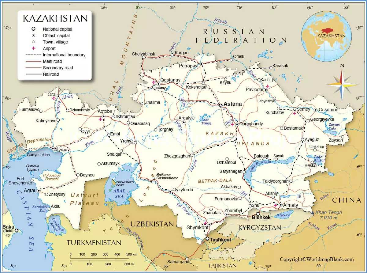
The labeled Map of Kazakhstan shows that it is recognized officially as the Republic of Kazakhstan in Central Asia. Kazakhstan is located in Russia (South). It extends to east from the Caspian Sea to the Altai Mountains and China. Kazakhstan was part of the Soviet republics till the year 1991. Geographically, Kazakhstan also known as Zhayyq is located within Europe. Countries like Uzbekistan, Turkmenistan, Russia, Kyrgyzstan, and China are situated along the border of Kazakhstan. It is the largest landlocked nation across the globe.
- World map with continents
- Physical world map
- Political world map
- Labeled map of Asia
- Labeled map of Africa
- Labeled map of Europe
- Labeled map of South America
- World time zone map
- Labeled map of world
- Blank map of world
- Labeled map of North America
- Blank map of Asia
- World map with oceans
- World map poster
Contents
Labeled Map of Kazakhstan
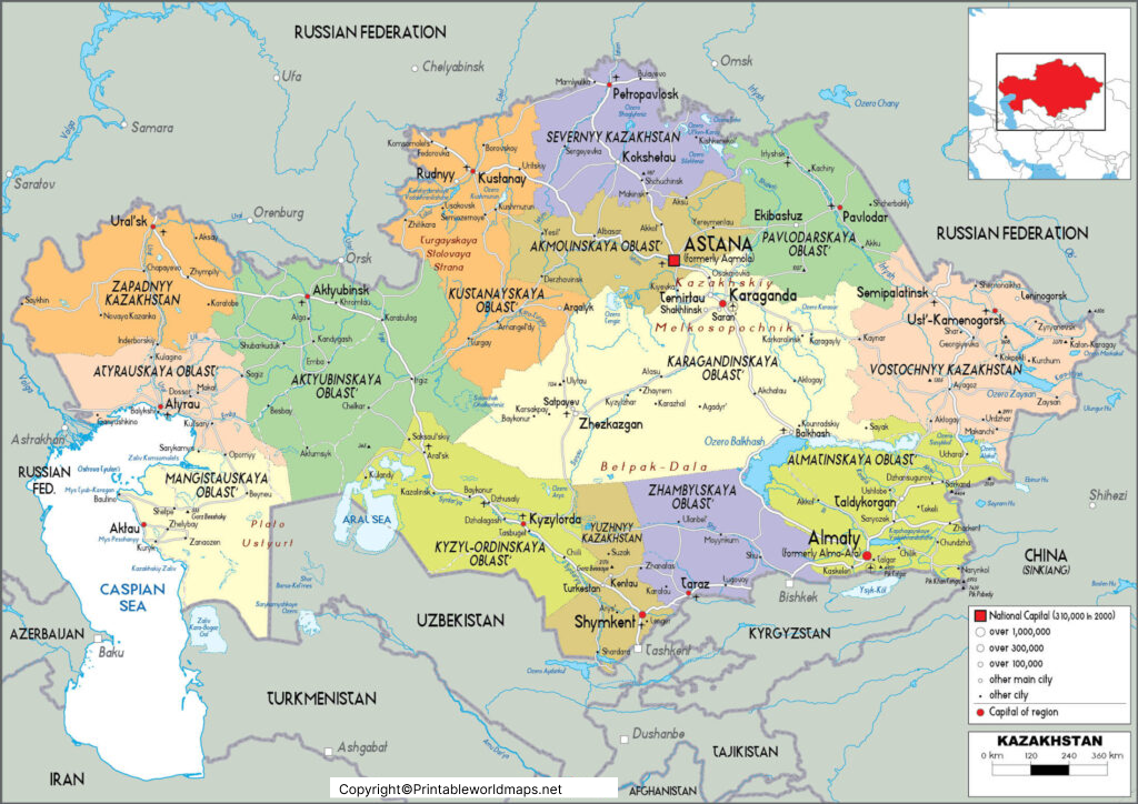
As an August 8, Saturday, 2020, the updated population of Kazakhstan is 18,799,280 people. The country’s land area is equivalent to 2.725 million square kilometers. The names of the important rivers in the country, include Badam River, Ayat River, Aschiagar River, Asa River, Arys River, Aksu River, Akan-Burluk River and Ajaguz River.
The most commonly practiced religion in this country is Islam. About seventy percent of the population follow the Islamic religion. Besides, there are Ethnic Kazakhs who predominantly belong to Sunni Muslims of the Hanafi School. Other religions, include Shias and Ahmadis.
Labeled Map of Kazakhstan with States
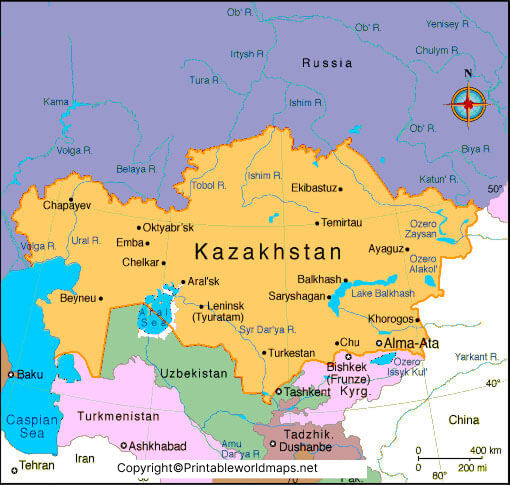
As a part of the labeled map of Kazakhstan with states or provinces, it can be seen that administratively, the country is divided into fourteen provinces or regions. They include Akmola, Aktobe, Almaty Province, Atyrau, East Kazakhstan, Karagandy, Kostanay, Kyzylorda, Manggystau, North Kazakhstan, Pavlodar, South Kazakhstan, West Kazakhstan, and Zhambyl.
Labeled Kazakhstan Map with Cities
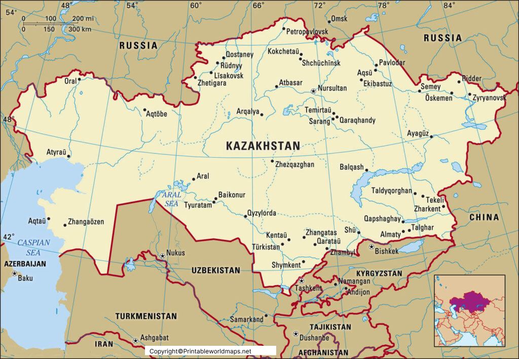
As a part of the labeled map of Kazakhstan with cities, it can be seen that there is one city with a population of more than two million people. There are twenty-two cities in which the population ranges from 100,000 to 1 million people. There are eighty-nine cities in which the population ranges between 10,000 and 100,000 people. The largest and the most populous city in Kazakhstan is Almaty that has a population of more than ten-percent of the total population of the country. This is located in the province of Almaty. Other names of populous cities, include Nursultan, Shymkent and Aktobe.
Labeled Kazakhstan Map with Capital
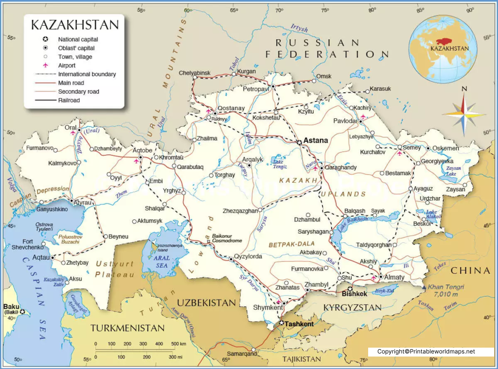
As a part of labeled Map of Kazakhstan with capital, it can be seen that Nur-Sultan, formerly known as Astana, is recognized as the capital city of the country. A Japanese architect designed this modern city with an effort to consolidate all the government offices. Even the presidential palace is situated in this city. The city has facilities, like malls for shopping, hospitals, centers for educational institutions, stadiums for sports, tourist spots, and theatres.
The location of this capital city is in the central region of the country, which makes it easily accessible from all the corners. An estimated area of 278 square miles is covered by this city and is home for more than a million residents. The temperatures of this city range -30 °C in winter to 35 °C in summer. The city has smooth system of transportation that comprises shared taxis, buses, and a modern railway serves the residents, efficiently.

