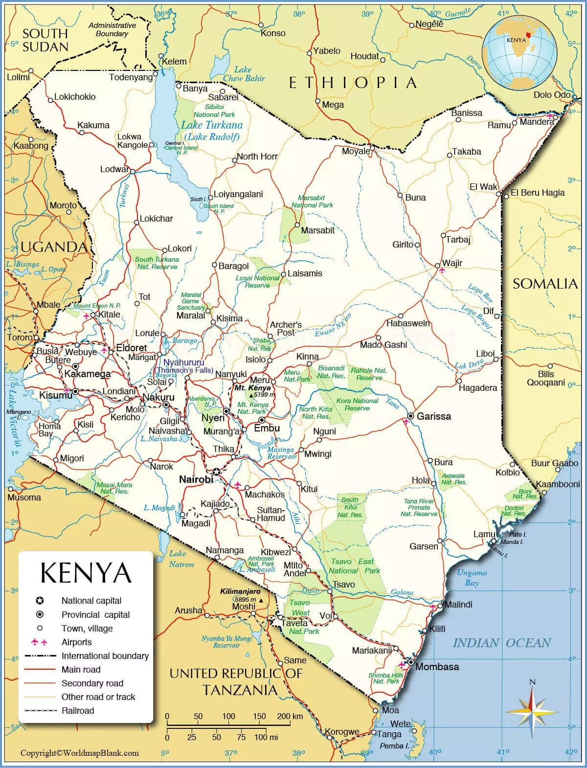
Labeled Map of Kenya reveals that Kenya is a country located in East Africa. Its neighboring countries are Uganda, South Sudan, Tanzania, Somalia, and Ethiopia. In the southeast, the country is bordering the Indian Ocean.
Kenya is larger in area when compared to that of France or slightly more than twice the size of the U.S. state of Nevada. The unique landscape of Kenya reflects many distinctive geographical regions. It is possible to find in Kenya, narrow, low-lying, fertile coastal strip that stretches along the shores of the Indian ocean.
- World map with continents
- Physical world map
- Political world map
- Labeled map of Asia
- Labeled map of Africa
- Labeled map of Europe
- Labeled map of South America
- World time zone map
- Labeled map of World
- Blank map of world
- Labeled map of North America
- Blank map of Asia
- World map with oceans
- World map poster
Contents
Labeled Map of Kenya
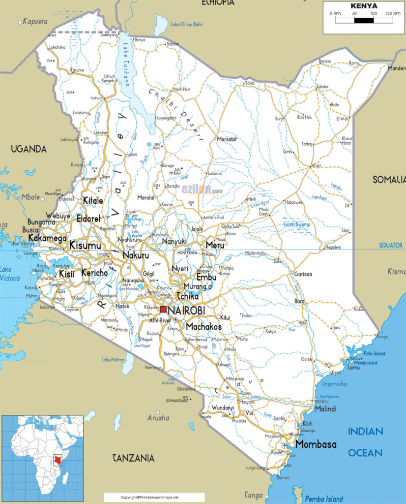
They are fringed with islands and coral reefs. The landscape of Kenya shows that it has a series of low hills in the south. This separates the coastal region from the vast bush-covered fertile plains of the eastern plateau. As of Wednesday, August 5, 2020, the updated population in Kenya is equivalent to 53,874,673 people.
This population in Kenya is equivalent to 0.69% of the global population. Kenya measures a land area of 580,367 square kilometers or 224,081 square miles. The rivers that flow in the country include Nile, Tana, Ewaso Ng’iro, and Dawa. Christianity is the religion in this country. Other religions include Islam, Baha’i, Buddhism, Hinduism, and traditional religions.
Labeled Map of Kenya with States
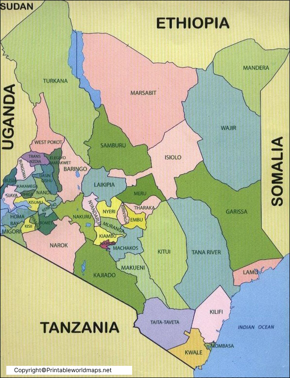
As a part of the labeled map of Kenya with states, it can be seen that the country is divided into eight administrative regions or provinces. These provinces with state capitals include Western Province with capital as Kakamega, Rift Valley Province with capital as Nakuru, Nyanza Province with capital as Kisumu, North Eastern Province with capital as Garissa, Nairobi with capital as Nairobi, Eastern Province with capital as Embu, Coast Province with capital as Mombasa, and Central Province with capital as Nyeri.
Labeled Kenya Map with Cities
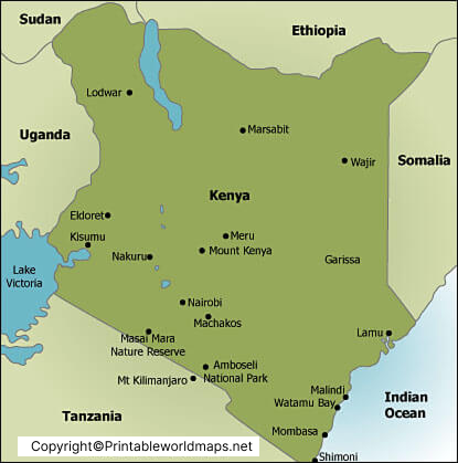
Through the labeled map of Kenya with cities, it can be seen that some of the most important cities of Kenya, include Nairobi, Mombasa, Kisumu, Nakuru, Eldoret, and Malindi. Kenya’s capital and largest city is Nairobi. The country’s second-largest and the oldest city is Mombasa. The third and fourth largest city of Kenya is Kisumu and Nakuru, respectively. In the northern region, Eldoret is the fifth-largest city. In the coastal region, Malindi is considered as the second-largest urban center.
Labeled Kenya Map with Capital
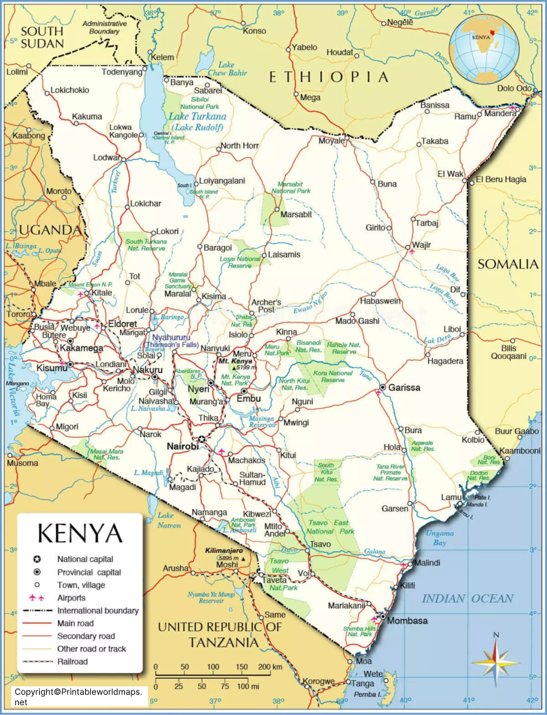
As a part of labeled Kenya with Capital, Nairobi is recognized as the capital of Kenya. Besides, being the urban core, the city has a place of interest like Nairobi National Park. It is a large game reserve, famous for breeding endangered black rhinos.
The park is also home to animals like lions, zebras, and giraffes. By the side of this park, it is possible to find a well-regarded orphanage for elephants, which is maintained by the David Sheldrick Wildlife Trust. Being the principal industrial center of the country, in the city of Nairobi, the railway is the largest single industrial employer. There are light manufacturing industries that produce processed food, cigarettes, and beverages.

