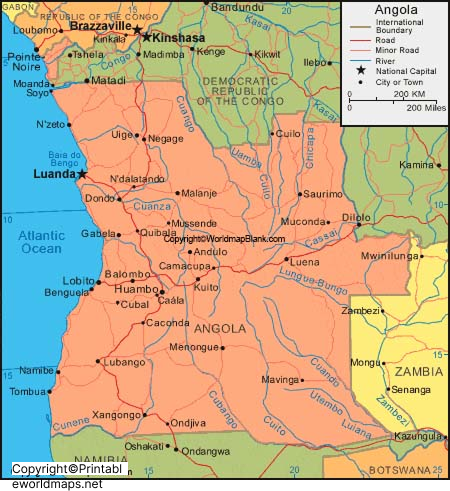
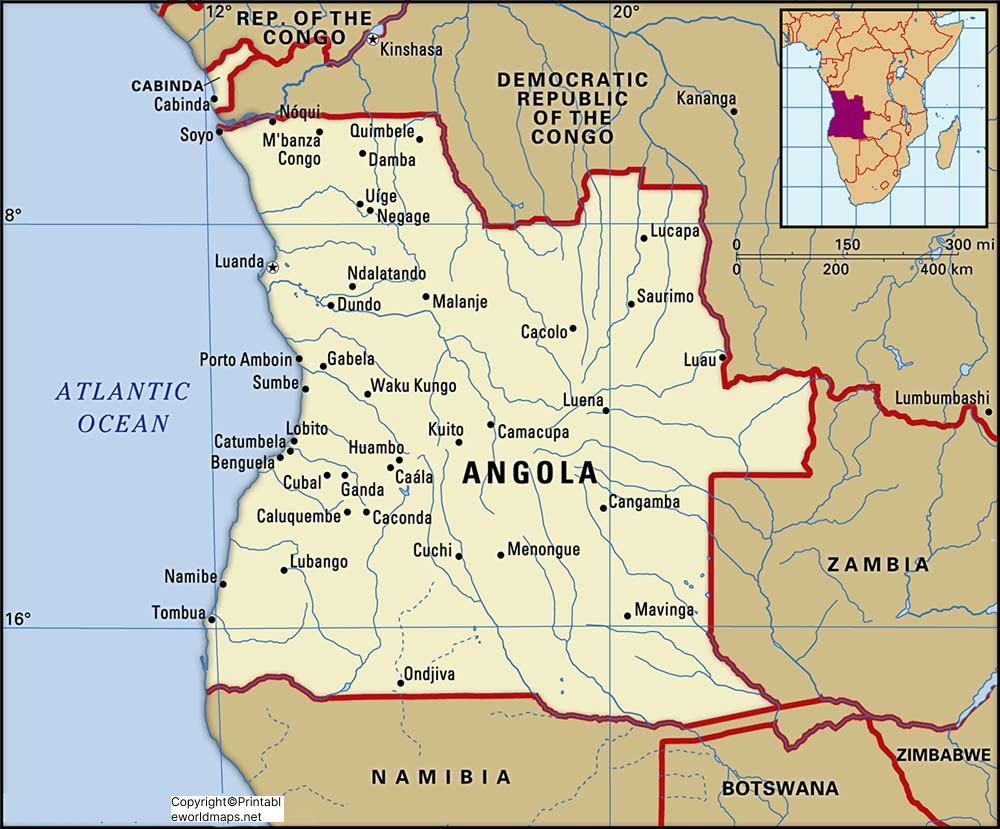
While looking into the Angola Labeled Map, one can see that it is a republic country, located on the western coast of Southern Africa. In the west, the country is bordered by the Atlantic Ocean, in the south with Namibia, in the north with the Democratic Republic of the Congo, and in the east with Zambia.
- World map with continents
- Physical world map
- Political world map
- Labeled map of Asia
- Labeled map of Africa
- Labeled map of Europe
- Labeled map of South America
- World time zone map
- Labeled map of World
- Blank map of world
- Labeled map of North America
- Blank map of Asia
- World map with oceans
- World map poster
The country measures a total area of 1,246,700 km². When compared with South Africa, the area of Angola is slightly larger but slightly less than that of Texas state in the US. Angola’s current population is equivalent to 32,888,945 as on Tuesday, July 14, 2020. This population is equivalent to 0.42% of the total global population. Rivers, Cubango and Cuito, join at the border of southern Angola forming a big river.
Contents
Labeled Map of Angola
Across the Caprivi strip, this flows through a narrow band of Namibia, and finally into Botswana. The river is known as Cuanza River, also spelled under different names, as Quanza, Kwanza or Coanza flows in the central part of Angola. Christian is the main religion. About eighty percent of the population are Roman Catholics and Protestants. The remaining population follows traditional beliefs or other religions.

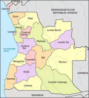
Labeled Map of Angola with States
Based on the Labeled Map of Angola with States, the country has Provinces and Administrative Divisions. Accordingly, Angola is divided into eighteen provinces or states.

The provinces are indicated with state capitals in the map. The names of the provinces, include Bengo, Benguela, Bie, Cabinda, Cuando Cubango, Cuanza Norte, Zaire, Uige, Namibe, Moxico, Malanje, Lunda Sul, Lunda Norte, Luanda, Huila, Huambo, Cunene, and Cuanza Sul.
Labeled Map of Angola with Cities

While looking into a labeled map of Angola with cities, it may be seen that Angola consists of one city with a population greater than one million people, six cities with a population ranging from 100,000 and one million people, and twenty-three cities with a population ranging from ten thousand to 100,000 people. The major ten cities of Angola, include Uíge, Kuito, Lobito, Saurimo, Malanje, Cabinda, Benguela, Huambo, Lubango, and Luanda.
Labeled Angola with Capital
Labeled Angola with Capital reveals that Luanda is the largest city and capital of Angola. This city is the urban center of Angola, consisting of cultural, major industrial establishments and primary port. It is the administrative center of Angola and located on the northern Atlantic coast of Angola. Incidentally, it is the capital of the Launda province or state.

The cities metropolitan area is inhabited by most of the Portuguese speaking population and has a total population of eight million people living in the city. The population of Luanda is equivalent to thirty-three percent of Angola’s total population.
The city includes industries, like agricultural products processing, production of beverages, cement, textile, new car assembly plants, metallurgy, plastics, materials required for construction, shoes, and cigarettes. The city is recognized as one of the economic centers for oil production. It has a refinery located in the city. It is considered as one of the most expensive cities in Angola.


