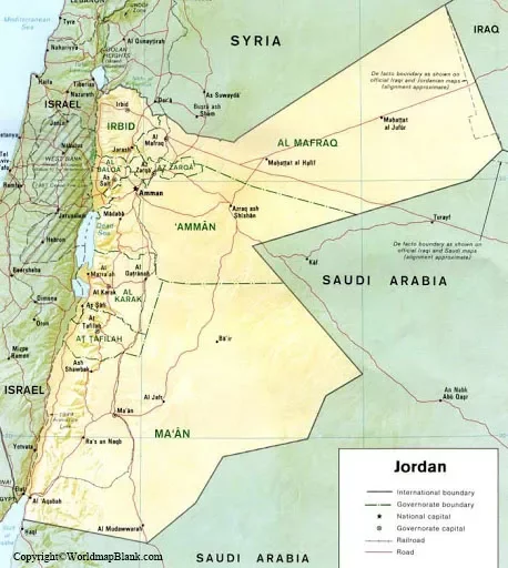
The Labeled Map of Jordan reveals that it is a desert country located in the Middle East. The country reflects a short coastline at the Strait of Aqaba. The profile of Jordon indicates that it is a landlocked nation located east of the River of Jordon and on the Arabian Peninsula.
- World map with continents
- Physical world map
- Political world map
- Labeled map of Asia
- Labeled map of Africa
- Labeled map of Europe
- Labeled map of South America
- World time zone map
- Labeled map of world
- Blank map of world
- Labeled map of North America
- Blank map of Asia
- World map with oceans
- World map poster
The Hashemite Kingdom of Jordan is the official name of the country. This kingdom of Jordon is bordered with Syria in the north, Iraq in the northeast, Saudi Arabia in the south as well as east. The river Jordon bifurcates the country from a portion of the territories of Palestinian and Israel. As of Thursday, August 6, 2020, the current population of Jordan is equivalent to 10,212,861 people.
Contents
Labeled Map of Jordan
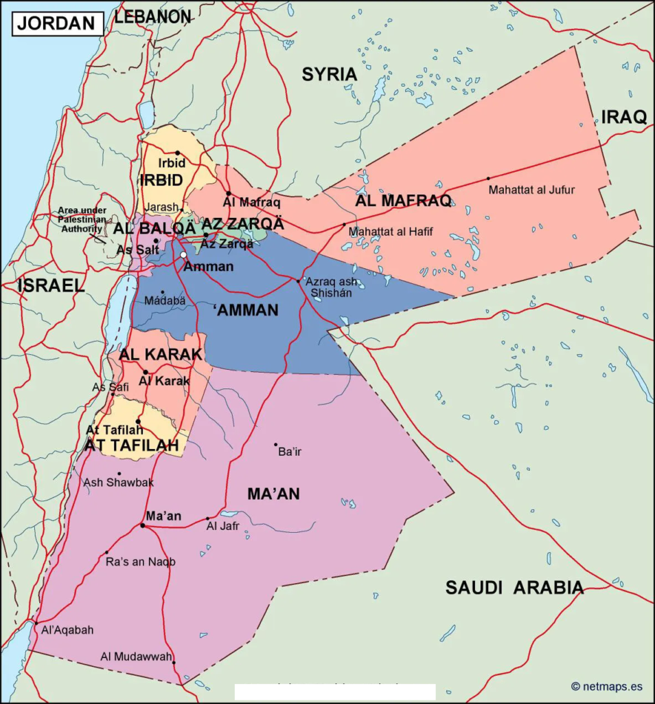
This population is equivalent to 0.13% of the total global population. The country is found to be small with a land area measuring 89,342 square kilometers or 34,495 square miles. Jordan river that flows through the country is the longest river with a length of 156 miles. There are two tributaries that join the Jordan river. They are known as Jabbok and Yarmouk rivers. Another longest river that flows through the country is Zarqa River. Muslim is the major religion followed in Jordan. About ninety-two percent of Jordanians are Sunni Muslims, and one percent Muslims are Shia or Sufi. Other religions include Christianity.
Labeled Map of Jordan with States
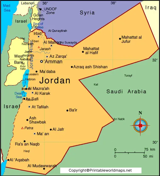
Through the labeled map of Jordan with states, it is possible to know that there are twelve provinces or states or governorates in Jordan. They include Aqaba, Maan, Tafileh, Karak, Balqa, Madaba, Jerash, Ajloun, Mafraq, Zarqa, and Amman. Every state is divided into a number of districts and sub districts.
Labeled Jordan Map with Cities
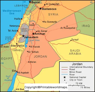
According to the details of the labeled map of Jordan with cities, it may be observed that one of the cities has more than a million people. It has five cities with a population ranging from 100,000 and 1 million people. Another thirty cities have a population between 10,000 and 100,000 people. One of the largest Jordan’s city is Amman. It is the center of a large continuous urban sprawl. The second-largest city of Jordan is Irbid. It is situated in the northern region of Jordan. This is a university town, main administrative and industrial center. Other cities include Zarqa, Russeifa, Al Quwaysimah, Ajloun, and Aqaba.
Labeled Jordan with Capital
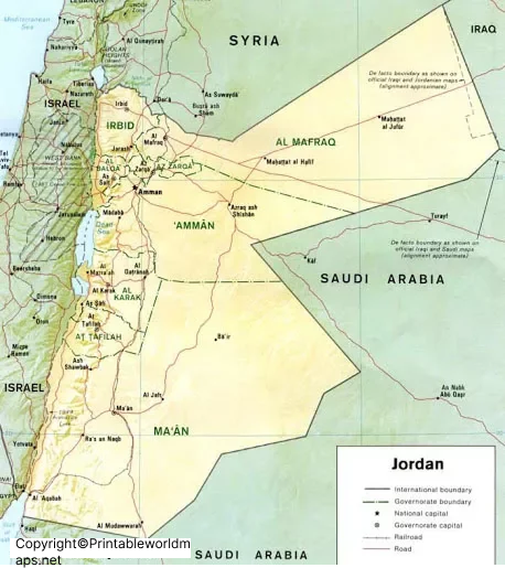
As a part of the labeled Jordan with capital, the capital city of Jordan is Amman. This is recognized as the most modern and ancient capital of the country. It is considered as one among the oldest and continuously inhibited cities of Jordan. This wonderful city is built on seven hills, each of which defines a neighborhood. The geography of the city is described in reference to eight circles that form the spine of the city. The seven hills of the city are an enchanting mixture of modern and ancient look. It is possible to see gleaming white houses and bustling markets in the city.

