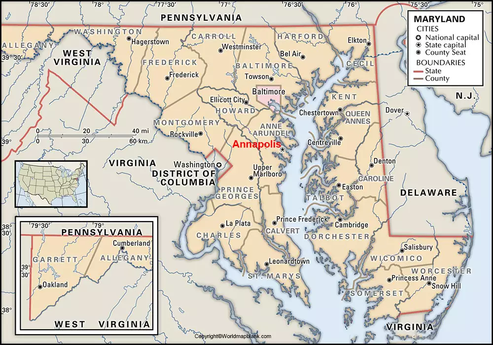
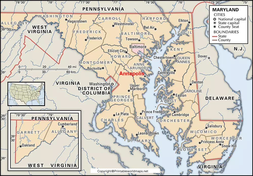
Labeled Map of Maryland provides the user all the details of this important US state. When the user clicks on the map, it will enlarge showing the location of Maryland. Out of one of the fifty US states, Maryland is situated in the middle region of the Atlantic and towards the northeast.
- World map with continents
- Physical world map
- Political world map
- Labeled map of Asia
- Labeled map of Africa
- Labeled map of Europe
- Labeled map of South America
- World time zone map
- Labeled map of World
- Blank map of world
- Labeled map of North America
- Blank map of Asia
- World map with oceans
- World map poster
The state has well-defined boundaries in the northern direction through the Mason-Dixon line, which borders with Pennsylvania. Most of its border is created by the Potomac River with Virginia and West Virginia. In the east, Maryland has border with Delaware and Atlantic Ocean on the Delmarva peninsula.
Contents
Labeled Map of Maryland
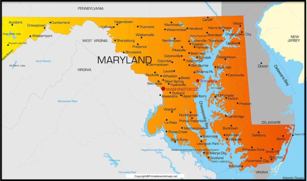
However, in the west, a good portion of Maryland is surrounded by Washington D.C. The land area occupied is 32,131 square kilometer or 12,406 square miles. Maryland is ranked as the forty-second state. There are 281 islands which include river islands and islands in the Chesapeake and other bays. The names of the major rivers that flow in this state include the Patapsco, the Patuxent, the Susquehanna, and the Potomac River. All these rivers empty into the Chesapeake Bay. The estimated population of Maryland is about six million people. The religion followed in the state is Roman Catholics. Other religions include Protestants, Baptists and Methodists.
Labeled Map of Maryland with States
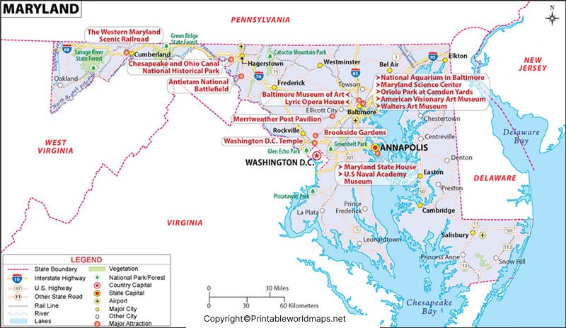
As a part of the labeled map of Maryland with states, there are twenty-four counties, and county-equivalents found in the state of Maryland. The city of Baltimore is recognized as equivalent to a county, and a county-equivalent even though it is an independent city. Maryland’s counties are governed through boards of county commissioners. Some of the names of these counties, include Worcester, Washington, Somerset, St. Mary’s, Queen Anne’s, Kent, Garret, Charles, Carroll, Caroline, Calvert, and Allegany.
Labeled Map of Maryland with Cities
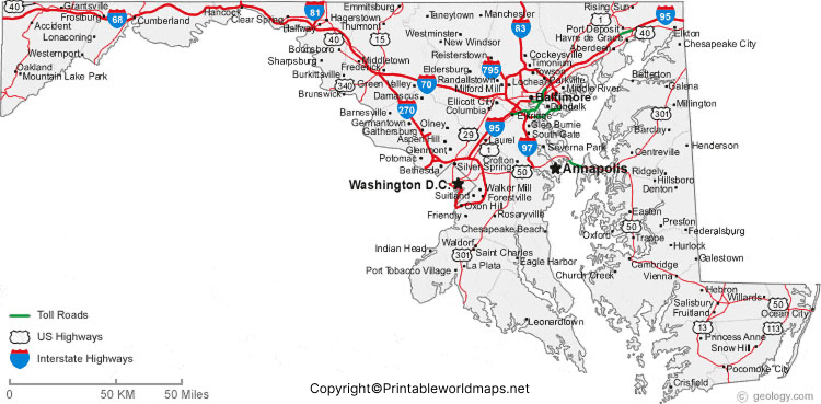
The labeled map of Maryland with cities shows the location of all the cities and towns in the state. The largest city is known as Baltimore that has a population of 602,000 inhabitants. Other cities are Bowie with a population of 58,700, Rockville with a population of 68,200, Gaithersburg with a population of 63,800. Frederick, being the second largest city, has a population of 72,100.
Labeled Maryland Map with Capital
According to labeled Maryland with capital, Annapolis is the capital city of Maryland. It is situated on the western coast of Chesapeake Bay. Anne Arundel County forms the seat of this city, which is located about forty-eight kilometers or thirty-miles south of Baltimore, and thirty-two miles or fifty kilometers east of Washington D.C. Annapolis is considered as one of the small US state capitals that has a population of approximately 38,000 inhabitants.
The city is the home for St. John’s College, which is the Naval Academy in the US, the Yacht Club and the US Sailboat Show. For a large number of sailing vessels and pleasure boats, this town has a home port. Other attractions of this Annapolis city, include Chesapeake Bay Bridge, Maryland State House, Annapolis Maritime Museum, and the U.S. Naval Academy Museum.

