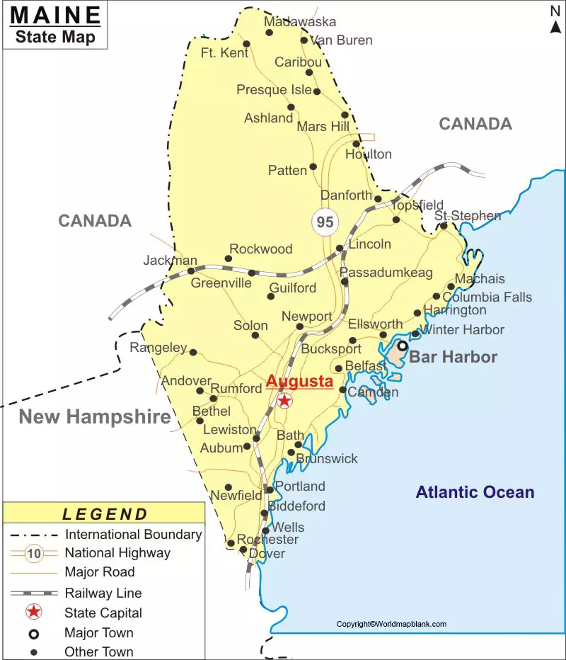
According to the Labeled Map of Maine, Maine is recognized as an important US state, situated in the northeastern part of the US. This state is known for its rocky coastline based on the nature of the area and maritime history. The state has borders with Canada. Out of the six New England states, Maine is considered the northernmost state.
- World map with continents
- Physical world map
- Political world map
- Labeled map of Asia
- Labeled map of Africa
- Labeled map of Europe
- Labeled map of South America
- World time zone map
- Labeled map of World
- Blank map of world
- Labeled map of North America
- Blank map of Asia
- World map with oceans
- World map poster
Contents
Labeled Map of Maine

The borders of Maine, include the Canadian provinces of Québec towards the northwest, and New Brunswick in the north and northeast. It has borders with the Atlantic Ocean known as, the Gulf of Maine, in the southeast. Maine has borders with the US state of New Hampshire, in the southwest. The nickname of this state is, “The Pine Tree State.” Maine state is also promoted as “Vacationland, ” by the destination-marketing organization, in the US.
The land area is 91,646 square kilometers or 35,385 square miles. The population of Maine is about 1.34 million people. The major rivers that flow in the state, include St. John River, St. Croix River, Saco River, Piscataquis River, Penobscot River, Mattawamkeag River, Kennebec River, Aroostook River, Androscoggin River, and the Allagash River. The major religion is Roman Catholic, followed by large groups of Baptists and other Protestant groups.
Labeled Map of Maine with State

There are sixteen counties in Maine according to the labeled map of Maine with states. Some of the names of these counties, include Penobscot County, Piscataquis County, Somerset County, Franklin County, Oxford County, and Cumberland County, York County, Kennebec County, and Sagadahoc County.
Labeled Map of Maine with Cities

As a part of the labeled map of Maine with cities, the largest cities in the state of Maine with more than 20,000 population, include Biddeford, Sanford, Auburn, South Portland, Bangor, Lewiston, and Portland.
Labeled Maine Map with Capital
As a part of labeled Maine with capital, the most populous city of Maine is Portland, but Augusta is recognized as the capital city of Maine. According to a satellite view of the map of Augusta city, it is the seat of Kennebec County, in the state of Maine. In the US, it is also known as, “The Pine Tree State.” In the New England Region and on the river Kennebec, this city is located. The capital city of Augusta has a population of approximately 18,600 inhabitants, based on census data of 2018.

The city has five public schools, one private school, and a college. The city has an established University known as the University of Maine. It has two public libraries as well. The State Capitol Building, known as, the Maine State House, is used for convening the bicameral Maine Legislature, every year. The capital city is known for its economic mainstays due to established light industries. It manufactures steel, food products, and other computer peripherals. The city has the Maine State Museum that consists of exhibits related to the state’s history and natural environment. Augusta is considered one of the state’s leading vacation centers.


