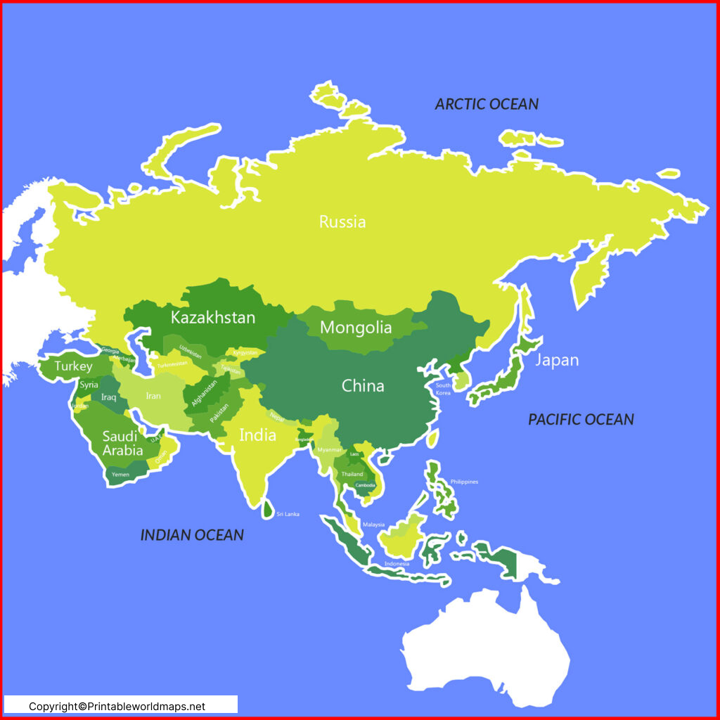
The Labeled Map of Asia shows the labeling of the Asian continent along with the boundaries. Here, the user may find that labeling may be of different types. The task of labeling can be left to the user as to what kind of labeling, he or she wants. Accordingly, based on the uses, preferences, and choices, the user can start the labeling task of the map of Asia.
- Labeled Map of Asia
- Labeled Map of Europe
- Labeled Map of South America
- Labeled Map of North America
- Australia Labeled Map
- World Map With Continents
- Physical World Map
- Political World Map
- World Map with Oceans
- World Map Poster
- World Time Zone Map
- Labeled Map of World
- Blank Map of the World
Contents
Labeled Map of Asia
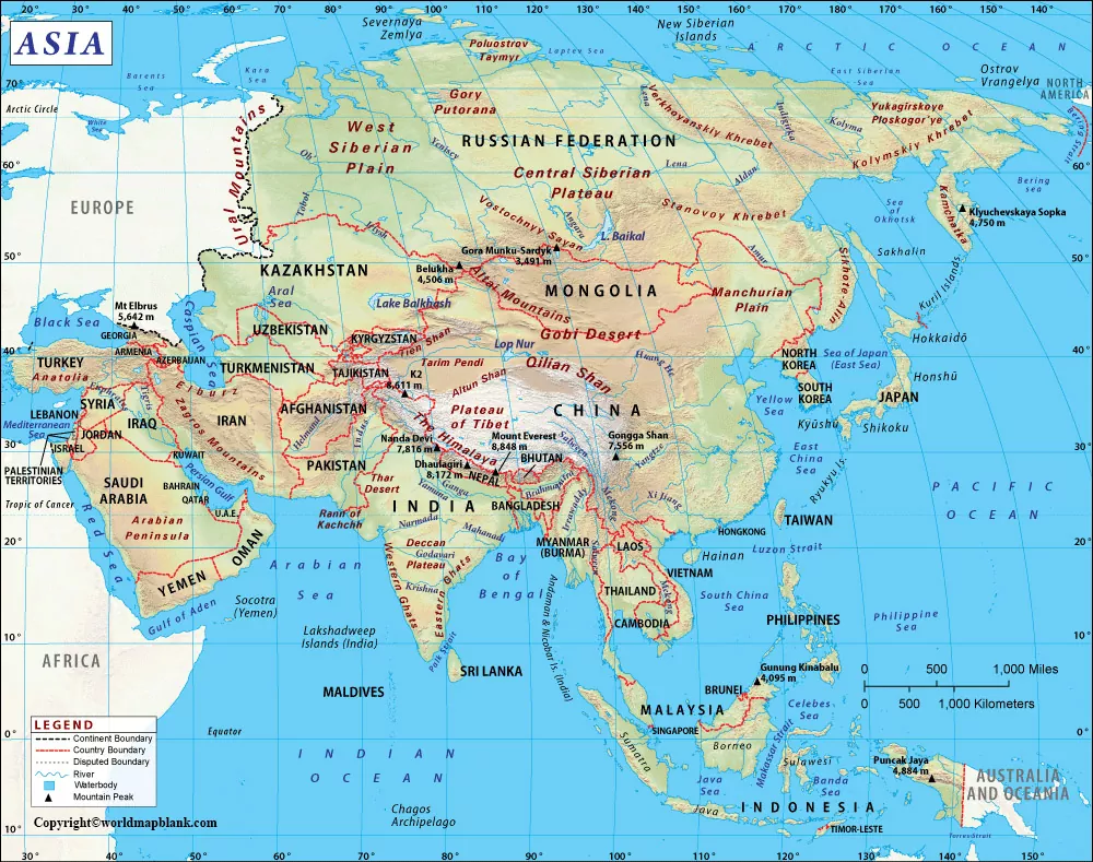
Such maps, when labeled, will allow the user to get information that is needed about a particular type of detail. If the user wants to know about the rivers of the continent, he or she can use the labeling of the river. Further, it can be seen that the labeled map of Asia has been broadly divided into six geographical regions, such as West Asia, South Asia, Southeast Asia, East Asia, Central Asia, and North Asia.
Labeled Asia Map with Countries
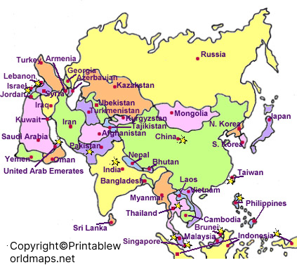
Labeled Asia with Countries comprises forty-eight countries, out of which two continents, like Russia and Turkey are also situated in Europe. In the entire region of North Asia, Russia is recognized as a gigantic country. However, the Soviet Union consists of numerous countries in the West as well as Central Asia, but separated during its division. The South Asian Region, in the labeled map of Asia, reveals the Indian subcontinent. The countries in West Asia can be labeled as Yemen, the United Arab Emirates, Turkey, Syria, Saudi Arabia, Qatar, Oman, Lebanon, Kuwait, Jordan, Israel, Iraq, Iran, Bahrain and Afghanistan.

The countries in Central Asia can be labeled as Kazakhstan, Kyrgyzstan, Tajikistan, Turkmenistan, and Uzbekistan. The labeled countries in East Asia, include Taiwan, Macau, Hongkong, Mongolia, South Korea, North Korea, Japan, and China. The labeled countries in South Asia, include Sri Lanka, Pakistan, Nepal, Maldives, India, Bhutan, and Bangladesh.

The countries which can be labeled in the region of Southeast Asia, include Vietnam, East Timor or Timor-Leste, Thailand, Singapore, the Philippines, Myanmar or Burma, Malaysia, Laos, Cambodia, Indonesia, and Brunei.
Labeled Map of Asia with Capitals
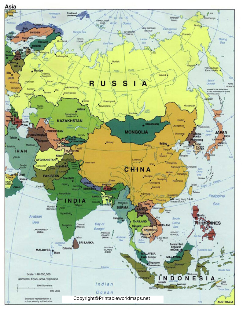
The labeled Asia map with major capitals includes Beijing in China, New Delhi in India, Bangkok in Thailand, Tokyo in Japan, Seoul in South Korea, Jakarta in Indonesia, Riyadh in Saudi Arabia, Kuala Lumpur in Malaysia, Ankara in Turkey, Doha in Qatar, Abu Dhabi in UAE and Jerusalem in Israel.

Asia Map with Cities Labeled
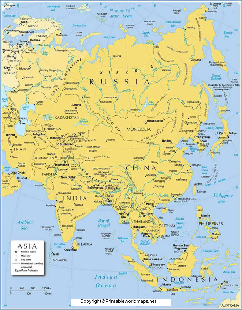
If the user is planning to get details of Asia map with cities labeled, he or she should opt for an Asia map that include information and details about the cities of the continent. It is easy to access a labeled Asia map with cities from the web, which can be downloaded and printed. This map can be used to obtain the details of each city of the Asian continent.
All these types of Asia map with cities labeled are found useful for working on surveys and other associated issues. The user can derive the best and minute details about a specific area as these maps are most widely used across the globe.


