
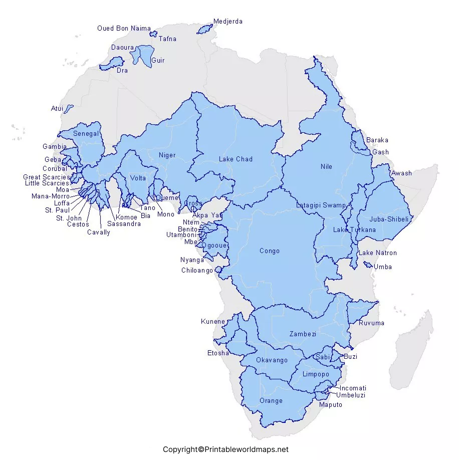

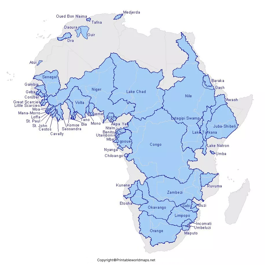
Explore our Africa Rivers Map to study the major rivers, drainage basins, and physical geography of Africa. Download a free printable Africa Rivers Map PDF with labeled rivers for students, teachers, travelers, and geography enthusiasts. Whether you’re preparing for school exams or learning about Africa’s landscapes, this map provides an easy way to identify the continent’s most important river systems.
Africa Rivers Map
Africa is the second-largest continent on Earth by both land area and population. It covers approximately 30.37 million square kilometers (11.7 million square miles), representing about 20% of Earth’s total land area. The continent is home to 54 internationally recognized countries and features diverse landscapes, including deserts, rainforests, mountains, lakes, and some of the world’s longest rivers.
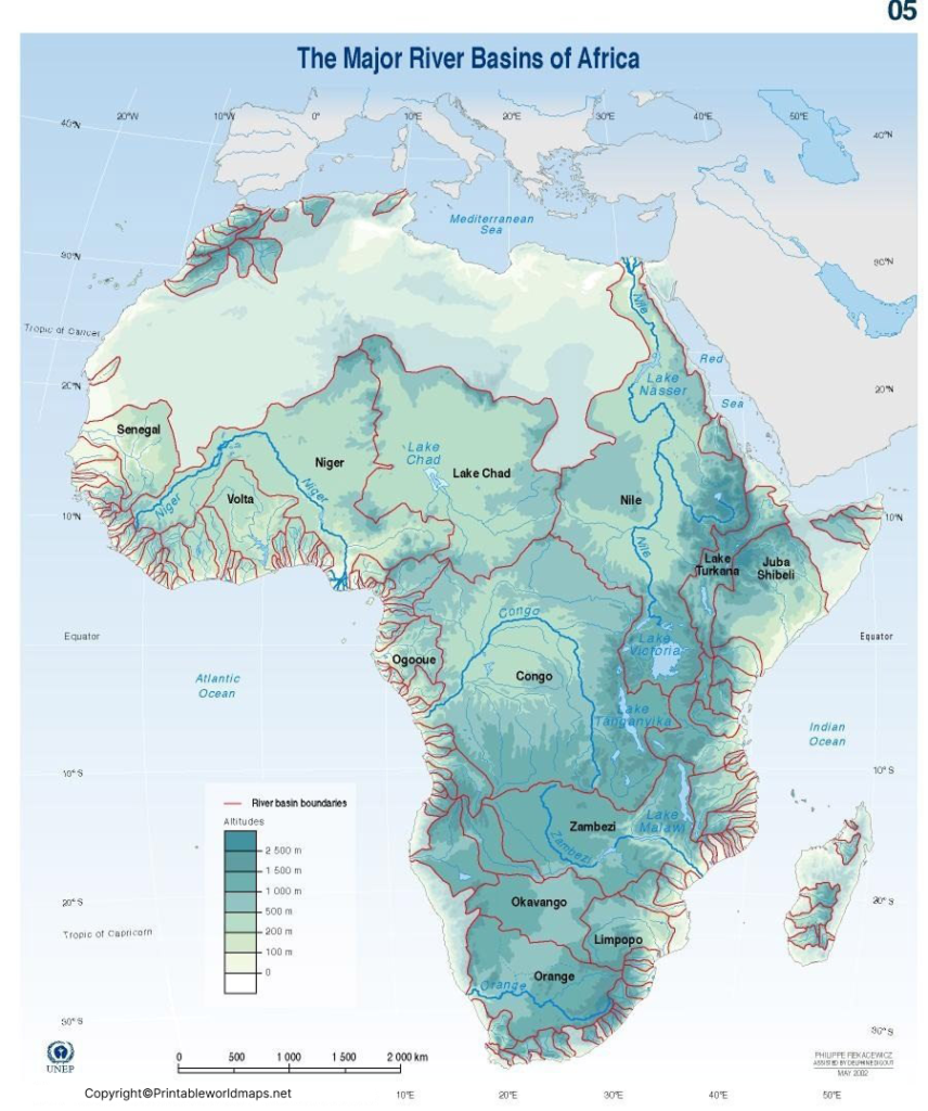
Africa contains several of the world’s most significant river systems, including:
- Nile River – Approximately 6,650 km (4,132 miles), widely recognized as the world’s longest river.
- Congo River – Africa’s deepest river, reaching depths of over 220 meters (720 feet) and the second-largest river globally by discharge.
- Niger River – Around 4,180 km (2,600 miles), flowing through West Africa.
- Zambezi River – Approximately 2,574 km (1,599 miles), famous for Victoria Falls.
- Orange River – South Africa’s longest river.
- Volta River – One of West Africa’s most important river systems.
These rivers provide freshwater, transportation, irrigation, hydroelectric power, biodiversity, and livelihoods for millions of people across Africa.
Map of Africa Rivers
An Africa Rivers Map is a specialized physical map that highlights the continent’s major rivers, tributaries, drainage basins, lakes, and surrounding geographical features. Unlike political maps, river maps focus on natural landscapes and water systems.
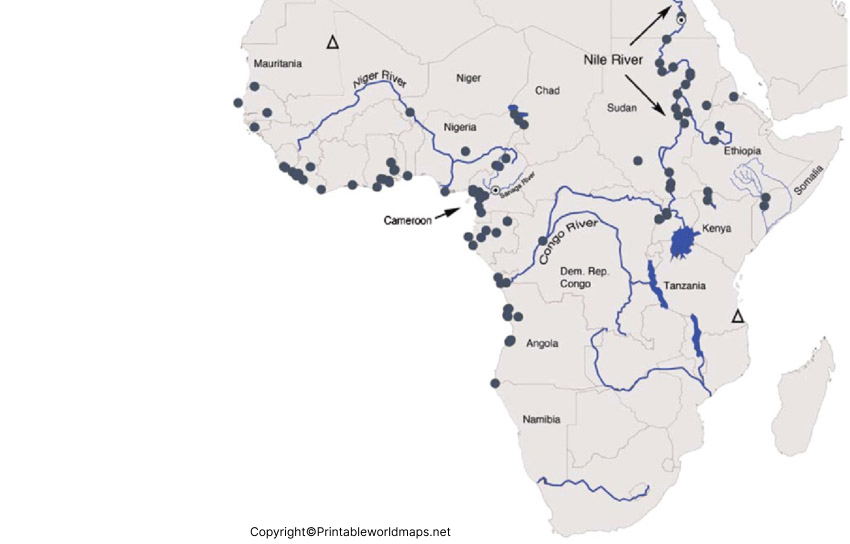
This map helps users:
- Locate Africa’s major rivers.
- Understand river flow directions.
- Identify river origins and mouths.
- Study drainage basins.
- Learn the relationship between rivers, mountains, lakes, and deserts.
- Prepare for geography examinations and competitive exams.
Students, teachers, researchers, and travelers frequently use an Africa Rivers Map for educational and reference purposes.
Map of Africa Rivers Labeled
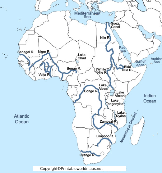
A Labeled Africa Rivers Map clearly identifies the names of the continent’s major rivers and important water bodies.
Major rivers shown include:
- Nile River
- Congo River
- Niger River
- Zambezi River
- Orange River
- Limpopo River
- Senegal River
- Volta River
- Benue River
- Ubangi River
- Blue Nile
- White Nile
A labeled map makes it easier to memorize river names and understand their geographical locations.
Printable Africa Rivers Map
Our Printable Africa Rivers Map is available in high-quality PDF format and is suitable for classrooms, homeschooling, assignments, presentations, and personal learning.
You can:
- Download instantly.
- Print in A4 or Letter size.
- Use for classroom activities.
- Practice map labeling.
- Prepare for competitive exams.
- Study offline anytime.
The printable map is available in multiple formats, including PDF, making it convenient for both digital and printed use.
Major Rivers of Africa
| River | Approximate Length | Countries |
|---|---|---|
| Nile | 6,650 km | Uganda, South Sudan, Sudan, Egypt, Ethiopia (tributary) |
| Congo | 4,700 km | DR Congo, Republic of the Congo |
| Niger | 4,180 km | Guinea, Mali, Niger, Nigeria |
| Zambezi | 2,574 km | Zambia, Angola, Namibia, Botswana, Zimbabwe, Mozambique |
| Orange | 2,432 km | Lesotho, South Africa, Namibia |
| Limpopo | 1,750 km | South Africa, Botswana, Zimbabwe, Mozambique |
Interesting Facts About Africa’s Rivers
- The Nile River is widely recognized as the world’s longest river.
- The Congo River is the deepest river in the world.
- Victoria Falls, one of the world’s largest waterfalls, is located on the Zambezi River.
- Lake Victoria is Africa’s largest lake by surface area and is one of the primary sources of the Nile River.
- The Congo Basin contains the world’s second-largest tropical rainforest after the Amazon.
- African rivers support agriculture, fisheries, transportation, hydroelectricity, and wildlife across the continent.
Why Use Our Africa Rivers Map?
- High-resolution printable PDF
- Clearly labeled rivers
- Suitable for students and teachers
- Ideal for geography projects
- Easy-to-read layout
- Free to download and print
- Helpful for UPSC, SSC, school, and university geography studies
Frequently Asked Questions
What is the longest river in Africa?
The Nile River, approximately 6,650 km long, is the longest river in Africa.
Which is the deepest river in Africa?
The Congo River is Africa’s deepest river and the deepest river in the world.
Can I download the Africa Rivers Map for free?
Yes. You can download the printable Africa Rivers Map PDF free for educational and personal use.
Who can use this map?
Students, teachers, researchers, travelers, homeschooling families, and anyone interested in African geography.
More Free Maps for Download
Here are some useful links to other printable world maps, continent maps and country maps for download as PDF files.
World Maps
- World Map for Kids
- Labeled World Map
- Time Zone World Map
- Printable World Map Poster
- World Map with Continents
- Physical World Map
- Political World Map
Continent Maps
- Africa Map with Countries
- Labeled Map of South America
- Blank Map of Asia
- Labeled Map of Europe
- Physical Map of Australia
- Blank Map of South America
- Blank Map of Europe
Country Maps
References
- Encyclopaedia Britannica – Africa Geography
https://www.britannica.com/place/Africa - National Geographic – Africa Resource Library
https://education.nationalgeographic.org/resource/africa/ - United Nations Environment Programme (UNEP) – Africa
https://www.unep.org/regions/africa - NASA Earth Observatory
https://earthobservatory.nasa.gov/
