

Looking for a Printable Africa Political Map that clearly shows all 55 internationally recognized countries, national boundaries, and major regions? This page provides a free, high-quality Map of Africa Political available in PDF, PNG, and printable formats for students, teachers, researchers, travelers, and geography enthusiasts.
Whether you’re studying African geography, preparing classroom materials, planning educational activities, or simply exploring the world’s second-largest continent, this political map offers an accurate and easy-to-read reference.
Our maps are designed using updated international boundary information and are suitable for educational and informational purposes.
Africa Political Map
A Printable Africa Political Map displays the political boundaries of every country across the African continent. Unlike physical maps that highlight mountains, rivers, and deserts, political maps focus on national borders, capital cities, neighboring countries, and administrative divisions.
Africa is the second-largest continent in the world, covering approximately 30.37 million square kilometers (11.7 million square miles), which represents about 20% of Earth’s total land area. It is also the second-most populous continent, with a population exceeding 1.5 billion people living in 55 internationally recognized sovereign countries.
The continent stretches from the Mediterranean Sea in the north to the Cape of Good Hope in the south and is bordered by:
- Atlantic Ocean (West)
- Indian Ocean (East)
- Mediterranean Sea (North)
- Red Sea (Northeast)
Africa is traditionally divided into five geographical regions:
- North Africa
- West Africa
- East Africa
- Central Africa
- Southern Africa
These regions help organize political, economic, and cultural studies across the continent.
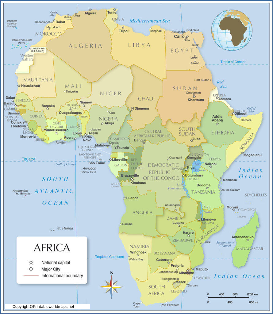
Map of Africa Political
A Map of Africa Political is an essential educational resource that illustrates how Africa is divided into independent nations and territories.
The political map helps users:
- Identify all 55 African countries.
- Learn international borders.
- Locate capital cities.
- Understand neighboring nations.
- Study regional organizations and geography.
- Improve map-reading skills.
Political maps are commonly used in:
- Schools and universities
- Competitive exam preparation
- Geography projects
- Travel planning
- Government and research institutions
- Educational presentations
Because international boundaries may occasionally change due to administrative updates or international agreements, using an updated political map is always recommended.

Printable Africa Political Map
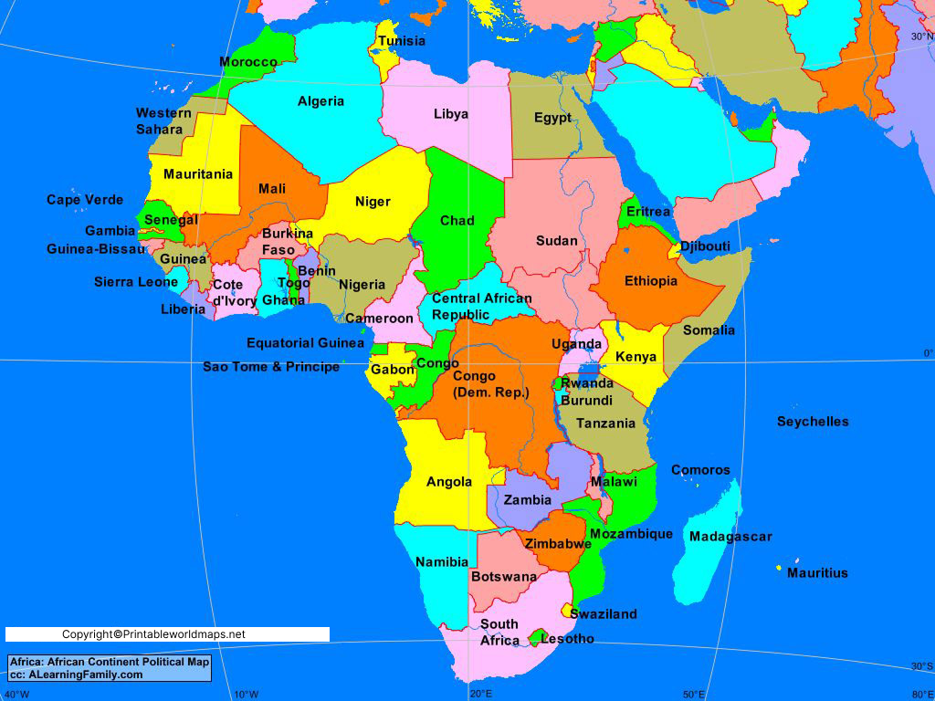
Our Printable Africa Political Map is available in high-resolution formats, making it ideal for both digital viewing and printing.
You can use this map for:
- Classroom teaching
- Geography assignments
- Wall posters
- Home schooling
- Educational presentations
- Quiz competitions
- Research projects
The printable version maintains excellent clarity even when printed on A4, Letter, or larger paper sizes.
Available formats include:
Transparent PNG (where available)
Printable PDF
PNG Image
High-Resolution JPG
Map of Africa Political Labeled
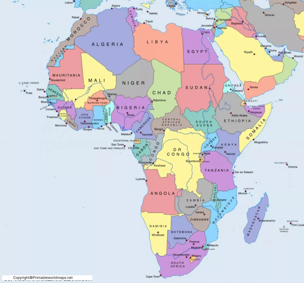
A Map of Africa Political Labeled includes the names of all African countries along with clearly marked international borders.
Depending on the version, the labeled political map may also include:
- Country names
- National capitals
- Major cities
- International boundaries
- Coastlines
- Islands
- Regional divisions
This version is especially useful for students preparing for geography examinations and anyone learning the political geography of Africa.
Countries Included on the Africa Political Map
The political map includes all 55 internationally recognized African sovereign states, including:
- Algeria
- Angola
- Benin
- Botswana
- Burkina Faso
- Burundi
- Cabo Verde
- Cameroon
- Central African Republic
- Chad
- Comoros
- Democratic Republic of the Congo
- Republic of the Congo
- Côte d’Ivoire
- Djibouti
- Egypt
- Equatorial Guinea
- Eritrea
- Eswatini
- Ethiopia
- Gabon
- Gambia
- Ghana
- Guinea
- Guinea-Bissau
- Kenya
- Lesotho
- Liberia
- Libya
- Madagascar
- Malawi
- Mali
- Mauritania
- Mauritius
- Morocco
- Mozambique
- Namibia
- Niger
- Nigeria
- Rwanda
- São Tomé and Príncipe
- Senegal
- Seychelles
- Sierra Leone
- Somalia
- South Africa
- South Sudan
- Sudan
- Tanzania
- Togo
- Tunisia
- Uganda
- Zambia
- Zimbabwe
Interesting Facts About Africa
- Africa has 55 internationally recognized sovereign countries.
- It covers approximately 30.37 million km².
- More than 1.5 billion people live in Africa.
- Nigeria is Africa’s most populous country.
- Algeria is the largest country by land area.
- Africa contains the Sahara Desert, the world’s largest hot desert.
- The Nile River, commonly regarded as one of the world’s longest rivers, flows through northeastern Africa.
- The continent is home to thousands of languages and rich cultural diversity.
- Africa contains eight internationally recognized major geographic regions under various classification systems, although five broad regions are most commonly used for educational purposes.
Why Use a Political Map of Africa?
A political map helps users:
- Learn country boundaries accurately.
- Identify neighboring countries.
- Understand regional geography.
- Improve classroom learning.
- Prepare for UPSC, SSC, PSC, and other competitive exams.
- Support travel and educational planning.
Frequently Asked Questions (FAQs)
What is a Printable Africa Political Map?
A Printable Africa Political Map is a map showing the political boundaries, countries, and often capital cities of Africa that can be downloaded and printed for educational or personal use.
How many countries are shown on the Africa Political Map?
Most updated political maps display 55 internationally recognized African sovereign states.
What is the difference between a political map and a physical map?
A political map focuses on country borders, capitals, and administrative divisions, while a physical map shows natural features such as mountains, rivers, lakes, and deserts.
Can I download the Africa Political Map for free?
Yes. The printable maps on this page are available for free educational and personal use.
Which file formats are available?
Most maps are available in PDF, PNG, JPG, and printable formats.
References
- United Nations Member States – https://www.un.org/en/about-us/member-states
- African Union – https://au.int/
- Encyclopaedia Britannica – https://www.britannica.com/place/Africa
More Free Maps for Download
Here are some useful links to other printable world maps, continent maps and country maps for download as PDF files.
World Maps
- World Map for Kids
- Labeled World Map
- Time Zone World Map
- Printable World Map Poster
- World Map with Continents
- Physical World Map
- Political World Map
Continent Maps
- Africa Map with Countries
- Labeled Map of South America
- Blank Map of Asia
- Labeled Map of Europe
- Physical Map of Australia
- Blank Map of South America
- Blank Map of Europe
