

The Europe Rivers Map is one of the most useful educational resources for understanding the physical geography of Europe. It displays the major rivers flowing across the continent, making it easier for students, teachers, travelers, and geography enthusiasts to learn about Europe’s important waterways. Our printable Europe Rivers Map is available in high-quality PDF format and can be downloaded for free for classroom learning, school assignments, competitive exams, and personal reference.
Europe is the second-smallest continent in the world by land area but has one of the world’s most developed transportation and river systems. Its rivers have shaped civilizations, supported agriculture, powered industries, and connected countries for centuries.
Europe Rivers Map
The Europe Rivers Map highlights all the significant rivers flowing across Europe, including their origins, directions, tributaries, and the seas into which they drain.
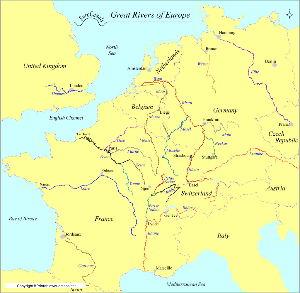
Major rivers shown on the map include:
- Volga River – The longest river in Europe, flowing entirely through Russia.
- Danube River – Europe’s second-longest river, passing through 10 countries, more than any other river in the world.
- Rhine River – A major commercial waterway flowing through Switzerland, Germany, France, and the Netherlands.
- Elbe River – Originates in the Czech Republic and flows into the North Sea.
- Loire River – The longest river in France.
- Seine River – Flows through Paris before reaching the English Channel.
- Po River – Italy’s longest river.
- Dnieper River – One of Eastern Europe’s most important rivers.
- Tagus River – The longest river on the Iberian Peninsula.
- Thames River – Famous river flowing through London.
This printable map clearly marks river routes, surrounding countries, and nearby mountain ranges for better geographical understanding.
Map of Europe Rivers
A Map of Europe Rivers provides a visual representation of Europe’s complete river network. It helps learners understand how rivers originate from mountain ranges such as the Alps, Carpathians, and Scandinavian Mountains before flowing into seas like:
Caspian Sea
Atlantic Ocean
Arctic Ocean
Mediterranean Sea
Baltic Sea
Black Sea
North Sea
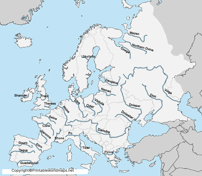
Many of these rivers serve as important transportation routes, hydroelectric power sources, irrigation systems, and freshwater supplies.
Students preparing for geography examinations frequently use the Europe Rivers Map to identify river locations and understand drainage patterns.
Printable Europe Rivers Map
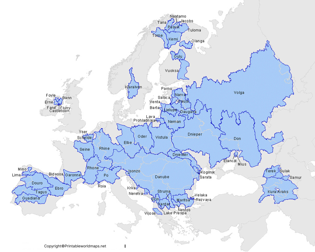
Our Printable Europe Rivers Map is specially designed for educational purposes. It can be printed on standard A4 or A3 paper without losing quality.
Features
- High-resolution printable PDF
- Clearly labeled rivers
- Country boundaries included
- Suitable for classrooms
- Perfect for school projects
- Easy-to-read design
- Free download
- Mobile-friendly version available
Teachers often use these printable maps during geography lessons, while students use them for map practice and exam preparation.
Map of Europe Rivers Labeled
All our templates are available both in the physical printable format and also in digital format as well. You can get the required format of the template as per your requirements.
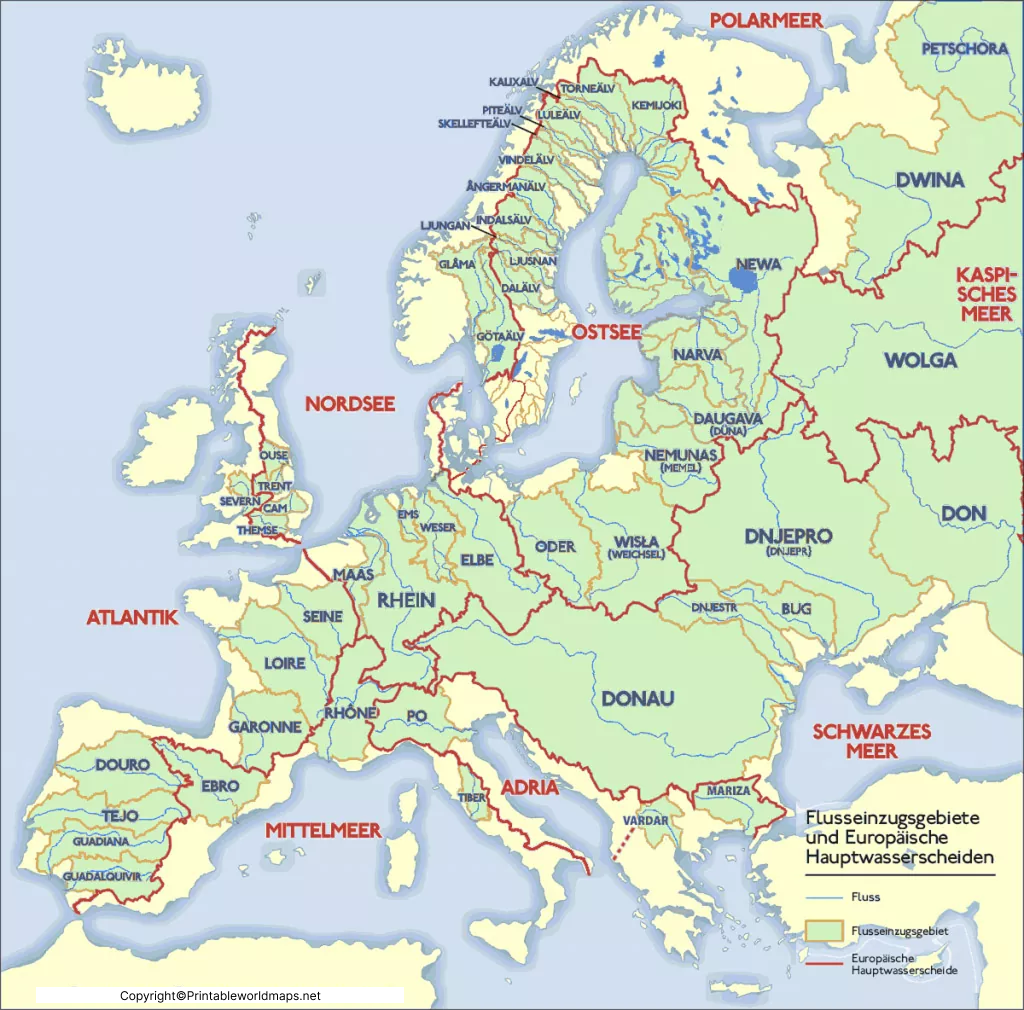
The Europe Rivers Map Labeled version includes the names of all major rivers, making it easier to identify important waterways without referring to textbooks.
Some of the prominently labeled rivers include:
- Volga
- Danube
- Rhine
- Elbe
- Loire
- Seine
- Po
- Dnieper
- Oder
- Vistula
- Tagus
- Thames
- Ebro
- Don
- Ural River
The labeled version is especially useful for beginners, school students, teachers, and competitive exam aspirants.
Major Rivers of Europe
| River | Approximate Length | Countries |
|---|---|---|
| Volga | 3,530 km | Russia |
| Danube | 2,850 km | Germany, Austria, Slovakia, Hungary, Croatia, Serbia, Romania, Bulgaria, Moldova, Ukraine |
| Rhine | 1,230 km | Switzerland, Liechtenstein, Austria, Germany, France, Netherlands |
| Elbe | 1,094 km | Czech Republic, Germany |
| Loire | 1,012 km | France |
| Dnieper | 2,201 km | Russia, Belarus, Ukraine |
| Po | 652 km | Italy |
| Thames | 346 km | United Kingdom |
Interesting Facts About Europe’s Rivers
- The Volga River is the longest river in Europe, stretching approximately 3,530 km.
- The Danube River flows through 10 countries, the highest number for any river in the world.
- The Rhine River is one of Europe’s busiest commercial waterways.
- The Loire River is known as the longest river in France.
- The Seine River flows through the heart of Paris and is famous for its historic bridges.
- The Thames River has played a major role in London’s development for over 2,000 years.
- Europe has thousands of rivers that drain into six major seas and the Atlantic Ocean.
Why Use Our Europe Rivers Map?
Our printable Europe Rivers Map is ideal for:
- Geography students
- School teachers
- College projects
- UPSC & competitive exam preparation
- Homeschool learning
- Travel planning
- Physical geography study
- Classroom presentations
Every map is designed for accuracy, easy readability, and educational value.
Frequently Asked Questions (FAQs)
What is the longest river in Europe?
The Volga River is the longest river in Europe, measuring approximately 3,530 km.
Which river flows through the most European countries?
The Danube River flows through 10 European countries, making it the most international river in Europe.
Can I download the Europe Rivers Map for free?
Yes. You can download the Europe Rivers Map in high-quality printable PDF format free for educational and personal use.
Is the Europe Rivers Map suitable for students?
Yes. The map is designed specifically for students, teachers, researchers, and competitive exam aspirants.
What rivers are included in the Europe Rivers Map?
The map includes the Volga, Danube, Rhine, Elbe, Loire, Seine, Po, Thames, Dnieper, Tagus, Vistula, Oder, Don, Ural, Ebro, and many other major European rivers.
Additional Free Printable Maps to Download
We provide many more printable maps of the world, continents and countries for free download. Below you will find a short link list to other interesting maps in PDF format. But of course you can also use our search feature at the top of this page.
World Maps
Continent Maps
- Blank Map of South America
- Blank Map of Asia
- Labeled Map of Europe
- Labeled Map of Asia
- Printable Blank Map of Europe
