
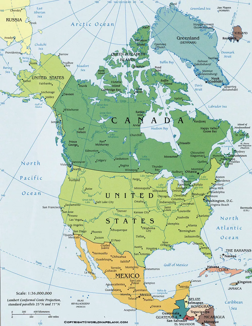
Our readers can here check out the North America Political Map boundaries to use it in their learning. We are further providing the printable template of the North American political map that users can use as a full-fledged map.
North America Political Map
The North America Political Map shows the political boundaries, countries, major territories, and geographic divisions of North America. It is useful for students, teachers, researchers, travelers, and anyone studying the political geography of the continent.
North America is located primarily in the Northern and Western Hemispheres. It is bordered by the Arctic Ocean to the north, the Atlantic Ocean to the east, the Pacific Ocean to the west, and the Caribbean Sea to the south.
A political map focuses on human-made boundaries and administrative divisions, rather than physical features such as mountains, rivers, and elevation.
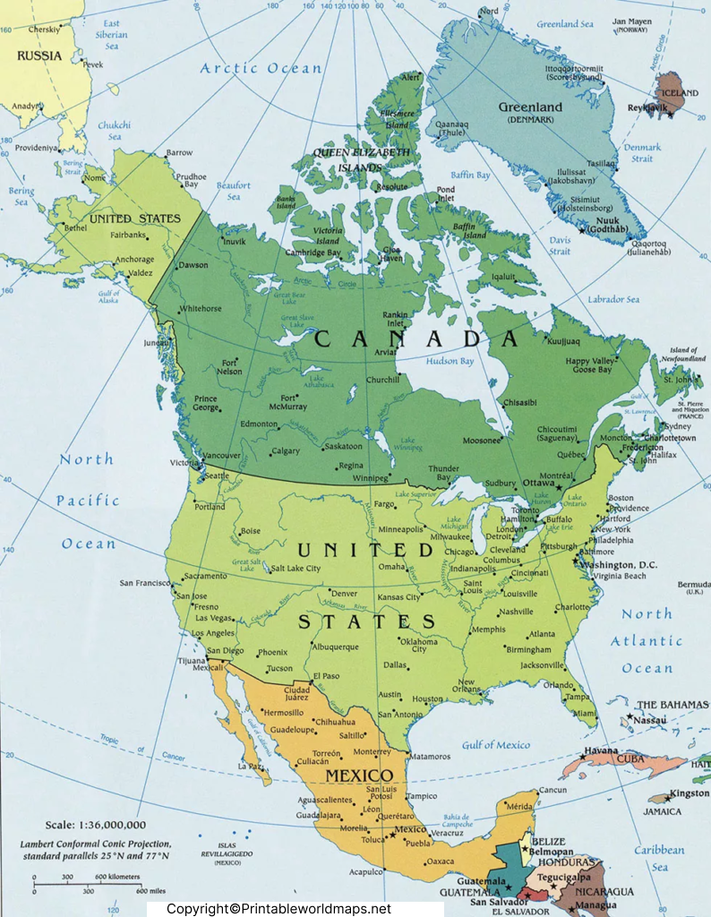
North America Political Map: What It Shows
A political map of North America can help users identify:
- International country boundaries
- Countries and their relative locations
- Capital cities where labeled
- Major islands and territories
- Political and administrative divisions
- Geographic relationships between neighboring countries
The map can be particularly useful for classroom activities, geography assignments, presentations, quizzes, and general reference.
Map of North America Political
The Map of North America Political provides a visual representation of political geography across the continent. North America includes countries such as Canada, the United States, Mexico, Guatemala, Belize, Honduras, El Salvador, Nicaragua, Costa Rica, and Panama, along with the countries of the Caribbean region.
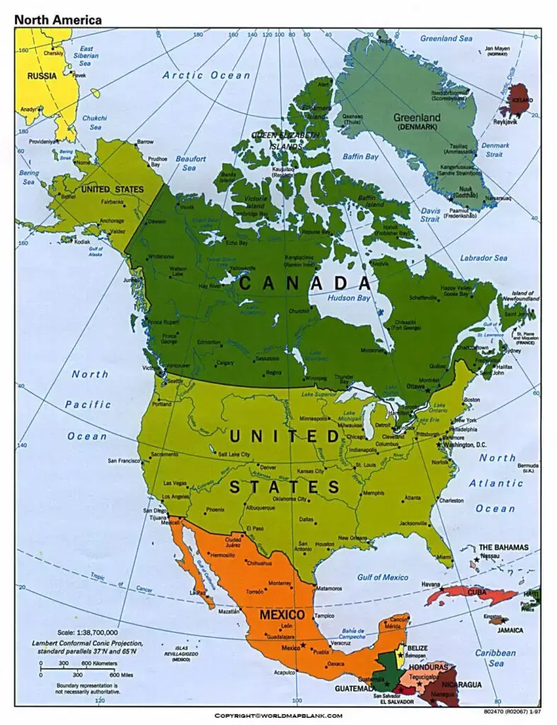
Political maps are different from physical maps because their primary purpose is to show political boundaries and administrative information. This makes them useful when studying countries, borders, capitals, and regional geography.
Countries Shown on a North America Political Map
Depending on the map’s coverage and labeling, a North America political map may include mainland countries and Caribbean nations. Commonly represented countries include:
- Canada
- United States
- Mexico
- Guatemala
- Belize
- Honduras
- El Salvador
- Nicaragua
- Costa Rica
- Panama
- Cuba
- Jamaica
- Haiti
- Dominican Republic
- The Bahamas
Some maps also show additional Caribbean island countries and territories.
Printable North America Political Map
The Printable North America Political Map is useful for students, educators, homeschool activities, geography practice, and classroom reference.
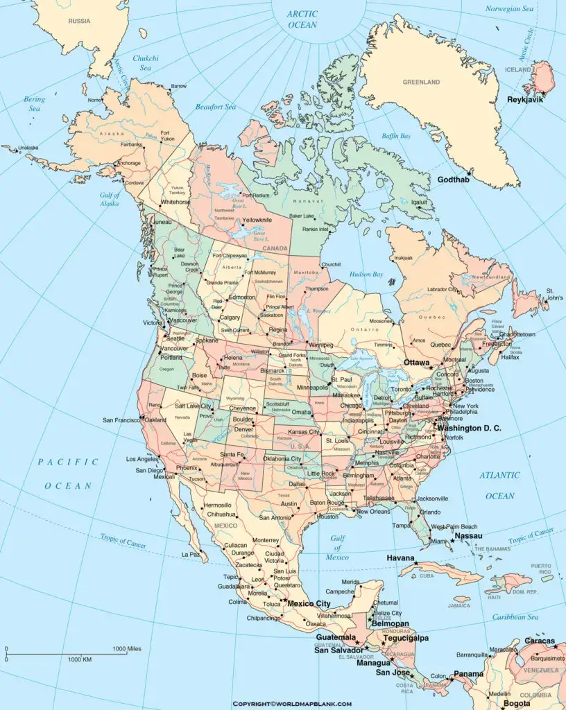
A printable version can be downloaded and printed for offline study. Depending on the source file, users can choose between an image format and PDF format.
How to Use a Printable Political Map
A printable map can be used to:
- Locate countries and neighboring nations.
- Practice identifying political boundaries.
- Learn country locations for geography classes.
- Mark capitals and important locations.
- Create geography quizzes and worksheets.
- Use as a reference during lessons or presentations.
For best results when printing, check the PDF or image dimensions and select an appropriate paper size and print orientation.
Map of North America Political Labeled
The Map of North America Political Labeled provides additional geographic context by identifying locations directly on the map.
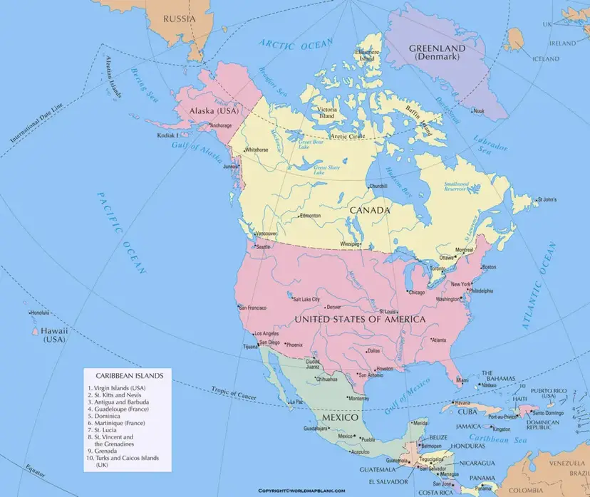
A labeled map can be especially helpful for beginners because names can be matched directly with their geographic positions.
North America Political Map and Geographic Boundaries
Political boundaries are created through historical agreements, treaties, administrative decisions, and changes in political organization. They do not necessarily follow physical geographic features.
For example, international borders can cross plains, mountains, rivers, and other physical landscapes. A political map therefore provides information that is different from a physical or relief map.
When studying a political map, it is important to remember that boundaries and administrative names can change over time. For current political information, users should verify details with authoritative government or international sources.
North America Map: Countries and Regions
North America is commonly discussed in several geographic regions, including:
Northern North America:
Canada and the United States form the principal countries of the northern part of the continent.
Central America:
The region connecting North America with South America includes Belize, Guatemala, Honduras, El Salvador, Nicaragua, Costa Rica, and Panama.
Caribbean:
The Caribbean region includes numerous island countries and territories located around the Caribbean Sea.
These regional groupings can vary depending on the geographic classification being used.
North America Political Map for Students
Students can use a North America Political Map to develop basic geographic knowledge and practice locating countries. Teachers can also use printable versions for classroom worksheets, labeling exercises, map quizzes, and geography projects.
A useful activity is to provide students with a blank map and ask them to identify countries, capitals, neighboring countries, and major bodies of water.
Frequently Asked Questions
What is a North America Political Map?
A North America Political Map shows political boundaries, countries, territories, and other administrative information within the North American region.
How is a political map different from a physical map?
A political map emphasizes countries, borders, capitals, and administrative divisions. A physical map focuses on natural features such as mountains, rivers, deserts, and elevation.
Which countries are in North America?
North America includes Canada, the United States, Mexico, the countries of Central America, and numerous Caribbean countries and territories, depending on the geographic classification used.
Can I print the North America Political Map?
Yes. The map resources provided on this page include printable image and PDF versions that can be used for educational and reference purposes.
What is the largest country in North America?
Canada is the largest country in North America by total area.
What oceans surround North America?
North America is bordered by the Arctic Ocean to the north, the Atlantic Ocean to the east, and the Pacific Ocean to the west. The Caribbean Sea lies to the south of the continent.
Why use a labeled North America political map?
A labeled map makes it easier to identify countries and their locations, making it useful for geography learning, teaching, and quick reference.
Can a political map change over time?
Yes. Political boundaries, country names, territories, and administrative divisions can change because of political agreements, legal changes, or other historical developments. Current information should therefore be checked against authoritative sources.
Reference Links
https://www.britannica.com/place/North-America
https://education.nationalgeographic.org/resource/north-america









