
Malta is an island country in the central Mediterranean Sea, located south of Sicily, Italy. The Labeled Map of Malta helps identify the country’s main islands, regions, capital, cities, and geographic location. Malta consists of the main island of Malta, the island of Gozo, and the smaller island of Comino, along with other uninhabited islets.
Malta is one of Europe’s smallest countries by area, but its location in the Mediterranean has given it considerable historical and cultural importance. This page provides labeled, regional, city, and capital maps of Malta that can be viewed online or downloaded as PDFs.
- World map with continents
- Physical world map
- Political world map
- Labeled map of Asia
- Labeled map of Africa
- Labeled map of Europe
- Labeled map of South America
- World time zone map
- Labeled map of World
- Blank map of world
- Labeled map of North America
- Blank map of Asia
- World map with oceans
- World map poster
Labeled Map of Malta
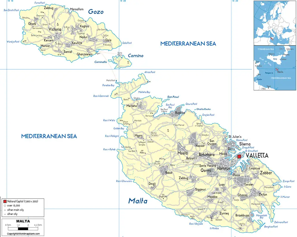
The Labeled Map of Malta shows the country’s geographic position and major islands. Malta lies in the Mediterranean Sea approximately 80 km south of Sicily, Italy, and about 284 km east of Tunisia.
Malta’s territory covers approximately 316 square kilometers. The country is made up primarily of Malta, Gozo, and Comino. Its compact size makes a labeled map useful for identifying settlements, islands, and important geographic features.
Malta has no permanent rivers or natural lakes of significant size. The country’s landscape is characterized by limestone terrain, coastal areas, low hills, and densely settled urban areas.
Labeled Map of Malta with Regions
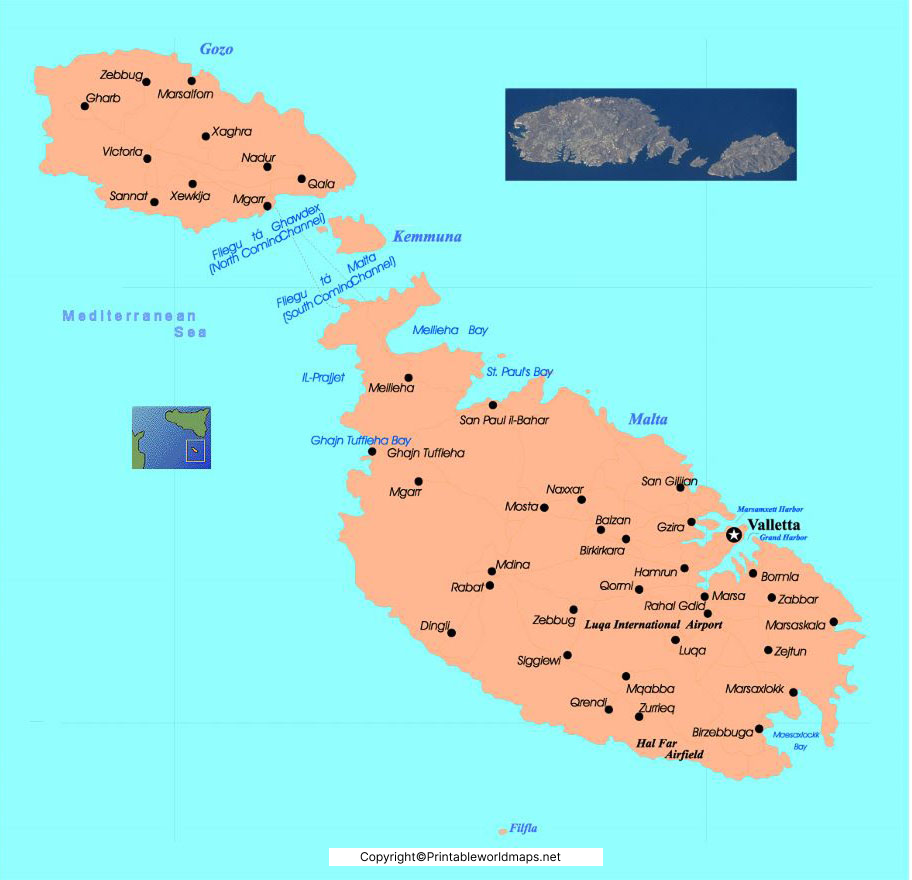
Malta is divided into five statistical regions:
- Central Region
- Gozo Region
- Northern Region
- South Eastern Region
- Southern Region
A Malta map with regions makes it easier to understand the country’s administrative and geographic organization. Gozo is particularly distinctive because it is Malta’s second-largest island and has its own regional identity.
Labeled Map of Malta with Cities
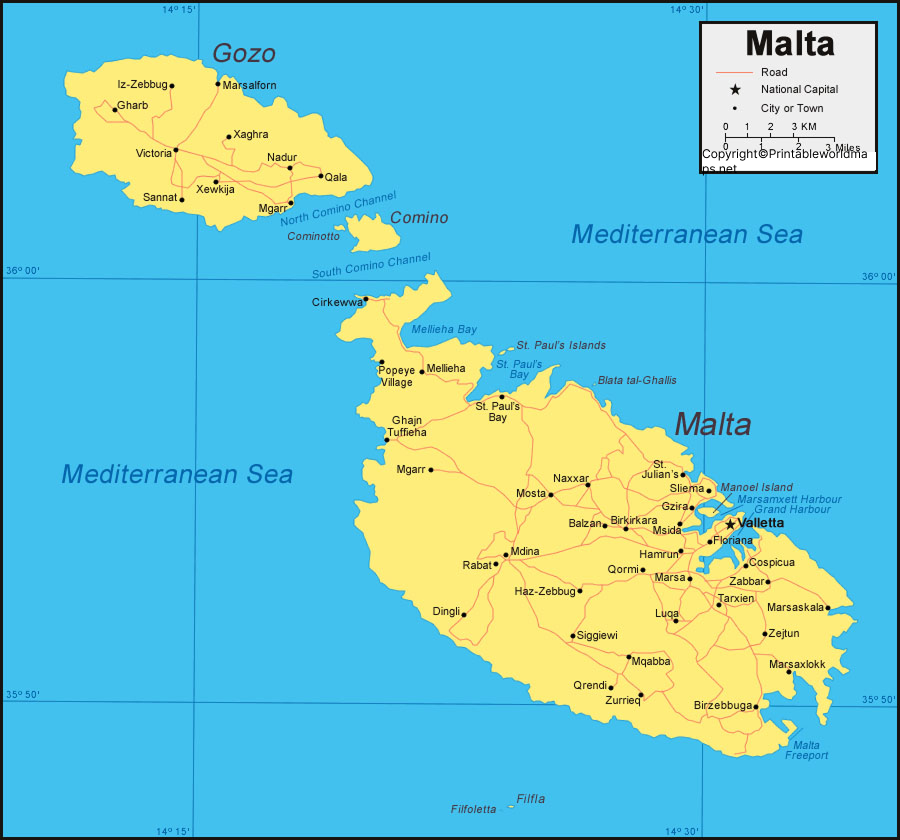
The Labeled Map of Malta with Cities identifies important towns and urban settlements across the islands. Some of the country’s major population centers include:
Valletta
Birkirkara
Qormi
Mosta
Żabbar
Sliema
St. Paul’s Bay
Naxxar
Marsaskala
Rabat
Because Malta is densely populated and highly urbanized, many towns and settlements form interconnected metropolitan areas, particularly around the Grand Harbour and the northeastern part of the main island.
Labeled Malta Map with Capital
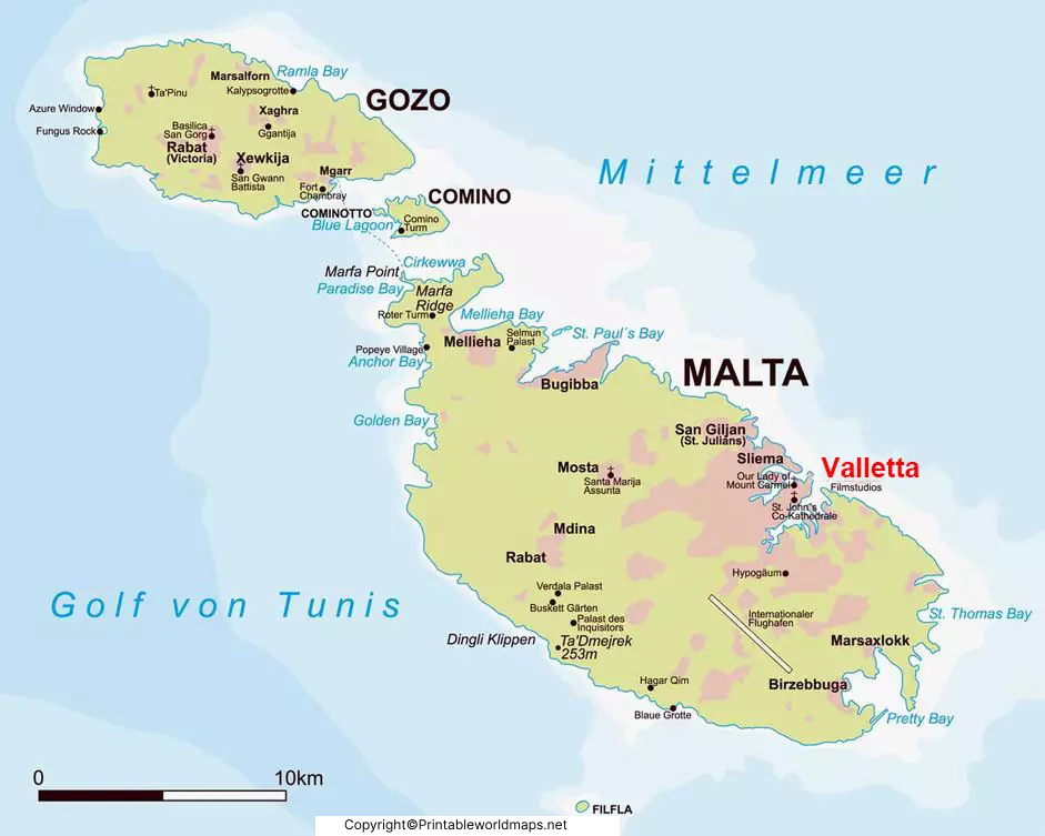
The capital of Malta is Valletta. The city is located on a peninsula between the Grand Harbour and Marsamxett Harbour.
Valletta was founded in the 16th century by the Order of St John and is known for its historic architecture, churches, fortifications, and narrow streets. The City of Valletta was inscribed on the UNESCO World Heritage List in 1980.
The capital is an important administrative, cultural, and commercial center of Malta. A Malta map with capital helps locate Valletta in relation to the country’s other towns, harbors, and surrounding areas.
Malta Map: Main Islands
Malta’s principal islands are:
Malta
The main island is the largest and most densely populated of the Maltese islands. Most of the country’s population, businesses, infrastructure, and major urban areas are located here.
Gozo
Gozo is the second-largest island and is located northwest of the main island of Malta. Its main town is Victoria, also known as Rabat.
Comino
Comino is a much smaller island located between Malta and Gozo. It is known particularly for its natural coastal environment and Blue Lagoon.
Where Is Malta Located?
Malta is located in the central Mediterranean Sea, south of Italy and north of Libya.
Its approximate geographic position is around 35.9° N latitude and 14.4° E longitude.
The country’s location places it between Europe and North Africa, making Malta an important geographic link within the Mediterranean region.
Interesting Facts About Malta
- Malta is an island country in the Mediterranean Sea.
- The capital city is Valletta.
- Malta, Gozo, and Comino are its principal inhabited islands.
- Malta covers approximately 316 square kilometers.
- Malta has five statistical regions.
- Valletta has been a UNESCO World Heritage Site since 1980.
- Malta has two official languages: Maltese and English.
- The euro (€) is Malta’s official currency.
- Malta is a member of the European Union.
- Malta became independent from the United Kingdom in 1964.
Malta Map for Students and Teachers
A printable Malta map can be useful for geography lessons, classroom activities, presentations, reports, travel planning, and educational projects.
The labeled versions can help students identify:
- Malta’s capital
- Major cities and towns
- Gozo and Comino
- Regional divisions
- Malta’s location in Europe
- Mediterranean Sea surroundings
The PDF versions are particularly useful when a map needs to be printed or included in an educational worksheet.
Frequently Asked Questions
What is the capital of Malta?
Valletta is the capital city of Malta.
How many regions does Malta have?
Malta has five statistical regions: Central, Gozo, Northern, South Eastern, and Southern.
What are the main islands of Malta?
The principal islands are Malta, Gozo, and Comino.
Where is Malta located?
Malta is located in the central Mediterranean Sea, approximately 80 km south of Sicily, Italy.
What is the area of Malta?
Malta covers approximately 316 square kilometers.
What language is spoken in Malta?
Maltese and English are the official languages of Malta.
Is Valletta a UNESCO World Heritage Site?
Yes. The City of Valletta was inscribed on the UNESCO World Heritage List in 1980.
Can I download a printable Malta map?
Yes. The maps on this page are provided in downloadable PDF formats for viewing and printing.
Reference Links
Official Government of Malta:
https://www.gov.mt/
National Statistics Office Malta:
https://nso.gov.mt/
Visit Malta:
https://www.visitmalta.com/
UNESCO – City of Valletta:
https://whc.unesco.org/en/list/131/
European Union – Malta:
https://european-union.europa.eu/principles-countries-history/country-profiles/malta_en









