
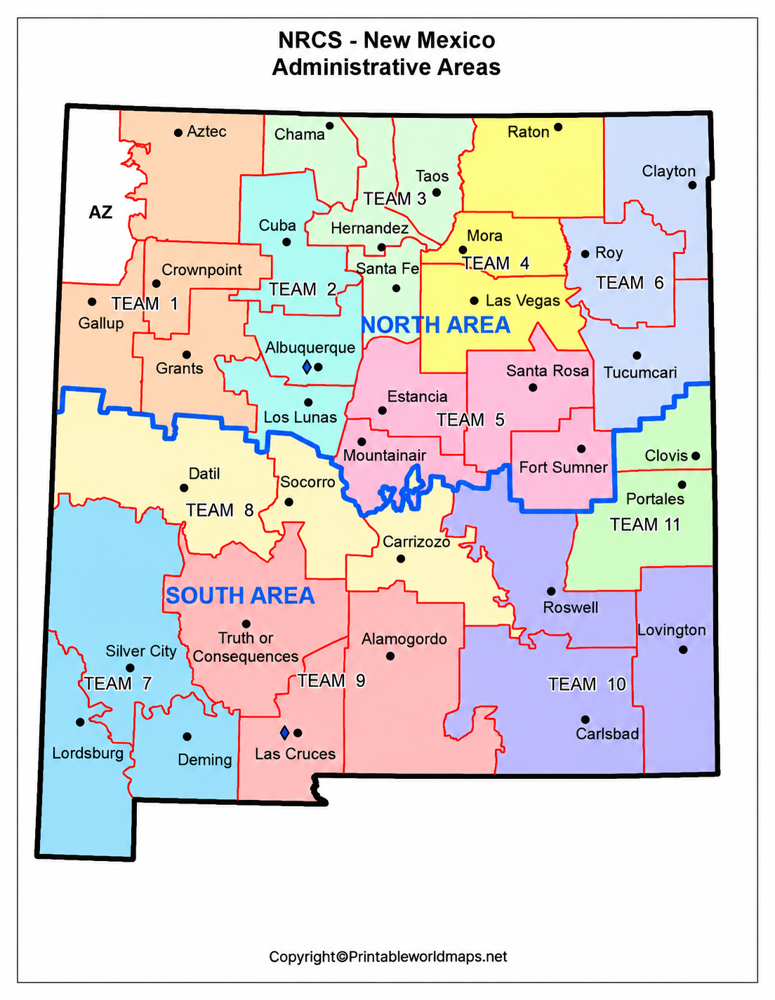

A Labeled Map of New Mexico helps you locate the state’s capital, major cities, neighboring states, rivers, and important geographic features. Whether you are studying U.S. geography, planning a trip, or looking for a printable reference, these maps make it easier to understand the location and layout of New Mexico.
New Mexico is located in the southwestern United States. Its capital is Santa Fe, while Albuquerque is its largest city by population. The state is known for its desert landscapes, mountain ranges, historic settlements, and distinctive blend of Native American, Hispanic, and Anglo-American cultural influences.
- World map with continents
- Physical world map
- Political world map
- Labeled map of Asia
- Labeled map of Africa
- Labeled map of Europe
- Labeled map of South America
- World time zone map
- Labeled map of world
- Blank map of world
- Labeled map of North America
- Blank map of Asia
- World map with oceans
- World map poster
Labeled Map of Mexico
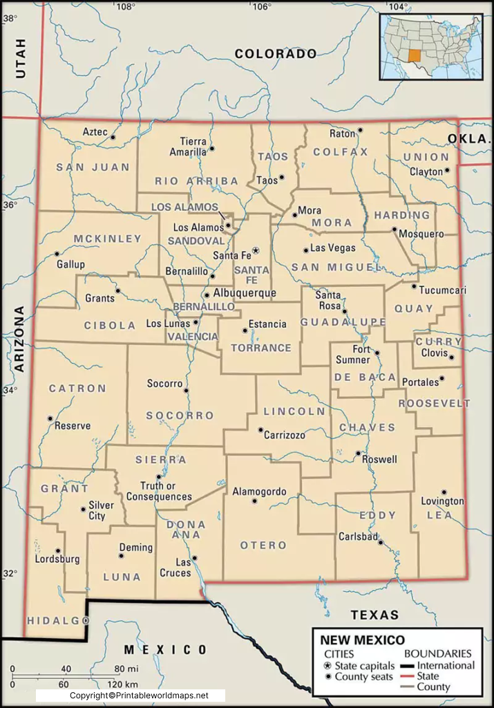
Use the labeled map below to identify New Mexico’s location, boundaries, capital, and major geographic features.
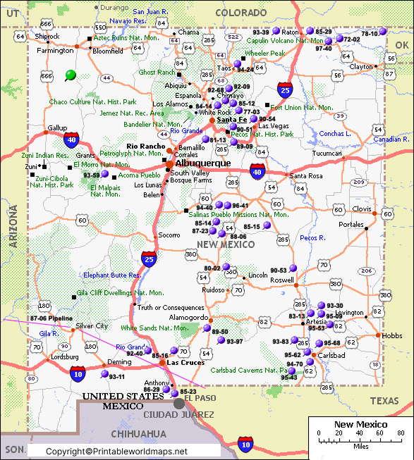
New Mexico covers approximately 121,300 square miles (314,900 square kilometers) of land, making it the fifth-largest U.S. state by land area. It borders Colorado to the north, Oklahoma and Texas to the east, Texas and the Mexican state of Chihuahua to the south, and Arizona to the west. The state also shares an international border with Mexico.
The Rio Grande is one of the state’s most important rivers, flowing through central New Mexico and past Albuquerque. The Pecos River is another significant river, particularly in the eastern part of the state.
According to the U.S. Census Bureau, New Mexico had an estimated population of 2,125,498 on July 1, 2025. The state has 33 counties and was admitted to the United States on January 6, 1912, as the 47th state.
Printable Map of Mexico Labeled
A printable map of New Mexico is useful for school assignments, geography lessons, travel planning, and general reference. Depending on the map, labels may identify the state capital, cities, county boundaries, rivers, highways, and neighboring states.
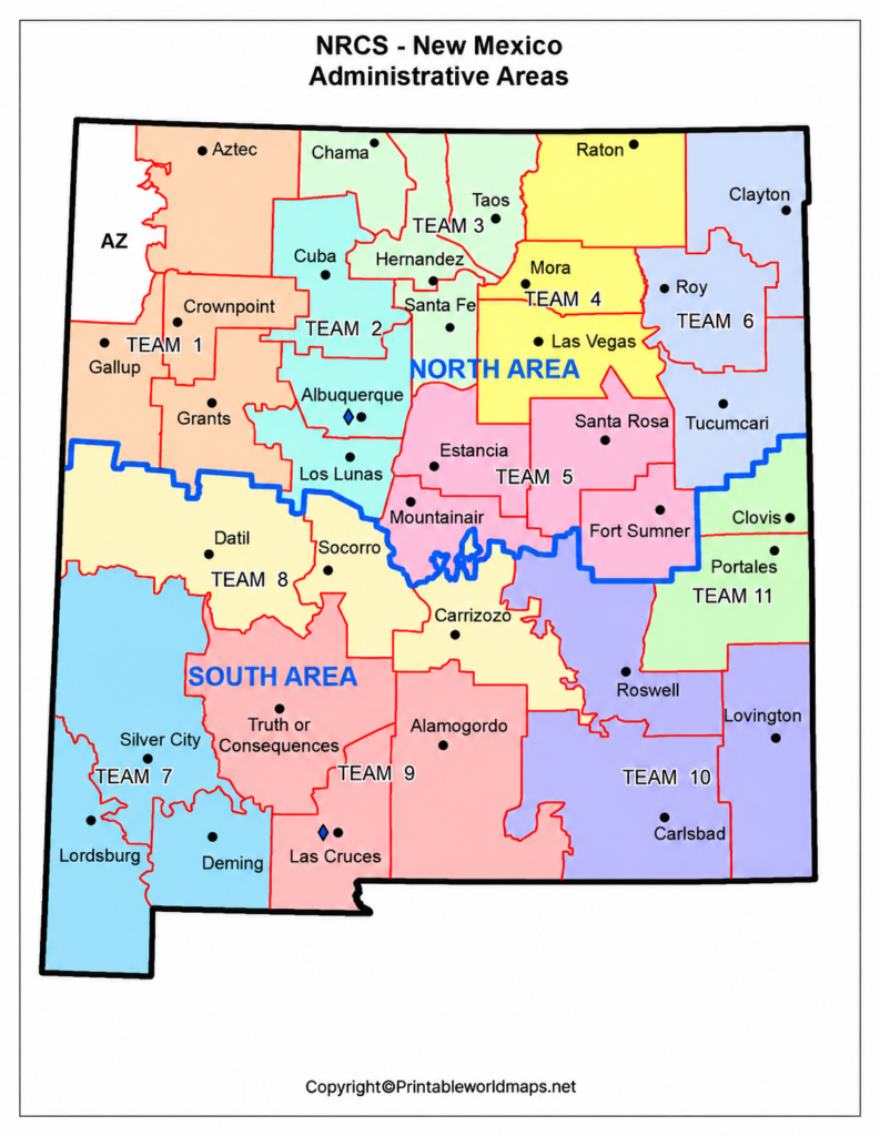
New Mexico is divided into 33 counties. A county map is particularly helpful for understanding local administrative boundaries and locating communities across the state.
For classroom use, print a labeled version to study place names or choose a blank map if you want to practice identifying cities, rivers, and borders yourself.
Labeled Mexico Map with Cities
A Labeled Map of New Mexico with Cities helps readers locate major urban centers and understand how communities are distributed across the state. Albuquerque is the largest city, followed by cities such as Las Cruces, Rio Rancho, and Santa Fe.
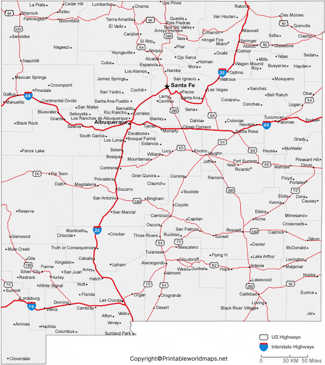
Major Cities in New Mexico
The following population figures are U.S. Census Bureau estimates for July 1, 2025. They refer to city populations, not the larger metropolitan areas.
- Albuquerque: Approximately 556,588 residents. It is New Mexico’s largest city and a major center for business, education, healthcare, and tourism.
- Las Cruces: Approximately 116,978 residents. Located in southern New Mexico, it is home to New Mexico State University.
- Rio Rancho: Approximately 114,419 residents. Located northwest of Albuquerque, it is one of the state’s important growing urban communities.
- Santa Fe: Approximately 89,837 residents. It is the state capital and is known for its historic architecture, museums, galleries, and cultural attractions.
- Roswell: Approximately 46,878 residents. The city is widely associated with UFO-related tourism and also serves as a regional center in southeastern New Mexico.
- Farmington: A major community in the state’s northwest, serving as a regional center for surrounding communities and outdoor recreation.
- Hobbs: Located in southeastern New Mexico, Hobbs is associated with the region’s energy industry and local commerce.
Population estimates change over time. For current figures, consult the U.S. Census Bureau’s New Mexico QuickFacts and its city-level data.
Labeled Mexico Map with Capital
Santa Fe is the capital of New Mexico. Located in the north-central part of the state, it sits at an elevation of approximately 7,000 feet (2,134 meters), making it one of the highest state capitals in the United States.
Santa Fe is known for its historic adobe-style buildings, art galleries, museums, and distinctive regional architecture. Important attractions include the Palace of the Governors and the New Mexico History Museum. The surrounding Sangre de Cristo Mountains provide opportunities for hiking, skiing, and other outdoor activities.
For students and travelers, a labeled map showing Santa Fe alongside Albuquerque, Las Cruces, and other cities is a useful way to understand the capital’s position within the state.
Geography and Natural Features of New Mexico
New Mexico has varied terrain, including high desert plateaus, mountain ranges, river valleys, forests, and grasslands. Its geography changes considerably from north to south and from east to west.
Major Rivers
- Rio Grande: Runs through central New Mexico and is important for agriculture, communities, and regional ecosystems.
- Pecos River: Flows through eastern New Mexico before continuing into Texas.
- Canadian River: Crosses northeastern New Mexico and forms part of the state’s wider river system.
Mountain Ranges and Landscapes
The Sangre de Cristo Mountains extend into northern New Mexico, while the southern part of the state includes ranges such as the Organ Mountains. The state is also home to White Sands National Park, known for its extensive white gypsum dunes.
A physical map can help readers understand how mountains, rivers, and elevation influence settlement, transportation, and land use throughout New Mexico.
Interesting Facts About New Mexico
Here are seven useful facts to remember when studying a labeled map of New Mexico.
- State capital: Santa Fe is the capital of New Mexico.
- Largest city: Albuquerque is the state’s largest city by population.
- Statehood: New Mexico became the 47th U.S. state on January 6, 1912.
- Counties: The state has 33 counties.
- Land area: New Mexico is the fifth-largest U.S. state by land area.
- Major river: The Rio Grande is a major geographic feature that passes through several important communities.
- International border: New Mexico shares its southern border with Mexico, including the Mexican state of Chihuahua.
These facts can help students identify key locations and understand the relationship between New Mexico’s geography, population, and history.
How to Use a Labeled Map of New Mexico
A labeled map can be useful for several purposes:
- Education: Learn the capital, major cities, neighboring states, rivers, and geographic regions.
- Travel planning: Understand the relative locations of destinations before planning a road trip.
- Geography projects: Use city and physical maps to compare settlement patterns and natural features.
- Research: Identify locations before consulting official census, historical, or geographic resources.
- Practice activities: Compare a labeled map with a blank map to test your knowledge.
Always check the map’s legend, publication date, and geographic coverage. Some maps show major cities and highways, while others emphasize physical features, counties, or administrative boundaries.
Frequently Asked Questions
1. What is the capital of New Mexico?
Santa Fe is the capital of New Mexico. It is located in the north-central part of the state and is known for its historic architecture, art, and cultural heritage.
2. What is the largest city in New Mexico?
Albuquerque is the largest city in New Mexico by population. The U.S. Census Bureau estimated its population at 556,588 on July 1, 2025.
3. How many counties are in New Mexico?
New Mexico has 33 counties. A labeled county map can help identify their boundaries and locations.
4. Which states border New Mexico?
New Mexico borders Colorado to the north, Oklahoma and Texas to the east, and Arizona to the west. Texas also borders the state to the south, along with Mexico.
5. When did New Mexico become a state?
New Mexico became the 47th state of the United States on January 6, 1912.
6. What are the major rivers in New Mexico?
The Rio Grande and Pecos River are two of the state’s most important rivers. The Canadian River is another notable river in northeastern New Mexico.
7. Where can I download a printable map of New Mexico?
You can use the printable map links in this article to view map images and PDF resources. Check the format and print quality before downloading or printing.
8. What is the difference between a labeled map and a blank map?
A labeled map already identifies features such as cities, rivers, and state boundaries. A blank map leaves some or all labels off so learners can fill them in for practice.
9. What is the population of New Mexico?
The U.S. Census Bureau estimated New Mexico’s population at 2,125,498 on July 1, 2025. Population figures are updated periodically, so consult official sources for the latest estimates.
10. Is New Mexico the same as Mexico?
No. New Mexico is a state in the southwestern United States. Mexico is an independent country to its south. Maps of New Mexico should not be confused with maps of the country of Mexico.
Reference links
https://www.census.gov/quickfacts/fact/table/NM/RTN130217
https://www.archives.gov/legislative/features/nm-az-statehood/sjres57.html
https://www.census.gov/quickfacts/fact/table/albuquerquecitynewmexico/POP815224
https://www.census.gov/quickfacts/fact/table/santafecitynewmexico/COM100223
