
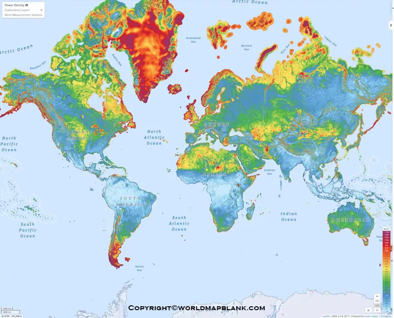
World Wind Map templates provide a useful visual reference for understanding global wind direction, wind patterns, speed, and related weather information. This page offers free printable World Wind Map templates in PNG and PDF formats for students, teachers, researchers, weather enthusiasts, and educational projects.
Wind is an important part of Earth’s weather system. Differences in air pressure and temperature contribute to atmospheric movement, while large-scale circulation patterns influence prevailing winds around the world. Use the printable maps below as educational and reference materials.
- World coronavirus map
- World geographical map
- World Map Wallpaper
- World population map
- Accurate map of World
- Ancient World map
World Wind Map
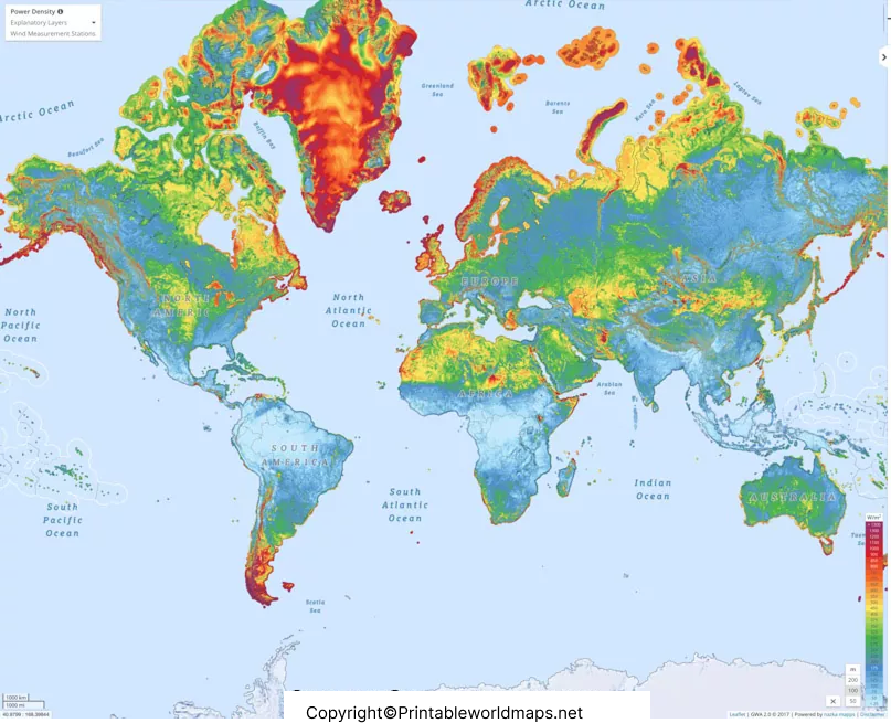
The World Wind Map provides a visual way to study atmospheric movement across different parts of the planet. Depending on the map design and data source, wind maps can represent wind direction, wind speed, temperature, pressure, or other atmospheric conditions.
How to Read a World Wind Map
A wind map can help readers identify several atmospheric characteristics:
- Wind direction: Shows the direction in which air is moving.
- Wind speed: Indicates how quickly air is moving.
- Temperature: Some maps use colors or contours to represent temperature differences.
- Regional patterns: Helps illustrate differences in atmospheric movement between regions.
- Large-scale circulation: Can be used to study broad global wind patterns.
For education, these maps can make atmospheric concepts easier to understand visually.
Wind Map of the World With Temperature
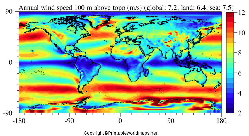
The World Wind Map with Temperature combines atmospheric movement with temperature information. Comparing these two variables can help students understand why weather conditions vary between different parts of the world.
Why Wind Direction and Temperature Matter
Wind and temperature are closely connected to atmospheric processes. Uneven heating of Earth’s surface contributes to differences in air pressure, and pressure differences help drive the movement of air.
However, wind does not move in exactly the same way everywhere. Earth’s rotation, land and ocean distribution, altitude, seasonal changes, and local geography can all influence atmospheric circulation.
Wind Currents World Map
A Wind Currents World Map can be used to visualize major patterns of atmospheric movement. Such maps are particularly useful for geography, environmental science, meteorology, and classroom activities.
Common Uses of Wind Maps
World wind maps can be useful for:
- Geography lessons – Understanding global atmospheric patterns.
- Weather education – Introducing students to wind direction and atmospheric movement.
- Environmental studies – Exploring the relationship between atmosphere and climate.
- Renewable energy studies – Understanding why wind conditions matter for wind-energy planning.
- Research and presentations – Providing a visual reference for educational projects.
- Classroom worksheets – Using printable maps for labeling and interpretation exercises.
Wind information can be particularly important for renewable-energy planning because wind resources vary by location and are influenced by local and regional conditions.
Printable Word Wind Map Templates
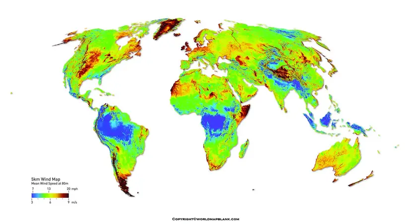
Our Printable World Wind Map templates are available in downloadable formats that can be used for educational activities, presentations, research references, and personal projects.
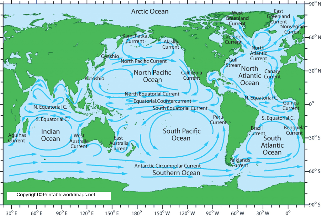
The printable versions are suitable for printing or viewing digitally. You can use them on a computer, tablet, or smartphone, depending on the file format and your intended activity.
Understanding Global Wind Patterns
Global wind circulation is influenced by several major factors. One important factor is the unequal heating of Earth’s surface by the Sun. Air also moves because of differences in atmospheric pressure.
At a global scale, atmospheric circulation is commonly discussed in terms of broad circulation cells, including the Hadley, Ferrel, and Polar cells. Earth’s rotation contributes to the Coriolis effect, which influences the apparent direction of moving air.
These concepts help explain why prevailing wind patterns differ across latitudes.
Prevailing Winds
Several broad categories of prevailing winds are commonly discussed in geography:
- Trade winds
- Westerlies
- Polar easterlies
These are simplified descriptions of large-scale atmospheric circulation. Actual winds at a particular location can vary because of weather systems, terrain, season, and local conditions.
World Wind Map for Students and Teachers
A printable World Wind Map can be used as a visual learning aid for lessons covering:
- Atmospheric circulation
- Weather and climate
- Wind direction
- Wind speed
- Temperature patterns
- Earth’s rotation
- Coriolis effect
- Renewable energy
- Geography and environmental science
Teachers can also use the maps for labeling exercises, classroom discussions, geography projects, and weather-related assignments.
Educational Facts About Wind
Here are useful facts that can increase the educational value of this page:
- Wind is the movement of air from areas of higher pressure toward areas of lower pressure, although Earth’s rotation and other forces affect its actual path.
- Unequal solar heating contributes to differences in atmospheric pressure and temperature.
- Earth’s rotation produces the Coriolis effect, which influences large-scale atmospheric circulation.
- Wind direction is generally named for the direction from which the wind originates.
- Wind speed can be measured using an anemometer.
- Prevailing wind patterns can vary by latitude, season, terrain, and location.
- Wind is an important resource for renewable electricity generation.
Why Use a Printable World Wind Map?
A printable wind map offers a simple visual resource when you need to explain or study global atmospheric patterns without relying on a live interactive system.
It can be particularly useful for:
- School assignments
- Geography projects
- Science presentations
- Weather lessons
- Classroom worksheets
- Environmental studies
- Research presentations
- Wind-energy educational materials
Frequently Asked Questions
What is a World Wind Map?
A World Wind Map is a visual representation of wind conditions or global atmospheric circulation. Depending on the map, it may show wind direction, speed, temperature, or broader prevailing wind patterns.
What does a World Wind Map show?
A wind map may show wind direction and speed and, depending on its design and data source, additional information such as temperature or atmospheric circulation patterns.
Can I print the World Wind Map?
Yes. The maps provided on this page are available in downloadable formats, including PDF files that can be printed for educational and reference purposes.
Is the printable World Wind Map real-time?
A static printable map should not automatically be considered real-time weather information. For current conditions, use an up-to-date meteorological or weather-data source.
What is wind direction?
Wind direction describes the direction from which the wind is coming. For example, a north wind originates from the north.
How is wind speed measured?
Wind speed is commonly measured using an anemometer. Weather services may report wind speed using units such as kilometers per hour, miles per hour, knots, or meters per second.
Why does wind direction change?
Wind direction can change because of changing pressure systems, weather fronts, temperature differences, terrain, Earth’s rotation, and local atmospheric conditions.
Why are wind maps useful for students?
Wind maps provide a visual way to study atmospheric circulation, prevailing winds, weather patterns, geography, climate, and renewable energy concepts.
Can wind maps be used for wind-energy studies?
Yes, wind information is relevant to understanding wind resources. However, professional wind-energy planning requires detailed, location-specific measurements and analysis rather than a general world map.
What is the difference between wind and air pressure?
Air pressure describes the force exerted by air, while wind describes moving air. Differences in pressure are one of the important factors that drive atmospheric movement.
Reference link
https://www.weather.gov/jetstream
https://science.nasa.gov/earth
https://scied.ucar.edu/learning-zone/atmosphere









