

A world geographical map with coordinates in PDF helps students, teachers, and geography enthusiasts explore the locations of countries, continents, oceans, and important physical features of Earth. Printable world maps are useful for classroom activities, geography assignments, revision, and independent learning.
On this page, you can explore several world geographical map templates and access the PDF files linked below each image. Choose a map that suits your learning activity, whether you want to study global geography, practise identifying locations, or understand latitude and longitude.

- World coronavirus map
- World geographical map
- World population map
- Accurate map of World
- Ancient World map
- World Map Wallpaper
World Geographical Map
A world geographical map presents a broad view of Earth’s land and water features. Depending on the map design, it may show continents, country boundaries, oceans, islands, mountains, deserts, and other geographical features.
Use the map below to explore the available design and download its associated PDF for offline study or printing.
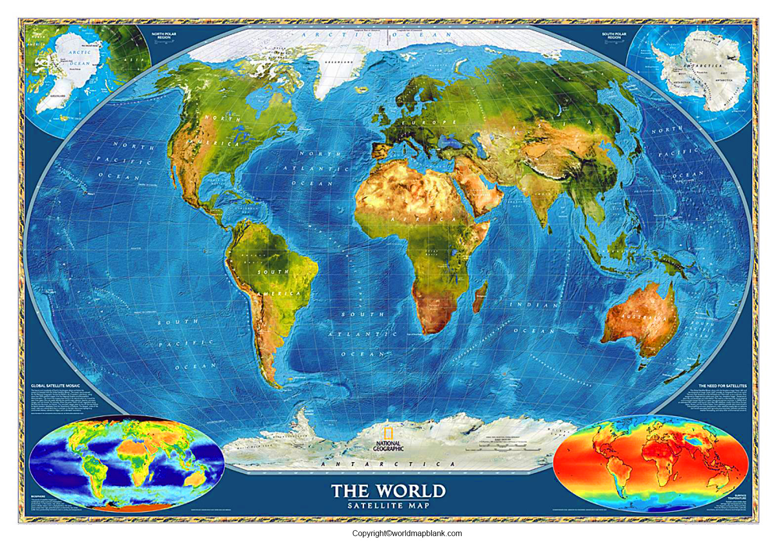
World Geographic Map
A geographic map helps readers understand how places and natural features are distributed across the planet. Depending on its purpose, it may emphasize physical features, political boundaries, or general geographical information.
A physical map commonly highlights mountains, plains, rivers, and other landforms. A political map focuses on countries, borders, and sometimes capital cities. Before using a map for an assignment, check its labels and legend to understand exactly what it represents.

World Geographical Map with Coordinates
Coordinates help identify locations on Earth’s surface. The two main geographic coordinates are latitude and longitude.
- Latitude measures a location north or south of the Equator, which is at 0° latitude.
- Longitude measures a location east or west of the Prime Meridian, which is at 0° longitude.
- Geographic coordinates combine latitude and longitude to describe a location.
For example, coordinates are commonly written in decimal degrees, such as 28.6139° N, 77.2090° E for a location in New Delhi, India. This is an illustrative coordinate example; the exact value depends on the selected point.
A coordinate grid makes it easier to practise locating places, comparing positions, and understanding the relationship between different parts of the world.

Worlds Geographic Printable Map Template
Printable world maps can support different learning activities. Select a suitable template based on whether you need geographical labels, a general world view, or a map for practice exercises.
1. Geographical Map of the World
Use this map to explore the broad arrangement of continents and other geographical features. It can be a starting point for identifying major regions and discussing the distribution of land and water.

2. World Geographical Map with Coordinates Template
A map with coordinate lines can help learners practise reading latitude and longitude. Try locating the Equator, the Prime Meridian, and selected places using their coordinates.

3. World Geographic Map Template
A general world map template can be used for classroom exercises, geography revision, and map-based activities. You can use a printed copy to mark selected countries, oceans, or other features if the format and labels allow it.

4. World Geographic Printable Map Template
A printable map template offers a convenient way to practise geographical concepts on paper. Teachers can adapt suitable activities for lessons, while students can use a copy for revision or self-testing.

How to Use a World Geographical Map for Learning
A printable world map can be used for more than identifying countries. Try these activities to build geographical knowledge:
- Identify continents: Locate Africa, Antarctica, Asia, Europe, North America, South America, and Australia.
- Locate oceans: Find the Pacific, Atlantic, Indian, Arctic, and Southern oceans.
- Practise coordinates: Identify the Equator and Prime Meridian, then practise reading latitude and longitude.
- Compare locations: Observe how countries and cities are positioned relative to one another.
- Create a revision exercise: Cover selected labels and try to identify the features from memory.
- Use it in the classroom: Mark places mentioned in a geography lesson and discuss their relative positions.
The seven-continent model and five-ocean naming convention are widely used in educational geography, although continent classifications and some ocean boundaries can vary by convention.
How to Download and Print the World Map PDF
Follow these steps to use one of the available templates:
- Select the map that best suits your activity.
- Click its PDF download link.
- Open the file in a PDF reader and check the page layout.
- Select a suitable paper size, such as A4 or A3, depending on the file and your printer.
- Use landscape orientation if it fits the map better.
- Check the print preview to ensure that labels, coordinate lines, and map edges are not cut off.
For classroom worksheets, a black-and-white print may be sufficient. For maps that use colour to distinguish geographical features, colour printing may make the information easier to read.
Printing tip: World maps represent Earth’s curved surface on a flat page. Depending on the projection, the relative shapes, areas, distances, or directions of geographical features may be distorted. Check the map’s projection and legend when accuracy matters.
Why Are World Maps Important?
World maps help people understand the spatial relationships between countries, continents, oceans, and physical features. They support geographical literacy by turning location information into a visual reference.
Students can use them to practise map reading, understand hemispheres, identify broad regional patterns, and connect textbook concepts with real-world locations. Teachers can also use printable maps for quizzes, group activities, and revision exercises.
For more precise work, such as navigation or geographic analysis, use authoritative mapping data and a suitable coordinate reference system rather than relying only on a general printable map.
Frequently Asked Questions
1. What is a world geographical map?
A world geographical map represents selected features of Earth, such as continents, oceans, countries, boundaries, and physical landforms. The information shown depends on the type and purpose of the map.
2. Where can I download a world geographical map in PDF?
You can use the PDF links provided in this article to access the available world map templates. Open the link for your preferred map and check the file before printing.
3. What are coordinates on a world map?
Geographic coordinates describe a location using latitude and longitude. Latitude indicates position north or south of the Equator, while longitude indicates position east or west of the Prime Meridian.
4. What is the difference between a geographic map and a political map?
A geographic map may show natural features, regions, or other spatial information. A political map emphasizes administrative boundaries, countries, and sometimes cities or capitals. The exact content varies by map.
5. How many continents are there?
A widely used educational model recognises seven continents: Africa, Antarctica, Asia, Europe, North America, South America, and Australia.
6. How many oceans are recognised in the five-ocean model?
The five-ocean model names the Pacific, Atlantic, Indian, Arctic, and Southern oceans. These are named regions of the interconnected global ocean.
7. Can I use a printable world map for school projects?
Yes. Printable maps can be useful for geography assignments, revision, labelling activities, and classroom presentations. Check any copyright or usage terms that apply to the particular map before republishing it.
8. Why can a world map look different from a globe?
A globe represents Earth’s approximately spherical surface, while a flat world map uses a map projection. Every flat-world projection introduces some form of distortion, so the apparent size, shape, distance, or direction of features can differ.
Reference links
https://education.nationalgeographic.org/resource/Continent/
https://education.nationalgeographic.org/resource/map/
https://natural-resources.canada.ca/maps-tools-publications/maps/atlas-canada/reference-maps

17 thoughts on “World Geographical Map with Coordinates in PDF”