
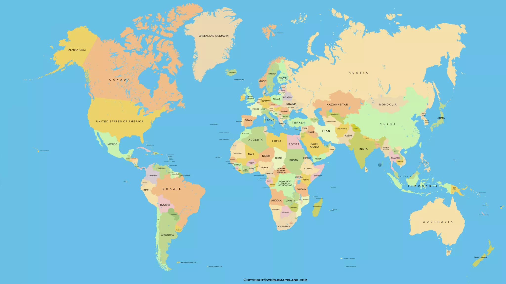

Looking for a printable accurate world map in PDF format? A world map poster is a useful resource for students, teachers, geography enthusiasts, and anyone who wants to explore the continents, countries, oceans, and major geographical features of Earth.
This page provides printable world map resources for studying geography, classroom activities, school projects, and home display. You can explore the available map images, open the associated PDF files, and choose a format that suits your printing requirements.
- World Map with Continents
- Labeled Map of South America
- Labeled Map of Africa
- Political World Map
- World Map with oceans
- World Map Poster
- Labeled Map of Europe
- Labeled Map of Africa
- Blank Map of Asia
- World Time Zone Map
- Labeled Map of World
- Physical World Map
Accurate Map of the World
An accurate world map helps readers understand the relative positions of continents, countries, oceans, and other geographical features. It can be useful for geography lessons, identifying locations, planning educational activities, and building general geographical knowledge.
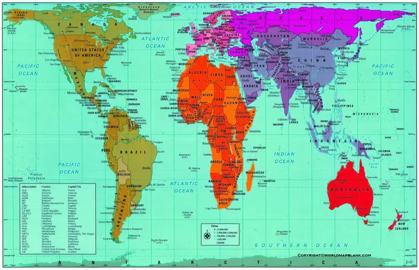
Before printing, check whether the map includes the labels, boundaries, and geographical details you need. For classroom learning, a clearly labeled map may be more useful than a decorative poster without country names.
Printable Accurate World Map
A printable accurate world map is a convenient option for students, teachers, and people who prefer learning from a physical copy. You can print a map for a notebook, classroom activity, school assignment, or wall display.

For the best printing results, choose a paper size that fits the map’s proportions. Use a higher-quality print setting if small country names and boundary lines need to remain readable.
Remember that every flat world map uses a map projection to represent Earth’s curved surface. Different projections preserve different properties, such as area, shape, direction, or distance. No flat world map can preserve all of these properties perfectly.
Accurate World Map Poster
An accurate world map poster can make geography easier to explore at home, in a classroom, or in a study area. A wall map allows learners to review the locations of countries and continents without repeatedly opening a textbook or digital device.

Before selecting a poster, consider its intended use:
- For students: Choose a map with readable country names and clear boundaries.
- For teachers: Select a map that makes continents, oceans, and important geographical features easy to identify.
- For home display: Consider the print size, color scheme, and available wall space.
- For geography practice: Use a labeled map for reference and a blank map for self-testing.
Check the PDF dimensions and preview the page before printing a large poster.
Most Accurate Map of the World
The most suitable world map depends on what you want to learn or display. A political map emphasizes countries and boundaries, while a physical map focuses on landforms, elevation, and other natural features. An equal-area projection is useful when comparing the relative sizes of land areas.
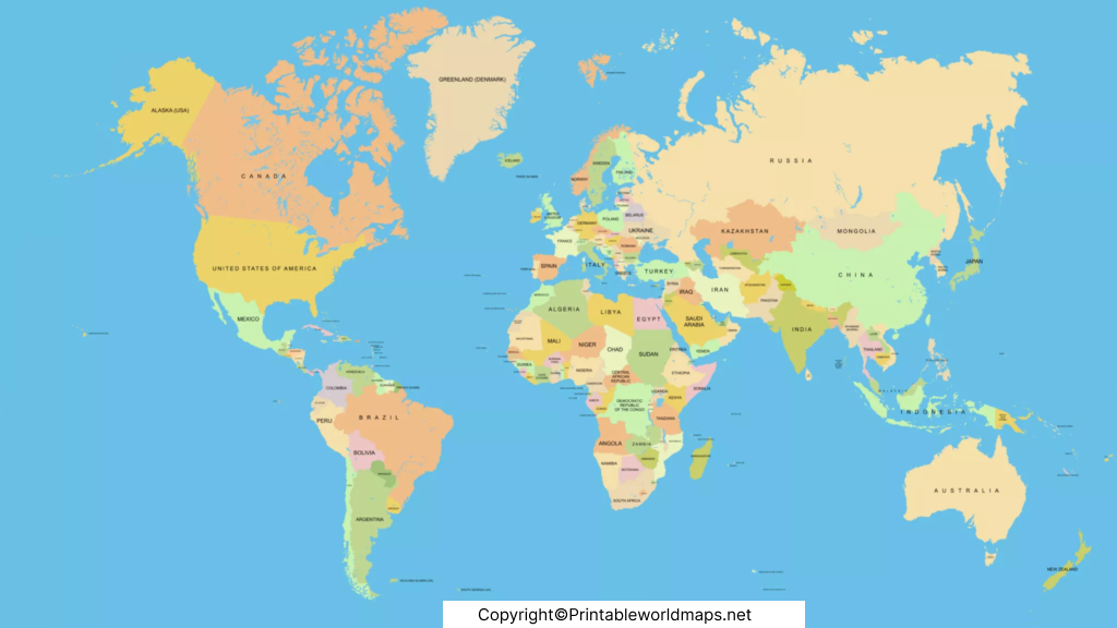
When evaluating a map, consider its publication date, source, projection, geographic labels, and intended purpose. These details help you determine whether it is suitable for education, reference, or decoration.
For authoritative information about map projections, the United States Geological Survey (USGS) explains why flat maps inevitably introduce some distortion. The United Nations Geospatial website also provides an official world map resource.
How to Choose the Right Printable World Map
Choosing the right map depends on your needs. Use this quick guide to compare common world map types.
| Map type | Best use |
|---|---|
| Political world map | Learning countries, capitals, and boundaries |
| Physical world map | Studying mountains, plains, deserts, and other landforms |
| Labeled world map | Identifying continents, countries, and oceans |
| Blank world map | Geography quizzes, practice, and school assignments |
| Equal-area world map | Comparing the relative areas of continents and regions |
Check the labels and geographic details before relying on a map for academic work. Political boundaries and place names can change, so consult current authoritative sources when up-to-date information is important.
Tips for Printing a World Map Poster
Follow these steps to get a clear, readable print:
- Open the PDF file using a PDF reader.
- Preview the document and check its page dimensions.
- Select A4 or A3 paper for ordinary printing, or choose a supported larger format for a wall poster.
- Use the correct orientation and scaling settings to avoid cutting off the map.
- Select a suitable print quality so that labels and boundary lines remain legible.
- Check the printed copy before making additional prints.
If the map appears blurry, check the source image resolution and the quality of the PDF. Increasing the print size does not create additional detail in a low-resolution image.
Frequently Asked Questions
1. Where can I download a printable accurate world map in PDF format?
You can use the PDF links provided in the sections above. Open the relevant file, review the page, and download or print it if the file is accessible.
2. Is there one completely accurate map of the world?
No flat world map can represent every property of Earth’s curved surface without distortion. Different projections prioritize different properties, such as area, shape, direction, or distance.
3. Which world map is best for students?
A clearly labeled political world map is useful for learning countries, boundaries, and capitals. A physical map is better for studying landforms and natural geographical features. Teachers can use blank maps for practice exercises.
4. What is the difference between a political and a physical world map?
A political map highlights countries, boundaries, and sometimes capitals. A physical map emphasizes natural features such as mountains, plains, rivers, and elevation.
5. Can I print a world map as a large wall poster?
Yes, if the PDF or source image has sufficient resolution and the document supports an appropriate print size. Check the page dimensions, image quality, and printer settings before printing.
6. Are all world maps approved by the United Nations?
No. The United Nations publishes official world maps, but it does not prescribe one universal projection for every map. The UN Geospatial FAQ explains that different projections are used according to the purpose and geographic area of a map.
7. How can I check whether a world map is reliable?
Check the publisher, publication date, map projection, labels, geographic boundaries, and intended use. For academic or professional work, compare the map with recognized geographic authorities and current official sources.
Reference links
https://www.un.org/geospatial/content/map-world-1
https://www.un.org/geospatial/node/744
https://www.usgs.gov/faqs/how-are-different-map-projections-used
https://www.usgs.gov/publications/map-projections
https://education.nationalgeographic.org/resource/investigating-map-projections
https://education.nationalgeographic.org/resource/selecting-map-projection

3 thoughts on “Printable Accurate Map of World Poster in PDF”