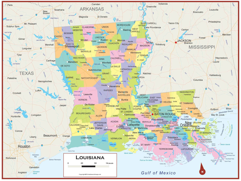
Labeled Map of Louisiana indicates the location of this state in the US. It is one among the fifty states that is situated in the West South-Central region of the mainland. It is located between Mississippi and Texas, and towards the south of Arkansas. The geographical feature of this state consists of about 4,800 kilometers or 3,000 miles of twisty, winding shorelines that runs along the Gulf of Mexico, in the south.
Contents
Labeled Map of Louisiana
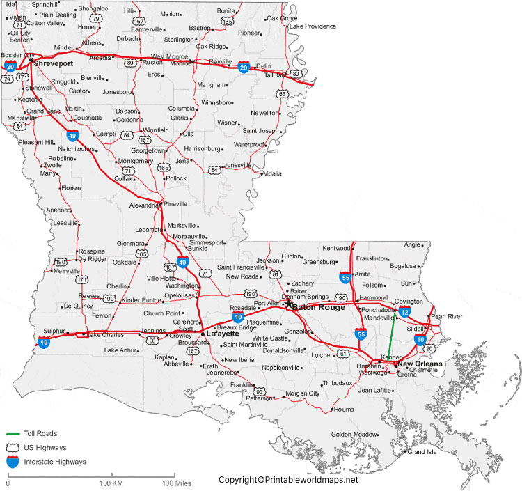
The state has Sabina River, which constitutes about sixty percent of its border with Texas. Rivers, like the Pearl River and the Mississippi, have well defined sections of the Louisiana state border with the state of Mississippi. From the labeled map of Louisiana, it is possible to identify all the details related to the boundaries of Louisiana, and the location of the state capital city, Baton Rouge. The map also provides details about populated places and major cities, lakes and rivers, principal and interstate highways, including railroads.

The nickname of Louisiana state is known as, the Pelican State. The total land area is 135,658 square kilometers or 52,378 square miles. The size of this state is about half the size of Colorado or slightly larger than that of Greece. The major rivers that flow in this state, includes the Sabine River, the Atchafalaya River, the Ouachita River, the Red River and the Mississippi River. The population of the state is 4.7 million people. The various religions observed in this state, include Protestantism, Roman Catholicism, Buddhism and Islam.
Labeled Map of Louisiana Printable

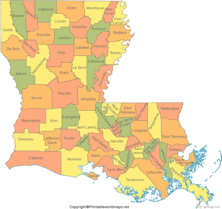
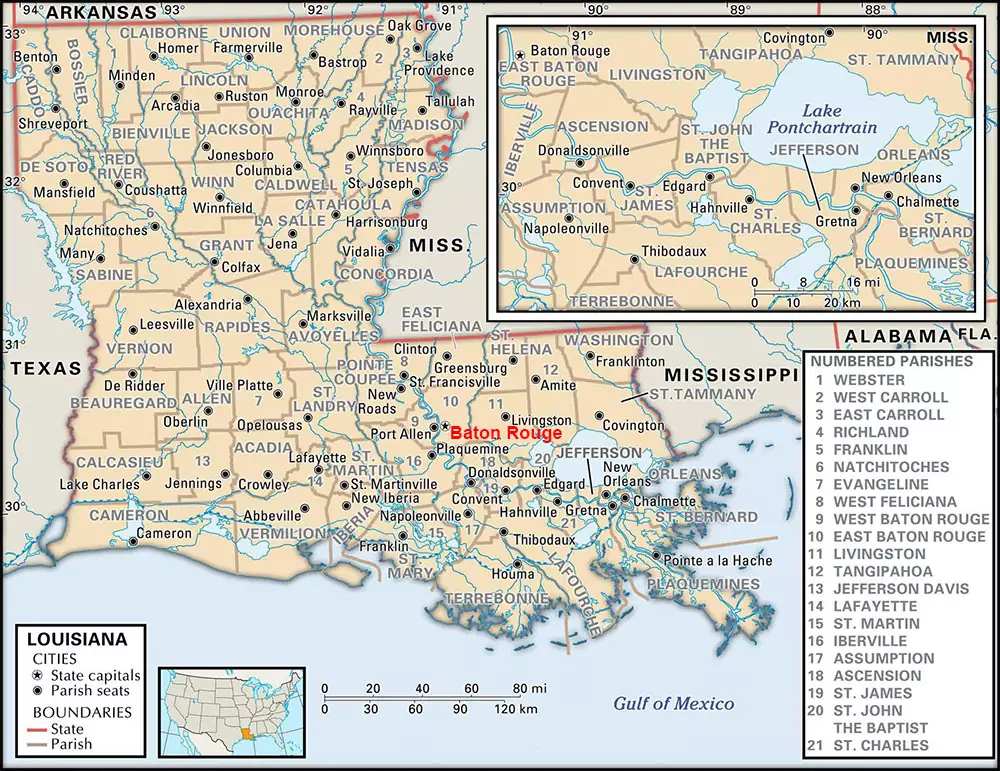
The labeled map of Louisiana with states indicates that there are no counties in this state. However, this state is divided into sixty-four parishes. The poorest parish in Louisiana is known as, Claiborne Parish. Annually, in this parish, the recorded household income was said to be $26,877. This is according to the US Census Bureau data of 2017. Some of the names of these parishes, include East Baton Rouge Parish that has a population of 440,059, Jefferson Parish with a population of 432,493, Orleans Parish with a population of 390,144, and St. Tammany Parish with a population of 260,419.
Labeled Map of Louisiana with Cities

The labeled map of Louisiana with cities, indicates that the largest city is known as New Orleans that has a population of 391,500 people. The second largest city is known as Baton Rouge, the capital city, with a population of 227,500. The other cities, include Shreveport with a population of 195,000, Metairie with a population of 138,500, and Lafayette with a population of 127,600. One of the cities in Louisiana that has more than 10,000 population is known as, the city of Morgan.
Labeled Louisiana Map with Capital

As a part of labeled Louisiana with capital, Baton Rouge is recognized as the capital city of Louisiana state, in the US. East Baton Rouge parish is where this city is located. On the Mississippi River, this city has a port that facilitates deepwater navigation and other business activities.


