

Looking forward to exploring the physical geography of South America? Check out our South America Mountains Map and explore the best from the geography of the continent. We shall further provide the printable template of all the South American mountain maps for the learning purpose of users.
- World coronavirus map
- World geographical map
- World map for kids
- World Map Wallpaper
- World population map
- Accurate map of World
- Ancient World map
South America Mountains Map
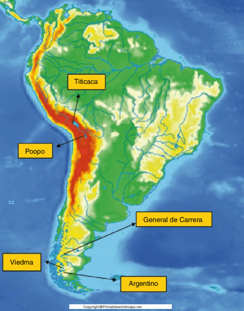
The South America Mountains Map is one of the best resources for understanding the continent’s remarkable mountain systems, physical geography, and highest peaks. Whether you’re a student, teacher, traveler, or geography enthusiast, this printable map helps you identify the major mountain ranges, their locations, and their importance across South America. It also serves as an educational reference for schools, competitive exams, and travel planning.
South America is the world’s fourth-largest continent, covering approximately 17.84 million square kilometres (6.89 million square miles) and accounting for nearly 12% of Earth’s land area. It is home to around 440 million people and includes 12 sovereign countries and several overseas territories. The continent stretches from the Caribbean Sea in the north to Cape Horn in the south, offering one of the world’s most diverse landscapes.
Printable South America Mountains Map Labeled
A printable South America Mountains Map makes learning easier by clearly showing the continent’s major mountain ranges and important peaks. Students can use labeled and blank versions for classroom assignments, geography practice, homeschooling, quizzes, and map activities.
The map highlights major mountain systems including:
- Andes Mountains
- Sierra Nevada de Santa Marta
- Cordillera Blanca
- Cordillera Central
- Serra do Mar
- Serra da Mantiqueira
- Serra Geral
Printable formats are available in:
- PNG
- JPG
- SVG (where available)
These printable maps are suitable for both digital learning and classroom printing.
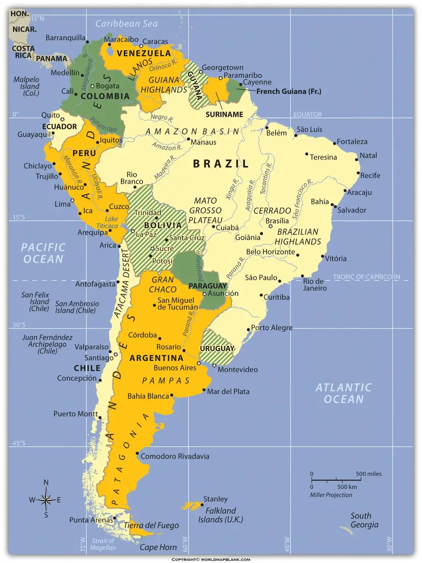
Physical Geography of South America’s Mountains
South America’s landscape is generally divided into three major physical regions:
- The Andes Mountain Region
- River Basins, including the Amazon Basin
- Eastern Highlands and Coastal Plains
The Andes Mountains dominate the western edge of the continent, extending for approximately 7,000 km (4,350 miles) from Venezuela to southern Chile and Argentina. They are the longest continental mountain range in the world.
The Andes influence:
- Climate patterns
- River systems
- Biodiversity
- Agriculture
- Mining
- Tourism
Several of South America’s largest rivers, including the Amazon and Magdalena, originate in the Andes.
Map of South America Mountains
A detailed South America Mountains Map allows users to identify the location of every major mountain range across the continent. It is particularly useful for geography lessons because it shows mountains alongside country borders, major cities, rivers, and elevation zones.
Some of the most famous mountain ranges include:
- Andes Mountains
- Cordillera Blanca (Peru)
- Sierra Nevada de Santa Marta (Colombia)
- Serra do Mar (Brazil)
- Serra da Mantiqueira (Brazil)
- Cordillera Real (Bolivia)
These mountain systems contain thousands of glaciers, volcanoes, valleys, and high-altitude lakes that make South America one of the world’s most geographically diverse continents.
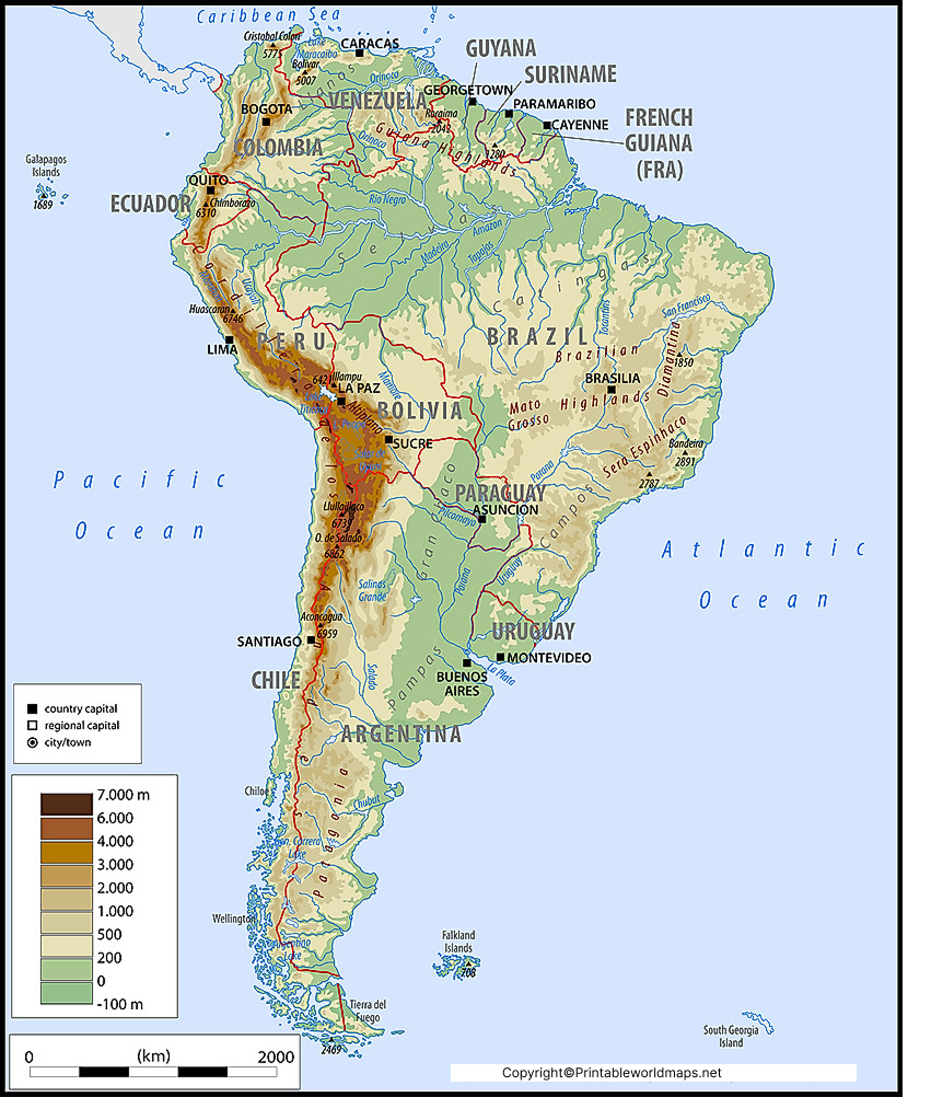
South America Map with Mountains
A South America Map with Mountains helps readers understand how mountain ranges influence transportation, climate, wildlife, and human settlement. The Andes create natural barriers, affect rainfall distribution, and contribute to unique ecosystems such as cloud forests and high-altitude grasslands.
Many mountain regions are also famous for:
- Hiking
- Mountaineering
- Wildlife observation
- National parks
- UNESCO World Heritage Sites
Popular destinations include Peru’s Sacred Valley, Bolivia’s Altiplano, Ecuador’s Avenue of the Volcanoes, and Patagonia in Chile and Argentina.
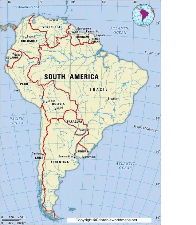
You can use it for your purpose whether you are a scholar or an explorer. Feel free to get this template both in printable and physical format for yourself. We are also offering the digital format of the template such as PDF, Word, Docs, etc. You can accordingly get the template in the desired format for better compatibility.
Highest Mountains in South America
| Mountain | Height | Country |
|---|---|---|
| Aconcagua | 6,961 m | Argentina |
| Ojos del Salado | 6,893 m | Argentina & Chile |
| Monte Pissis | 6,793 m | Argentina |
| Huascarán | 6,768 m | Peru |
| Nevado Tres Cruces | 6,748 m | Chile |
Aconcagua is the highest mountain in South America, the highest peak in the Southern Hemisphere, and the highest mountain outside Asia.
Interesting Facts About South America Mountains
- The Andes are the longest continental mountain range on Earth.
- Aconcagua stands at 6,961 metres (22,838 feet).
- The Andes pass through seven countries.
- The Atacama Desert lies along the western Andes and is one of the driest places on Earth.
- Lake Titicaca, located in the Andes, is the world’s highest large navigable lake.
- The Andes contain hundreds of active and dormant volcanoes.
- Many of South America’s major rivers begin in the Andes Mountains.
Why Use Our South America Mountains Map?
Our printable maps are designed for:
- Geography education
- School projects
- College assignments
- Competitive exam preparation
- Homeschooling
- Travel planning
- Physical geography research
The maps are available in high-quality printable formats for easy download and offline use.
Frequently Asked Questions (FAQs)
What is the largest mountain range in South America?
The Andes Mountains are the largest and longest mountain range in South America, stretching approximately 7,000 km.
Which is the highest mountain in South America?
Aconcagua in Argentina is the highest mountain in South America, standing at 6,961 metres (22,838 feet).
Can I download a printable South America Mountains Map?
Yes. Printable versions are available in PDF and image formats for educational and personal use.
Which countries contain the Andes Mountains?
The Andes extend through Venezuela, Colombia, Ecuador, Peru, Bolivia, Chile, and Argentina.
Why are the Andes Mountains important?
They influence South America’s climate, biodiversity, rivers, agriculture, mining, tourism, and transportation while supporting unique ecosystems and cultures.
