
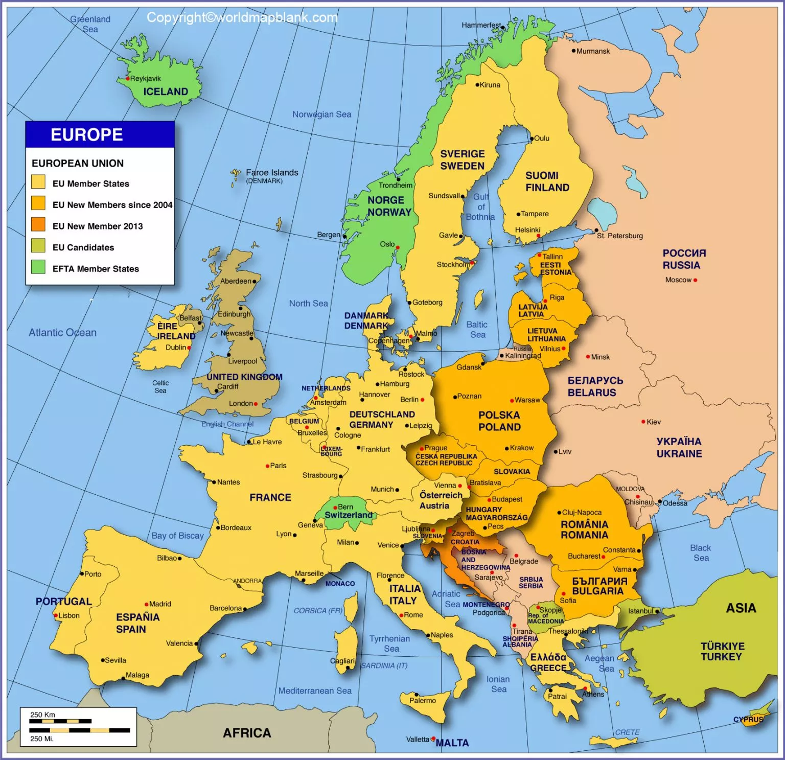

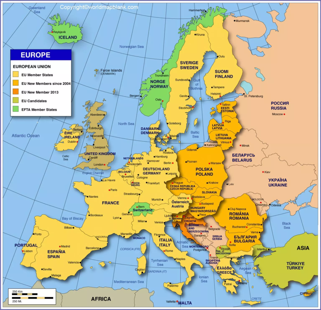
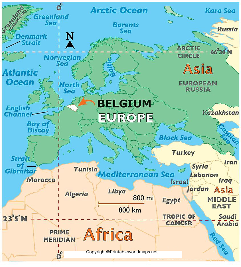
Belgium is a small country in Western Europe with a federal structure, three regions, 10 provinces and Brussels as its federal capital. This Labeled Map of Belgium helps identify the country’s provinces, capital, major cities and geographical divisions. Belgium borders the Netherlands, Germany, Luxembourg and France, and has a coastline along the North Sea.
The maps below are useful for students, teachers, researchers, travelers and anyone looking for a printable reference map of Belgium.
Labeled Map of Belgium
A Labeled Map of Belgium makes it easier to locate Brussels, Antwerp, Ghent, Liège, Leuven, Mons, Namur and other important places.
Belgium covers approximately 30,689 square kilometers according to Belgium’s official country profile. The country’s highest point is Signal de Botrange, at 694 meters.
According to Statbel, Belgium had 11,867,634 inhabitants on 1 January 2026. The population increased by 42,083 people, or 0.36%, during 2025.
Belgium at a Glance
| Fact | Information |
|---|---|
| Country | Belgium |
| Official name | Kingdom of Belgium |
| Capital | Brussels |
| Population | 11,867,634 (1 January 2026) |
| Area | About 30,689 km² |
| Regions | 3 |
| Provinces | 10 |
| Official languages | Dutch, French and German |
| Currency | Euro (€) |
| Highest point | Signal de Botrange, 694 m |
| Coastline | North Sea |
Official Belgian government sources confirm the country’s three official languages, three regions and 10 provinces.
Labeled Map of Belgium with States
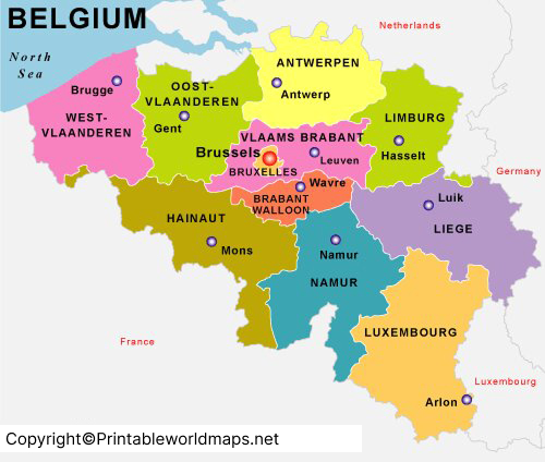
Belgium does not officially divide its territory into states in the same way as countries such as the United States. The appropriate administrative term is provinces.
Belgium has 10 provinces. The provinces are distributed across the Flemish Region and Walloon Region. The Brussels-Capital Region is separate and is not one of the 10 provinces.
10 Provinces of Belgium
Flemish Region
- Antwerp
- East Flanders
- Flemish Brabant
- Limburg
- West Flanders
Walloon Region
6. Hainaut
7. Liège
8. Luxembourg
9. Namur
10. Walloon Brabant
The official Belgium.be portal confirms that Belgium has ten provinces.
Labeled Map of Belgium with Cities
A Labeled Map of Belgium with Cities helps readers identify major urban areas and understand their locations within the country.
Important Belgian cities commonly shown on maps include:
- Brussels
- Antwerp
- Ghent
- Liège
- Leuven
- Bruges
- Namur
- Mons
- Charleroi
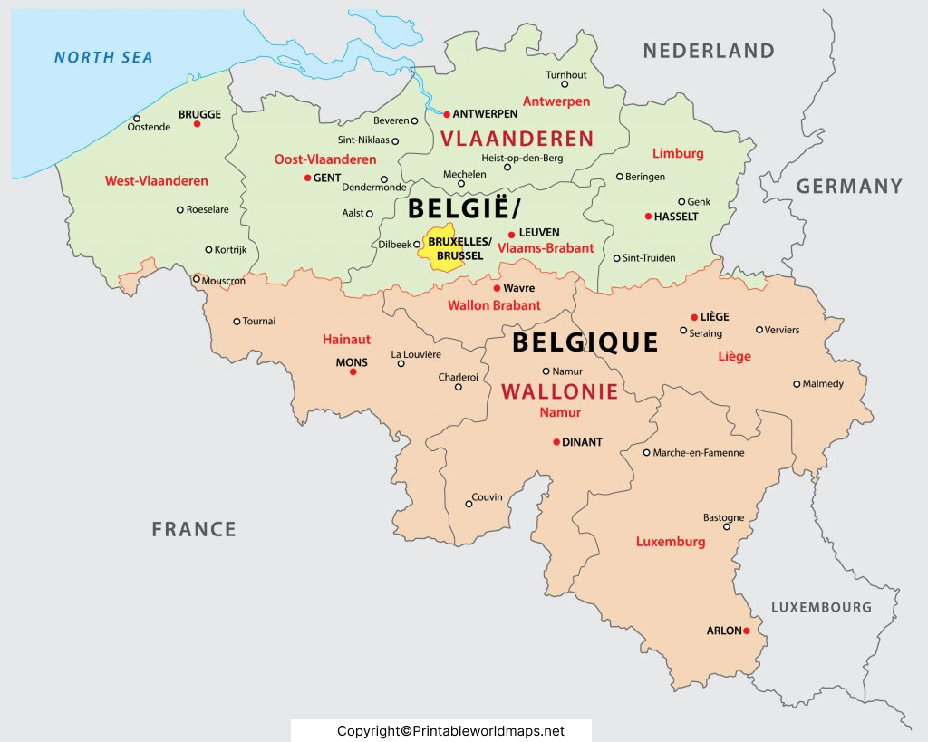
Labeled Belgium Map with Capital
The capital of Belgium is Brussels. Belgium’s official country profile identifies Brussels as the federal capital.
Brussels is also the capital of the Brussels-Capital Region, one of Belgium’s three regions. The Brussels-Capital Region has its own regional parliament and government.
Brussels is particularly important for understanding Belgium’s political and administrative geography. It is also a multilingual city within a country where Dutch, French and German are the three official national languages.
Brussels and Belgium’s Language Regions
Belgium has three official languages:
- Dutch
- French
- German
Belgium also has three language-based Communities: the Flemish Community, French Community and German-speaking Community. These Communities exist alongside the country’s three Regions: the Flemish Region, Brussels-Capital Region and Walloon Region.
Geography of Belgium
Belgium is located in Western Europe. It shares land borders with:
- Netherlands to the north
- Germany to the east
- Luxembourg to the southeast/east
- France to the south and west
Belgium also has a North Sea coastline.
Belgium’s geography can broadly be described through three major areas:
- Lower Belgium – generally below 100 meters
- Central Belgium – approximately 100–200 meters
- Upper Belgium – generally above 200 meters and extending to higher elevations
The official Belgium geographic description uses these three broad geographical areas.
Belgium Map: Regions, Provinces and Cities
One of the most useful ways to understand a Belgium map is to distinguish between its different administrative levels.
| Level | Number | Examples |
|---|---|---|
| Regions | 3 | Flemish, Walloon, Brussels-Capital |
| Provinces | 10 | Antwerp, Liège, Namur, Hainaut |
| Municipalities | 565 | Local administrative units |
Belgium.be states that the country has three Regions, 10 provinces and 565 municipal councils.
This makes a labeled map particularly useful for geography lessons because it allows readers to compare the country’s regional, provincial and urban geography.
Printable Labeled Map of Belgium
The printable maps on this page can be used for:
- Geography assignments
- Classroom activities
- Country research
- Travel planning
- Province identification
- City-location practice
- Map-labeling exercises
- General geographic reference
For educational use, readers can print a blank version and label the provinces, regions, capital and major cities themselves.
Belgium Map Learning Activity
Use the map to answer these questions:
- What is the capital of Belgium?
- How many provinces does Belgium have?
- Which countries border Belgium?
- Which three regions make up Belgium?
- What are Belgium’s three official languages?
- Which province contains Antwerp?
- Where is Brussels located?
- What is Belgium’s highest point?
This makes the page more useful for students instead of serving only as an image-download page.
Interesting Facts About Belgium
- Belgium is located in Western Europe.
- Brussels is the federal capital.
- Belgium has three regions.
- Belgium has 10 provinces.
- Belgium has three official languages: Dutch, French and German.
- Belgium’s highest point is Signal de Botrange at 694 meters.
- Belgium had 11,867,634 inhabitants on 1 January 2026, according to Statbel.
- Belgium’s geography includes lower, central and upper areas with different elevations.
Frequently Asked Questions
What is the capital of Belgium?
Brussels is the federal capital of Belgium. Belgium
How many provinces are there in Belgium?
Belgium has 10 provinces.
How many regions does Belgium have?
Belgium has three regions: the Flemish Region, Brussels-Capital Region and Walloon Region.
What are the official languages of Belgium?
The three official national languages are Dutch, French and German.
What countries border Belgium?
Belgium shares land borders with the Netherlands, Germany, Luxembourg and France. It also has a coastline on the North Sea.
What is the highest point in Belgium?
The highest point is Signal de Botrange, which is 694 meters high.
What is the population of Belgium?
Statbel reports 11,867,634 inhabitants as of 1 January 2026.
Is Brussels a province of Belgium?
No. Brussels is the federal capital and forms the Brussels-Capital Region. It is separate from Belgium’s 10 provinces.
Why is a labeled map of Belgium useful?
A labeled map helps users quickly identify Belgium’s capital, provinces, cities, regions and geographical position. It is particularly useful for education, research and map-based learning.
Reference Links
https://www.belgium.be/en/about_belgium/country/belgium_in_nutshell/filing_card_belgium
https://www.belgium.be/en/about_belgium/country/geography
https://www.belgium.be/en/about_belgium/government/regions
https://www.belgium.be/en/about_belgium/government/provinces
https://www.belgium.be/en/about_belgium/government/federale_staat
https://statbel.fgov.be/en/themes/population/population-movement
