
A Labeled Map of Rhode Island makes it easier to identify the state’s capital, major cities, counties, waterways, and geographic location within New England. Rhode Island is the smallest U.S. state by land area and is known for its extensive coastline and Narragansett Bay. The state capital and largest city by population is Providence.
This collection of Rhode Island maps is useful for students, teachers, researchers, travelers, and anyone looking for a clear geographic reference. You can use the maps to locate Providence, Warwick, Cranston, Pawtucket, Newport, and other communities, as well as understand the state’s surrounding geography.
Labeled Map of Rhode Island
A Labeled Map of Rhode Island provides a visual reference for the state’s location, boundaries, cities, waterways, and major geographic features. Rhode Island is located in the southeastern part of New England and borders Connecticut and Massachusetts. It also has a maritime boundary with New York.
The state’s geography is strongly influenced by water. Narragansett Bay extends inland from the Atlantic Ocean, while the state’s coastal landscape includes numerous bays, islands, and inlets. Rhode Island has about 1,531 square miles of total area, including land and water, according to the Rhode Island Department of Environmental Management.
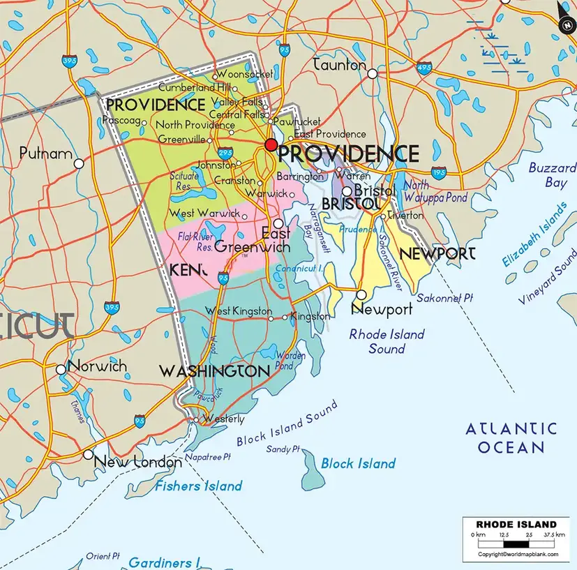
Rhode Island Map: Key Facts
- Capital: Providence
- Largest city by population: Providence
- State: Rhode Island
- Region: New England
- Land area: 1,033.89 square miles
- 2020 Census population: 1,097,379
- 2025 population estimate: 1,114,521
- Population density: 1,061.4 people per square mile based on 2020 Census data
- Official nickname: The Ocean State
- Counties: 5
- Municipalities: 39 cities and towns
- Major bay: Narragansett Bay
The Census Bureau reports Rhode Island’s 2025 population estimate at 1,114,521, compared with 1,097,379 in the 2020 Census.
Printable Map of Rhode Island Labeled
A Printable Map of Rhode Island can be useful for classroom activities, geography assignments, study materials, travel planning, and reference purposes.
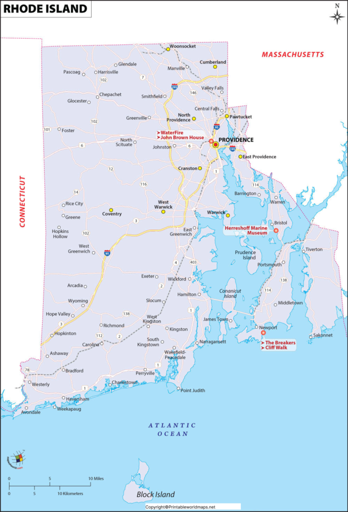
Rhode Island has five counties:
- Bristol County
- Kent County
- Newport County
- Providence County
- Washington County
Current Census geographic data confirms these five Rhode Island counties.
An important geographic detail is that Rhode Island has no county government structure. Local government is organized through the state’s 39 municipalities.
Labeled Map of Rhode Island with Cities
A Labeled Map of Rhode Island with Cities helps users locate major population centers and understand how Rhode Island’s communities are distributed across the state.
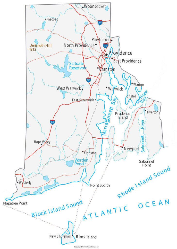
Some of the state’s well-known cities include:
- Providence
- Warwick
- Cranston
- Pawtucket
- East Providence
- Woonsocket
- Newport
- Central Falls
Providence is the state’s capital and largest city by population.
Labeled Rhode Island Map with Capital
The Labeled Rhode Island Map with Capital identifies Providence, the state capital, and provides a useful reference for understanding its location within Rhode Island.
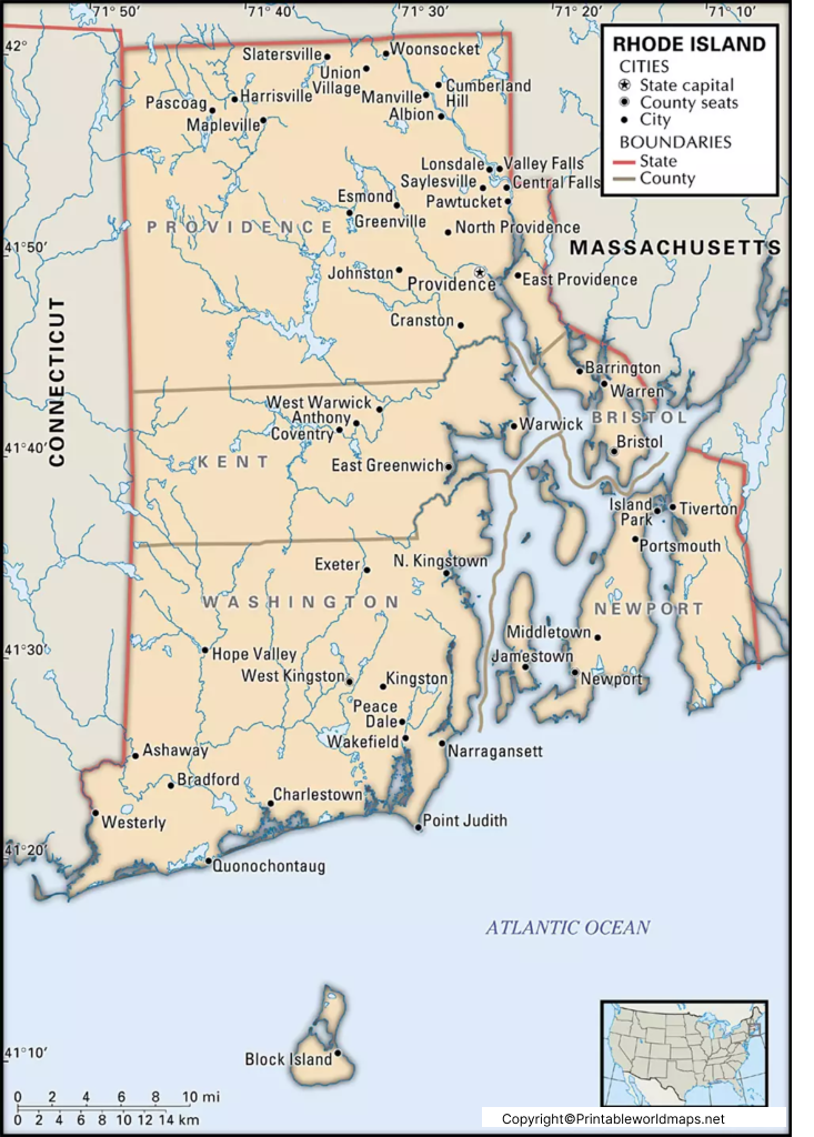
Providence was founded in 1636 and is located in Providence County. The official Rhode Island government website identifies Providence as both the state capital and the state’s largest city by population.
Rhode Island Counties on the Map
The five counties shown on a Rhode Island county map are Bristol, Kent, Newport, Providence, and Washington. Providence County is the most populous of the five based on the 2020 Census, with 660,741 residents.
| County | 2020 Census Population |
|---|---|
| Providence County | 660,741 |
| Kent County | 170,363 |
| Washington County | 129,839 |
| Newport County | 85,643 |
| Bristol County | 50,793 |
These figures are from the 2020 Decennial Census and should not be confused with newer population estimates.
Major Geographic Features of Rhode Island
A Labeled Map of Rhode Island can also help identify the state’s major geographic features.
Narragansett Bay
Narragansett Bay is one of Rhode Island’s defining geographic features. It extends inland from the Atlantic Ocean and strongly influences the state’s coastline and geography.
Rhode Island Coastline
Rhode Island has a substantial shoreline relative to its small size. Rhode Island’s official government resources report approximately 384 miles of shoreline, based on NOAA shoreline data.
New England Location
Rhode Island is part of the New England region and is bordered by Connecticut and Massachusetts. Its position on the Atlantic coast has historically contributed to its importance as a maritime and commercial region.
Interesting Facts About Rhode Island
- Rhode Island is the smallest U.S. state by land area.
- Its official nickname is “The Ocean State.”
- Providence is the state capital and largest city by population.
- Rhode Island has five counties but no county-level government structure.
- The state has 39 municipalities.
- Rhode Island’s 2020 Census population was 1,097,379.
- The Census Bureau estimated the state’s population at 1,114,521 on July 1, 2025.
- Rhode Island has a maritime boundary with New York.
How to Use a Labeled Map of Rhode Island
A Labeled Map of Rhode Island can be useful for:
- Geography homework and classroom activities
- Identifying Rhode Island’s capital and cities
- Learning the state’s five counties
- Understanding Rhode Island’s location in New England
- Planning educational projects
- Studying state geography
- Printing a reference map for offline use
- Comparing Rhode Island’s geography with neighboring states
Frequently Asked Questions
What is the capital of Rhode Island?
Providence is the capital of Rhode Island. It is also the state’s largest city by population.
What is the smallest state in the United States?
Rhode Island is the smallest U.S. state by land area.
How many counties are in Rhode Island?
Rhode Island has five counties: Bristol, Kent, Newport, Providence, and Washington.
Does Rhode Island have county governments?
No. Rhode Island has five counties, but it does not have a county government structure. Its local government is organized through 39 municipalities.
What are the major cities in Rhode Island?
Major Rhode Island cities include Providence, Warwick, Cranston, Pawtucket, East Providence, Woonsocket, Newport, and Central Falls.
What is Rhode Island’s nickname?
Rhode Island’s official nickname is “The Ocean State.”
What states border Rhode Island?
Rhode Island has land borders with Connecticut and Massachusetts. It also has a maritime boundary with New York.
What is the population of Rhode Island?
The 2020 Census recorded 1,097,379 residents, while the U.S. Census Bureau estimated 1,114,521 residents as of July 1, 2025.
Where is Providence located?
Providence is located in northeastern Rhode Island in Providence County. It serves as the state’s capital.
Why is Rhode Island called the Ocean State?
The nickname reflects Rhode Island’s extensive coastline and the important role of Narragansett Bay and the Atlantic Ocean in the state’s geography and history.
Reference Links
https://www.census.gov/quickfacts/fact/table/RI/RHI125221
https://dem.ri.gov/environmental-protection-bureau/air-resources/climatology/climate-rhode-island
https://www.ri.gov/facts/history.php
https://tigerweb.geo.census.gov/tigerwebmain/Files/acs26/tigerweb_acs26_county_ri.html









