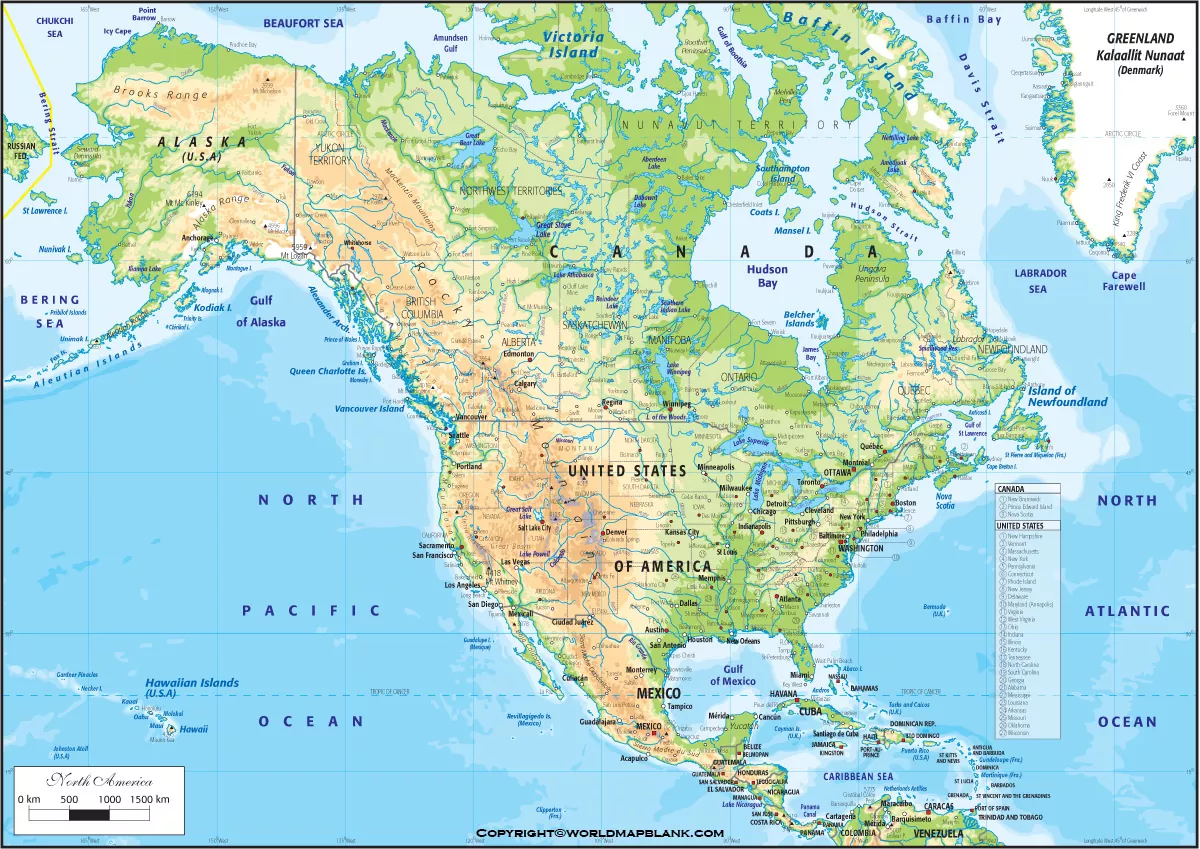
North America Physical Map format is available here for all the learning enthusiasts of North America’s physical geography. We are also offering the printable template of the map so as to help our readers in their learnings.
Contents
North America Physical Map
North America is a continent that is primarily located in the Northern Hemisphere. It’s the third-largest continent in terms of its total land area and the fourth in population terms. The continent comprises 17% of the world’s total land area and nearly 8% of the world’s population.

North America is home to some of the most well-known and influential countries in the world. It includes the USA, Mexico, Cuba, Canada, Dominican Republic, etc. The USA and Canada are the major countries of the continent that contain over 60% of the total share of the continent. The majority of the North American countries are highly developed and urbanized just like Europe.
Printable North America Physical Map
In fact, the majority of North Americans speak the same language as the Europeans and share a similar culture as well.

North America in its geographical context contains the plain, mountainous west, Canadian shield, and the Caribbean regions. Furthermore, the continent is bounded by the pacific ocean, Caribbean sea, arctic ocean, and Atlantic ocean on its various sides. It shares its land connection only with South America and closely connected to the region.
Map of North America Physical

The physical map of North America is all about showing up the physical geography of the continent. We highly recommend this map to the users who are willing to learn and explore the overall geography of the continent. The map shows up the whole physical geography of the continent in a systematic manner. For instance, you can check out the whole North American physical landscape with its physical map. It includes the mountains, oceans, lakes, rivers, etc from one country of North America to the other.
Physical Map of North America Labeled
Well, we are here providing the readily usable printable template of North America’s physical map. Readers can easily use the template just like the physical map of the continent. The template will guide them in exploring the overall physical geography of the continent and looking into the special details of country-specific geography.

All our templates have a high-definition format so as to provide a crystal clear physical geography view of North America’s physical geography. Feel free to get the template in the digital format as well to digitally learn North America’s physical geography.


