
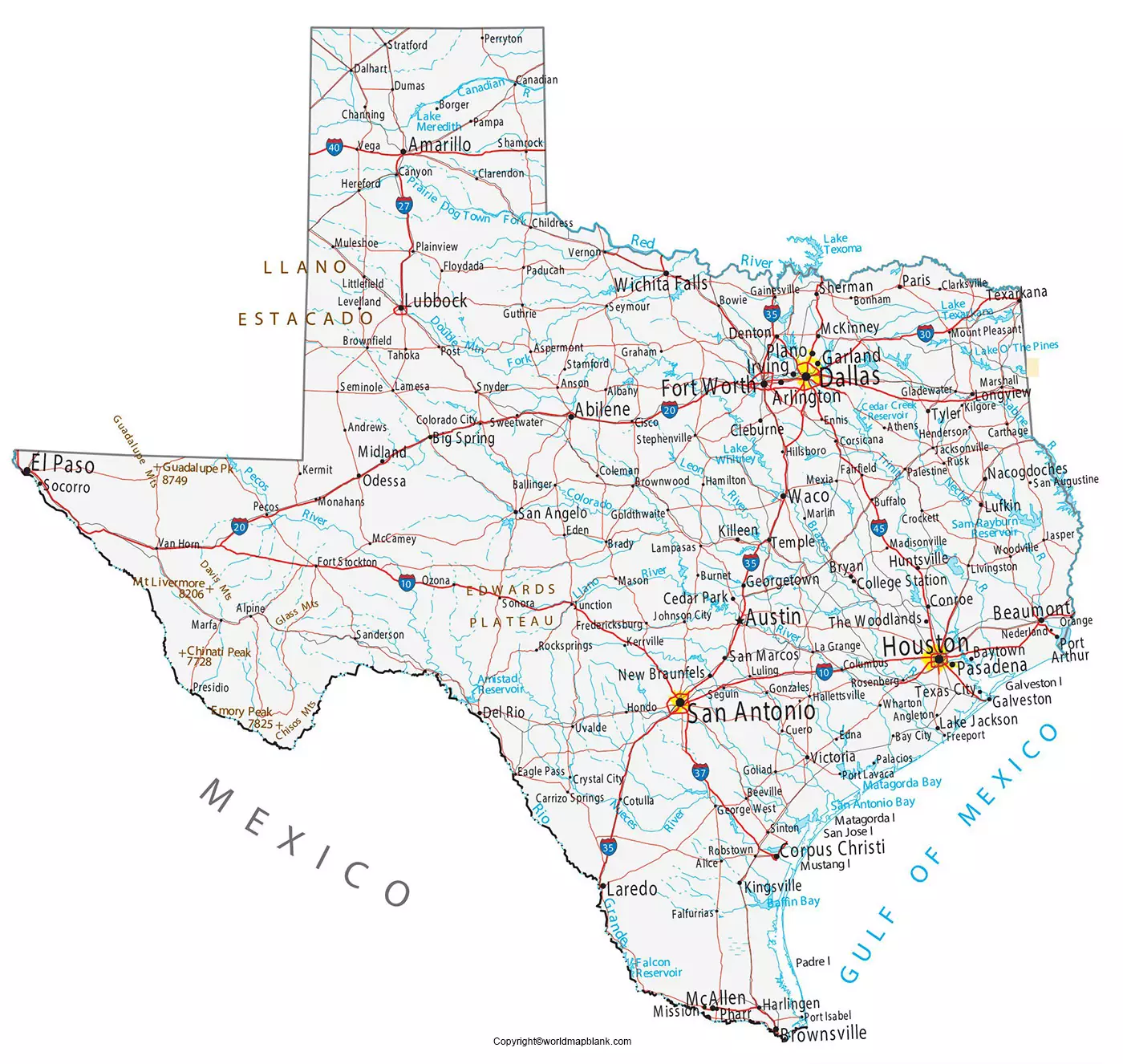

Labeled Map of Texas helps students, teachers, travelers, researchers, and anyone interested in U.S. geography identify Texas’s capital, major cities, counties, rivers, borders, and other important geographic features. The maps below are provided in image and printable PDF formats for convenient study and reference.
Texas is located in the south-central United States and borders New Mexico, Oklahoma, Arkansas, and Louisiana. It also shares an international border with Mexico and has a coastline along the Gulf of Mexico.
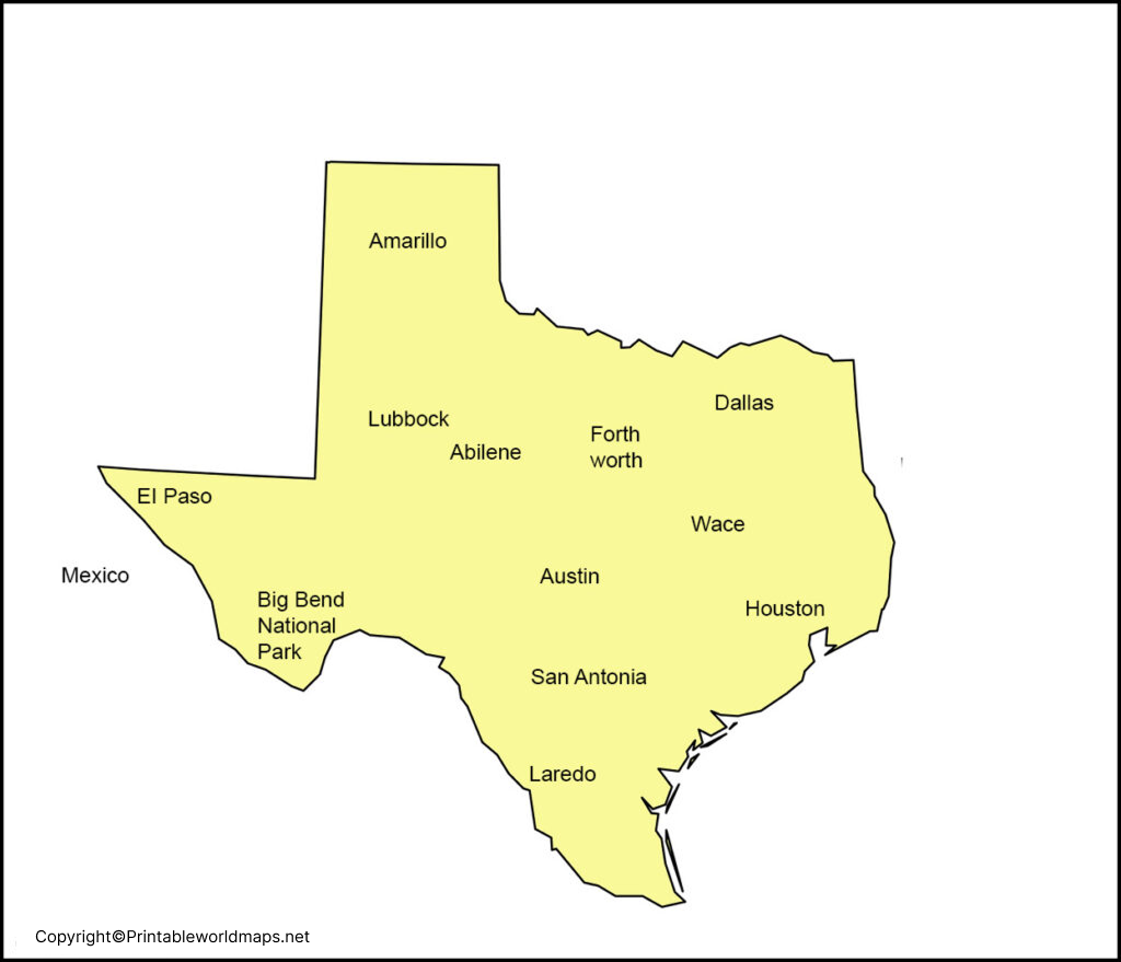
Labeled Map of Texas
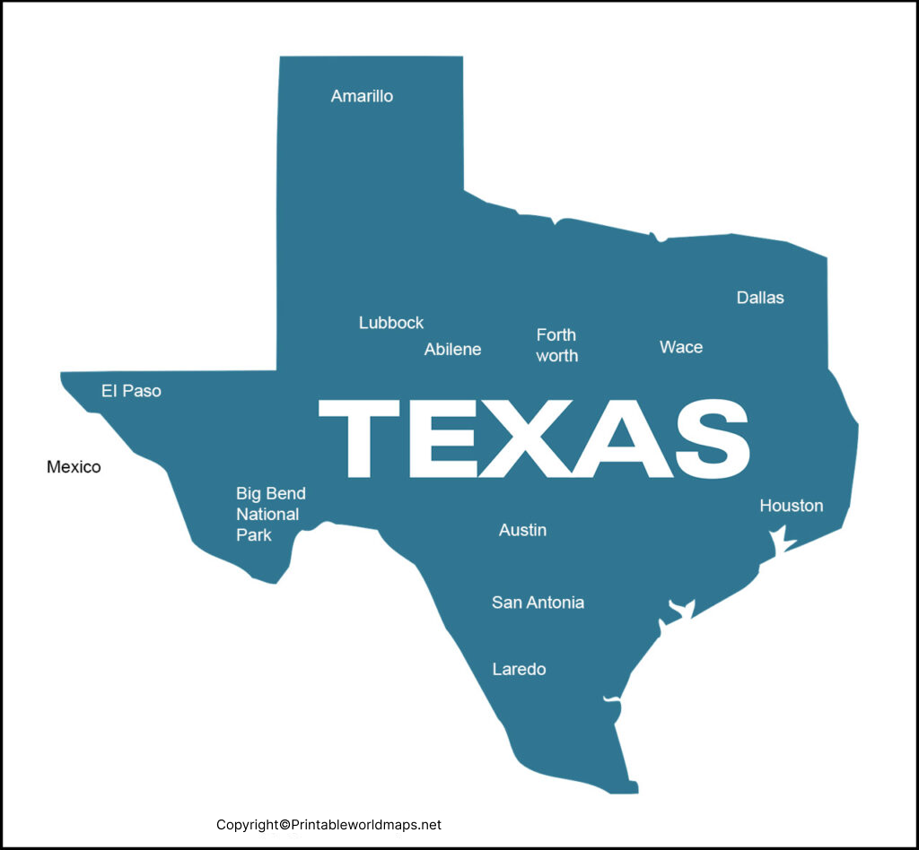
A labeled map makes it easier to locate Austin, Houston, San Antonio, Dallas, Fort Worth, El Paso, Corpus Christi, and other major Texas cities. Depending on the map, additional features may include county boundaries, highways, rivers, lakes, and surrounding states.
Texas has 254 counties, more than any other U.S. state. The state is also known for its large geographic area and varied landscapes, ranging from the Gulf Coast and Piney Woods to the Hill Country, Great Plains, and desert regions of West Texas.
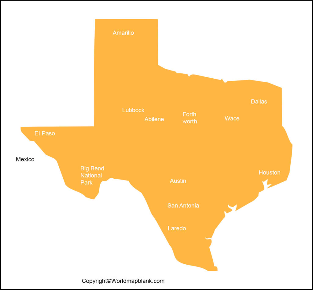
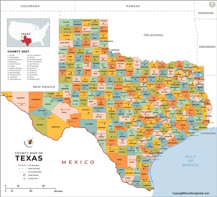
Printable Map of Texas Labeled
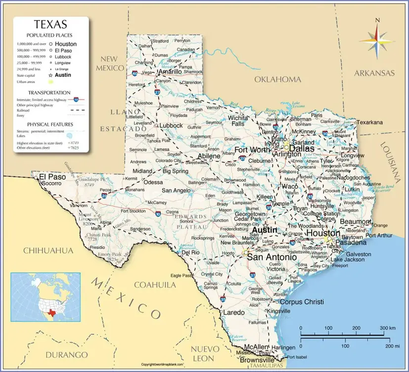
A printable map is useful for classroom activities, geography assignments, trip planning, state studies, and general reference. A labeled version can help users identify geographic locations without having to add city or state names manually.
For best printing results, use the PDF version when available because it can provide a cleaner printable format than a compressed web image.
Labeled Map of Texas with Cities
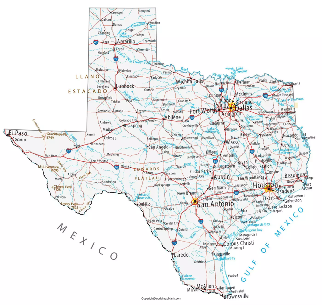
Texas contains several of the largest cities in the United States. According to the U.S. Census Bureau’s Vintage 2025 population estimates, the four Texas cities among the 15 most populous U.S. cities were Houston, San Antonio, Dallas, and Austin.
The Census Bureau estimated the July 1, 2025 populations of these cities at approximately:
- Houston: 2,397,315
- San Antonio: 1,548,422
- Dallas: 1,329,491
- Austin: 1,002,632
These estimates are newer than the older population figures previously listed on this page and should be used when presenting current city population information.
Labeled Texas Map with Capital
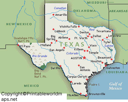
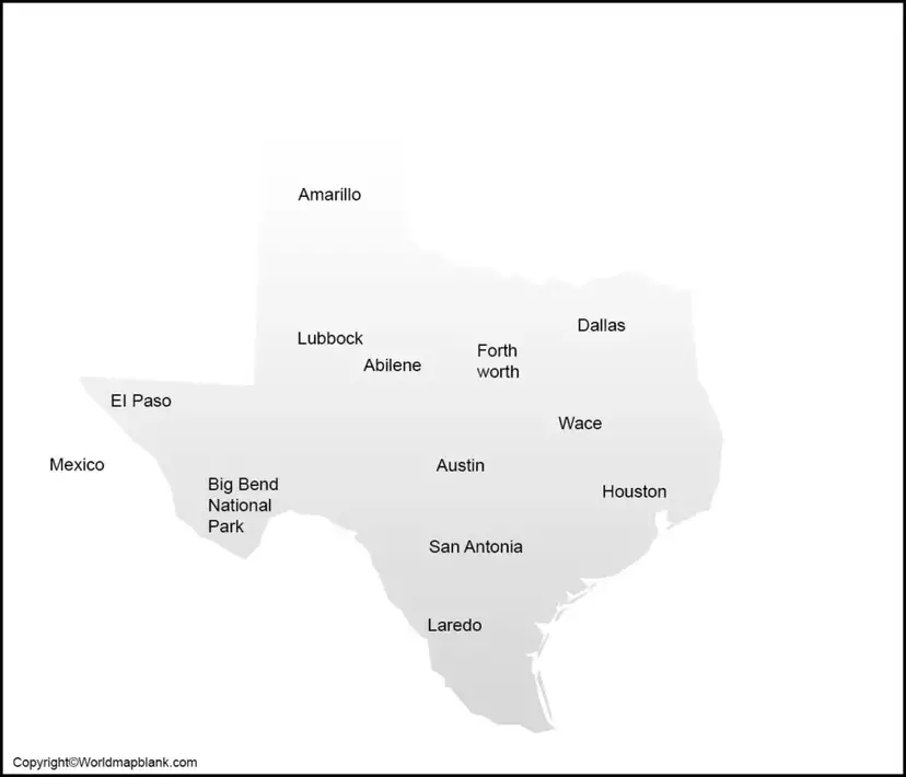
Labeled Texas with capital shows that the capital city of Texas state is Austin. It is recognized as the seat of Travis County and is located at the point at which the River Colorado crosses the Balcones Escarpment. It is in the south-central region of the state about eighty miles or 130 kilometers northeast of San Antonio.
The capital of Texas is Austin. Austin is located in Central Texas and serves as the seat of Travis County. A capital map helps users quickly identify Austin’s position within the state and understand its relationship to surrounding cities and regions.
The Austin area is part of the Austin-Round Rock-San Marcos metropolitan region. The Texas Comptroller’s 2025 regional snapshot reports that the broader 10-county Capital Region includes Bastrop, Blanco, Burnet, Caldwell, Fayette, Hays, Lee, Llano, Travis, and Williamson counties.
Texas Map with Major Cities and Geographic Features
A detailed Texas map can help identify important geographic features such as:
- Austin, the state capital
- Houston, San Antonio, Dallas, and Fort Worth
- El Paso and other major cities
- Texas’s 254 counties
- The Rio Grande along much of the Texas-Mexico border
- The Gulf of Mexico coastline
- Major rivers and lakes
- Interstate highways and other transportation routes
- Neighboring states and Mexico
The exact features shown depend on the individual map, so readers should check the map legend when using it for detailed geographic work.
Texas Population and Geographic Facts
Texas had a population of 29,145,505 in the 2020 Census. The U.S. Census Bureau’s latest completed Vintage 2025 estimate places the state’s population at 31,709,821 as of July 1, 2025.
Texas is divided into 254 counties and has a diverse geography covering large portions of the southern United States. Its location along the Gulf of Mexico and its international border with Mexico make Texas an important geographic region for transportation, commerce, and cross-border activity.
For current population figures, use Census Bureau estimates rather than older figures that may appear on previously published maps.
Why Use a Labeled Map of Texas?
A labeled map can be useful for several purposes:
Education: Students can identify cities, counties, borders, and physical features while studying Texas geography.
Travel planning: Travelers can use city and highway information to understand the relative locations of major destinations.
Teaching: Teachers can use printable maps for worksheets, classroom exercises, quizzes, and geography projects.
Research: Researchers and writers can use geographic maps as a visual reference when discussing locations within Texas.
General reference: A clearly labeled map provides a quick way to locate cities, the state capital, counties, and surrounding regions.
Texas Map for Students and Teachers
Students can use a printable Texas map to practice locating Austin, major cities, neighboring states, counties, rivers, and other geographic features.
Teachers can also use blank and labeled versions together. A labeled map can be used to introduce locations, while a blank map can be used for classroom tests, assignments, or practice activities.
Frequently Asked Questions About the Labeled Map of Texas
What is the capital of Texas?
Austin is the capital of Texas. It is located in Central Texas and is the seat of Travis County.
How many counties are in Texas?
Texas has 254 counties, the highest number of counties of any U.S. state.
What are the largest cities in Texas?
Houston, San Antonio, Dallas, and Austin are among the largest Texas cities by population. The U.S. Census Bureau’s Vintage 2025 estimates provide the latest completed set of city population estimates.
What states border Texas?
Texas borders New Mexico, Oklahoma, Arkansas, and Louisiana. Texas also shares an international border with Mexico.
Does Texas have a coastline?
Yes. Texas has a coastline along the Gulf of Mexico.
What river forms much of the Texas-Mexico border?
The Rio Grande forms a substantial portion of the international boundary between Texas and Mexico.
Can I print the Texas map?
Yes. Printable PDF versions can be provided for the individual maps on this page where available. PDF files are generally preferable for printing.
What can I find on a labeled Texas map?
Depending on the map, you may find the state capital, major cities, county boundaries, rivers, lakes, highways, neighboring states, and other geographic features.
Interesting Facts About Texas
- Texas has 254 counties.
- Austin is the state capital.
- Houston was the most populous Texas city in the Census Bureau’s 2025 city estimates.
- Texas borders four U.S. states and Mexico.
- The state has a coastline on the Gulf of Mexico.
- Texas’s 2025 estimated population was more than 31.7 million.
- Texas contains several of the largest cities in the United States.
Reference Links
https://www.census.gov/quickfacts/fact/table/TX/RTN130222
https://www.census.gov/data/tables/time-series/demo/popest/2020s-total-cities-and-towns.html
https://comptroller.texas.gov/transparency/local/counties.php
https://comptroller.texas.gov/economy/economic-data/regions/2025/capital.php
