

A Printable Blank Map of Samoa is a useful resource for students, teachers, geography enthusiasts, and anyone learning about the islands of the South Pacific. Use these blank outline maps, printable worksheets, transparent PNG images, and PDF versions to study Samoa’s island geography, identify locations, and practise map-labeling activities.
Samoa is an island country in Polynesia in the South Pacific Ocean. Its two largest islands are Upolu and Savai’i, and its capital, Apia, is located on Upolu. These maps can help learners understand the country’s shape, the arrangement of its islands, and its location in the Pacific region.
Blank Map of Samoa – Outline
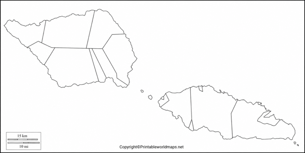
Use the blank outline map of Samoa to explore the country’s geographical shape and island arrangement. An outline map is especially helpful for classroom activities, geography homework, map-labeling exercises, and educational projects.
Samoa consists of two main islands, Upolu and Savai’i, together with smaller islands and islets. Its volcanic origins have shaped much of its landscape, including mountainous interiors, coastal plains, and distinctive geological features.
Apia, the national capital, is situated on the northern coast of Upolu. Savai’i, the largest island, is known for its volcanic landscapes, lava fields, and Mount Silisili, the country’s highest peak.

Students can print the outline and label the major islands, capital city, surrounding ocean, and other geographical features. Teachers can also use it to prepare quizzes, revision sheets, and classroom assignments.
Printable Map of Samoa
A printable map of Samoa provides a convenient way to study the country’s geography without having to draw its outline from scratch. Download the available image or PDF and use it for school projects, geography lessons, or independent learning.

Before printing, check the page orientation and print preview to ensure that the map fits properly on the paper. Choose a suitable scale so that island outlines and any included labels remain readable.
For a classroom activity, students can mark Upolu and Savai’i, locate Apia if the map includes sufficient detail, and describe the islands’ positions relative to one another.
Transparent PNG Blank Map of Samoa
A transparent PNG map is useful when you want to place a map over another background without displaying a solid rectangular image behind it. Depending on the image file, transparency can make the map easier to incorporate into presentations, worksheets, educational posters, and digital geography projects.

A transparent PNG is particularly useful for combining an island outline with colored backgrounds, labels, or educational annotations. Check the actual image before using it, as transparency depends on how the file was created and exported.
For accurate geographical study, use a map that clearly shows the island outlines. Do not assume that a blank outline identifies every mountain, volcano, coastline feature, or elevation; these details require a sufficiently detailed physical or topographic map.
Map of Samoa for Practice Worksheet
A map worksheet helps students develop their geographical knowledge through repeated practice. Rather than simply reading place names, learners can identify islands, add labels, answer questions, and compare their work with a reliable reference map.
Suggested map practice activities
- Locate and label Upolu and Savai’i.
- Mark Apia, the capital of Samoa, if the worksheet provides enough detail.
- Identify the Pacific Ocean surrounding the islands.
- Research Mount Silisili and note which island it is located on.
- Write two differences between a blank outline map and a physical map.
- Compare your answers with an authoritative geographical reference.
These activities can be adapted for different grade levels. Younger learners may focus on identifying the main islands, while older students can research volcanic landforms, settlement patterns, and the relationship between geography and human activity.
Geography Facts About Samoa
The following facts provide additional context for anyone using a Samoa map for study or research.
| Geographical detail | Information |
|---|---|
| Country | Independent State of Samoa |
| Region | Polynesia, South Pacific Ocean |
| Capital | Apia |
| Two main islands | Upolu and Savai’i |
| Official languages | Samoan and English |
| Land area | Approximately 2,830 square kilometres |
| Highest peak | Mount Silisili, on Savai’i |
| Island origin | Volcanic |
These geographical details are consistent with published information from the Samoa Bureau of Statistics and other official geographical resources. Population figures vary by reference year, so consult the latest national census or official statistical release when you need a current population estimate.
How to Use a Blank Map of Samoa
A blank map can support a variety of educational and creative activities.
- For students: Practise labeling islands, locating the capital, and learning basic geographical terminology.
- For teachers: Create printable tests, classroom exercises, and revision materials.
- For presentations: Add labels, arrows, and explanatory notes to a suitable PNG image.
- For geography projects: Compare an outline map with a labeled political map or a physical map.
- For independent learning: Use an atlas or authoritative online source to check the accuracy of your answers.
Choosing the right map format
PNG: Suitable for digital worksheets, presentations, and image editing.
PDF: Convenient for printing and distributing classroom materials while preserving page layout.
Blank outline: Best for labeling exercises and geography tests.
Labeled reference map: Best for checking place names and verifying answers.
Always review the map’s level of detail before using it for a specific assignment. A simplified outline may be suitable for identifying the main islands but may not be accurate enough for detailed navigation or topographic analysis.
Frequently Asked Questions
1. What is a blank map of Samoa used for?
A blank map of Samoa is used for geography homework, classroom exercises, island-labeling activities, educational presentations, and independent study.
2. Can I print a blank map of Samoa?
Yes. You can use the available PNG image for image-based printing or download the PDF version when provided. Check the print preview and page size before printing.
3. What is the capital city of Samoa?
Apia is the capital city of Samoa. It is located on the island of Upolu.
4. What are the two main islands of Samoa?
The two main islands are Upolu and Savai’i. Upolu contains the capital, Apia, while Savai’i is the country’s largest island.
5. What is the difference between a PNG map and a PDF map?
PNG is an image format suitable for digital editing and inserting into documents. PDF is a document format that is convenient for printing and sharing while preserving page layout.
6. What is a transparent PNG map?
A transparent PNG map is an image that can have transparent areas around the map outline, allowing it to be placed over another background. Verify that the specific file actually contains transparency.
7. Which geographical features can I label on a Samoa outline map?
Depending on the map’s detail, you may label Upolu, Savai’i, Apia, the surrounding Pacific Ocean, and selected physical features such as Mount Silisili. Use a detailed reference map to verify locations.
8. Where can I find reliable geographical information about Samoa?
The Samoa Bureau of Statistics, Samoa Tourism Authority, and United Nations Statistics Division are useful starting points for checking geographical and statistical information.
Reference links
https://www.samoa.travel/discover/the-islands-of-samoa
https://www.samoa.travel/discover/the-islands-of-samoa/upolu-island/apia
