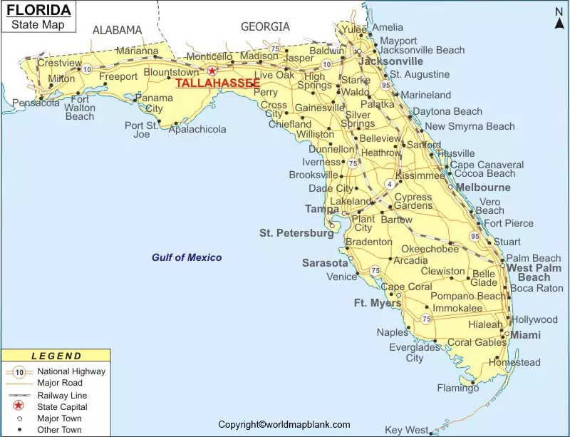
Florida Labeled Map enables the user to find out the details of Florida state and its location in the US. It reveals about the state boundaries surrounding Florida. Besides, it is possible to learn about the location of the state capital, Tallahassee. Other details, such as populated places and major cities, lakes and rivers, principal and interstate highways and railroads, can be found out from the labeled map of Florida.
Contents
Labeled Map of Florida
This US state is recognized as an internationally well-known place situated in the southeastern region in the US. The nickname for Florida state is known as, The Sunshine State. This important state has occupied a long flat peninsula between the Atlantic Ocean, in the east and in the west, Gulf of Mexico. The state is bordered in the north by the states of Georgia and Alabama. On 3rd March, 1845, the state was admitted to the Union as the 27th state. The Sunshine State of Florida has a population of 21.48 million as estimated by the US Census Bureau.
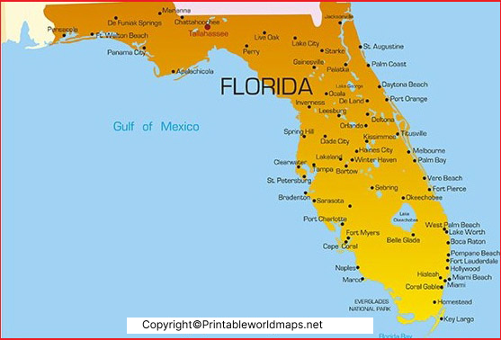
Major rivers that flow in the state, include the Caloosahatchee River, Myakka River, Peace River, Kissimmee River, Hillsborough River, Econlockhatchee River, Withlacoochee River, Saint Johns River, Nassau River, Santa Fe River, Suwannee River, Wakulla River, Apalachicola River, and Escambia River. The names of the large rivers include the Apalachicola River, the Escambia River, the Choctawhatchee, and St. Johns Rivers.
Labeled Map of Florida Printable
The land area occupied by the state of Florida is 170,304 square kilometers. Religions followed, including Christianity, Protestantism, Evangelical Protestant, Mainline Protestant, Historically Black Protestant, Catholicism, and Mormonism.
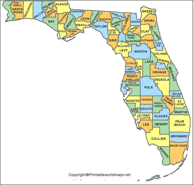
As a part of the labeled map of Florida with states, this state is divided into sixty-seven counties. Climatically, it is bifurcated into two regions. The entire land is divided into four main regions. They include the Florida Keys, the swampy Everglades in the far south, the upland or hilly area in the north and northwest, and the Gulf Coast or Atlantic Ocean coastal plains.
Labeled Florida Map with Cities
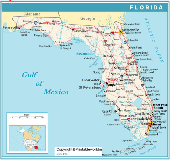
Through the labeled map of Florida with cities, Florida state has 282 cities, 109 towns and twenty villages. The state has 411 incorporated municipalities. All these municipalities are distributed across sixty-seven counties in addition to sixty-six county governments. However, it can be seen that Jacksonville is the only consolidated city-county government in the state. Some of the names of major cities in Florida state, include Miami, Tampa, Orlando, St. Petersburg, and Hialeah. The most populous city is Jacksonville, apart from the capital city, Tallahassee.
Labeled Florida Map with Capital
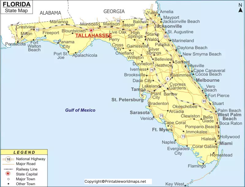
The labeled Florida map with capital shows that Tallahassee is situated in the central region of Florida and is located in the midway between Jacksonville in the east, and Pensacola in the west. This city is considered as a recognized trade distribution point for all the surrounding regions consisting of agriculture, livestock, and lumbering activities. Besides, other important activities of a business in this city, include publishing and printing, production of electronic equipment, and metal products.

