
A Blank Map of Kentucky is a useful resource for students, teachers, homeschoolers, researchers, and anyone who needs to study or label the geography of Kentucky. Kentucky is a U.S. state in the East South Central region, with Frankfort as its capital and Louisville as its largest city by population.
Kentucky is bordered by Illinois, Indiana, Ohio, West Virginia, Virginia, Tennessee, and Missouri. The Ohio River forms much of Kentucky’s northern boundary, while the Mississippi River forms part of its western boundary.
The maps below provide different formats, including an outline map, printable map, transparent PNG, and practice worksheet. These resources can be used for classroom activities, geography assignments, presentations, and personal study.
Blank Map of Kentucky – Outline
This Blank Map of Kentucky shows the general outline and shape of the state without unnecessary geographic labels. It can be used as a base map for identifying cities, counties, rivers, mountain areas, neighboring states, and other geographic features.
Kentucky has a distinctive shape and is bordered by seven states. The Ohio River forms a large part of the northern boundary, separating Kentucky from Ohio, Indiana, and Illinois. The Mississippi River forms part of the western boundary with Missouri.
The eastern part of Kentucky includes the Appalachian region, while the central and western portions contain different landscapes and geographic regions.
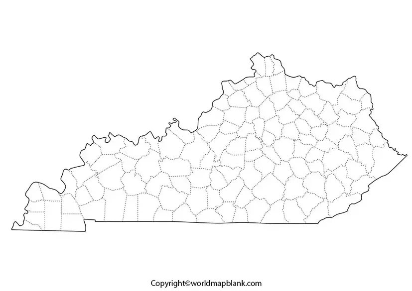
A printable outline map can be especially helpful for geography practice. Students can print the map and label Kentucky’s neighboring states, major cities, rivers, and physical features.
What Can You Label on a Blank Kentucky Map?
A blank map can be used to practice identifying:
- Frankfort, the state capital
- Louisville
- Lexington
- Bowling Green
- Owensboro
- Covington
- Major rivers
- Appalachian Mountains
- Neighboring states
- Counties and county seats
- Important geographic regions
This makes the Blank Map of Kentucky useful for classroom quizzes, homework, geography projects, and map-drawing exercises.
Printable Map of Kentucky
A printable Kentucky map provides a convenient way to study the state’s geography away from a computer or phone. The map can be printed on standard paper and used for school projects, worksheets, presentations, and personal reference.
For educational use, students can print multiple copies and create different exercises. For example, one copy can be used to identify cities, another for rivers, and another for neighboring states.
Transparent PNG Blank Map of Kentucky
A transparent PNG is useful when a Kentucky outline needs to be placed over another design, presentation, worksheet, or educational graphic.
Because the background is transparent, users can place the Blank Map of Kentucky over different background colors or images without having to remove a white background manually.
It can be useful for:
- PowerPoint presentations
- Classroom materials
- Geography worksheets
- Digital educational projects
- Map labeling exercises
- Educational websites and graphics
Always check the applicable usage and copyright terms before using map images for commercial purposes.
Kentucky Map worksheets for Practice

A Kentucky map worksheet can turn an outline map into an interactive geography activity. Students can use the worksheet to identify important locations, geographic features, and neighboring states.
Teachers can create exercises such as:
- Label Kentucky’s seven neighboring states.
- Mark Frankfort on the map.
- Locate Louisville and Lexington.
- Identify the Ohio and Mississippi Rivers.
- Mark the Appalachian region.
- Add major cities.
- Color different geographic regions.
- Draw and label important rivers.
These activities can help students develop map-reading and geographic identification skills.
Kentucky Geography Facts
Understanding a few basic facts makes a Blank Map of Kentucky more useful for geography study.
| Fact | Information |
|---|---|
| State | Kentucky |
| Capital | Frankfort |
| Largest city | Louisville |
| Region | East South Central United States |
| Admission to Union | June 1, 1792 |
| Statehood | 15th state |
| Nickname | The Bluegrass State |
| Highest point | Black Mountain |
| Major river | Ohio River |
| Western boundary | Mississippi River |
| Time zones | Eastern and Central |
| Neighboring states | 7 |
For authoritative information about Kentucky’s government and geography, users can consult the official Commonwealth of Kentucky website and U.S. government resources.
Kentucky Bordering States
Kentucky shares land or river boundaries with seven states:
- Illinois
- Indiana
- Ohio
- West Virginia
- Virginia
- Tennessee
- Missouri
The Ohio River is particularly important because it forms much of Kentucky’s northern boundary. The Mississippi River forms part of the western boundary.
This makes a blank outline map particularly useful for practicing the location of Kentucky within the central and eastern United States.
Major Cities in Kentucky
A Blank Map of Kentucky can also be used to practice locating the state’s major population centers.
Louisville
Louisville is Kentucky’s largest city by population and is located along the Ohio River in the northern part of the state.
Lexington
Lexington is one of Kentucky’s major cities and is widely associated with the state’s Bluegrass region and horse industry.
Bowling Green
Bowling Green is located in south-central Kentucky and is an important regional center.
Owensboro
Owensboro is located along the Ohio River in western Kentucky.
Covington
Covington is located in northern Kentucky across the Ohio River from Cincinnati, Ohio.
Kentucky Rivers and Physical Geography
Rivers are an important part of Kentucky’s geography and are useful features to label on a blank map.
The Ohio River forms much of the northern boundary of the state. The Mississippi River forms part of Kentucky’s western boundary.
Kentucky also includes portions of the Appalachian Mountains in its eastern region. The state’s landscapes include mountains, plateaus, rolling hills, forests, farmland, and river valleys.
For students studying physical geography, adding rivers and mountain regions to a Blank Map of Kentucky can provide a more detailed understanding of the state’s landscape.
How to Use a Blank Map of Kentucky
A blank map can be used in several ways depending on the learner’s objective.
For students: Print the map and label states, cities, rivers, and physical features.
For teachers: Use multiple versions of the map to create quizzes, worksheets, and classroom activities.
For homeschool education: Combine the map with lessons about U.S. states, capitals, regional geography, and physical geography.
For presentations: Use a transparent PNG to create slides and educational graphics.
For map practice: Start with major geographic features and gradually add smaller locations.
Why Use a Printable Kentucky Map?
Printable maps provide a simple way to combine visual learning with geography exercises. Instead of only reading a list of Kentucky locations, students can see where those locations are positioned relative to one another.
A printable Blank Map of Kentucky is particularly useful for:
- Geography homework
- Classroom assignments
- Homeschool lessons
- State geography quizzes
- U.S. geography projects
- Map labeling practice
- Educational presentations
- Study guides
Frequently Asked Questions
What is a Blank Map of Kentucky?
A Blank Map of Kentucky is an outline map without detailed labels that can be used to identify and mark cities, rivers, neighboring states, counties, and other geographic features.
Can I print a Blank Map of Kentucky?
Yes. The maps and PDF resources provided on this page can be used as printable geography resources. Choose the appropriate map or PDF format for your activity.
What is the capital of Kentucky?
Frankfort is the capital of Kentucky.
What is the largest city in Kentucky?
Louisville is Kentucky’s largest city by population.
How many states border Kentucky?
Kentucky borders seven states: Illinois, Indiana, Ohio, West Virginia, Virginia, Tennessee, and Missouri.
Which river forms much of Kentucky’s northern border?
The Ohio River forms much of Kentucky’s northern boundary.
Does Kentucky border the Mississippi River?
Yes. The Mississippi River forms part of Kentucky’s western boundary.
What is Kentucky’s nickname?
Kentucky is commonly known as the Bluegrass State.
What are Blank Map of Kentucky worksheets used for?
They can be used for geography lessons, homework, classroom quizzes, homeschooling, map-labeling activities, and U.S. state geography practice.
Is a transparent Kentucky map useful for presentations?
Yes. A transparent PNG can be placed over different backgrounds and is useful for presentations, digital worksheets, and educational graphics.
Reference links
https://www.census.gov/quickfacts/fact/table/KY/PST045225









