

A Blank Map of Connecticut is a useful resource for students, teachers, researchers, and anyone who needs a simple outline of Connecticut for geography practice or educational projects. It can be used to identify the state’s borders, cities, towns, rivers, geographic regions, and other important locations.
Connecticut is one of the six New England states in the northeastern United States. It borders Massachusetts to the north, Rhode Island to the east, New York to the west, and Long Island Sound to the south. The Connecticut River flows generally south through the state and is an important geographic feature.

Blank Map of Connecticut – Outline

The Blank Map of Connecticut provides a simple state outline that can be used for classroom activities, geography assignments, map-labeling exercises, and educational projects.
Students can use the outline to add:
- Major cities
- Towns
- Rivers
- Lakes and waterways
- Neighboring states
- Geographic regions
- Important landmarks
- Counties and other geographic features
Connecticut has a land area of approximately 4,842.5 square miles, according to the U.S. Census Bureau, and is bordered by New York, Massachusetts, and Rhode Island. Long Island Sound forms its southern boundary.

A Blank Map of Connecticut is particularly useful when students need to practice drawing or labeling the state’s geography without the assistance of pre-labeled locations.
Printable Map of Connecticut

A printable Connecticut map gives students and teachers a convenient way to study the state’s geographic shape and location. Instead of drawing the outline from scratch, users can print the map and add their own labels and notes.
Printable maps can be useful for:
- School geography assignments
- Classroom worksheets
- State studies
- Homeschooling activities
- Geography quizzes
- Map-labeling exercises
- Research projects
For best results, print the map at a suitable scale and choose the PDF version when a clean printable format is preferred.

Transparent PNG Connecticut Map

A transparent PNG Connecticut map can be useful when the state outline needs to be placed over another design, presentation, worksheet, or educational graphic.
The transparent background makes it easier to combine the Connecticut outline with:
- Geography presentations
- Educational worksheets
- Digital classroom materials
- Infographics
- Research projects
- Custom map activities
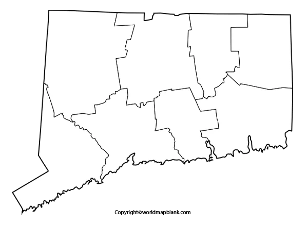
Blank Map of Connecticut Map worksheet
A Blank Map of Connecticut worksheet can turn the map into an interactive geography exercise. Students can label locations themselves instead of simply viewing a completed map.

The worksheet can be used for activities such as:
- Labeling neighboring states.
- Marking Hartford, the state capital.
- Identifying major cities.
- Locating the Connecticut River.
- Identifying Long Island Sound.
- Adding counties or towns.
- Marking important geographic features.
This type of worksheet is especially useful for classroom instruction, homework, homeschooling, and geography test preparation.
Connecticut Geography Facts
A few verified facts can make the map more useful as an educational resource.
| Fact | Information |
|---|---|
| State | Connecticut |
| Capital | Hartford |
| Statehood | January 9, 1788 |
| Order of admission | 5th U.S. state |
| Nickname | The Constitution State |
| Land area | 4,842.5 sq. mi. |
| 2020 Census population | 3,605,944 |
| 2025 population estimate | 3,688,496 |
| Bordering states | New York, Massachusetts, Rhode Island |
| Southern boundary | Long Island Sound |
| Number of counties | 8 |
| Number of towns | 169 |
| State abbreviation | CT |
The 2025 population estimate is 3,688,496, according to the U.S. Census Bureau. The 2020 Census counted 3,605,944 residents.
Connecticut became the fifth state to ratify the U.S. Constitution on January 9, 1788.
Connecticut currently has 169 towns. Its eight counties continue to exist as geographic areas, although Connecticut does not have traditional county governments.
Connecticut Map: Important Geographic Features
The Connecticut River is one of the state’s most important geographic features. It flows southward and roughly divides the state into eastern and western sections. The state’s landscape includes coastal areas, central valleys, forests, and hills.
Another useful fact for geography students is that Connecticut’s highest elevation is Mount Frissell on the southern slope at the state line, with an elevation of approximately 2,380 feet. Long Island Sound is the state’s lowest elevation at sea level.
These features make a blank outline particularly useful for practicing physical geography.
Connecticut Capital and Government
Hartford is the capital of Connecticut and has served as the state’s sole capital since 1875. Before that, Hartford and New Haven shared capital responsibilities for an extended period.
Connecticut’s government consists of executive, legislative, and judicial branches. The state has no county governments; local government is organized primarily through cities and towns.
Connecticut State Symbols
Connecticut has several official state symbols that can also be useful topics for student research.
Some include:
- State flower: Mountain laurel
- State bird: American robin
- State tree: White oak
- State animal: Sperm whale
- State insect: Praying mantis
- State motto: Qui Transtulit Sustinet
These official symbols are documented by the Connecticut state government.
How to Use a Blank Map of Connecticut
A blank map can be used in several ways depending on the learning objective.
For beginners:
Start by identifying Connecticut’s shape and neighboring states.
For geography practice:
Add Hartford, major cities, rivers, and Long Island Sound.
For advanced exercises:
Label the state’s towns, counties, physical features, and transportation routes.
For classroom quizzes:
Print an unlabeled map and ask students to identify locations from memory.
For digital projects:
Use a transparent PNG to add labels, arrows, colors, and other visual information.
Frequently Asked Questions
What is a Blank Map of Connecticut used for?
A Blank Map of Connecticut is commonly used for geography assignments, classroom exercises, map-labeling practice, homeschooling, research projects, and educational presentations.
Can I print the Blank Map of Connecticut?
Yes. The printable Connecticut maps provided on this page can be downloaded and printed for educational and personal use according to the applicable terms for the provided files.
What states border Connecticut?
Connecticut borders Massachusetts to the north, Rhode Island to the east, and New York to the west. Long Island Sound is along the southern side of the state.
What is the capital of Connecticut?
Hartford is the capital of Connecticut. It has been the state’s sole capital since 1875.
When did Connecticut become a state?
Connecticut ratified the U.S. Constitution on January 9, 1788, becoming the fifth state to do so.
How many towns are in Connecticut?
Connecticut has 169 towns.
What is Connecticut’s largest geographic feature?
The Connecticut River is a major geographic feature that flows south through the state, while Long Island Sound forms the state’s southern coastal boundary.
What is the highest point in Connecticut?
The highest point is Mount Frissell on its southern slope at the Connecticut-Massachusetts state line, with an elevation of about 2,380 feet.
What population does Connecticut have?
The U.S. Census Bureau estimated Connecticut’s population at 3,688,496 on July 1, 2025.
What file format is best for printing a Connecticut map?
A PDF is generally convenient for printing because it preserves the document’s layout and dimensions. A PNG can be more useful when the map needs to be inserted into a digital document or customized graphic.
Reference Links
https://www.census.gov/quickfacts/fact/table/connecticut/PST045215
https://data.census.gov/profile/Connecticut?g=040XX00US09
https://portal.ct.gov/about/the-land
https://portal.ct.gov/csl/research/ct-towns-counties
https://portal.ct.gov/csl/research/connecticuts-capitals
https://pubs.usgs.gov/gip/Elevations-Distances/elvadist.html

2 thoughts on “Printable Blank Map of Connecticut – Outline Transparent map”