
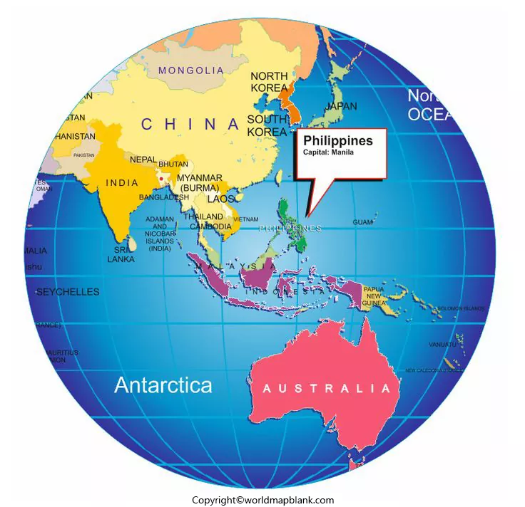

The location of Philippines on world map is in Southeast Asia, in the western Pacific Ocean. The Philippines is an archipelagic country made up of thousands of islands, with Manila as its capital. These printable Philippines world map templates help students, teachers, travelers, and geography enthusiasts understand where the country is located in relation to Asia and the rest of the world.
You can view the map images below and use the available PDF versions for educational activities, geography projects, and personal reference. Check the map legend, labels, date, and source before using a map for detailed geographical or administrative information.
- World coronavirus map
- World geographical map
- World population map
- Accurate map of World
- Ancient World map
- World Map Wallpaper
Philippines on World Map Globe
This map provides a global perspective on the Philippines and helps readers understand its position in Southeast Asia. Because the country consists of many islands, a globe or world map can help show its geographical relationship with the surrounding seas and neighboring countries.
Use this map for classroom presentations, basic geography lessons, and introductory research. For precise boundaries, navigation, or official geographic information, consult an authoritative mapping source.
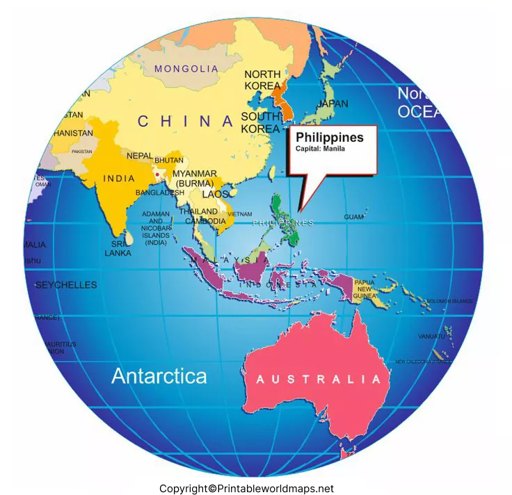
Philippines Location on World Map
The Philippines lies east of Vietnam and is surrounded by important bodies of water, including the Philippine Sea to the east and the South China Sea to the west. Its northern islands are near Taiwan, while parts of Indonesia lie to the south.
The country occupies a strategic position in the western Pacific. Its location has influenced regional trade, maritime transportation, cultural connections, and the movement of people throughout Southeast Asia.
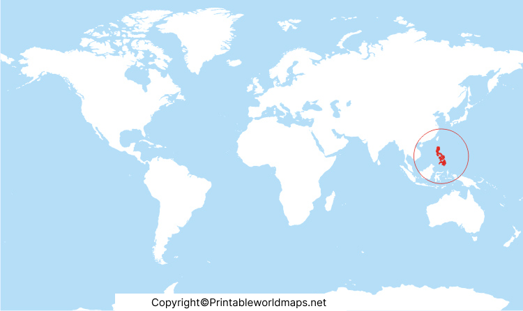
When reading a world map, look for the Philippine archipelago east of mainland Southeast Asia. Zooming in on a regional map makes it easier to identify individual islands and nearby countries.
Printable Philippines World Map Template
A printable Philippines world map template can be useful for school assignments, geography worksheets, presentations, and independent learning. Depending on the labels and scale, a map may help users compare the Philippines with nearby countries or identify its position on a global map.
Before printing, open the PDF and check the page size, orientation, image clarity, and labels. Choose a larger page size when small island names or boundary details are difficult to read. For classroom use, check whether the map is labeled or blank so it matches the activity.
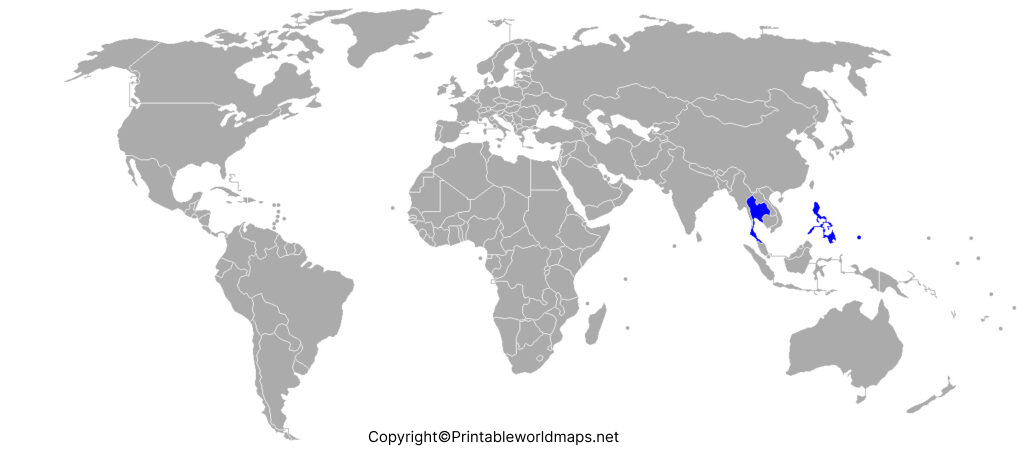
Philippines World Map
This Philippines world map provides another way to explore the country’s location and surrounding geography. Use it to identify the archipelago, compare its position with other parts of Asia, or introduce the three major island groups: Luzon, Visayas, and Mindanao.
The Philippines has an approximate land area of 300,000 square kilometres. Official and educational references may report different historical counts of its islands, so current geographical information should be checked against authoritative sources.
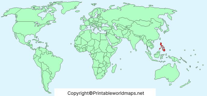
The downloadable files linked on this page are provided for reference and learning. Their availability does not mean that the maps have been officially approved by the United Nations. Check the original map publisher’s licensing and usage terms before reproducing or distributing the files.
Where Is the Philippines Located Geographically?
The Philippines is located in Southeast Asia, in the western Pacific Ocean. Its approximate central geographic coordinates are 13° north latitude and 122° east longitude. These coordinates provide a general reference point rather than the exact location of every island.
The country’s surrounding waters include the Philippine Sea to the east, the South China Sea to the west, the Sulu Sea to the southwest, and the Celebes Sea to the south.
Three Major Island Groups of the Philippines
- Luzon: The northern major island group, which includes the capital region around Manila.
- Visayas: The central island group, containing islands such as Cebu, Bohol, and Panay.
- Mindanao: The southern major island group, known for its diverse landscapes and regional cultures.
These divisions are helpful when reading regional maps and understanding the country’s geography.
Quick Facts About the Philippines
- Country: Republic of the Philippines
- Region: Southeast Asia
- Capital: Manila
- Approximate land area: 300,000 square kilometres
- Approximate central coordinates: 13° N, 122° E
- Major island groups: Luzon, Visayas, and Mindanao
- Geographical type: Archipelagic country
- Currency: Philippine peso (PHP)
These facts provide a starting point for geography learning. For updated population statistics, administrative boundaries, and official mapping information, refer to government and United Nations resources.
How to Use a Printable Philippines World Map
- Open the map: Select the image link to preview the map before downloading it.
- Download the PDF: Use the corresponding PDF link where available.
- Check the map details: Review its labels, legend, scale, publication date, and source.
- Print or save: Select a suitable page size and orientation for your project.
- Use it for learning: Locate the Philippines, identify its major island groups, and compare its position with neighboring countries.
A printable map is useful for education and general reference, but a world map may not provide sufficient detail for navigation, surveying, or legal boundary decisions.
1. Where is the Philippines located on the world map?
The Philippines is located in Southeast Asia, in the western Pacific Ocean, east of Vietnam and mainland Southeast Asia.
2. What is the capital of the Philippines?
Manila is the capital of the Philippines. Metro Manila, also known as the National Capital Region, includes Manila and several surrounding cities and municipalities.
3. How many islands does the Philippines have?
The Philippines is commonly described as having approximately 7,641 islands, based on a more recent official count. Older references may list 7,107 islands, which explains why different sources sometimes provide different figures.
4. What are the three major island groups of the Philippines?
The three major island groups are Luzon in the north, Visayas in the central part of the country, and Mindanao in the south.
5. Can I download a Philippines world map in PDF format?
Yes. This page provides links to several Philippines world map PDF files. Open the relevant PDF link to view the file and check its printing and usage conditions.
6. Which countries are near the Philippines?
Nearby countries and territories include Taiwan to the north, Vietnam to the west, and Indonesia to the south. Their precise relative positions are easiest to understand on a regional map.
7. Is the Philippines part of East Asia or Southeast Asia?
The Philippines is geographically classified as part of Southeast Asia.
8. Are these Philippines maps officially approved by the United Nations?
No official UN approval has been established for the specific downloadable templates on this page. For authoritative geographic information, consult the Philippine government’s mapping agency, NAMRIA, or relevant United Nations geographic resources.
Reference links
https://www.un.int/philippines/philippines/philippines-glance
https://data.un.org/legacy/en/iso/ph.html
https://ncca.gov.ph/about-culture-and-arts/culture-profile/philippine-fast-facts
