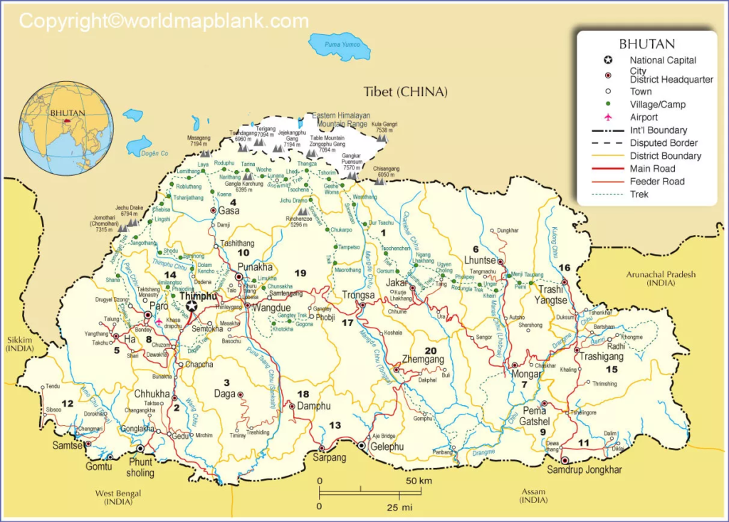
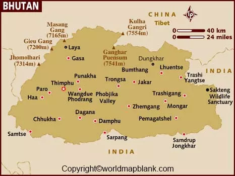
Labeled Map of Bhutan shows printed names of the location of the country including the boundaries. This labeled map of Bhutan is found to be useful for users who are preparing for map study of the country. They may not be able to identify the location without labeling a map.
While referring to one such labeled map of Bhutan, the user can find that Bhutan is officially known as, the Kingdom of Bhutan. The other name given to this country is called, Druk Yul, which means the Land of Thunder Dragon. The kingdom of Bhutan is a landlocked nation located in the southern slopes of eastern Himalayas.
Contents
Labeled Map of Bhutan
In the west, it has borders with Indian states like Sikkim, in the south with Assam and West Bengal, in the east with Arunachal Pradesh. In the north, Bhutan shares borders with China and Tibet, which is an autonomous region. The country’s land area of 38,294 square kilometers is found to be somewhat smaller than that of Switzerland or about half the size of the US state of Indiana. The landscape of Bhutan is found to be mountainous interspersed with valleys that are fertile as it provides the user a pristine environment.

The population of Bhutan in 2020 is estimated to be about 771,608 people, in middle of the year, based on UN data. This population of is equivalent to 0.01% of the total global population. The names of four major rivers that flow through Bhutan, include Torsa Chu, Wang Chu, Mo Chu, and Drangme Chu, which are further divided into smaller streams of water during the course of their flow through the country. About seventy-percent of the population in Bhutan follow Buddhism religion. Besides, other religions include Hindu and folk type.
Labeled Map of Bhutan with States

The labeled map of Bhutan with states, indicates that Bhutan does not have any states but have twenty administrative units known as Dzongkhag, which are identical to districts elsewhere. Some of the names of districts in Bhutan, include Wangduephodrang, Punakha, Haa, Paro and Thimpu.
Labeled Map of Bhutan with Cities

According to the labeled map of Bhutan with cities, the user can find that there ten cities in this country. They are labeled as Samtse, Nganglam, Jakar, Punakha, Wangdue Phodrang, Samdrup Jongkhar, Gelephu, Paro, Phuntsholing and Thimphu.
Labeled Bhutan Map with Capital
The labeled Bhutan Map with Capital, indicates that Thimphu or Thimbu is recognized as the capital city of Bhutan. In the western part of the country this beautiful city is located as it is found on the Raidak River of the Himalaya Mountains at a height of about seven thousand feet above the level of the sea.

The government of Bhutan is based in this city that consists of offices and hoses of the royal government of Bhutan. The construction of these government offices and houses conform to the finest examples of the old-style of Bhutanese architecture. The government of Bhutan provides high priority to agriculture and crops grown that include wheat, corn, and rice.


