
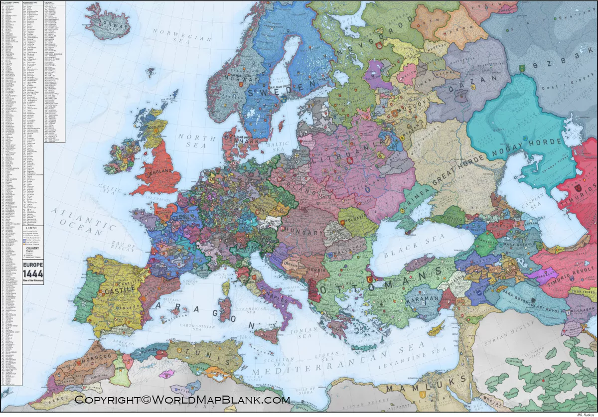

The medieval world map is a useful historical geography resource for exploring how the world was represented during the medieval period. This page provides medieval world map posters, printable maps, and PDF resources that can support history lessons, classroom activities, research, and personal study.
Because medieval maps were created in different regions and periods, they do not all represent geography in the same way as modern maps. Some medieval maps emphasized religious, political, cultural, or regional information rather than modern geographic accuracy. The maps below can therefore be used as visual resources for understanding historical ideas about geography and the medieval world.
Medieval World Map Poster
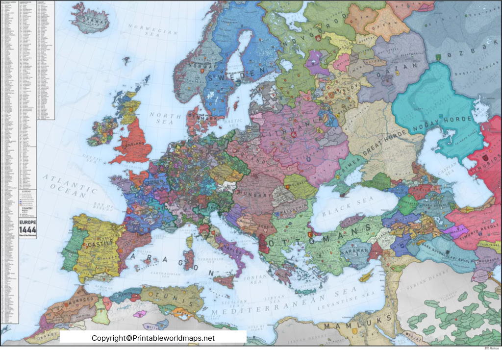
The Medieval World Map Poster provides a visual reference for studying geography during the medieval period. A poster format can be useful for classrooms, history projects, educational displays, and independent learning.
The medieval period is commonly associated with the centuries between antiquity and the early modern period. In European historical terminology, the Middle Ages are generally dated from around the 5th century to the late 15th century, although the exact boundaries vary depending on the region and historical framework.
When studying medieval maps, it is important to remember that political boundaries, place names, trade routes, and geographical knowledge changed considerably over time. A single map should therefore not be treated as a representation of the entire medieval world.
Medieval Islamic World Map
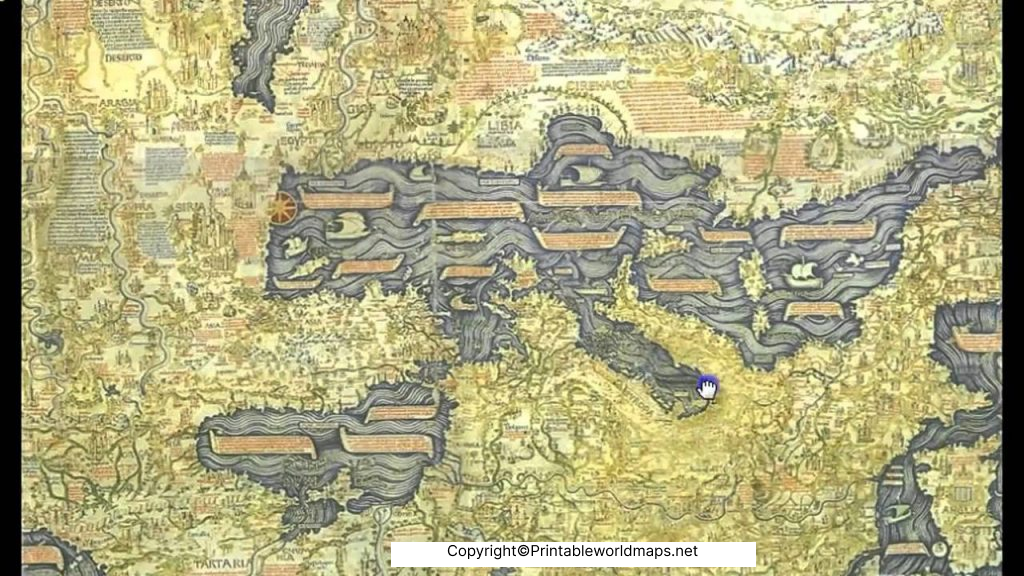
The Medieval Islamic World Map can be used as a visual starting point for studying the geographical knowledge and cartographic traditions associated with the medieval Islamic world.
Islamic scholars and geographers produced important geographical works during the medieval period. One particularly well-known figure was Muhammad al-Idrisi, whose Tabula Rogeriana was completed in 1154 for the Norman king Roger II of Sicily. Al-Idrisi’s work combined geographical information from multiple sources and regions.
Medieval Islamic geography was connected with extensive networks of travel, trade, scholarship, and cultural exchange across parts of Europe, North Africa, the Middle East, and Asia. Historical maps from this tradition can therefore provide useful context when studying the development of geographical knowledge.

A Medieval World Map can help students compare historical representations of geography with contemporary maps. Medieval cartographers worked with the geographical information available to them at the time, which could come from written descriptions, travelers, earlier geographical works, religious traditions, and other sources.
This makes historical maps valuable not only for locating places but also for studying how people in different periods understood the world around them.
Why Study Medieval World Maps?
A medieval map can be useful for:
- Understanding historical geography
- Comparing medieval and modern maps
- Studying historical regions and empires
- Exploring medieval cartography
- Supporting classroom history projects
- Creating educational presentations and posters
- Examining historical place names and geographical concepts
Printable Medieval World Map
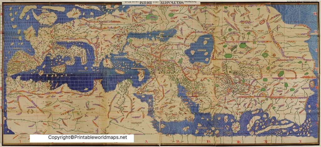
The Printable Medieval World Map is convenient for students, teachers, researchers, and history enthusiasts who need a downloadable visual reference.
A printable historical map can be used for classroom handouts, study notes, presentations, worksheets, or educational displays. Before printing, check the image dimensions and PDF format to select the version that best fits your intended use.

Medieval World Map Printable PDF
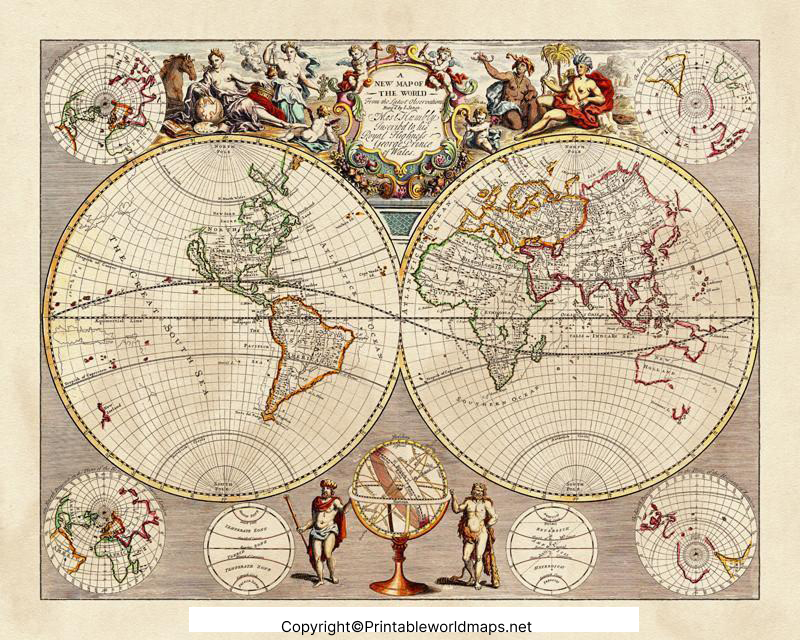
The Medieval World Map Printable PDF provides a convenient digital format for viewing or printing the map. PDF resources are particularly useful when a map needs to be shared between computers, tablets, and other supported devices.
For educational use, students can compare the historical map with a current world map and investigate how geographical knowledge, political territories, and place names have changed.
Medieval Cartography and Historical Geography
Medieval cartography was not a single standardized system. Different cultures and regions produced maps for different purposes, and the appearance and content of a map could depend on the sources and geographic traditions available to its creator.
For this reason, historical maps should be interpreted within their historical context. A medieval map may be valuable evidence of how its creator or society understood geography, but it should not automatically be judged by the standards of modern scientific cartography.
Medieval Maps vs Modern Maps
| Feature | Medieval Maps | Modern Maps |
|---|---|---|
| Geographic knowledge | Depended on historical sources and available observations | Supported by extensive surveying and modern technology |
| Political boundaries | Reflected historical periods and changing territories | Usually based on current or specified political boundaries |
| Purpose | Could be religious, educational, political, regional, or navigational | Often designed for navigation, reference, analysis, or education |
| Place names | Historical names and spellings may differ | Generally uses contemporary standardized names |
| Accuracy | Varies considerably by map and period | Generally based on modern geographic measurement |
How to Use a Medieval World Map
A medieval world map can be used in several educational ways:
- History research: Identify important regions, kingdoms, and historical territories.
- Geography comparison: Compare historical representations with a current world map.
- Classroom activities: Use printed maps for geography and history exercises.
- Historical analysis: Examine how different societies represented geographic knowledge.
- Projects and presentations: Use maps as visual material for medieval history topics.
- Independent learning: Explore historical geography and medieval cartography.
Important Facts About Medieval World Maps
- The Middle Ages are generally associated with the period between antiquity and the early modern era, although dates differ by region and historical tradition.
- Medieval maps were produced in different cultural and geographical contexts.
- Medieval Islamic scholars made significant contributions to geography and cartography.
- Muhammad al-Idrisi completed an important geographical work in 1154.
- Historical maps may use geographic concepts, orientations, names, and boundaries that differ substantially from modern maps.
- A map created in one medieval period cannot necessarily represent the geographic or political situation of another medieval period.
- Comparing historical maps with modern maps can help illustrate changes in geographical knowledge and political geography
Educational Uses of a Medieval World Map Poster
Teachers and students can use a Medieval World Map Poster for:
- World history lessons
- Medieval history projects
- Geography assignments
- Cartography studies
- Classroom wall displays
- Historical research
- Presentation backgrounds
- Map comparison activities
Frequently Asked Questions
What is a medieval world map?
A medieval world map is a historical representation of the known world created during the medieval period or based on medieval geographical traditions. Different maps can vary considerably in purpose, design, geographic coverage, and accuracy.
What period does the medieval era cover?
The dates vary by region and historical tradition. In European history, the Middle Ages are commonly placed approximately between the 5th and late 15th centuries.
What is a medieval Islamic world map?
A medieval Islamic world map refers broadly to maps or geographical representations associated with the Islamic world during the medieval period. Islamic scholars developed important geographical traditions and works during this era.
Who was Muhammad al-Idrisi?
Muhammad al-Idrisi was a 12th-century geographer and cartographer whose major geographical work was completed in 1154 for Roger II of Sicily.
Can I print the medieval world map?
Yes. The maps on this page include downloadable PDF versions that can be used for printing, subject to the applicable usage rights of each resource.
Are medieval maps geographically accurate?
Accuracy varies by map, period, region, purpose, and available geographic knowledge. Medieval maps should be interpreted within their historical context rather than evaluated solely using modern mapping standards.
Can students use a medieval world map for school projects?
Yes. Historical maps can be useful visual resources for history, geography, cartography, and medieval studies projects.
What can I learn from a medieval world map?
A medieval map can help you investigate historical geography, geographic knowledge, regions, place names, political territories, cartographic traditions, and how people represented the world in different periods.
Reference link
https://www.britannica.com/event/Middle-Ages
